National Parks of the World Map Set. This set contains 190 maps covering national parks for many countries around the world. These maps are maps produced as special maps for the national park and are not part of the national topographic series for that country. Individual maps may be ordered below. There is a 15% discount for the set or a 20% discount if this set is purchased in conjunction with the US National Park Map Set (coming soon).
For individual park maps, select a country link below or scroll down the page.
(Argentina) National Parks - Lanin, Los Arrayanes, Nahuel Huapi (Parques Nacionales). Approx. 1:415,000. Automovil Club Argentino. No date. Shaded relief map of this popular section of central-western Argentina. In Spanish.
Nationalpark Hohe Tauern - Krimml - Mittersill. 1:35,000. (F/B 0343-5). In German.
$11.95
64-1475-03
Nationalpark Thayatal. 1:50,000. (F/B WK073). In German.
$11.95
Bolivia National Park Maps
Nevado Sajama. 1:50,000. Walter Guzman Cordova. 1993. This map covers the Sajama National Park and the 21,000 ft. Nevado Sajama. With a small amount of bilingual text and legend at the bottom of the map. 20 meter contour intervals. 71 x 53 cm.
64-22723
1 sheet, rolled
$14.95
64-22723L
Laminated
$28.95
Botswana National Park Maps
Recommended! The Shell Tourist Maps of Botswana and the Botswana Game Reserves. Veronica Roodt, South Africa. These attractive and detailed maps cover some of the most popular tourist game areas in Botswana. The front side is a large satellite image map of the park or reserve. The reverse side has detailed satellite image inset maps covering the main areas within the park/reserve. The maps have general information for the region, plus park regulations and tour guide information where appropriate.
64-2370-CH
Chobe National Park. 2004. 1:290,000 + more detailed inset maps of the Chobe River, Nogatsaa, and Savute.
$16.99
64-2370-KG
Kgalagadi Transfrontier Park. 2004. 1:400,000 + insets of Kaa Kalahari concession, Mabuasehube area, plus others.
$16.99
64-2370-MO
Moremi Game Reserve. 1:200,000. + insets for Third Bridge, Xakaxana, Mboma Island, Khwai floodplain, and Moremi game reserve.
$16.99
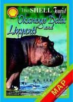
64-2370-OK
Okavango Delta and Linyanti. 2004.
$16.99
Canada National Park Maps
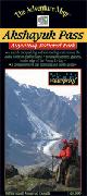
Ayuittuq National Park - Akshayuk Pass. 1:65,000. Chrismar. One of the world's greatest long distance backpacking trips takes place through a glacier-edged valley on Baffin Island. The Akshayuk Pass, formerly known as Pangnirtung Pass, is an extraordinary 100-km trek through a land recently vacated by glaciers - though they line the edges of the valley and send fingers of ice creeping into the edges of it. Mountains over 2000 metres high line a route through the finest scenery in North America. In 2004 Outside Magazine voted the Auyuittuq Backpacking trip one of the top "Trips Of A Lifetime".
In a land not without its hazards, this Adventure Map®, which has been adopted by the Park as their official map and safety guide, is an essential tool for planning the logistically challenging trip, and for the 5 to 14 day trip itself. Various routes are possible, with numerous sites well worth seeing along the way.
In addition to an extraordinarily detailed map of the valley, this guide also includes a smaller map of the entire park as well as detailed maps of the two towns (Pangnirtung and Qikiqtarjuaq) closely associated with the route - even though they are many kilometres away. If you're looking for a truly amazing experience then the Akshayuk Pass is the place to go.
At 1:65,000 scale this map shows emergency facilities, glaciers, glacial streams, moraines and the incredibly detailed land and waterscape you've come to expect from this series. Also colour photos, inset maps and detailed text about natural and human history, vital safety tips, recommended equipment, weather, local communities, contact info and much more. Released July 2005.
Index showing area coverage of this map.
64-26910-02
1 sheet, folded
$24.99
(Canada) Glacier National Park - Rogers Pass Region Hiking Map. 1:50,000. Add the cool grandeur of huge glaciers and icefields to the majesty of the
Columbia Mountains and you've got British Columbia's Glacier N.P. A fabulous hiking, camping,
mountaineering and winter adventure destination. This 1:50,000 scale map covers the hub of
activity in Glacier NP, including hundreds of kilometres of hiking trails and ski country, the
historic Rogers Pass itself, train tunnels, facilities, and attractions. One of the finest maps
showing amazing contour detail, glacier and terrain features.
64-26917
1 sheet, folded.
$18.99
La Mauricie National Park. 1:50,000. Chrismar. This superb National Park is located in the Laurentians north of Trois-Rivieres in Quebec, and it's a toss-up whether it makes a better hiking or paddling destination.
There are over 150 kilometres of hiking and backpacking trails, from short level walks to the rugged and challenging 75 km long Laurentian Trail. There are also about 200 lakes and rivers in the park that make for excellent canoe tripping possibilities. And just about the best fall colours we've ever seen!
This large sheet (24x28") is waterproof, has 15m contours, and is covered with features including natural and human history, trail and canoe route descriptions, enlargement maps of key activity centres, great colour photographs - in short just about everything you'd want to help you plan and enjoy your trip.
As with most other maps in the series, we're pleased to say that this one has been adopted by the Park as their official map.
64-26910-10
1 sheet, folded
$18.99
Chile National Park Maps
Chile--Topographic Map of the Torres del Paine National Park (Parque Nacional Torres del Paine). 1:80,000. Zagier & Urutty. A double-sided sheet showing the topography and hiking routes of this popular park in southern Chile. In Spanish with bilingual legend.
Thumbnail of the map Detail of the map Detail of the map
64-3970
1 sheet, folded
$14.95
Cuba National Park Maps
(Cuba) Parque Baconao map (UNESCO National Reserve of the Biosphere site). GEO. 1992. In Spanish.
64-4470PB
Each, folded
$9.95
Czech Republic National Park Maps
Czech Protected Natural Territories. 1:515,000. Shocart, 1999. A general travel map highlighting the locations of over 2000 natural protected areas such as national parks, regional parks, local parks, etc. The reverse side has contact information on each park noted on the map. Bilingual Czech and English.
64-46663
1 sheet, folded.
$9.99
Czech Republic National Park Hiking Maps. Kartografie Praha. This series of maps highlights the national parks of the Czech Republic. The maps are topographic maps overprinted with trails and information for hikers and cyclists. Information is also on the reverse of the maps. In Czech.
64-46715-PO
Podyji National Park. 1:50,000. 1996. ISBN 80-7011-428-2.
$6.95
64-46715-SUS
Sumava National Park, in summer. 1:100,000. 1996. ISBN 80-7011-445-2.
$6.95
64-46715-SUW
Sumava National Park, in winter. 1:100,000. 1995. ISBN 80-7011-398-7.
$6.95
64-46715-VY
Vysoké Tatry (High Tatras). 1:50,000. 1997. ISBN 80-7011-507-6.
$6.95
64-46715-ZA
Západní Tatry. 1:50,000. 1997. ISBN 80-7011-508-4.
$6.95
Czech Republic--Bratislavsky National Park (Bratislavsky lesny park). 1:25,000. SK. 1991. Produced on a topographic base map with tourist and hiking information. In Czech.
64-4670BR
1 sheet, folded
$7.95
Ecuador National Park Maps
(Ecuador)--Ecotourist Map of Chimborazo and Carihuayrazo (Mapa Ecoturistico de los Volcanes Chimborazo y Carihuayrazo). 1:66,666 (approx.). Instituto Geografico Militar, Quito. Attractive maps in the style of the U.S. Park Service national park maps. On one side there is a shaded relief map with latitude and longitude markings. There are also photographs showing typical vegetation types and types of landscapes. The reverse side has English-Spanish descriptive text and a few photographs.
4" x 4" sample image 9" x 9" sample image #1 9" x 9" sample image #2
64-5080-02
1 sheet, folded
$14.95
France National Park Maps
France Natural Areas Map. 1:1,000,000. IGN.
64-5664-909
France Sites Naturels d'Escalades #909.
$13.99
Mt. Blanc Topographic Map (Massif du Mont Blanc). 1:25,000. IGN. This double-size map illustrates the spectacular topography of this famous mountain. Series Bleue sheet 3531ET & 3630OT. In French.
64-5648-3531ET
Western sheet, 3531ET
$19.99
64-5648-3630OT
Eastern sheet, 3630OT
$19.99
Cévennes & Vercours National Park Maps. 1:100,000. IGN. An excellent shaded relief map with loads of tourist information - trails, caves, spas, pools, etc.
64-5684-CE
Cevennes. 1:100,000. 2002.
$14.95
64-5686-VE
Vercours. 1:60,000.
$14.95
Germany National Park Maps
Germany National Park Maps. 1:25,000 & 1:50,000.
65-5462-02
Berchtesgadener Alpen. 1:50,000.
$14.95
65-5462-04
Deutsch - Luxemburg N.P. 1:50,000.
$14.95
65-5462-05
Dubener Heide N.P. 1:50,000.
$14.95
65-5462-06
Dummer N.P. 1:50,000.
$14.95
65-5462-07
Frankisches Seenland N.P. Altmuhltal. 1:50,000.
$14.95
65-5462-08
Rhein Westerwald N.P. 1:50,000.
$14.95
65-5462-09
Saar-Hunsruck N.P. 1:50,000.
$14.95
65-5462-10
Solling Voguer N.P. 1:50,000.
$14.95
65-5462-11
Steigerwald N.P. 1:50,000.
$14.95
65-5462-12
Sudheide N.P. 1:50,000.
$14.95
Great Britain National Park Maps
Great Britain National Park Maps. See the Explorer map series for detailed multi-sheet maps of Britain's national parks.
64-61851-01
Dartmoor. 1:40,000. Waterproof map. Harvey Maps.
$12.95
Greece National Park Maps
Greece National Park Maps. Various scales. Road Editions, Greece. This is a superb series, with 100-meter contour intervals. Paved and unpaved dirt roads are shown, along with extensive tourist information and tourist sites. Bilingual Greek/English maps and text and Greek/English/German/Italian legends. Included is a text booklet that gives detailed guides to the hiking trails.
64-66861-043
#43. Iti. 1:50,000.
$16.95
64-66861-031
#31. Olympus. 1:50,000.
$16.95
64-66861-042
#42. Parnassos. 1:50,000.
$16.95
Hungary National Park Maps
Hungary National Park Hiking Maps.
64-7483-02
Aggtelek National Park. 1:50,000.
$12.95
64-7483-56
Balaton-Felvidéki National Park (Balaton-Felvidéki Nemzeti Park). 1:90,000. ISBN 963-85963-7-6.
$12.95
64-7483-55
Bükk National Park (Bükk Nemzeti Park). 1:50,000. 2001. ISBN 963-9339-03-2.
$12.95
64-7483-65
Duna-Drava National Park.
$14.95
64-7483-66
Duna-Drava National Park - north half.
$14.95
64-7483-67
Duna-Drava National Park - south half.
$14.95
64-7483-69
Duna-Ipoly National Park.
$14.95
64-7483-17
Fertö-Hansag/Neusiedler See. 1:60,000.
$12.95
64-7483-23
Hortobágyi National Park (Hortobágyi Nemzeti Park). 1:90,000. ISNB 963-9339-02-4.
$12.95
64-7483-68
Kiskunsagi National Park.
$14.95
64-7483-54
Körös-Maros National Park (Körös-Maros Nemzeti Park). 1:90,000. 2002. 963-85405-1-6.
$12.95
64-7483-32
Orsegi National Park.
$14.95
Iceland National Park Maps
Iceland National Parks.
64-75515-6
Skaftafell. 1:25,000 & 1:100,000.
$19.99
India National Park Maps
India--National Parks Map. 1:5,000,000. Survey of India. 1990. A color map showing the locations of the national parks and forest and wildlife preserves in India. Descriptive text and a few photographs are in the margins. Flat sheet, laminated.
64-76661
1 sheet, laminated.
$7.95
Ireland National Park Maps
Ireland National Park Maps. Superb detail for these three popular national parks.
#60. Parco Nazionale dei Sibillini. 1:25,000. Ed. Multigraphic.
$15.99
64-82744-904
Parco delle Alpi Apuane. 1:50,000. Ed. Multigraphic.
$11.99
64-8272-017
Casentinesi Forest National Park, Monte Falterona, and Campigna. 1:70,000.
$10.95
Kenya National Park Maps
Kenya Game Park Travel Maps. Macmillan Kenya. High quality travel maps of the major game parks. Recommended.
64-8888A
Amboseli Game Park.1:75,000. 1988. A map of the Park with a wildlife identification chart.
$9.95
64-8888M
Masai Mara Game Park.1:125,000. 1988. A map of the Park with a wildlife and bird guide.
$9.95
64-8888T
Tsavo Game Park.1:420,000. 1988. A map of the Park with a wildlife and bird guide.
$9.95
Aberdares & Lake Nakuru National Parks. 1:150,000. 1977, reprinted 1997. Shaded relief/contour map. detailed. Lots of text info on the reverse. Size is 36 x 24".
64-8888AB
1 sheet, flat.
$12.95
Gombe Stream National Park Map. 1:50,000. Kenya Survey, 1978. This is sheet 92/1 of the national 1:50,000 series which completely covers the national park.
64-8888G
1 sheet, flat.
$19.95
Lewa and Il Ngwesi Wildlife Conservancy map. 1:40,000. D and R Watson, 2005. Lewa is a private wildlife park with camps, campsites, lodges, and more. Size is 82 x 48 cm.
64-8888LE
1 sheet, folded.
$19.95
Marsabit National Park and Reserve. 1:100,000. 1990. Shaded relief map fo the park. Includes a list of bird and animal species.
64-8888MA
1 sheet, folded.
$12.95
Meru National Park. 1:100,000. 1988. Hypsometric map of the park. Includes list of birds and pictures of animals found in the park. Size is 24 x 24".
64-8888ME
1 sheet, flat.
$12.95
Mt. Kenya Hiking Map. 1:25,000; 1:50,000; and 1:400,000. West Col, Britain. Excellent map of this popular tourist spot, with trekker information on the reverse.
64-8871
1 sheet, folded
$19.99
Mt. Elgon Hiking Map, Kenya/Uganda. 1:50,000; 1:125,000; and 1:500,000. West Col, Britain. Excellent map of this popular tourist spot, with trekker information on the reverse.
64-8872
1 sheet, folded
$20.95
Tsavo East National Park. 1:250,000. 1982, reprinted 1997. Hypsometric map with list of common birds and animals and pictures of animals found in the park. Size is 32 x 23".
64-8888TE
1 sheet, flat.
$12.95
Tsavo West National Park. 1:250,000. 1994. Hypsometric map with list of common birds and animals and pictures of animals found in the park. Size is 25 x 32.
64-8888TW
1 sheet, flat.
$12.95
Macedonia National Park Maps
Prespa National Park (Greece & Macedonia). 1:50,000. 100m contours. 50 x 70 cm. map with 32-page text and 25 color photographs. In English.
64-6678-14
1 sheet, folded
$9.95
Nepal National Park Maps
65-0481-41
Royal Chitwan National Park.
$14.99
65-0481
Mt. Everest. 1:50,000.
$37.99
KHUMBU. 1:100,000. Nepa, Kathmandu. No date. The map covers Sagarmatha National Park, Jiri, Namche, Everest Base Camp, Kala Pattar Gokyo Island Peak, Cho La, and Renjo La. Probably based on soviet 1:200,000 topo maps. Lacks latitude/longitude markings and an index. Uses 200 meter contours. Not indexed.
65-0481-08
1 sheet, folded
$16.99
ROYAL CHITWAN National Park Map. 1:150,000. Nepa. Sept. 1998. Covers this popular national park. Includes jungle safaris, river rafting, and birdwatching information.
65-0481-41
1 sheet, folded
$14.99
New Zealand National Park Maps
New Zealand--National Park Topographic Maps. New Zealand Department of Survey and Land Information. This includes New Zealand's Trackmap and Parkmaps series. These maps illustrate the spectacular scenery of New Zealand's mountains and rocky coastal shores. Each map has full topographic detail, hiking trails, and other tourist information.
New Zealand National Park Maps (196K) New Zealand Parks and Tracks (221K)
65-0774B
Abel Tasman. 1:50,000. #273/7. 1995.
$16.99
65-0774D
Arthur's Pass. 1:80,000. #273/1. 1992.
$14.95
65-0774F
Egmont. 1:50,000. 273/9. 1994.
$14.95
65-0774H
Fiordland. 1:250,000. 273/3. 1993.
$14.95
65-0774K
Kahurangi. 1:150,000. 274/13.
$14.95
65-0774KC
Kaweka. 1:100,000. 274/12. 1990.
$14.95
65-0774LA
Lake Sumner. 1:80,000. 274/16. 1993.
$14.95
65-0776MB
Marlborough Sounds. 1:100,000. #336/7. 1994.
$14.95
65-0774J
Mt. Aspiring. 1:150,000. 273/2. 1987.
$14.95
65-0774L
Mt. Cook/Westland. 1:100,000. 273/10. 1992.
$14.95
65-0774M
Milford Track. 1:75,000. 335/1. 1994.
$16.99
65-0774N
Nelson Lakes. 1:100,000. 273/5. 1995.
$16.99
65-0774NP
Paparoa. 1:50,000. 273/12. 1990.
$14.95
65-0774RU
Ruahine. 1:100,000. 274/5. 1994.
$14.95
65-0776ST
Stewart Island. 1:150,000. #336/10. 1992.
$14.95
65-0774ST
St. James & Lewis Pass. 1:50,000. 335/06.
$14.95
65-0774TA
Tararua. 1:100,000. 274/2. 1988.
$14.95
65-0774P
Tongariro. 1:80,000. 1991. 273/4.
$14.95
65-0774R
Urewera. 1:130,000. 273/8. 1993.
$14.95
Peru National Park Maps
Recommended! (Peru)-Inca Trail and Sacred Valley Topographic Map (Machu Picchu). 1:50,000. Lima 2000. This is a new topographic map of the Sacred Valley and Machu Picchu. The map has tourist information along the bottom edge and symbols locating tourist sites and services along the trail. Bilingual; printed on water and tear-resistent synthetic paper.
Detail from the map.
65-1778
1 sheet, folded
$14.95
Poland National Park Maps
65-1993BH
Bialowieza Forest. 1:75,000. 1991.
$9.95
65-1993BC
Biebrzanski. 1:120,000.
$9.95
65-1993BI
Bieszczady Mts. 1:75,000. 1992.
$9.95
65-1993GO
Gorce Mts. 1:75,000. 1991.
$9.95
65-1993KA
Kampinoski Mts. N.P.
$9.95
65-1993KB
Karkonosze Mts. N.P. 1:75,000. 1991.
$9.95
65-1993PI
Pieniny Mts. N.P. 1:22,500. 1992.
$9.95
65-1993SS
Stolowe Mts. 1:60,000. 1992.
$9.95
65-1993SW
Swietokrzyskie Mts. 1:150,000. 1991.
$9.95
65-1993TB
Tatra Mts. N.P. 1:30,000. 1991.
$9.95
65-1993WO
Wolinski. N.P. 1:30,000.
$9.95
Slovenia National Park Maps
65-9770-TR
Triglav National Park. 1:50,000.
$22.99
South Africa National Park Maps
Kruger National Park. 1:450,000. MapStudio, 2003.
65-3091-1
1 sheet, folded.
$17.99
Spain National Park Maps
(Spain) Hiking Maps. Mapa Guia. These hiking maps cover popular areas in Spain. With contour lines, tourist information, and more. In Spanish.
65-32822-01
Barcelona y su entorno, Scale 1:200,000.
$14.95
65-32822-02
Cordillera Cantabrica, Scale 1:200,000.
$14.95
65-32822-03
Costa del Sol, Scale 1:200,000.
$14.95
65-32822-04
Gran Canaria, Scale 1:100,000.
$14.95
65-32822-05
La Gomera, Scale 1:50,000.
$14.95
65-32822-06
Lago de Sanabria, Scale 1:50,000.
$14.95
65-32822-07
Macizo Central de Gredos, Scale 1:50,000.
$14.95
65-32822-08
Madrid y su entorno, Scale 1:200,000.
$14.95
65-32822-09
Mallorca, Scale 1:150,000.
$14.95
65-32822-10
Mar Menor, Scale 1:25,000.
$14.95
65-32822-11
Paraje Natural Marismas del Odiel, Scale 1:25,000.
$14.95
65-32822-12
Parque Nacional de Donana, Scale 1:50,000.
$14.95
65-32822-13
Parque Natural Bahia de Cadiz, Scale 1:50,000.
$14.95
65-32822-14
Parque Natural Cabo de Gata-Nijar, Scale 1:50,000.
Ordesa & Monte Perdido Hiking Map. 1:40,000. Editorial Alpina. Excellent hiking map of this popular hiking and climbing area. In Spanish.
65-3280-OR
hiking map
$29.99
Cordillera Cantabrica #3 - P.N. de Somiedo. 1:60,000. Andrados. In Spanish.
65-3283-03
1 sheet, folded
$12.95
Tanzania National Park Maps
Mt. Kilimanjaro 1:100,000 Topographic Map. 1:100,000. D.O.S./Kenya Survey 1989. A colorful, detailed topographic map of Mt. Kilimanjaro, with 100-ft contours.
65-4170
1 sheet, flat.
$19.95
Mt. Kilimajaro--Mt. Kilimanjaro Hiking Map. 1:30,000; 1:75,000; and 1:682,000. West Col, U.K. A good hiking map with descriptive text.
(70K)
Arusha National Park. Approx. 1:35,000. 1997. Covers this small national park in northern Tanzania. Size 23-1/2 x 17".
65-41710
1 sheet, folded.
$14.99
(Tanzania)--New Map of the Kilimanjaro National Park. Approx. 1:18,000/1:85,000. 1998. A general map on one side and a detailed trekking map on the reverse with route maps and trekking information. Size is 23-1/2 x 17".
65-41713
Kilimanjaro, 1 sheet, folded.
$13.99
Lake Manyara National Park, Dry Season. Approx. 1:62,500/1:69,000. 1995. Covers this park along the western shoreline of Lake Manyara in the Rift Valley. Size is 23-1/2 x 17".
Sample of Wet Season map Sample of Dry Season map
65-41716
Lake Manyara, 1 sheet, folded.
$13.99
Ngorongoro Conservation Area Map. Approx. 1:150,000. 1997. This map covers another of the six parks in northern Tanzania. This park is dominated by lush volcanic craters and desert lowlands.
The reverse side includes maps of the craters in both wet and dry seasons. Size is 23-1/2 x 17".
65-41719
Ngorongoro, 1 sheet, folded.
$13.99
Serengeti National Park, Dry Season & Wet Season. Approx. 1:350,000. 1995. One side has a map showing the park in the dry season, with insets of the common vegetation and the wildebeast and Burchell's zebras migration.
The reverse side shows the park in the wet season with insets of the vegetation, the migrations, and animal tracks likely to be seen. Size is 27-1/2 x 19-1/2".
Sample of Wet Season map Sample of Dry Season map
65-41722
Serengeti, 1 sheet, folded.
$13.99
Tarangire National Park, Wet and Dry Seasons. Approx. 1:142,000. 1996. One side shows this lowland park in the wet season, and the reverse shows it in the dry season.
Inset maps show the ecosystem and seasonal migrations. Size is 25 x 17-1/2".
65-41728
Tarangire, 1 sheet, folded.
$13.99
Thailand National Park Maps
Map of Khao Yai National Park (Nakhon Ratchasima). 1:400,000. This map shows roads and highways with milestones and surface conditions; distance chart; and cities and tourist attractions.
65-4265-21
1 sheet, folded
$9.95
Uganda National Park Maps
Uganda--Ruwenzori Mts. of Uganda/Zaire. 1:20,000; 1:50,000; 1:400,000. West Col Productions, Britain. An excellent travel map of this popular trekking spot.
65-4770
1 sheet, folded
$21.95
Zimbabwe National Park Maps
Nyanga National Park map. 1:50,000. Zimbabwe Survey Dept. (Zimap). 1997. An excellent map of this national park and nature preserve, located on the eastern border of Zimbabwe. This map is a SPOT image base map overprinted with tourist information. The map shows the location of roads, tourist facilities, camps, and recreation spots. Extensive text on camping, siteseeing, tours and more is included in the margins.

 Thumbnail image of the map.
 Detail of the map.
 Legend of the map.
 Cover of the map.
 Thumbnail of the map.
 Detail of the map.
 Legend of the map.
 Cover of the map.


 Index showing area coverage of this map.
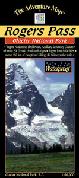


 Thumbnail of the map
 Detail of the map
 Detail of the map


 4" x 4" sample image
 9" x 9" sample image #1
 9" x 9" sample image #2


 New Zealand National Park Maps (196K)
  New Zealand Parks and Tracks (221K)
  Detail from the map.
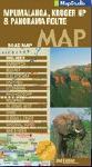


 Sample of Wet Season map
 Sample of Dry Season map
 Sample of Wet Season map
 Sample of Dry Season map

