Austria 1:200,000 Topographic Map Series - Provincial-based Set. 1:200,000. Bundesamt für Eich- und Vermessungswesen. This is the current series for Austria, replacing the 23-sheet quadrangle-based series listed further down the page.
This series is derived by generalising the mapping of the 1:50,000 series. Topography is shown by contour lines at 100m intervals, spot heights and shaded relief. Land types such as forests, vineyards, and swamps are denoted by colors and graphic patterns. Attractive, finely-drawn map detail includes minor roads, tracks, railways, chairlifts and other mountain transport, national parks, and administrative boundaries. Small symbols show many landmarks such as caves, towers, castles, refuges, isolated buildings, etc.
Please note that some of the place names are in very small print. The maps have a UTM grid, with latitude lines at intervals of 12' and longitude at 20'. Map is in German while the map legend includes English. Each title also includes a small map with administrative sub-divisions of the province.
Sample detail from the Vorarlberg map
64-1449-BUR
Burgenland sheet.
$15.99
64-1449-KAR
Kärnten sheet.
$15.99
64-1449-NIE
Niederösterreich sheet.
$15.99
64-1449-OBE
Oberösterreich sheet.
$15.99
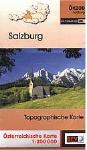
64-1449-SAL
Salzburg sheet.
$15.99
64-1449-STE
Steiermark sheet.
$15.99
64-1449-TIR
Tirol sheet.
$15.99
64-1449-VOR
Vorarlberg sheet.
$15.99
64-1449-SET
Set of 8 sheets listed above.
$92.99
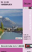
The 1:200,000 series listed below is a quadrangle/grid-based series that has been replaced by the new series listed above. We have some sheets still in stock and others can be obtained, at least for a while.
Austria Topographic Map Series - 1:200,000 - grid-based series.
 Sample detail of the Austria 1:250,000 topographic map series.
 Sketch map showing layout of the maps.
 Sample detail from the Vorarlberg map