Austria Topographic Map Series
Austria Topographic Map Series - 1:50,000
Published by
BfE.
Publication dates
Variable.
Scale
1:50,000
Map size
.
Projection
Gauss Kruger.
Contour interval
20 meters.
Number of sheets
213 sheet for complete coverage.
Index map
Austria 1:50,000 Index Map.
Listing of Quadrangles
Click here to order individual sheets.
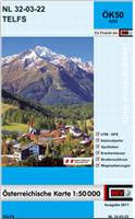
Map sample
Sample image #1.
Sample image #2.
Map quality
Good quality full-color topographic maps.
Language
German.
64-1452-XXX
Individual sheets - click on "List of Quads" above to order individual sheets.
$19.99
Austria Topographic Map Series - 1:25,000
Published by
BfE.
Publication dates
Variable.
Scale
1:25,000
Map size
.
Projection
Gauss Kruger.
Contour interval
.
Number of sheets
213 sheet for complete coverage.
Index map
Austria 1:25,000 Index Map.
Listing of Quadrangles
Click here to order individual sheets.
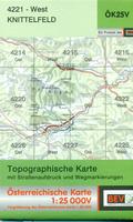
Map sample
Click here.
Map quality
Good quality full-color topographic maps.
Language
German.
64-1452-XXX
Individual sheets - click on "List of Quads" above to order individual sheets.
$19.99
$<
© Copyright 2026 East View Companies, Inc.
5130 Industrial Street, Suite 100, Maple Plain, MN 55359-8005
All Rights Reserved
For more information please
Contact Us