|
|
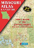
Missouri Road Atlases
Missouri Road Maps - Paper Maps
Missouri Road Maps - Laminated Maps
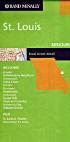
Missouri City Maps - Paper
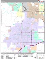
Missouri City Wall Maps
We offer wall maps for Blue Springs, Columbia, Florissant, Independence, Jefferson City, Joplin, Kansas City, Lee's Summit, O'Fallon, Springfield, St. Charles, St. Joseph, St. Louis, and St. Peters. Click here to order and to see sample images, prices, sizes, and mounting options.
Missouri Recreation Maps.
Ozark Scenic National Riverway Map. 1:63,360. Trails Illustrated/National Geographic Maps #260.
Missouri Wall Maps
We offer state and county wall maps for all of the USA. The maps come in sizes from 24 x 36 to 108 x 144 inches. They are available in variety of mounting and framing options. The maps are ideal for business applications, sales territory, delivery planning, direct mail targeting and hundreds of other applications. Click here to order county wall maps and to see sample images, descriptions, and prices. Click here to order state wall maps and to see sample images, descriptions, and prices.
Missouri Geological and Thematic MapsMissouri Magnetic Anomaly Map. 1:500,000. 1985. USGS (GP-965). One sheet in black and white. Map size is 120 x 106 cm.
Missouri ERTS Band 7 Photomosaic Map. 1:1,000,000. 1974. MGS. This black/white map highlights topography and water features. Map size is 64 x 56 cm.
Missouri Flags
|
|||||||||||||||||||||||||||||||||||||||||||||||||||||||||||||||||||||||||||||||||||||||||||||||||||||||||||||||||||||||||||||||||||||||||||
 Missouri Maps


 A sample from the Maine atlas.

 Sample detail of the Route 66 road atlas


 Sample detail from the Joplin wall map.
 Waterproof!

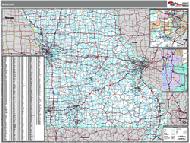 Missouri State and County Wall Maps. Intelligent Direct.
 Thumbnail of the map.
 Sample of the detail.
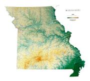
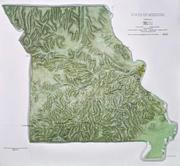
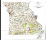 Missouri Topographic Map. 1:500,000. 1973-1978. USGS. Size 50 x 56 inches.
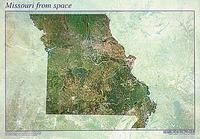
 Sample of the Missouri satellite poster.
 Sample detail of the St. Louis satellite poster.
 Missouri Flags