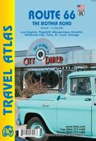
Route 66 Road Atlas. ITMB. The 'Mother Road' of the USA is one of the most famous highways of the world, ranking in importance with adventure highways such as the Karakorum. When the highway was developed in the 1920s, America was just discovering the automobile and long-distance roads were visionary. This road assumed monumental significance in joining the western half of America to the more developed East. Initially a dirt track, it was paved as a massive 'make work' project during the Great Depression, and millions of destitute Americans moved along it to reach California and, hopefully, future prosperity. During WW2 and the Korean War, it was the route of preference to move large numbers of troops to training camps and embarkation points. Today, it has been replaced by super-motorways, the US Interstate system, but large portions of original highway remain, as well as many buildings from the early days of travel. Immortalized and romanticized by several movies, a TV show, and various songs, Route 66 symbolizes everything that means AMERICA.
This atlas shows the route from its origins in Chicago, through Illinois and other states to California and its terminus in Santa Monica. Not only is the route followed and filled in with capsule comments about attractions en route, it includes all parks, historic sites, and attractions within reasonable driving distances from Route 66. This is the only highway in the world to have its own atlas. It is beautifully arranged and very detailed. It covers the entire 2,400 miles of the Route and includes many detailed city plans of urban areas along the highway. As a bonus, the Las Vegas and San Diego urban areas are included; 64 pages, printed on paper, saddle stitched. Center-stapled soft-cover atlas.
Sample detail of the Route 66 road atlas
62-20973
Atlas.
$16.95
Missouri's Bicycle Trails Guidebook. American Bike Trails. Softcover.
Most guides & journals in the series include:
Directions to Trail sites & accesses
Location & Distance to nearby Communities
Trail Distances, general setting
Conditions & Facilities
Points of interest
State, Sectional & Selective County Overviews
Riding Tips, Contacts, Alternate Trail Uses & Bike Routes
City & County-to-Trail Cross-References
Logs for recording your notes on the rides and trails
62-77812
Guide
$16.95
Missouri Bicycle Trails Map. American Bike Trails. Includes inset maps of Columbia and Kansas City. This series of maps offers full state coverage of several mid-western & eastern states.
Most maps in the series include:
Trail to Map index
City to Trail index
County to Trail index
Trail Facts: Length, surface, biking type (road or mountain bike)
Trail settings - wooded, prairie, open, wetlands, etc.
Alternate trail uses - hiking, in-line skating, equestrian, etc.
Trail facilities - water, toilets, food, camping, etc.
Great Rivers South Route. Adventure Cycling Association. 1,340 miles - Explore the Mississippi on a route that
would make Tom Sawyer and Huck Finn proud. Along the way visit the jumping-off spot of the
Mormons' long trek west, and enjoy some great cycling in the Ozarks, and along the Natchez Trace.
Route map.
62-2230-GRS
Muscatine, IA, to St. Francisville, LA. Set of 3 maps. 10% discount!
$45.22
62-2230-GRS1
Muscatine, IA, to Cape Girardeau, MO.
$16.75
62-2230-GRS2
Cape Girardeau, MO, to Tupelo, MS.
$16.75
62-2230-GRS3
Tupelo, MS, to St. Francisville, LA.
$16.75
Lewis & Clark Trail Route
Lewis & Clark Bicycle Trail. Adventure Cycling Association. 4,618 miles. Since 1998, Adventure Cycling Association has been compiling a new and ambitious set of bicycling maps following the route of Lewis and Clark. The Lewis & Clark Bicycle Trail was born of a desire to offer bicyclists a way to celebrate the bicentennial anniversary of the Corps of Discovery's journey, which began in 1804.
The Lewis & Clark Bicycle Trail's 4,618 miles cross nine mountain passes, pass through four national parks and monuments, overlook dozens of rivers in addition to the Missouri and the Columbia, and promise you views of bison, elk, deer, antelope and other wildlife. The Trail will be the best possible way to experience the magnificent landscapes witnessed by Lewis and Clark: all of the sense of wonder, all of the adventure, but a lot less inconvenience and hardship.
Our main 1804 westward route of Lewis and Clark is 3,254 miles in length, but overall the maps will cover 4,618 miles. The maps have been divided into eight sections covering both the westbound and eastbound routes taken by the Corps. There will be some mountain biking options available. Services are sometimes few and far between, making this one of our most challenging routes.
Route map.
62-2230-LCS
Hanford, IL to Astoria, OR & back. Set of 8 maps. 10% discount!
$120.60
62-2230-LC1
Hartford, IL to Council Bluffs, IA (555 miles).
$16.75
62-2230-LC2
Council Bluffs, IA to Pierre, SD (485.5 miles).
$16.75
62-2230-LC3
Pierre, SD to Williston, ND (510.5 miles).
$16.75
62-2230-LC4
Williston, ND to Great Falls, MT (538.5 miles).
$16.75
62-2230-LC5
Great Falls, MT to Missoula, MT (479.5 miles).
$16.75
62-2230-LC6
Missoula, MT to Clarkston, WA (242.5 miles), Lolo Trail (145.3 miles), Blackfoot Option (187.5 miles).
$16.75
62-2230-LC7
Clarkston, WA to Astoria, OR (442.5 miles).
$16.75
62-2230-LC8
Three Forks, MT to Williston, ND (506 miles).
$16.75
TransAmerica Bicycle Trail
TransAmerica Bicycle Trail. Adventure Cycling Association. 4,245 miles - The route that made cross-country cycling famous (Outside Magazine calls the TransAmerica the "ultimate bicycle tour").
Ride through the history of the nation - Colonial Virginia, plantations, Civil War battlefields, Lincoln's birthplace, and the Oregon Trail.
Route map.
62-2230-TA
TransAmerica Route; Astoria, OR to Yorktown, VA. Set of 12 maps. 10% discount!
 Sample detail of the Route 66 road atlas


 Sample detail from the Iowa map in the same series
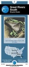
 Route map.
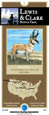
 Route map.
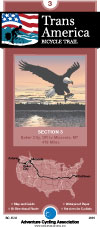
 Route map.