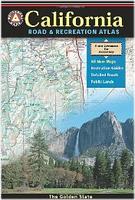
California Road and Recreation Atlas. 1:300,000. Benchmark Maps.
From its verdant mountains and vast deserts to the azure sea, California is rich in geographical diversity and natural beauty. Get to know the best of California with this recently updated and improved atlas. Now freeway exit numbers are shown and the Landscape Maps™ are clearer, brighter. The comprehensive Recreation Guide and accompanying maps are the perfect resource to plan the ultimate outdoor adventure.
Sample detail from the California recreation atlas.
$29.95
62-56481
Atlas
California Topographic Atlas & Gazetteer. 1:200,000. DeLorme.
Excellent atlas using USGS topographic maps. Ideal for hikers or backroad enthusiasts.
Sample of the map detail
$29.95
62-5648
California Atlas
Route 66 Road Atlas. 1:1,000,000. ITMB.
The 'Mother Road' of the USA is one of the most famous highways of the world. When the highway was developed in the 1920s, America was just discovering the automobile and long-distance roads were visionary. Today, it has been replaced by the US Interstate system, but portions of the original highway remain, as well as many of its original buildings.
This atlas shows the route from its origins in Chicago, through Illinois and other states to California and its terminus in Santa Monica. The atlas shows the Route and has capsule comments about attractions; it includes parks, historic sites, and attractions within reasonable driving distances from Route 66. It covers the entire 2,400 miles of the Route and includes many detailed city plans of urban areas along the highway. 64 pages, printed on paper, saddle stitched. Center-stapled soft-cover atlas.
Sample detail of the Route 66 road atlas
$16.95
62-20973
Atlas.
California Road Maps - Paper
California Road Map. Rand McNally.
Rand McNally's cartography shows all Interstate, U.S., state, and county highways, along with clearly indicated parks, points of interest, airports, county boundaries, and streets. The easy-to-use legend and detailed index make for quick and easy location of destinations. Includes inset maps of Bakersfield, Fresno, Joshua Tree National Park, Kings Canyon Natl Park & Sequoia Natl Park, Lake Tahoe Region, Lancaster/Palmdale, Los Angeles, Modesto, Monterey/Salinas, Oceanside, Oxnard/Ventura, Palm Springs, Sacramento, San Diego, and San Francisco. Map size is 28" x 40" unfolded.
California Road Map. Global Graphics.
Highway map features Interstate, U.S highways, State highways, relief-shading, index of cities/towns, inset maps of Los Angeles, San Francisco and San Diego.
$4.95
62-56901
1 sheet, folded.
California Coastal Road Map Series. Global Graphics.
$5.95
62-56901N
Northern California & Southern Oregon Coast road map. 1:500,000. Covers from Port Orford to San Francisco featuring places of interest, with text and photos.
$5.95
62-56901C
Central California Coast road map. 1:500,000. Has a lot of overlap with the two adjacent maps. Covers from Oxnard to Fort Ross featuring places of interest, with text and photos.
$5.95
62-56901S
Southern California & Northern Mexico Coast road map. 1:500,000. Has lots of overlap with the Central California sheet. Covers from San Luis Obispo to Enseneda, Mexico featuring places of interest, with text and photos
USA Southwest - Mexico Border & San Diego Travel Map. 1:1,390,000 & 1:10,000. ITMB.
The US side of the map extends north from San Diego all the way to Las Vegas eastward to Flagstaff, San Antonio, and Houston, showing tourist attractions across this vast area of America. The map also includes a detailed city-center map of San Diego.
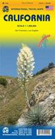
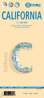
Waterproof California Road Map. 1:1,000,000. ITMB.
Printed in waterproof paper (plastic). Included are inset maps of San Francisco and Los Angeles. Very detailed with points of interest, golf courses, border crossings, state parks, museums, National Parks, lighthouses, beaches, caves, mountain peaks (with elevation in feet) and much more.
Sample detail of the California road map.
$7.95
62-56904
1 sheet, folded.
Laminated California 'Pearl' Road Map. GM Johnson.
Laminated road map of California showing the major highways throughout the state. Ideal for long road trips.
$6.95
62-56909
1 sheet, folded.
Laminated! Laminated California Road Map. Borch. California North 1:1 200 000, California South 1:1 200 000, Yosemite National Park 1:675 000, USA administrative and time zones. Borch Maps are easy to fold, durable and water-repellent with a wipeable surface. Borch Maps show hotels, museums, monuments, markets, public transport, top sights and points of interest, useful statistics, conversion charts for temperatures, weights and measurements, climate charts showing temperatures, sunshine hours, precipitation and humidity, overview maps, time zones, and much more...
The front of the Borch California road map The reverse of the Borch California road map Sample detail of the Borch California road map
$9.95
62-56914
1 sheet, folded
Laminated! California Pocket Road Map. Streetwise. California is a state of being as well as a destination state. From Imperial Beach, San Diego north to Pelican State beach near Oregon, the STREETWISE® California map lays out all the major state and county roads, freeways, cities, towns and major sites on one map.
On the back of the California state map you'll find enlarged inset maps of Los Angeles, San Diego, San Francisco, and Sacramento revealing more detailed driving information. In addition to city inset maps, also included is a detailed access map for Los Angeles International airport including the specific locations of car rental companies. Another small inset with driving distances and travel times was created to aid trip planning.
The front of the Streetwise California road map The reverse of the Streetwise California road map Sample detail of the Streetwise California road map
$7.95
62-56913
1 sheet, folded.
Waterproof! Northern and Southern California Road Maps - waterproof. National Geographic Maps.
The front side of the Northern California map is an easy-to-read road map with insets of: - San Francisco Bay Area - Stockton - Sacramento - Lake Tahoe - Redwood National and State Parks The back includes: - Map and information for San Francisco - Information for Yosemite National Park - Points of interest - Scenic drive - Park Service sites in Northern California.
The Southern California map is an easy-to-read road map with insets of: - Palm Springs - Monterey Bay Area - Fresno - Santa Barbara - Bakersfield - Los Angeles area - Oxnard / Ventura - San Diego The back includes: - Maps and information for Los Angeles and San Diego - Information for Sequoia & Kings Canyon National Parks - Points of interest - Scenic drive - Park Service sites in Southern California.
Size of both maps is 18 x 25 inches when open. Printed on water resistant, tear resistant synthetic paper.
The front of the National Geographic Northern California road map The reverse of the National Geographic Northern California road map Sample detail of the National Geographic Northern California road map
$7.95
62-56902N
Northern California Guidemap.
$7.95
62-56902S
Southern California Guidemap.
Laminated Northern and Southern California Easy-to-Fold Road Maps. Rand McNally.
Laminated road map of California showing the major highways throughout the state. Ideal for long road trips.
$9.99
62-56905
Northern California Easy-to-fold road map.
$9.99
62-56906
Southern California Easy-to-fold road map.
Waterproof California Highway One Road Map. MapEasy.
California Highway One is one of the most spectacular drives anywhere in the world! The map will provide you with the history and unique stories about the natural wonders, bridges, and attractions that you will be seeing along the way. Want to pick a spot to stop for lunch? Looking to spend the night in a small inn? Are you interested in enjoying a picnic from one of the scenic overlooks? MapEasy will show you the perfect one for all occasions.
Sample detail #1 of the California Highway One road map. Sample detail #2 of the California Highway One road map.
$4.50
62-56903
1 sheet, folded.
Laminated Southern California Road Map. Borch.
Laminated road map of California showing the major highways throughout the state. Ideal for long road trips.
Sample detail of the Southern California road map.
$9.95
62-56914S
1 sheet, folded.
California & Hawaii Lighthouse Map. Bella Terra Maps. Map size is 24 x 36 when unfolded.
Detailed shaded relief maps
Insets for Bay Area, Lake Tahoe & Lake Havasu (including Arizona)
Laminated California Missions Road Map. Global Graphics.
Laminated road map of California showing the locations of the 21 historic missions and 3 Asistencias, including a brief history and how to get there.
$5.95
62-56841
1 sheet, folded.
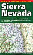
Sierra Nevada Road Map. 1:500,000. Imus Geographics. From Lassen Volcanic National Park through the High Sierra to Tehachapi Pass, this map displays the entire Sierra Nevada in a continuous sweep of dramatic mountain landscape. Size is 30 x 50 inches, folded. Note that the flat and laminated maps are printed on heavier poster-weight paper.
Sierra Nevada map sample Image of the entire Sierra Nevada map
$9.95
62-56726
1 sheet, folded.
$29.95
62-56726R
1 sheet, flat.
$39.95
62-56726L
1 sheet, laminated.
Walking, Biking, and Hiking maps of the San Francisco area. Rufus Graphics. Rufus Graphics is a San Francisco-based graphics design company that produces excellent walking maps for northern California, the Redwoods, and Yosemite. The maps are clear, easy to read maps with extensive text and photographs, all in a handy-sized accordian-fold map. Most maps are done in partnership with park visitor associations, city governments, etc.
$3.95
62-56871-AL
Alcatraz map and guide. Everything you'd like to know for your visit to Alcatraz. Includes its history, Indian Occupation, its prison era, and much more. Includes detailed drawings of the cell blocks, prisoner mug shots, information on escape attempts, and more.
Map detail from the Alcatraz map. Front of the Alcatraz map. Reverse of the Alcatraz map.
Golden Gate Park Map and Guide. A detailed map of this wonderful park in the middle of San Francisco - the equivalent to NYC's Central Park. The map shows the trails for walking, hiking, cycling, and horseback riding. Includes the locations of the museums, statuary, and other points of interest. The only map you'll need for a visit to this spectacular park.
Map detail from the Golden Gate Park map. Front of the Golden Gate Park map. Reverse of the Golden Gate Park map.
California City Maps - paper maps. Various publishers.
$4.95
62-5692AM
Amador County street map. (GM Johnson).
$5.95
62-5692ORN
Anaheim and Orange County North city map.Same as North Orange County below. Includes Buena Park, Fullerton, and surrounding cities. 2010. (Global Graphics).
$5.95
62-5692BB
Bakersfield city & Kern County map. (GM Johnson).
$5.99
62-5692BC
Bakersfield City Map. (Rand McNally).
Beverly Hills - See San Fernando Valley map below.
$4.95
62-5692CA
Calaveras County street map. (GM Johnson).
$5.95
62-5692CH
Chico, Oroville, Paradise city map. (GM Johnson).
$4.95
62-5692CO
Contra Costa County street map.
$5.95
62-5692DA
Davis city map. Includes Woodland and West Sacramento. (GM Johnson).
$4.95
62-5692ELC
El Centro & Calexico street map. (GM Johnson).
$5.95
62-5692EU
Eureka and Arkata street map. (GM Johnson).
$4.95
62-5692FAI
Fairfield & Vacaville street map.
$4.95
62-5692FRE
Fremont & Hayward City Map. (GM Johnson).
$5.95
62-5692FR
Fresno & Clovis city map. (GM Johnson).
$5.95
62-5692GJ
Gilroy city map. (GM Johnson).
$4.95
62-5692HE
Hemet, Perris. Includes Green Acres, Homeland, Nuevo, Quail Valley, and Valle Vista. (Global Graphics).
$5.95
62-5692HO
Hollywood and West Hollywood. 1:16,000. (Global Graphics)
$5.95
62-5692TAH
Lake Tahoe & Carson City street map. (GM Johnson).
$4.95
62-5692LI
Livermore and Pleasanton city map. ISBN 9781926532226.
$5.95
62-5692LON
(CA) Long Beach city map. Includes South Bay, Torrance, Carson. 2011. (Global Graphics).
$6.99
62-5692LA
Central Los Angeles & Hollywood city map. Also includes Beverly Hills, Santa Monica, Culver City, Hollywood, Inglewood, Baldwin Hills, and adjoining communities. (Universal).
$6.95
62-56921PO
Los Angeles Popout street map. With Popout's unique origami-style folding pattern. (Popout).
$6.99
62-5692LA
Los Angeles & Hollywood street map. (Rand McNally).
$4.95
62-5692LG
Los Angeles & Hollywood street map. (Global Graphics).
$6.99
62-56921LP
Los Angeles to San Diego & Vicinity street map. Regional road map at 1:279,000. (Rand McNally).
$4.95
62-5692MAL
Malibu street map. (Global Graphics).
$6.95
62-5692MB
Marin County Map. (Rand McNally).
$5.95
62-5692MAR
Mariposa & Yosemite National Park street map. (GM Johnson).
$5.95
62-5692MEN
Mendocino & Lake Counties street map. (GM Johnson).
$5.95
62-5692MAD
Merced & Madera street map. (GM Johnson).
$5.95
62-5692MOD
Modesto city map.
$5.99
62-5692MO
Monterey Peninsula. (Rand McNally).
$5.95
62-5692MP
Monterey Bay & Monterey Peninsula. (Global Graphics).
$5.95
62-5692MON
Monterey, Carmel, and Salinas city map. (GM Johnson).
$7.95
62-5682-04
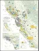
Napa & Sonoma wine country map. Popular hand drawn map showing wineries, vineyards, shopping, etc. On waterproof paper. (MapEasy).
$4.95
62-5682-03
Napa & Lake County Winery Locations. (Compass). A detailed black and white street map of the area.
$5.95
62-5692NAP
Napa & the Wineries city map. (GM Johnson).
$5.95
62-5692OAK
Oakland & Berkeley City Map. (GM Johnson).
$5.95
62-5692ON
Ontario, Pomona. (Global Graphics)
62-5692AN
Orange County - North Map by Rand McNally: See Anaheim map 62-5692AN above.
$5.95
62-5692ORC
Orange County Central street map. 1:32,000. Includes Huntington Beach, Irvine, Newport Beach, Santa Ana, Costa Mesa, Fountain Valley, Garden Grove, Laguna Woods, Tustin, Westminster and portions of surrounding cities. (Global Graphics).
$5.95
62-5692ORN
Orange County North and Anaheim city map. 1:32,000. Includes Buena Park, Fullerton, and surrounding cities. (Global Graphics).
$5.95
62-5692ORS
Orange County South street map. 1:32,000. Includes Laguna Beach, Mission Viejo, Dana Point, San Clemente, Aliso Village, Laguna Hills, Laguna Niguel, Laguna Woods, Lake Forest, Rancho Santa Margarita, San Juan Capistrano and surrounding cities. (Global Graphics).
$5.95
62-5692PALM
Palm Springs and Desert City Map. (Global Graphics).
$5.95
62-5692SY
Pasadena, El Monte, and San Gabriel Valley. Includes Alhambra, Altadena, Azusa, Montebello, Monterey Park, Pico Rivera, Downey, La Puente, Baldwin, San Gabriel, San Marino, and Sierra Madre. (Global Graphics).
$5.95
62-5692PL
Placerville, El Dorado Hills, Cameron Park city map. 2008. (GM Johnson).
$5.95
62-5692RED
Redding & Red Bluff city map.
$5.95
62-5692RIV
Riverside, Corona, Moreno Valley, and Norco. Includes adjacent parts of Orange, Perris, Riverside and San Bernardino counties. (Global Graphics)
$5.99
62-5692RJ
Riverside & Vicinity. Includes Corona, Norco, and March Air Force Base.
$5.95
62-5692RO
Roseville city map. Includes Rocklin, Citrus Heights, Auburn, Folsom. 2008. (GM Johnson).
$6.99
62-5692SA
Sacramento City Map. (Rand McNally).
$5.95
62-5692SAC
Sacramento street map. (GM Johnson)
$5.95
62-5692SANB
San Bernardino city map. Includes Bloomington, Colton, Fontana, Grand Terrace, Highlands, Loma Linda, Redlands, Rialto, Yucaipa. 2011. (Global Graphics).
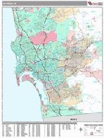
San Diego Recreation Map. (Great Pacific Recreation).
$5.95
62-5692SR
San Fernando Valley, Glendale, and Burbank. 1:32,000. Includes La Ca&ntilda;ada Flintridge, Hidden Hills, La Cresenta, Beverly Hills, and San Fernando. (Global Graphics).
$5.99
62-5692SV
San Fernando Valley street map. (Rand McNally). Out of print when sold out.
$5.95
62-5692SFR
San Francisco in Detail street map. 1:19,000. Large scale street map, fully indexed, with insets of Fisherman's Wharf, Downtown & Golden Gate Park. (Global Graphics).
$6.99
62-5692SF
San Francisco & northern peninsula street map. (Rand McNally).
$5.95
62-5692SFG
San Francisco & northern peninsula street map. (GM Johnson).
$6.99
62-5692SM
San Francisco Bay Area street map. (Rand McNally).
$6.95
62-5692SFC
San Francisco Transit street map. (Great Pacific Recreation).
$5.95
62-5692SFT
San Francisco Transit street map. (Global Graphics).
$5.95
62-5692SFB
San Francisco Recreation Map. (Great Pacific Recreation).
$5.95
62-5692SY
San Gabriel Valley city map. Includes Pasadena and Arcadia. (Global Graphics).
$5.95
62-5692SJC
San Jose City Map. (GM Johnson).
$5.95
62-5692SNM
San Mateo & Peninsula street map.
$5.99
62-5692SO
San Luis Obispo City Map. (Rand McNally).
62-5692OC
Santa Ana, Irvine, and Central Orange County. See Orange County Central map above.
$4.95
62-5692STB
Santa Barbara street map. (GM Johnson)
$5.95
62-5692SGC
Santa Cruz City Map. (GM Johnson).
$4.95
62-5692SHA
Shasta city map. Includes Cascade, Yreka, Weed, and Mt. Shasta. 2010. (GM Johnson).
$4.95
62-5692SX
Silicon Valley. 1:35,000. 2006. Detailed street map of multi-city area plus inset map of Downtown San Jose. (Global Graphics)
$5.95
62-5692SON
Sonoma & Santa Rosa City Map. Also includes Bodega Bay, Geyserville, Sebastopol. (Rand McNally).
$5.95
62-5692SOR
Sonora street map.
$5.95
63-1570
Stanford University.
$5.95
62-5692ST
Stockton city map. Includes Tracy, Lodi. (GM Johnson).
$5.99
62-5692STO
Stockton City Map. Includes Lodi, Tracy, Manteca. (Rand McNally).
$5.95
62-5692SUS
Susanville city map. Includes Quincy, Portola, Lassen, and Plumas County. (GM Johnson).
$4.95
62-5692TE
Temecula, Murrieta, Lake Elsinore. Includes Murrieta Hot Springs, Canyon Lake, and Rancho California.
$5.95
62-5692THO
Thousand Oaks & Simi Valley city map. (Global Graphics).
$5.95
62-5692VEN
Ventura & Oxnard city map. (GM Johnson).
$4.95
62-5692VIS
Visalia city map. Includes Tulare, Hanford, Porterville. (GM Johnson).
$5.95
62-5692YUB
Yuba City, Marysville, Grass Valley, Nevada City city map. (GM Johnson).
California City Maps - Laminated/Waterproof
California City Maps - Laminated. Various publishers.
$9.95
62-56921BB
Los Angeles city center map, laminated. (Borch). 1:17,000/1:60,000. Laminated. Recommended for drivers.
$7.95
62-5692LB
Los Angeles MapEasy map, laminated. Artistic drawing street map with shopping and restaurant information on the map. (MapEasy).
$7.95
62-56921LN
Los Angeles waterproof city map. (National Geographic Maps).
$9.95
62-56921LR
Los Angeles laminated city map. (Red Map).
$8.95
62-56921LI
Los Angeles waterproof city map. 1:15,000 & 1:1,000,000. (ITMB).
$5.95
62-56921LOH
Los Angeles & Hollywood Quickmap laminated city map. (Global Graphics).
$7.95
62-56921LOF
Los Angeles Freeyway Easyfinder laminated city map. (Rand McNally).
$6.95
62-56921MO
Monterey laminated city map. Includes Carmel, Pacific Grove, Seaside, & Salinas. (GM Johnson).
$7.95
62-5682-12
Napa & Sonoma wine country map. Fold-up laminated map of the wine country. (Global Graphics).
$7.95
62-5692PA
Palm Springs waterproof city map. (MapEasy).
$6.95
62-56921SAC
Sacramento laminated city map. Includes Citrus Heights, Elk Grove, Folsom, & ddjoining communities. (GM Johnson).
$7.95
62-56921SA
San Diego waterproof city map. Artist's drawing street map with shopping and restaurant information. (MapEasy).
$7.95
62-56921SB
San Francisco laminated city map. (Borch).
$7.95
62-56921SN
San Francisco waterproof city map. (National Geographic Maps).
$9.95
62-56921SR
San Francisco laminated city map. (Red Map).
$10.95
62-56921SI
San Francisco waterproof city map. 1:12,500 & 1:1,101,000. (ITMB).
$7.95
62-5692SN
San Francisco MapEasy waterproof city map. (MapEasy).
$6.95
62-56921SE
San Francisco ShopEasy waterproof city map. (MapEasy).
$5.95
62-56923SFF
San Francisco & Fisherman's Wharf FabricMap. This delightful and detailed map is printed on fabric so it can be used as a scarf, stuffed in a pocket, etc. (Rand McNally).
$6.95
62-56921SANB
Santa Barbara laminated city map. (GM Johnson).
$6.95
62-5682-13
Santa Barbara Wine Region Map, folded, laminated.
California City Street Atlases
California City Street Atlases. Various publishers.
$34.95
62-56922LOO
Los Angeles and Orange Counties Street Atlas. Spiral-bound atlas. (Kappa). This is the classic Thoms Bros. street atlas of Los Angeles and Orange Counties.
$19.99
62-56922SJV
San Joaquin Valley Street Atlas. Spiral-bound atlas. (Kappa).
California City Wall Maps
California City Wall Maps.
When it comes to general planning, defining delivery areas, planning direct marketing and delivering products, our city wall maps are perfect to get the detailed information you need.
We offer wall maps for:
Alameda, Alhambra, Aliso Viejo, Anaheim, Antioch, Apple Valley, Arcadia, Bakersfield, Baldwin Park, Bay Area, Bellflower, Berkeley, Brentwood, Buena Park, Burbank, Camarillo, Carlsbad, Carson,
Castro Valley, Cathedral City, Cerritos, Chico, Chino, Chino Hills, Chula Vista, Citrus Heights, Clovis, Coachella Valley, Colton, Compton, Concord, Corona, Costa Mesa, Cupertino, Daly City, Davis. Delano, Diamond Bar, Downey,
Dublin, East Los Angeles, Eastvale, El Cajon, El Monte, Elk Grove, Encinitas, Escondido, Fairfield, Folsom, Fontana, Fountain Valley, Fremont, Fresno, Fullerton, Garden Grove, Gardena, Gilroy, Glendale, Glendora, Hacienda Heights, Hanford,
Hawthorne, Hayward, Hemet, Hesperia, Highland, Hollywood, Huntington Beach, Huntington Park, Indio, Inglewood, Irvine, Jurupa Valley, La Habra, La Mesa, Laguna Niguel, Lake Elsinore, Lake Forest, Lakewood, Lancaster, Livermore,
Lodi, Long Beach, Los Angeles, Lynwood, Madera, Manteca, Menifee, Merced, Milpitas, Mission Viejo, Modesto, Montebello, Monterey Park, Moreno Valley, Mountain View, Murrieta, Napa, National City, Newport Beach, Norwalk, Novato,
Oakland, Oceanside, Ontario, Orange, Oxnard, Palm Desert, Palmdale, Palo Alto, Paramount, Pasadena, Perris, Petaluma, Pico Rivera, Pittsburg, Placentia, Pleasanton, Pomona, Porterville, Rancho Cordova, Rancho Cucamonga, Redding,
Redlands, Redondo Beach, Redwood City, Rialto, Richmond, Riverside, Rocklin, Rosemead, Roseville, Sacramento, Salinas, San Bernardino, San Clemente, San Diego, San Francisco, San Jose, San Leandro, San Marcos, San Mateo, San Rafael,
San Ramon, Santa Ana, Santa Barbara, Santa Clara, Santa Clarita, Santa Cruz, Santa Maria, Santa Monica, Santa Rosa, Santee, Simi Valley, South Gate, South San Francisco, Stockton, Sunnyvale, Temecula, Thousand Oaks, Torrance, Tracy,
Tulare, Turlock, Tustin, Union City, Upland, Vacaville, Vallejo, Ventura, Victorville, Visalia, Vista, Walnut Creek, Watsonville, West Covina, West Sacramento, Westminster, Whittier, Woodland, Yorba Linda, Yuba City, and Yucaipa.
Click here to see prices, sizes, and mounting options.
We offer state and county wall maps for all of the USA. The maps come in sizes from 24 x 36 to 108 x 144 inches. They are available in variety of mounting and framing options. The maps are ideal for business applications, sales territory, delivery planning, direct mail targeting and hundreds of other applications.
Click here to order county wall maps and to see sample images, descriptions, and prices.
Click here to order state wall maps and to see sample images, descriptions, and prices.
California Wall Maps. Kappa Maps.
This map details all state/federal highways, some secondary roads, cities and towns, major waterways, airports, wildlife areas, state universities, state and national parks, military installations, color coded counties, state facts and points of interest. Features insets of San Diego, San Francisco and Los Angeles. Cities and Counties are indexed on the face of the map.
Available in two styles - one without zip codes and colored counties and a second style with zip codes and white counties. Map size is 54 x 60" for the map without zip codes and 52 x 60" for the map with zip codes.
Thumbnail of the California wall map with zip codes. Sample detail from the California wall map without zip codes.
$219.99
62-56513
California wall map, without zip codes
$219.99
62-56514
California wall map, with zip codes
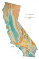
California Raven Shaded Relief Map. Raven Maps.
From the spectacular volcano Mt Shasta in the north through the Coastal Range, Cascade Mountains, and fertile Central Valley to the San Francisco Bay, Sierra Nevada, the beautiful Pacific Coast beaches and stunning deserts of the southeast, our Raven California wall map presents a strikingly beautiful view of the state. Elevations are represented by color, and this, in combination with our relief shading technique, gives the map a 3-dimensional look.
Available in two sizes; small at 34 x 49" and large at 43 x 65". Please note that the large is only available as a paper map.
Thumbnail of the map. Sample of the detail.
Southern California Raven Shaded Relief Map. 1:375,000. Raven Maps. Size is 33 x 64". This intricately detailed map shows off Southern California's spectacular land and sea scapes. The warm blues of the coastal waters are a perfect match for the rich earth tones of the inland cliffs and mountains. Elevations are represented by color, and this, in combination with our relief shading technique, gives the map a 3-dimensional look.
Thumbnail of the map. Sample of the detail.
$40.00
62-56512
Each, rolled
$65.00
62-56512L
Laminated
California Wall Map. National Geographic Maps. All NGS state wall maps are printed in Colorado by a certified green printer using 10% recycled paper stock, low V.O.C. inks, and shipped less than 30 miles to National Geographic Map's central warehouse.


 Sample detail from the California recreation atlas.
 Sample of the map detail
 Sample detail of the Route 66 road atlas
 Sample detail of the Benchmark California road map
 Sample detail of the Lake Tahoe inset map

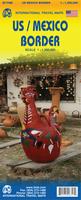
 Sample detail #1 of the USA - Mexico Border Travel Map
 Sample detail #2 of the USA - Mexico Border Travel Map
 Waterproof
 Sample detail of the California road map.
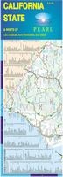 Laminated
 Laminated!
 The front of the Borch California road map
 The reverse of the Borch California road map
 Sample detail of the Borch California road map
 Laminated!
 The front of the Streetwise California road map
 The reverse of the Streetwise California road map
 Sample detail of the Streetwise California road map
 Waterproof!
 The front of the National Geographic Northern California road map
 The reverse of the National Geographic Northern California road map
 Sample detail of the National Geographic Northern California road map
 Laminated
 Waterproof
 Sample detail #1 of the California Highway One road map.
 Sample detail #2 of the California Highway One road map.
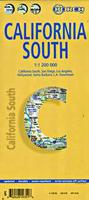 Laminated
 Sample detail of the Southern California road map.
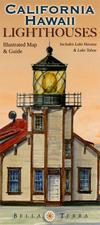
 Front of the California lighthouse map
 Reverse of the California lighthouse map
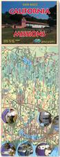 Laminated
 Sierra Nevada map sample
 Image of the entire Sierra Nevada map
 Map detail from the Alcatraz map.
 Front of the Alcatraz map.
 Reverse of the Alcatraz map.
 Map detail from the Berkeley map.
 Front of the Berkeley map.
 Reverse of the Berkeley map.
 Map detail from the Golden Gate Park map.
 Front of the Golden Gate Park map.
 Reverse of the Golden Gate Park map.
 Map detail from the Haight-Ashbury district map.
 Front of the Haight-Ashbury district map.
 Reverse of the Haight-Ashbury district map.
 Map detail from the Oakland district map.
 Front of the Oakland district map.
 Reverse of the Oakland district map.
 Map detail from the Redwood Parks district map.
 Front of the Redwood Parks district map.
 Reverse of the Redwood Parks district map.
 Map detail from the San Francisco district map.
 Front of the San Francisco district map.
 Reverse of the San Francisco district map.
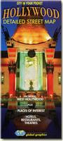

 Map detail from the San Diego map.
 Map detail from the SW USA Border Area map.
 Thumbnail of the California wall map.
 Sample detail of the California wall map.
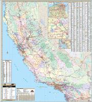
 Thumbnail of the California wall map with zip codes.
 Sample detail from the California wall map without zip codes.
 Thumbnail of the map.
 Sample of the detail.

 Thumbnail of the map.
 Sample of the detail.
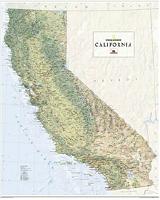
 Image of the whole map
 Sample of the map detail