Do you need map pins, map tacks, map pennants/flags to go with your world map? If so click here to see a complete list. Great marker pins, pennants, and flags for marking locations on maps. Multiple colors, multiple styles, numbered pins also available.
Flexible Magnetic World Political Wall Maps. Futuremapping, UK.
These very attractive equal-area maps are laminated and mounted on flexible sheet metal so that the maps can be rolled and stored in a tube.
Each map has a safe, durable, write/on wipe off surface that magnets will stick to.
The maps can be easily fixed to a wall using two magnetic strips along the top and bottom of the maps (included with each map).
Each map comes with a dozen magnetic dots.
Each map also available as a laminated-only (not magnetic) version.
Futuremap's Huge World Political Wall Map. 1:20,000,000. Futuremapping, UK.
Emerald to Lime to Metallic Khaki.
At 2 x 1 meter (78-1/2 x 39-1/4") this single-sheet map creates a huge impact in any room or office.
The map uses a cylindrical equal area projection that represents countries in their correct proportional size. It achieves this by sacrificing shape, particularly in the areas closest to the poles. The result is an alternative and thought-provoking vision of the planet on which we live.
The attractive color palette flows through countries and continents removing the abrupt country border lines of more traditional lines. This gives a soothing appeal to this map without sacrificing accuracy or information.
Futuremap World Political Wall Map. 1:50,000,000. Futuremapping, UK.
The attractive color palette flows through countries and continents removing the abrupt country border color changes of more traditional maps, yet each country has a distinct black border to clearly show country borders. This gives a soothing appeal to this map without sacrificing accuracy or information.
Map size is 90 x 45.6 cm (36 x 20").
Available in several color palettes - please see below.
Physical relief is shown as a shaded relief layer.
Bathymetric layering in silver represents the oceans and seas.
The map uses a cylindrical equal area projection that represents countries in their correct proportional size. It achieves this by sacrificing shape, particularly in the areas closest to the poles. The result is an alternative and thought-provoking vision of the planet on which we live.
Details include: political boundaries, capital and major cities, rivers, highest peaks, sea depths, North and South Pole projections and a shaded physical relief layer.
Maps are printed on a very high quality silk finish paper.
World Political Wall Map - Colormap editions. 1:30,000,000. Futuremapping, UK. Are you looking for something different from the typical world political maps? These are beautiful, artistic world maps with a unique style ideal for a more modern setting. They are available as plain paper, laminated, or mounted on flexible magnetic backing.
Each country colored separately so the country borders are more apparent.
Map size is 120 x 62 cm (47 x 25").
Available in several color palettes - see below.
The oceans and seas are colored in 15° x 15° blocks, making it very easy to see latitude and longitude across the entire map.
Sea beds and plate tectonic boundaries and movements are also shown.
The map uses the Robinson Projection, a modified cylindrical equal area projection that represents countries in their correct proportional size. It achieves this by sacrificing shape, particularly in the areas closest to the poles. The result is an alternative and thought-provoking vision of the planet on which we live.
Details include: Country boundaries, capital and major cities, rivers, roads, and airports, time zones, and North and South Pole inset maps.
Maps are printed on a very high quality silk finish paper.
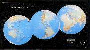
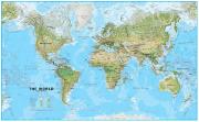
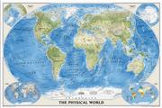
Recommended World Physical Map. 1:30,000,000. DMA/NIMA/USGS. An attractive large-sized world physical map that is reasonably up-to-date (lacking only the Zaire to Democratic Republic of Congo change). This is the updated single-sheet version of the 8-sheet World Wall Mural map (67-8805).
Updated 3-sheet and 6-sheet versions are also available. These maps are all made from the same original cartographic image, so the detail is the same on each map, just enlarged more for the larger wall maps. Please note that we have put sample images up for each size. Each sample is scanned at 1:1 and covers the same area of the map; the SE USA. This way you can see the comparable size and detail of the maps. Mercator projection.
World Physical map, full view. Image of Wall Mural map after mounting on wall.
AA-0058
1 sheet, rolled. Size 42 x 55 inches.
$16.99
AA-0058L
Laminated, rolled. Size 42 x 55 inches.
$29.99
67-1051
3 sheets, rolled. Size 57 x 74 inches.
$49.99
67-1050
6 sheets, rolled. Size 86 x 118 inches.
$99.99
67-8805
8 sheets, rolled. Size 8.5 x 13.5 feet. Printed on wall paper for easy application.
$159.99
67-88051
8 sheets, rolled. Size 8.5 x 13.5 feet. "Executive" version with special coating to allow writing on the map with watersoluble markers. Printed on wall paper for easy application.
World Political Map, tyvek. 1:33,000,000. Interarts/Mapquest. A very colorful map, printed on waterproof and tear resistant tyvek(r). Ideal for thumbtacking to a wall as the thumbtacks don't tear out of the tyvek.
Sample of the map Thumbnail image of the map
67-1105
Tyvek map, flat/rolled. Size is 28-1/2 x 50".
$25.00
67-1105L
Laminated, flat/rolled. Size is 29-1/2 x 53-1/2".
$39.99
World Political Wall Map - large size. 1:20,000,000. Hema. A very colorful map, printed on paper. This large wall map is less cluttered and has larger type size than the comparable National Geographic maps, although the NG map has a little more detail. Size is approx. 48 x 77". Available in plain paper or laminated.
Sample of the map detail. Thumbnail image of the map.
67-1108
Paper map, flat/rolled.
$54.99
67-1108L
Laminated, flat/rolled.
$69.99
World Map - Pacific Centered. 1:30,000,000. Hema. With time zones and flags of the world.
67-10521
1 sheet, flat
$14.95
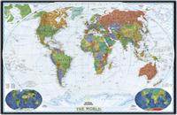
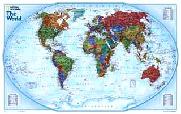
World Wall Maps by National Geographic
Our favorite two world maps
World Maps - Decorator style.
Colorful and bold - countries easily identified. Enjoy the accuracy and beauty of the latest world map from the cartographers at National Geographic. This map features the Winkel Tripel projection. The Decorator map has spectacular color and detail to bring the world alive. Ideal for home, office, or school.
Thumbnail of the entire map Sample map detail #1 Sample map detail #2 An enlarged view of the mounted map
67-10536
World Political Map, Winkel projection. 1:38,931,000. 46 x 30".
$16.99
67-10536L
World Political Map, laminated.
$29.95
67-10536BL
World Political Map, regular size - mounted, black.
$199.95
67-10536GO
World Political Map, regular size - mounted, gold.
$199.95
67-10536WH
World Political Map, regular size - mounted, white.
$199.95
67-10536WO
World Political Map, regular size - mounted, wood-grain.
$199.95
67-10537
World Political Map, Winkel projection - large size. 1:24,000,000. 73 x 48".
$34.99
67-10537L
World Political Map - large size, laminated.
$59.99
67-10537BL
World Political Map, large size - mounted, black.
$499.95
67-10537GO
World Political Map, large size - mounted, gold.
$499.95
67-10537WH
World Political Map, large size - mounted, white.
$499.95
67-10537WO
World Political Map, large size - mounted, wood-grain.
$499.95
World Maps - Executive Style (Antique style).
Current information with an old look. Enjoy the accuracy and beauty of the latest world map from the cartographers at National Geographic. This map features the Winkel Tripel projection and has elegant, rich tones that will complement any office or home. Astounding detail and board room quality make these maps excellent for reference or as a keepsake for your map library. This is a current political map featuring an antique style. 43'' x 30''.
Winner of the 2001 Premier Print Award from Printing Industries of America for "a unique ability to create visual masterpieces"
World Political Map, Winkel projection. 1:38,931,000. 46 x 30".
$16.99
67-10538L
World Political Map - standard size, laminated. 46 x 30".
$24.99
67-10538BL
Standard size - mounted, black.
$199.95
67-10538GO
Standard size - mounted, gold.
$199.95
67-10538WH
Standard size - mounted, white.
$199.95
67-10538WO
Standard size - mounted, wood-grain.
$199.95
67-10539
World Political Map, large size. 1:24,000,000. 70 x 49".
$34.99
67-10539L
World Political Map - large size, laminated. 73 x 48".
$59.99
67-10539M
World Political Map - wall mural size. 116 x 76."
$99.99
67-10539BL
Large size - mounted, black.
$499.95
67-10539GO
Large size - mounted, gold.
$499.95
67-10539WH
Large size - mounted, white.
$499.95
67-10539WO
Large size - mounted, wood-grain.
$499.95
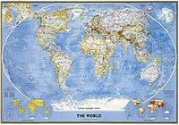
Classic National Geographic World Map! World Political Map. This famous map features the Robinson projection, which minimizes distortion relative to shapes, distances and perspective. Insets of physical hemispheres, polar views, vegetation and land use, and population density. Available in three sizes.
Standard size - 43-1/2" x 30-1/4". Huge size - 71-1/4" x 50". Mural size - 110" x 76" (9' 2" x 6' 4"). An image of the full map A detail of the map A sample of the legend An enlarged view of the mounted map
67-10530
Standard size - 43-1/2" x 30-1/4". Rolled.
$14.99
67-10530L
Standard size - laminated.
$24.99
67-10530BL
Standard size - mounted, black.
$199.95
67-10530GO
Standard size - mounted, gold.
$199.95
67-10530WH
Standard size - mounted, white.
$199.95
67-10530WO
Standard size - mounted, wood-grain.
$199.95
67-10531
Large size - 71-1/4" x 50".
$34.99
67-10531L
Large size - laminated.
$59.99
67-10531BL
Large size - mounted, black.
$499.95
67-10531GO
Large size - mounted, gold.
$499.95
67-10531WH
Large size - mounted, white.
$499.95
67-10531WO
Large size - mounted, wood-grain.
$499.95
67-10532
Mural size - 110" x 76" (9' 2" x 6' 4"). 1:15,267,000. This supersized panorama comes boxed in three sections and hangs like wallpaper. Printed on latex-coated paper stock.
$99.99
World Hemispheres Map. National Geographic Maps, 2007. During the 1930's and 1940's, several National Geographic world maps were designed using a projection that separated the eastern and western hemispheres. NGS have brought back this classic view of the world with updated, modern cartography and an elegant earth-tone color palette. This new, yet fashionably retro, world map is the World Hemispheres Map.
Thumbnail image of the entire map Sample of the map detail
67-10529
1 sheet, flat.
$12.99
67-10529L
Laminated.
$24.99
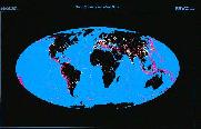
World Satellite Map. 1:39,000,000. The most accurate map of Earth's surface yet produced from satellite data. This computer-generated composite map draws from more that 500 images to give one-kilometer detail and consistent representation of natural colors.
An enlarged view of the mounted map
67-10542
World Satellite Image Map. 1:39,000,000. 44 x 30".
$12.99
67-10542L
World Satellite Image Map, laminated. 44 x 30".
$24.99
67-10542BL
World Satellite Image Map - mounted, black.
$199.95
67-10542GO
World Satellite Image Map - mounted, gold.
$199.95
67-10542WH
World Satellite Image Map - mounted, white.
$199.95
67-10542WO
World Satellite Image Map - mounted, wood-grain.
$199.95
World Explorer Map. Enjoy the accuracy and beauty of the latest world map from the cartographers at National Geographic. Map features Winkel Triple projection to reduce distortion of land masses as they near the poles. Features include charts listing largest cities by population and the largest countries in the world by land mass and population.
An enlarged view of the mounted map
Maps of Discovery - East & West mounted set. National Geographic Maps. In 1927, famed American painter N.C. Wyeth completed a series of five murals for Hubbard Memorial Hall, the National Geographic Society's first formal library. Called "The Romance of Discovery," the murals were flanked by highly illustrated maps of the eastern and western hemispheres showing the paths taken by some of the world's most significant explorers. The eastern hemisphere map is decorated with portraits of these men charting their courses. The western hemisphere features Poseidon and a mermaid keeping watch over the oceans. These two murals have been captured on paper for everyone to enjoy.
Each plaque measures 20" x 18". Available as an east + west set mounted on wood, or as individual east or west maps, either plain paper, or laminated.
An image of the full map A detail of the map An enlarged view of the mounted map
67-10505BL
Mounted, black
$169.95
67-10505GO
Mounted, gold
$169.95
67-10505WH
Mounted, white
$169.95
67-10505WO
Mounted, wood-grain
$169.95
67-10505E
Eastern hemisphere, flat/rolled
$16.99
67-10505EL
Eastern hemisphere, laminated
$33.99
67-10505W
Western hemisphere, flat/rolled
$16.99
67-10505WL
Western hemisphere, laminated
$33.99
World Upside Down Wall Maps
"Upside Down" World Map. ODT.
This map has the world turned upside down to give a different perspective on the world. The map has shaded relief to show mountain ranges; each country is colored differently and the map has several comparative world views along the bottom. Available either flat/rolled or as a laminated wall map.
Available in two sizes is 24 x 36" and 36 x 56".
Thumbnail image of whole map A detail from the map
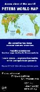
World Peters Projection Map. ODT.
The Peters Projection World Map is one of the most stimulating, and controversial, images of the world.
When this map was first introduced by historian and cartographer Dr. Arno Peters at a Press Conference in Germany in 1974 it generated a firestorm of debate and it continues to have passionate fans as well as staunch detractors, as noted in its portrayal on The West Wing tv show.
The earth is round. The challenge of any world map is to represent a round earth on a flat surface. There are literally hundreds of map projections. Each has certain strengths and corresponding weaknesses. Choosing among them is an exercise in values clarification: you have to decide what's important to you. That is generally determined by the way you intend to use the map. The Peters Projection is an area accurate map, meaning the sizes of each land mass is accurate in relation to each other.
Size is 24 x 36".
67-10511SF
Folded map, paper.
$15.99
67-10511S
Wall map, paper.
$19.99
67-10511SL
Laminated wall map.
$24.99
Peters Pacific-Centered Equal-Area World Map. ODT, Inc. A Pacific-centered, equal-area world map. The map shows accurate sizes and proportions - see how big Greenland really is compared to the USA. Pacific-centered to show the true dimensions of the Pacific Ocean. Folded, overall size is 20½ x 32".
Thumbnail of the whole map
67-10523
1 sheet, folded. Size is 20½ x 32".
$9.95
Equal-area World Placemat. ODT, Inc. This attractive placemat/map is printed on both sides! The image on one side is North-up, Africa in the center. Turn the map over and you see the EXACT same map with different orientation and different centering: South-up and Australia center-top! Size is 11 x 17" (28 x 43 cm.).
Front side of the placemat Reverse side of the placemat
67-93943
Placemat.
$8.95
67-93943S
Placemat 4-set - buy 3, get one free.
$26.85
World Population Maps
World Population Map. ODT, Inc.
The Population Map shows the world in an entirely new light! See where the human beings of the world live, and how many are where. The map image is startling, provocative and BEAUTIFUL. Each country is shown proportional to its population. The map presents people, not territory. Each square of the grid on the map represents a million people. From the perspective of population, China is the biggest country in the world! India is not far behind. For a real shock, compare Indonesia with the United States. This map shows how the USA is only a small part of the whole, 4.5% or less than one-twentieth of the Earth's humans. The main map is enhanced by a series of startling and informative images at the bottom: Population, by continent, throughout human history. This series of "snapshot" images shows the people, and where they were at (1) 100,000 years ago, (2) at the time of the birth of Christ, (3) at 1650 AD, (4) at 1900 AD, and includes (5) population projections for the year 2150. There is also a map of population density showing where there are more than 30 people per square mile. In contrast to the usual continents of land, this density image shows the continents and islands of humankind!
Image of the full map
67-1062
Folded.
$24.99
67-1062L
Flat, laminated.
$29.99
Foreign Language World Maps
World Political Map, in French. 1:33,700,000. France IGN. A colorful political map that has relief shading to indicate the topography. Internal political boundaries are shown for India, Mexico, Canada, and the USA. Major rivers, towns and cities are marked. Examples of early world maps are illustrated along the bottom. In French. Aitoff-Wagner projection, in French. Size is 120 x 90 cm.
67-10513
1 sheet, flat, rolled, paper.
$19.99
67-10513L
Laminated.
$36.99
World Physical Map, in French. 1:33,000,000. France IGN. An attractive physical map whose brighter than normal colors make for easy, clear viewing. In French. Size is 83 x 127 cm (33 x 50 inches).
67-1057-FR
1 sheet, flat/rolled, paper.
$24.99
67-1057-FRL
Laminated.
$34.95
World Physical Map, in French. 1:15,000,000. France IGN. This 3-sheet map has a dark turquoise sea with good physical relief. Four levels of settlement are noted, three different types of roads, plus canals, pipelines and railways. The three sheets join easily and can be put together to be either Europe/Africa or Pacific centerd. The map includes ice flow limits. The names of the countries and major cities are spelled as they are in that country itself; for less well known countries/cities, the French equivalent is also shown. Otherwise the map is in French. Mercator projection. Map size is approximately 8'11" x 4'5" (270 x 135 cm).
Image of the entire World wall map. Sample detail of the French world wall map.
67-10571-FR
3 sheets, flat/rolled.
$79.99
World Political Map, in Hungarian (Folded map). 1:36,000,000. Szarvas. A good quality folded world political map, in Hungarian.
67-1130-HU
1 sheet, folded.
$12.95
World Political Map, in Russian. 1:30,000,000. GUGK. An attractive antique-style political map with current information, produced by the Russians. In Russian.
67-10512
1 sheet, flat/rolled.
$39.99
World Maps For Children
Children's Map of the Prehistoric World. Dino's. Dino's all new Illustrated Map of the Prehistoric World includes hundreds of historical, educational, and entertaining points of interest illustrations amazingly drawn by skilled artists combining detailed information and creativity results in one of the most uniquely entertaining maps available. Protected by durable lamination. Map size is approximately 54" x 38."
Sample of the map detail Image of the entire map
67-5801
1 sheet, rolled.
$19.99
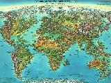
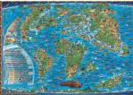
Children's World Map. Dino's. Illustrated with flags of the world and 450 fun facts. It shows all the continents with illustrations of their natural resources and national costumes. How did people discover far off lands with their indiginous flaura and fauna? Take a look - its a most entertaining and well thought out childrens map, looks good with a flat bright background and the countries, birds animals etc., all UV varnished to stand out and look attractive. This children's map of the world is the most interesting and eye-catching map we have ever seen. Your kids will spend hours looking and studying all the graphics on this map. What's more, they will accidentally learn world geography in the process.
This world map is "off the hook" when it comes to awesome graphics. It is perfect for a teenager's room. Be sure to take a look at the close-up to see the detailed pictures used on this map. They are intended to represent the primary activities in that part of the world. The Childrens World Map comes standard with a heavy varnish coating on the front. This coating will allow you to clean the map with a wet paper towel.
Image of the entire map Sample of the map detail
67-5802
1 sheet, rolled.
$14.99
World Physical Map. Global Map. Over 80 million spot heights were used to create the accurate hill shading and there are tints to show ocean depths and currents. Time clocks are usefully appended along the top to show zone changes
Image of the entire map
67-5803
1 sheet, rolled, laminated.
$49.99
World Map of Container Ports
World Map of Container Ports - wall map. 53" x 77". It is a premium quality map designed as a decorative office resource for a wall or boardroom environment. The map is printed on one side and one sheet of paper. It features a large scale global projection as well as detailed inset maps. In addition, over 1100 container ports are indexed, plotted and categorized, by annual container throughput as well as 322 airports with IATA codes are indexed and plotted.
Thumbnail image of the map
67-21070
Wall map
$99.99
Desktop World Map of Container Ports - small edition. 27 x 39". This small version is designed for forwarders and traffic managers and for professionals managing large volumes of containers. The map is printed on two sides featuring a global projections as well as detailed inset maps. In addition over 1100 container ports are indexed, plotted and categorized, by annual container throughput. Furthermore, over 900 Port Authority websites are indexed in a supporting table.
Thumbnail image of the map
67-21071
Map, folded
$9.95
67-21071L
Map, laminated
$16.99
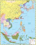
South East Asia Map Ports Wall Map. KG Johnson & Co. 41 x 28" ink jet plotted map of Asia, priced at $49.00, featuring Asia's Container Ports from Vladivostok in the north to Singapore in the south including inset maps featuring Japan's Inland Sea, Shanghai & Lower Yangtze River and Hong Kong and the Pearl River Delta.
Sample of the map detail Thumbnail image of the entire map
66-20936
Wall map
$99.99
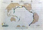
Ocean Floor Maps by Marie Tharp
World Ocean Floor Panorama. 1977. Heezen & Tharp. The map is based on more than 5,000,000 miles of soundings. 96 x 61 cm (38 x 24").
67-3000
Small size, 38" x 24"
$39.99
World Atmosphere Chart
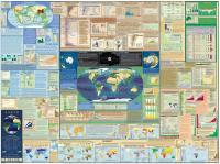
The Atmosphere Chart. For the first time ever, here is a wall chart that depicts all of the major weather phenomena used by meteorologists, aviators and space scientists. The chart illustrates each weather system with a diagram and brief explanation. It shows spectacular color photographs of the basic cloud types, frontal systems, and more. Intended for students, hobbyists and professionals alike, The Atmosphere will prove invaluable as an easy wall reference. Size 55" x 33".
71-5250
Each, rolled
$17.95
71-5250L
Each, laminated
$29.95
World Environment Maps
The Environment Chart. This attractive book-in-a-chart format will raise students' awareness of environmental hazards. 42 color photos illustrate the hazards of deforestation, toxic wastes, ozone depletion, oil spills, pollution, chemical accidents, severe weather, and more. Size is 55" x 33".
Detail of one of the inset maps. View of the entire chart.
71-5290
Each
$33.99
71-5290L
Each, laminated
$29.95
World Earthquake and Seismicity Maps
World Seismicity Poster: 1979-1988. USGS. This poster (64 x 36") displays selected hypocenters for earthquakes that occurred during 1979-1988.
More than 23,000 separate epicenter locations, representing 97,069 earthquakes, are displayed. The base map is Raven Maps' famous "Three Worlds" map.
67-3208
Each, rolled
$19.99
Global Seismicity and World Cities. USGS. This map (53 x 34.5") displays the worldwide hazard to cities posed by large earthquakes.
When earthquakes occur near cities of any size, the potential for damage is great. On this map more than 39,000 earthquake epicenters (purple dots) are depicted.
Where earthquake epicenters are co-located with cities, the earthquake epicenters are denoted by orange dots. Base map from Raven Maps.
67-3205
Each, rolled
$14.95
A Century of Great Earthquakes: 1897-1996. USGS. This map (27 x 18") sohws selected earthquakes having a determined magnitude of 7.8 or greater.
Portions of the Southwest and North Pacific are not included, even though they may have experienced great earthquakes. The base map is from Unique Media.
67-3209
Each, rolled
$14.95
Circum-Pacific Seismic Potential. USGS. The map (35 x 26") shows the time-dependent probabilities for the recurrence of large (7.07.7) shallow, plate-boundary earthquakes within specified segments of the Circum-Pacific region. The time window depicted is 1989-1999. Base map is from Raven Maps.
67-3210
Each, rolled
$14.95
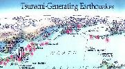
Tsunami-Generating Earthquakes. USGS. This map (27 x 18") shows those earthquakes that occurred in 1900-1994 that generated destructive tsunamis somewhere in the Pacific region.
Many of the earthquakes shown denerated tsunamis that resulted in loss of life. Tsunamis that originated from distant earthquakes are also shown on the map. Base map from Unique Media.
 Sample of the map detail
 Thumbnail image of the entire map
 Shows the flexibility of the map and the magnetic mounting strip
 Shows magnet use on the front of the map

 Sample #1 of the map detail
 Sample #2 of the map detail
 Thumbnail image of the entire map
 Sample #1 of the map detail
 Sample #2 of the map detail
 Thumbnail image of the entire map
 Sample #1 of the map detail
 Sample #2 of the map detail
 Thumbnail image of the entire map
 Sample #1 of the map detail
 Sample #2 of the map detail
 Thumbnail image of the entire map
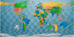
 Sample of the map detail
 Thumbnail image of the entire map
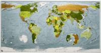
 Sample of the World Colormap map detail
 Thumbnail image of the entire World Colormap map
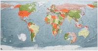
 Sample #1 of the World Colormap map detail
 Sample #2 of the World Colormap map detail
 Thumbnail image of the entire World Colormap map
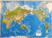 Recommended
 World Physical map, full view.
 Image of Wall Mural map after mounting on wall.


 Sample of the detail of the blue-ocean map
 Thumbnail of the blue-ocean map
 Thumbnail image
 Sample detail
 Image of the entire map
 Sample of the map detail
 Sample of the map
 Thumbnail image of the map
 Sample of the map detail.
 Thumbnail image of the map.
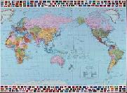
 Thumbnail of the entire map
 Sample map detail #1
 Sample map detail #2
 An enlarged view of the mounted map
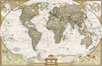


 An image of the full map
 A detail of the map
 A sample of the legend
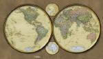
 Thumbnail image of the entire map
 Sample of the map detail
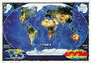


 An image of the full map
 A detail of the map
 A sample of the legend
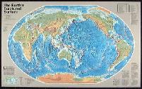
 An image of the full map
 A detail of the map
 A sample of the legend
 An image of the full map
 A detail of the map
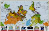
 Thumbnail image of whole map
 A detail from the map
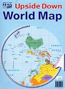
 Sample detail of the Upside down world map
 Thumbnail image of whole map
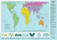

 Thumbnail of the whole map
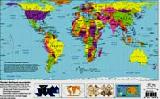
 Front side of the placemat
 Reverse side of the placemat
 Image of the full map
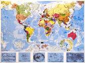

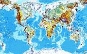

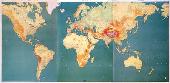
 Image of the entire World wall map.
 Sample detail of the French world wall map.
 Sample of the map detail
 Image of the entire map
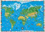
 Image of the entire map
 Sample of the map detail
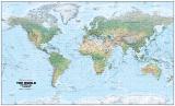
 Image of the entire map
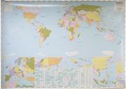
 Thumbnail image of the map
 Sample of the map detail
 Thumbnail image of the entire map
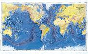 World Ocean Floor Panorama. 1977. Heezen & Tharp. The map is based on more than 5,000,000 miles of soundings. 96 x 61 cm (38 x 24").


 Detail of one of the inset maps.
 View of the entire chart.