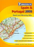
Spain Road Atlas. 1:400,000. Michelin. Spiral-bound, also covers Portugal. Michelin's mapping of Spain & Portugal at 1:400,000 is combined here into a spiral-bound atlas (A4-sized pages). Includes Canaries, Azores and Balearics.
Road detail shows minor roads, toll barriers & high passes and includes intermediate driving distances, with steep road gradients and seasonal restrictions also marked. The maps use bold relief shading to show the terrain, and symbols depict plenty of landmarks. Railways, cablecars, funiculars and ferries are marked. Tourist information includes scenic routes and viewpoints, golf courses, caravan & camping sites, pleasure boat harbours. The maps also indicate towns and villages with entries in Michelin's Red Guide to hotels and restaurants. Map legend includes English.
Additional features of the atlas include: a distance table; and indexed street plans of major towns.
Sample detail from the Sapin road atlas.
$22.00
65-3287
Atlas.
Spain & Portugal Superatlas. 1:400,000. Freytag & Berndt. Excellent spiral-bound road atlas. Includes tourist information, city maps, and an index with postal codes. 8½ x 11" in size.
$29.95
65-32871
Atlas.
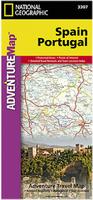
Spain & Portugal Travel Map. 1:1,000,000. Michelin. A very popular, easy-to-read map which is excellent for route planning. The road network is clearly portrayed against an uncluttered background, with roads classified by width, so it is easy to plan your preferred route. The larger cities are very clearly marked and named. Scenic routes and forests are noted, and relief shading highlights the hills and mountains. National and provincial borders are also shown. Includes driving distance/time chart and index.
$12.95
65-3291
Spain. 1:1,000,000. #990.
Michelin Regional Travel Maps. 1:250,000 - 1:400,000. Michelin maps of Spain are highly regarded by travelers. These are current maps with good detail. Multilingual shaded relief maps with indexes. Map size varies.
Spain Road Map Series Sample from the Andalucia map
$11.95
65-3294-571
Northwest Spain - Galicia. #571.
$11.95
65-3294-575
Northcentral Spain - Castilla y León. #575.
$11.95
65-3294-574
Northeast Spain - Aragón, Cataluña. #574.
$11.95
65-3294-576
Central Spain - Madrid, Castilla-La Mancha. #576.
$11.95
65-3294-577
Eastcentral Spain - Valenciana, Murcia. #577.
$11.95
65-3294-578
Southern Spain - Andalucía. #578.
$11.95
65-3294-572
Northwest coast of Spain - Asturias, Cantabria. #572. 1:250,000.
$11.95
65-3294-573
Northcentral coast of Spain. #573. 1:250,000.
$11.95
65-3294-579
Balearic Islands. #579. 1:140,000.
Recommended! Spain Zoom Regional Road Maps. 1:150,000. Michelin. Much more detailed than the regular 1:300,000 regional series, this series covers the most popular tourist areas of Spain, from Barcelona to Madrid, from northern Spain to Valencia, from the Pyrenees to the Canary Islands, and from the Costa Brava to El Camino de Santiago. Multilingual.
Index of the coverage of the Michelin Zoom Spain map series. Sample from the Michelin Zoom Spain map series
$11.99
65-32905-121
Madrid and Vicinity (Madrid y alrededores). 1:170,000.
$13.99
65-32905-123
Costa Blanca. 1:130,000.
$11.99
65-32905-124
Costa del Sol. 1:200,000.
$11.99
65-32905-125
Canary Islands (Islas Canarias). 1:150,000.
$11.99
65-32905-141
Côte de Galice. 1:150,000.
$12.99
65-32905-142
Asturia, Costa Verde. 1:150,000.
$11.99
65-32905-143
Côte Cantabrique. Temporarily out of stock, due Oct. 1.
$11.99
65-32905-144
Pyrénées occidentales. Western Pyrénées. 1:150,000.
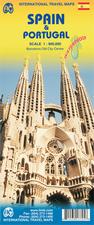
Spain & Portugal Travel Map. 1:1,100,000. ITMB. Detailed road map with shaded relief and elevation tinting to show physical relief.
$12.95
65-32915
1 sheet, folded
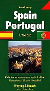
Spain & Portugal Travel Map. 1:700,000. Freytag & Berndt. Good overview map of the Iberian Peninsula (Spain & Portugal). Inset maps show the Strait of Gibraltar, Mallorca & Menorca. Relief shading indicates the topography. Latitude & longitude lines are at 30' intervals.
Tourist information includes scenic roads, viewpoints, places of interest, etc. An extensive index booklet for the main map is attached to the map cover. This booklet also contains city centre street plans for Madrid, Barcelona and Lisbon, which are not indexed.
$15.99
65-3290
1 sheet, folded
Waterproof! Spain and Portugal Travel Map. Scale 1:1,000,000. National Geographic Maps. The front side of the Spain/Portugal map shows the eastern half of Spain from its northern borders with France and Andorra south along its Mediterranean coastline to Almería. Portugal and the western half of Spain including the Canary Islands are covered on the reverse side of the map. Base cartography by Reise Know-How. Size is 26 x 38".
Sample detail of the Spain travel map Front of the Spain travel map Rear of the Spain travel map
$11.99
65-32906
1 sheet, folded
Waterproof! Northern Spain Travel Map. Scale 1:380,000. National Geographic Maps. The front side of the Spain/Portugal map shows the eastern half of Spain from its northern borders with France and Andorra south along its Mediterranean coastline to Almería. Portugal and the western half of Spain including the Canary Islands are covered on the reverse side of the map. Base cartography by Reise Know-How. Size is 26 x 38".
Sample detail of the Northern Spain travel map Front of the Northern Spain travel map Rear of the Northern Spain travel map
$11.99
65-32904
1 sheet, folded
Canary Islands Travel Map. ITMB. Spain's Canary Islands chain, off the coast of southern Morocco, are a well-established tourism haven for winter-weary Europeans. All the islands have been included on this map, as well as the ferry routes connecting them. Naturally, airports, roads, major resorts, towns, beaches, parks, hiking trails, and touristic attractions are included. Each island is shown at the same scale and with the same attention to detail. As well, several inset maps of urban areas has been included, such as Santa Cruz de la Palma, Cancajos, Los Llanos de Aridane and Puerto Naos on La Palma, Santa Cruz on Tenerife, Las Palmas on Gran Canaria, Corralejo on Fuerteventura, and Arricife on Lanzarote.
Sample detail of the Canary Islands Travel Map
Spain - Laminated City Maps. We offer laminated city-center tourist maps that are very popular with travellers. These maps are sturdier and last longer and are smaller and easier to use than normal paper maps. They tend to cover smaller areas, such as the tourist parts of a city rather than the full metropolitan area that paper maps normally cover. Ideal for travellers with a few days in a city.
Spain City Topographic Maps. 1:10,000. Soviet government. These maps are regular topographic maps that include contour lines, power lines, rail/trolley lines, etc. In Russian. Some are available only as digital raster files - they are noted as "digital files."
$120.00
65-3296BB
Barcelona. 1975. 6 sheets.
Spain Bicycling Maps
Cycle Touring in Spain. By Harry Dowdell. Cicerone, UK. With an agreeable climate, Western Europe's greatest wilderness areas, unmatched flora and fauna, a history stretching back beyond civilisation, Spain, with its friendly people and readily available accommodation makes an outstanding destination for the cycle tourist. This guide contains the hard won practical information needed by cyclists who wish to independently tour Spain, including when and where to go, how to get there, how to get around, accommodation, passports, visas and insurance, money and banks, bicycle considerations, living on the road, points of arrival.
In addition to the practical information eight routes are described in detail along with maps, profiles and accommodation lists. The routes vary in challenge with suitability for novice through to keen cyclists and are described in five to twelve daily stages with options to shorten, extend or go off road as the cyclist wishes.
Overview map showing all of the described routes Sample of one of the trip overview maps
Editorial Alpina has a wide selection of hiking maps for various parts of Spain. All are detailed topographic maps with additional hiking information added - trails, huts, etc. Most are Spanish only, some are bilingual English-Spanish.
Spain Hiking Maps. Mapa Guia. These hiking maps cover popular areas in Spain. With contour lines, tourist information, and more. In Spanish.
$14.95
65-32822-01
Barcelona y su entorno, Scale 1:200,000.
$14.95
65-32822-03
Costa del Sol, Scale 1:200,000.
$14.95
65-32822-08
Madrid y su entorno, Scale 1:200,000.
$14.95
65-32822-10
Mar Menor, Scale 1:25,000.
$14.95
65-32822-12
Parque Nacional de Donana, Scale 1:50,000.
$14.95
65-32822-14
Parque Natural Cabo de Gata-Nijar, Scale 1:50,000.
$14.95
65-32822-16
Parque Natural Sierra Nevada, Scale 1:100,000.
$14.95
65-32822-19
Rias Baixas, Scale 1:100,000.
$14.95
65-32822-20
Sierra de Ancares, Scale 1:50,000.
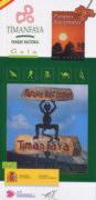
Parque Nacional Timanfaya. 1:25,000. CNIG, 2003/2005. Very detailed topographic map of this national park on Lanzarote in the Canary Islands. The map shows the volcanic terrain in detail with both contour lines and shaded relief. With separate 54-page guidebook covering tourist routes through the park. In Spanish.
$17.95
65-32822-23
Set, folded.
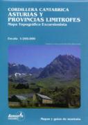
Cordillera Cantabrica Hiking Maps
Cordillera Cantabrica Topographic Excursion Maps. Adrados Ediciones. These maps have contour lines as well as shaded relief. In Spanish.
$12.95
65-3283-01
Asturias Y Provincias Limitrofes, Scale 1:260,000.
$12.95
65-3283-02
Macizo De Pena Ubina, Scale 1:25,000.
$12.95
65-3283-04
Parque Regional De La Sierra De Gredos, Scale 1:135,000.
Spanish Pyrenees Hiking Maps
The Spanish side of the Pyrenees, quite different from the French side, offers unique hiking opportunities. Click here for hiking maps of the French side of the Pyrenees. There are several different hiking map series for the Spanish side of the Pyrenees. Quality is similar between each series, so choose whichever map best covers your area of interest.
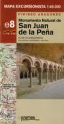
Hiking Maps of the Aragones Pyrenees (Mapa Excursionista, Pirineo Aragones). 1:40,000. Prames. These packs have guidebooks filled with information and pictures, as well as a map of the given area, with contour lines.
Sample #1 Sample #2
$10.95
65-32801-15
Anso-Echo Aragues-Jasa.
$10.95
65-32801-50
Serrania de Albarracin/1. Zona Septentrional de la Sierra de Albarracin, Cuenca de Teruel, Llanos de Pozondon, Peracense.
$10.95
65-32801-51
Serrania de Albarracin/2. Zona occidental de la Sierra del Albarracin y Montes Universales.
$10.95
65-32801-52
Serrania de Albarracin/3. Sierra de Albarracin, Montes Universales, Paisaje Protegido de los Pinares de Rodeno.
Sierra Nevada Hiking Maps
Clearance Sale Sierra Nevada Hiking Map Series. 1:25,000. Editorial Penibetica. This series of seven maps covers the very popular Sierra Nevada region of Spain. Each map comes with a booklet. In Spanish.
NOTE: Penibetica is now out of business and their maps are out of print. We have only a single copy left of sheet 2 of this excellent series.
Index map Sample map
$6.99
65-3282-02
Sheet 2 - Valle de Lanjaron.
Ordesa & Monte Perdido
Raised Relief Map of Monte Perdido & Ordesa. An attractive small raised relief map of this famous National Park in Spain. This map makes a great gift or souvenir of a trek through the area. This map is made from a topographic map and shows good vertical relief and includes symbols representing tourist facilities such as refuges, camp sites, and more. Size is 13" x 9". In Spanish.
$19.95
65-32775
raised relief map
Ordesa & Monte Perdido Hiking Map. 1:40,000. Editorial Alpina. Excellent hiking map of this popular hiking and climbing area. In Spanish.
$29.99
65-3280-OR
hiking map
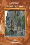
El Camino de Santiago - The Way of St. James
We have several popular maps and guidebooks that cover part or all of the El Camino de Santiago/The Way of St. James. Several of these are listed below. We recommend the two Cicerone guides as the best for English-speaking hikers. For other Cicerone hiking guides to Spain and France, please see Spain hiking guides - click here and France hiking guides - click here.
The Way of St. James: Le Puy to the Pyrenees (France part). Cicerone Press. Covers the French part of the Trail from Le Puy-en-Velay to the Pyrenees. As well as giving directions for walking the route the book also provides information on places to visit along the way, the history of the pilgrimage and the availability of practical facilities such as shops, bars, restaurants and accommodation. This guide contains an outline of the route along the Cèlè valley (53km) as one appendix and, unlike existing guides (in any language), a comprehensive listing of St. James and other pilgrim references along the way as another. There is a list of suggestions for further reading and a glossary of geographical and other useful terms. It also contains a series of sketch maps covering the entire route, to aid the user in planning his or her journey.
The author recommends five 1:100,000 France IGN maps for this part of the Camino. They are listed below.
$22.95
64-56981SJ
.
$11.95
64-5652-50
Sheet 50. St-Etiènne, Le Puy.
$11.95
64-5652-57
Sheet 57. Cahors, Montauban.
$11.95
64-5652-58
Sheet 58. Rodez, Mende.
$11.95
64-5652-63
Sheet 63. Tarbes, Auch.
$11.95
64-5652-69
Sheet 69. Pau, Bayonne.
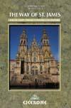
The Way of St. James - Pyrenees: Santiago to Finesterre (Spain part). Cicerone Press. This guide is the only English-language guide for the popular Pilgrim Road from Le Puy to Santiago de Compostela. A walker's guide to the 778km Pilgrim Road from Saint-Jean-Pied-de-Port in the foothills of the Pyrenees on the French side to Santiago de Compostela in northwestern Spain and finally to the "end of the earth" in Finisterre on the Galician coast. It is the first original guide to the route in English, replacing the second part of the single volume previously published by Cicerone Press. As well as giving directions for walking the route, the book also provides information on places to visit along the way, the history of the pilgrimage and the availability of practical facilities such as shops, bars, restaurants and accommodation.
Unlike existing guides (in any language) this one contains two features not included in any others: details of the walker's continuation from Santiago to Finisterre (75km) and a comprehensive listing of St. James and other pilgrim references along the way (as an Appendix). It also contains a list of suggestions for further reading, a glossary of geographical and other useful terms and a series of sketch maps covering the entire route, to aid the user in planning his or her journey.
Recently Michelin re-formatted and re-numbered their Spain maps; after the publication of this guidebook. The two maps recommended in the book, Michelin 471 and 472 have been replaced. The maps needed to cover the path are #571, covering the western end of the path; #575 which covers the central (and largest) portion of the path; and #573 which covers the eastern end of the path.
Although they are not up to the quality of the British OS mapsFrench IGN maps, we also recommend the Spanish 1:50,000 topos for the Spanish portion of the trail. These maps are useful for side trips off the trail and for detail not shown on the Michelin below.
$24.95
65-32961SJ
Guide
$11.95
65-3294-571
Northwest Spain - Galicia map. Michelin #571. 1:400,000. Western end of path.
$11.95
65-3294-575
Northwest (north-central) Spain - Castilla y Leon map. Michelin #575. 1:400,000. Central part of the path.
$11.95
65-3294-573
Northcentral coast of Spain - Pais/Vasco/ Navarra/La Rioja map. Michelin #573. 1:250,000. Eastern end of the path.
The Way of St. James: Le Puy to Santiago - A Cyclist's Guide. By John Higginson. Cicerone Press. The new edition of the Way of Saint James Cyclist's Guide (researched and written during the Holy Year of 2004) provides an up-to-date description of this ever-popular 1570km cycle route from Le Puy in France to Santaigo de Compostela in Spain.
By using roads with a good surface for touring cyclists, this guide attempts to follow the original pilgrimage route as closely as possible and offers the opportunity to visit every major church and shrine along the way with a few detours to outlying monasteries for good measure. The average distance on most days is only 50km, easily within the compass of the moderately fit.
The guide includes routes from Santiago to Finisterre and Padron for those cyclists who want that little extra, while several variants are mentioned to cater for the fit and not-so-fit pilgrim.
There is a comprehensive kit list and an English-French-Spanish list of essential words for the journey, as well as details of accommodation in gites d'ètape, chambres d'hote, hotels, refugios and hostals.
$24.95
65-32961SK
Guide
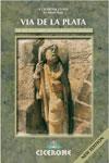
Via de la Plata (Southern Way of St. James route). Cicerone Press. A walker's guide to the southern pilgrim route to Santiago de Compostela. Nearly 1000 km long, the Camino mozarabe, or Via de la Plata as it is also known, starts in Seville and leads north and then north-west along paths and old tracks through the historic towns and varied scenery of Extremadura, Castille and Galicia. Most of it is also suitable for mountain (but not touring) bikes. This is the only guide to the route in English.
As well as giving directions for walking the route (with notes for cyclists in sections where riding it is impracticable) the book provides information on the history of the pilgrimage, places of interest along the way and the availability of practical facilities such as shops, bars, restaurants and accommodation. One appendix provides walking instructions for the continuation from Santiago to Finisterre (75km) whilst another contains a summary of Santiago and other pilgrim references along the way, a list of suggestions for further reading and a glossary of geographical and other useful items.
$26.95
65-32961VI
Guide
National and Regional Park Maps
Hiking Map of Parque Natural de Urbasa y Andia. 1:35,000. Centro Nacional De Informacion Geografica. Detailed topographic hiking map of this park in northern Spain. With 1' lat/long tick marks and a UTM grid. In Spanish.
$11.95
65-3284-03
1 sheet, folded.
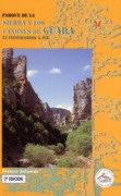
Clearance sale! Excursion Map of the Sierra and Los Canones de Guara Park (Mapa Excursionista Parque De La Sierra Y Los Canones De Guara). 1:40,000. Federacion Aragonesa De Montanismo. With contour lines. In Spanish.
$6.99
65-3284-04
1 sheet, folded.
Clearance sale! Parque De La Sierra Y Los Canones De Guara. Federacion Aragonesa De Montanismo. This guidebook offers 22 itineraries filled with lots of information, photographs and maps. In Spanish.
$12.99
65-3284-05
1 sheet, folded.
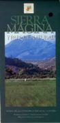
Hiking Map of Sierra Magina Natural Park (Sierra Magina Y Parque Natural). 1:50,000. Editorial Everest, 1998. This map also has contour lines as well as symbols showing castles, and much more. In Spanish.
$9.99
65-3284-06
1 sheet, folded.
Hiking Map of La Pedriza Del Manzanares. 1:15,000. La Tienda Verde. This map is in Spanish and contains a small legend, contour and hypsometric lines.
$9.95
65-32790-04
1 sheet, folded.
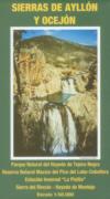
Clearance sale! Hiking Map of Sierras de Ayllon Y Ocejon. 1:50,000. La Tienda Verde. This map covers the Parque Natural del Hayedo de Tejera Negra, Reserva Nacional de Caza de Sonsaz, etc. In Spanish, contains a small legend, contour and hypsometric lines.
$9.99
65-32790-05
1 sheet, folded.
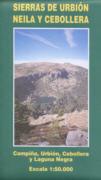
Hiking Map of Sierras de Urbion Neila Y Cebollera. 1:50,000. La Tienda Verde. This map is in Spanish and contains a small legend, contour and hypsometric lines.
$9.95
65-32790-06
1 sheet folded.
Hiking Map of Sierra Norte. 1:50,000. La Tienda Verde. This map is in Spanish and contains a small legend, contour and hypsometric lines.
Spain Topographic Quadrangle Map. 1:25,000. IGN. The 1:25,000 maps are special-order items; please allow 4-5 weeks for delivery. In Spanish. We offer discounts on complete sets or large blocks of the 1:25,000 sheets - please inquire for prices.
Note: The index for the 1:50,000 and 1:25,000 topographic map series is a combined index. The squares are the 1:50,000 series and the circles inside the squares represent the 1:25,000 series. If the square is colored red, then it is available; if it is gray it is not yet printed. The circle inside the square represents the four 1:25,000 maps needed for that area. If a quarter of the circle is colored dark red, then it is available; if it is not dark red it is not available. For several areas, the 1:25,000 are available but the 1:50,000 are not. To order 1:25,000 individual sheets, click on the blue "order" button, then tell us the sheet numbers you need in the "Comments" section of the order form.
Spain 1:25,000 sample Spain 1:50,000 & 1:25,000 Index Map. Northwest Spain Spain 1:50,000 & 1:25,000 Index Map. Northeast Spain Spain 1:50,000 & 1:25,000 Index Map. Southwest Spain Spain 1:50,000 & 1:25,000 Index Map. Southeast Spain Spain 1:50,000 & 1:25,000 Index Map. Canary Islands
Spain 1:100,000 Topographic Maps. Click on the link above for a complete listing of quadrangles, index maps, and projection information.
Spain 1:200,000 Provincial Topographic Maps
SpainProvincial Topographic Maps. 1:200,000. IGN. This set of 48 topographic map sheets provides complete coverage of Spain, with each sheet covering one administrative province. The maps have 100m contour lines, spot heights, and shaded relief. The maps show backroads and tracks up through national highways (both free and toll). These maps make decent bicycling maps as they show the backroads and require fewer sheets than the 1:100,000 topographic series noted above.
Vegetation zones are shown by coloring and the numerous parks are highlighted. The new series sheets show topography beyond the province boundary while the older series sheets information stops at the province boundary. The new series have UTM grids and latitude/longitude tick marks at 15' intervals, plus an index of place names on the back. In Spanish only.
The series is being re-designed and improved, however this means that some sheets are out of print for 2 or 3 years during this update process.
Spain Provincial 1:200,000 topographic map index. Sample from the new series. Sample from the older series.
Spain and Portugal Political Wall Map. Scale 1:2,074,000. National Geographic Maps. A detailed and current wall map of Spain and Portugal, colored with the soft tans/browns commonly found on antique maps. Ideal for framing. Size is 31 x 20".
Sample detail of the Spain wall map Front of the Spain wall map
$14.99
65-32462
1 sheet, paper, rolled
$24.99
65-32462L
Laminated
Antique-style! Spain and Portugal Executive (antique-style) Wall Map. Scale 1:1,803,000. National Geographic Maps. A detailed and current wall map of Spain and Portugal, colored with the soft tans/browns commonly found on antique maps. Ideal for framing. Size is 31 x 20".
Sample detail of the Spain wall map Front of the Spain wall map


 Sample detail from the Sapin road atlas.


 Spain Road Map Series
  Sample from the Andalucia map
 Recommended!
 Index of the coverage of the Michelin Zoom Spain map series.
 Sample from the Michelin Zoom Spain map series


 Waterproof!
 Sample detail of the Spain travel map
 Front of the Spain travel map
 Rear of the Spain travel map
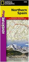 Waterproof!
 Sample detail of the Northern Spain travel map
 Front of the Northern Spain travel map
 Rear of the Northern Spain travel map
 Sample detail of the Canary Islands Travel Map
 Index of the coverage of the map.
 Detail from the map.
 Detail from the map.
 Thumbnail of the cover of the map.
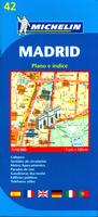

 Sample of detail of the Girona map.
 Sample of detail of the Pamplona map
 Sample detail from the Michelin Madrid map.
 Overview map showing all of the described routes
 Sample of one of the trip overview maps
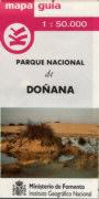
 Sample #1
 Sample #2
 Index map
 Sample map
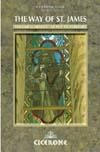
 Clearance sale!
 Clearance sale!


 Spain 1:50,000 & 1:25,000 Index Map. Northwest Spain
 Spain 1:50,000 & 1:25,000 Index Map. Northeast Spain
 Spain 1:50,000 & 1:25,000 Index Map. Southwest Spain
 Spain 1:50,000 & 1:25,000 Index Map. Southeast Spain
 Spain 1:50,000 & 1:25,000 Index Map. Canary Islands
 Spain 1:50,000 sample, Cadiz sheet.
 Spain 1:50,000 sample, Ingenio sheet.
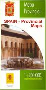
 Spain Provincial 1:200,000 topographic map index.
 Sample from the new series.
 Sample from the older series.
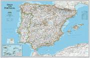
 Sample detail of the Spain wall map
 Front of the Spain wall map
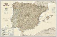 Antique-style!
 Sample detail of the Spain wall map
 Front of the Spain wall map
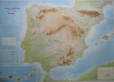
 Detail from 65-32460L.
 Image of 65-32460L large physical map.
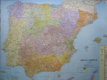
 Detail from 65-32896.
 Image of 65-32896 large political map.