Baja California is a very popular adventure tourism destination, from kayaking the eastern coast to fishing off the coast of Cabo San Luca. The topographic maps for Baja are listed in with the other topographic map series. The digital CD-ROM of the 1:250,000 topos is probably the most popular item for Baja - see the link at the top of the page.
Baja California Travel Maps. 1:450,000. National Geographic Maps. National Geographic's Baja California and Baja California Sur AdventureMaps combine detailed terrain with local information ideal for more adventurous travelers. Together the two maps cover the entire Baja peninsula and include detailed insets of Tijuana, Mexicali, Ensenada, La Paz, San Jose Del Cabo, Cabo San Lucas, and the Cabo Resort Corridor. The Baja California North map covers the entire State of Baja California, the northernmost half of the Baja California Peninsula. The Baja South map covers Baja California Sur, the second and southernmost Mexican State on the peninsula. Both maps are available individually or in a special priced bundle package. Each approx. 25 x 37".
Sample of the map detail from Baja North sheet Thumbnail of Baja North sheet Thumbnail of Baja North reverse side Sample of the map detail from Baja South sheet Thumbnail of Baja South map Thumbnail of Baja South reverse side
$19.95
65-0190BP
Set of 2 sheets, folded.
$11.95
65-0190BN
Baja North sheet..
$11.95
65-0190BS
Baja South sheet..
Waterproof Baja California Travel Map. 1:650,000. ITMB.
Detailed waterproof travel map showing roads, physical features, and tourist sites and service. The map uses color shading to show elevation/relief.
Sample detail from the Baja map
$10.95
65-0192Z
1 sheet, folded.
Baja California Travel Maps. Editorial Ediciones, Mexico.
Two sheets, one covering northern Baja and one covering southern Baja. These are basic road maps, on paper, less detailed than the maps above. Their advantage is that they have several city street maps on the reverse side of the maps. These city maps typically have enough detail to be useful, especially for walking around the city centers.
$11.95
65-0194BN
Baja California road map. 1:800,000. Mexicali (1:26,400); Tijuana (1:35,200). With smaller inset maps of San Felipe, Rosarito, Ensenada, and Tecate.
$11.95
65-0194BS
Baja California Sur road map. 1:1,000,000. With city maps of La Paz, Loreto, San José del Cabo, Cabo San Lucas, Cd. Insurgentes, Cd. Constitución, Guerrero Negro, and Santa Rosalía.
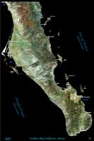
Southern Baja California Satellite Poster. SatPrint. This poster offers excellent detail of the southern 1/3 of Baja California. These are ideal for those with a favorite spot on the southern Peninsula. These posters also include main roads, some 4WD trails, many town names, and names of the major bays. Available as paper only.
Thumbnail image of the Southern Baja poster Sample of the image detail, from the Southern Baja poster
$29.99
67-88054S
Southern Baja California. Paper, flat.
Mexico Travel and Road Atlases
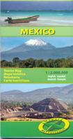
Recommended! Mexico Road Atlas. Guia Roji. 1:1,000,000.
This is the road atlas for Mexico for those that don't need tourist information. Includes 35 city maps, 42 pages of highway route strip maps showing each exit and the services available at each exit; 14 pages of city/village index. In Spanish.
$28.99
65-019027
Atlas. 1:1,000,000. Guia Roji.
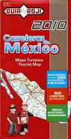
Mexico Large Road Atlas (Gran Atlas de Carreteras). Guia Roji. This is a large-sized road atlas. Each state is shown as a two-page map (16" x 20"), with inset maps of the major cities. There is a 20,500 name index in the atlas. In Spanish.
$39.99
65-01901
Atlas
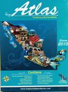
Mexico Road Atlas (Atlas turístico y de arreteras República Mexicana). 1:1,089,000. Ediciones Independencia.
This lightweight, yet detailed, road atlas offers useful coverage of all of Mexico. The maps show intermediate road distances, lots of symbols locating tourist sites and services, and a section of city maps and city-center maps. The atlas has an 11-page index of city/village names. 96 pages, softcover, in Spanish.
Sample detail of the Mexico road map Sample detail of the Mexico road map tourist zones insets
$16.99
65-019021
Folded
Mexico Road Atlas. 1:1,000,000. ITMB.
Handy (8.5" x 6") travel atlas covers all of Mexico at the scale of 1:1,000,000 and includes 28 pages of extensive place name index. Distinguishes roads ranging from expressways (free/toll) to rural roads. Legend includes tracks, trails, distances in km, ferry routes, international/domestic airports, airfields, border crossings, gas stations, points of interest, historic sites, museums, archaeological sites, caves, beaches, fishing, spas, hotels, camping sites, watersports, potteries, ancient/colonial architecture, golf courses, waterfalls, national parks, deserts. Practical, easy to carry, tool for exploring Mexico by driving or by public transport.
$19.95
65-01902
Atlas
Mexico Travel and Road Maps
Waterproof! Mexico Travel Map. 1:2,425,000. National Geographic Maps #3108.
A double-sided detailed road map of Mexico. Contour lines at 200 meter intervals and shaded relief show elevation. Tourist sites and services are noted by symbols. Fully indexed. Double-sided map, printed on waterproof, tear-resistant synthetic paper. The base map is by Reise Know-How, with NGS adding data and formatting the map in their classic adventure map format.
Sample detail of the Mexico Travel Map Image of the front of the MexicoTravel Map
$11.95
65-01917
1 sheet, folded.
Waterproof! Mexico Road Map. 1:2,000,000. ITMB.
One of the largest-scale single-sheet maps of Mexico. Printed double-sided on waterproof synthetic paper.
$11.95
65-01906
1 sheet, folded
Mexico Tourist Map. 1:2,000,000. Mapas NaTurismo.
A superb, detailed, double-sided shaded relief travel map of Mexico. The map clearly notes the reserves and parks, visitor centers, major estancias, tourist sites such as caves, fishing beaches, etc., The map shows the locations of gas stations, airports, distances along main roads, spot heights, and much more. Multilingual legend, including English.
Sample detail of the Mexico Tourist Map
$12.99
65-01919
1 sheet, folded.
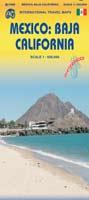
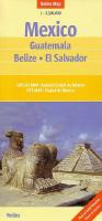
México Regional Travel Maps. ITMB.
There are numerous travel maps available for Mexico. The ITMB series of five maps are the best-selling maps. The ITMB Yucatan map includes Belize and much of Guatemala. Shows hundreds of Mayan ruins, as well as being an excellent road map. The Baja map provides generalized topographic coverage with descriptive text on travelling in Baja.
Sample detail from the Baja map
Mexico Travel Map. 1:3,400,000. Guia Roji.
Bilingual road and tourist map of Mexico shows roads from divided highways to minor roads and tracks; airports; railways; ports; rivers, lakes, volcanoes, and other physical features; archaeological sites. Scale 1:3,450,000. With table of distances; guide to road signs. Includes city maps of Mexico City, Monterrey, and Guadalajara. Single-sided.
$12.99
65-01905
Mexico.
Mexico Travel Map. 1:2,500,000. Nelles Verlag. Travel map with highways and roads, shaded relief. Places of interest include waterfalls, archeological sites, historical sites, cathedrals, museums, aqueducts. Printed on two sides.
$13.95
65-01909
Mexico. 1:2,500,000. Nelles Verlag.
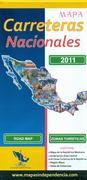
Mexico Road Map (Mapa Carreteras Nacionales). 1:3,350,000. Ediciones Independencia.
This is a clear and easy to read detailed road map of Mexico showing far more villages than most road maps. The reverse side has 18 inset maps showing tourist areas in more detail, with numerous symobls to show tourist sites and services. In Spanish. Map size is 70 x 95 cm.
Sample detail of the Mexico road map Sample detail of the Mexico road map tourist zones insets
Northern Yucatan Peninsula and Maya Sites Travel Map. 1:500,000. National Geographic Maps.
The Northern Yucatán Peninsula and Maya Sites map provides unmatched detail and information for the highly popular Yucatán Peninsula and its important Maya archeological sites. Detailed city inset maps of Cancún and Mérida provide locations of attractions and key infrastructure. Detailed descriptions, photographs, and site maps on the reverse guide the traveler through important Maya buildings and history. Coverage Highlights: Maya site locations with detailed Maya site inset maps and information for: Chichén Itzá, Ek' Balam, Tulum, El Rey, Uxmal, Cobá, & San Gervasio. The Northern Yucatan AdventureMap covers most of the Yucatan peninsula including the popular Caribbean destinations of Isla Mujeres, Cancun, Playa del Carmen, Akumal, Cozumel, Puerto Aventuras, and Tulum. Map size is approx. 25 x 38".
Sample of the map detail. Thumbnail of the front of the map Thumbnail of the reverse of the map
$11.95
65-0190YU
1 sheet, folded.
Western Mexico Cruise Tour Guide/Map - Baja and the Mexican Riviera. Coastal Cruise Tour Guides.
Explore Baja and the Mexican Riviera. Travel to Western Mexico with this unique map/guide packed with detailed information on the history, customs and culture of Mexico and its people.
Colorfully illustrated with drawings, photos and early engravings. The super-large six-foot by 11-3/4" fold-out color map offers the latest cartographic information on roads, mountains, ferry routes and other topographical details of Western Mexico so vital to the curious traveler. Sections on Mazatlan, Puerto Vallarta, Manzanillo, Ixtapa/Zihuatanejo, Acapulco, and the Los Cabos region of Baja include both informative text and city maps including features and points-of-interest.
Sample detail from the western Mexico Cruise map.
$15.95
65-01795
1 sheet, folded.
Waterproof! Cancun & Riviera Maya Guide & Dive Map. Franko's Maps.
Franko's Guide Map of Cancun and the Riviera Maya Franko's Guide Map of Cancun and the Riviera Maya has all kinds of information covering everything there is to see and do in Cancun and the Riviera Maya. Side One of Franko's Guide Map of Cancun and the Riviera Maya focuses on Cancun's hotel zone, downtown Cancun, and the Mayan ruins at Chichen Itza. Side Two of Franko's Guide map of Cancun and the Riviera Maya focuses on the entire Riviera Maya, and has maps of Isla Mujeres, Playa del Carmen, Xcaret, Xel-Ha Park, and has information on the great scuba diving and snorkeling sites in Cancun and the Riviera Maya.
Sample detail of the Cancun guide map Front of the Cancun guide map Reverse of the Cancun guide map
$7.99
65-0193CAN
1 sheet, folded.
Waterproof map! Cozumel Guide and Dive Map. 1:650,000. Franko's Maps.
This map features a layout of Isla de Cozumel, based on nautical charts and aerial photos. Cozumel roads, Maya ruins, resorts, and other features are shown on side one. Most importantly, is the location and detailed descriptions of 55 scuba diving and snorkeling sites, which is what Cozumel gains it's prestige and fame. The reverse side features a couple of zoom-in maps and a Cozumel Reefs explanation and artwork. Available both folded and flat. Both versions are waterproof.
Cozumel map sample front of the Cozumel map reverse of the Cozumel map
$8.99
65-0193COZ
1 sheet, folded
$9.99
65-0193COZL
1 sheet, flat
Waterproof map! Cozumel Reef Fish Card. Franko's Maps.
A sturdy laminated card 5.5 x 8.5 inches with reef fish information on one side and a sketch map of Cozumel on the reverse. Side one is a mini-map of Cozumel, taken from Franko's Map of Cozumel (65-0193COZ above). It shows the names and locations of Cozumel's principle dive sites. On side two there are fish - lots and lots of colorful, tropical, Caribbean fish, plus invertebrates, sponges, and corals. There are over 100 species shown. There are big fish like the nurse shark, tiny fish like the blue chromis, and middle-size fish like the princess parrotfish.
front of the Cozumel reef fish card reverse of the Cozumel reef fish card
$5.99
65-0172-CO
1 card
Mexico State Road Maps. Guia Roji.
These road maps offer complete coverage of Mexico. In Spanish, not indexed.
$7.99
65-0191A
Aguascalientas. 1:800,000.
$7.99
65-0191B
Baja California Norte. 1:800,000.
$7.99
65-0191BB
Baja California Sur. 1:1,200,000.
$7.99
65-0191C
Campeche. 1:800,000.
$7.99
65-0191D
Chiapas. 1:800,000.
$7.99
65-0191E
Chihuahua. 1:1,200,000.
$7.99
65-0191F
Coahuila. 1:1,000,000.
$7.99
65-0191G
Colima. 1:200,000.
$7.99
65-0191DF
Distrito Federal. 1:100,000.
$7.99
65-0191H
Durango. 1:1,000,000.
$7.99
65-0191J
Guanajuato. 1:200,000.
$7.99
65-0191K
Guerrero. 1:600,000.
$7.99
65-0191L
Hidalgo. 1:400,000.
$7.99
65-0191M
Jalisco. 1:800,000.
$7.99
65-0191N
Mexico State. 1:400,000.
$7.99
65-0191P
Michoacan. 1:600,000.
$7.99
65-0191Q
Morelos. 1:200,000.
$7.99
65-0191R
Nayarit. 1:400,000.
$7.99
65-0191S
Nuevo Leon. 1:800,000.
$7.99
65-0191T
Oaxaca. 1:800,000.
$7.99
65-0191U
Puebla. 1:600,000.
$7.99
65-0191V
Queretaro. 1:400,000.
$7.99
65-0191W
Quintana Roo. 1:600,000.
$7.99
65-0191X
San Luis Potosi. 1:800,000.
$7.99
65-0191Y
Sinaloa. 1:800,000.
$7.99
65-0191Z
Sonora. 1:1,200,000.
$7.99
65-0191ZA
Tabasco. 1:600,000.
$7.99
65-0191ZB
Tamaulipas. 1:800,000.
$7.99
65-0191ZC
Tlaxcala. 1:200,000.
$7.99
65-0191ZD
Veracruz. 1:500,000.
$7.99
65-0191ZE
Yucatan. 1:600,000.
$7.99
65-0191ZF
Zacatecas. 1:800,000.
Maps of Mexico's States and Major Cities. Ediciones Independencia.
The definitive road maps of the Mexican states with a full-size map of the capital city on the reverse of each map. The maps also include numerous inset city plans. Distinguishes 6 levels of highways including toll highways, and types of roads: paved and unpaved roads, roads under construction. Pictographs on the map show places of touristic interest for non-Spanish speakers: museums, cultural facilities, swimming places, golf courses and more. Tourist information in Spanish (text) and in chart with pictographs for non-Spanish speakers. Distinguishes four sizes of airports.
Sample of the road maps Sample of the city maps on the reverse of the maps
$11.95
65-0194AG
Aguascalientes road map. 1:200,000. With city maps of Ciudad de Aguascalientes (1:17,400), Calvillo, Cosío, Jesús María, Pabellón de Arteaga, Rincón de Romos, San José de Gracia.
$11.95
65-0194BN
Baja California road map. 1:800,000. Mexicali (1:26,400); Tijuana (1:35,200). With smaller inset maps of San Felipe, Rosarito, Ensenada, and Tecate.
$11.95
65-0194BS
Baja California Sur road map. 1:1,000,000. With city maps of La Paz, Loreto, San José del Cabo, Cabo San Lucas, Cd. Insurgentes, Cd. Constitución, Guerrero Negro, and Santa Rosalía.
$11.95
65-0194CA
Campeche road map. 1:800,000. With city maps of Campeche (1:16,400), Cd. del Carmen, Escárcega, Hopelchen, Calkini, Champotón, Hecelchakan, and Tenabo.
$11.95
65-0194CH
Chiapas road map. 1:900,000. With city maps of Arriaga, Tuxtla Gutiérrez, San Cristóbal, Tapachula, Tonalá, Palenque, and Comitán.
$11.95
65-0194CJ
Chihuahua road map. 1:400,000. With city maps of Chihuahua (1:37,200), Cd. Juárez (1:34,200), and Delicias.
$11.95
65-0194CO
Coahuila road map. 1:1,067,000. With city maps of Saltillo (1:25,00), Monclova, Nueva Rosita, Acuña, and Torreón
$11.95
65-0194CP
Colima road map. 1:200,000. With city maps of Manzanillo, Armeria, and Minatitlán.
$11.95
65-0194DU
Durango road map. 1:88,300. With city maps of Cuidad de Durango (1:23,200), Stgo. Papasquíro, Tlahualillo, Gómez-Lerdo, and Cuencamé.
$11.95
65-0194GU
Guanajuato road map. 1:930,000. With city maps of León (1:23,250), Celaya, Irapuato, Guanajuato, San Miguel de A., and Salamanca.
$11.95
65-0194GW
Guerrero road map. 1:620,000. With city maps of Acapulco (1:23,440), Chilpancingo, Cuidad Altamirano, Atoyac de Alvarez, and Zihuatanejo.
$11.95
65-0194HI
Hidalgo road map. 1:357,140. With city maps of Pachuca, Tulancingo, Actopan, Apan, Tula de Allende, Huejutla, and Ixmiquilpan.
$11.95
65-0194JA
Jalisco road map. 1:667,000. With city maps of Guadalajara (1:34,000), Puerto Vallarta, Ciudad Guzmán, San Juan de los Lagos, and Tepatitlán.
$11.95
65-0194ME
Estado de Mexico road map. 1:32,900. With city maps of Toluca, Teotihuacán, Texcoco, Valle de Bravo, Ixtapan, Tenancingo, and Tepotzotlán.
$11.95
65-0194MI
Michoacán road map. 1:570,000. With city maps of Morelía, Apatzíngán, Uruapan, Zamora-Jacona, and Zitácuaro.
$11.95
65-0194MO
Morelos road map. 1:200,000. With a city map of Cuernavaca (1:26,000).
$11.95
65-0194NA
Nayarit road map. 1:460,000. With city maps of Ahuacatlán, Acaponeta, Compostela, Ixtlán del Río, Santiago Ixcuintla, Tecuala, Tepic, and Tuxpan.
$11.95
65-0194NU
Nuevo León road map. 1:650,000. With city maps of Monterrey (1:24,000), Linares, Montemorelos, and Sabinas.
$11.95
65-0194OA
Oaxaca road map. 1:650,000. With city maps of Ciudad de Oaxaca (1:22,600), Juchitán, Puerto Escondido, Salina Cruz, and Santo Domingo.
$11.95
65-0194PU
Puebla road map. 1:4,800,000. With city maps of Puebla (1:36,250), Atlixco, Izúcar de Matamoros, San Martin Texmelucan, and Tehuacán.
$11.95
65-0194QE
Querétaro road map. 1:281,700. With city maps of Querétaro (1:17,000), Amealco, Cadereyta, Ezequíal Montes, Jalpan de Serra, San Juan del Rio, and Tequisquiapan.
$11.95
65-0194QI
Quintana Roo road map. 1:67,700. With city maps of Cancún (1:25,150), Cozumel (1:24,080), Playa del Carmen, Tulúm, Isla Mujeres, Carrillo Puerto, Chetumal, Bacalar, and Kantunilkin.
$11.95
65-0194SA
San Luis Potosí road map. 1:900,000. With city maps of San Luis Potosí (1:22,000), Ciudad Valles, Matehuala, Ebano, Tamazunchale, Santa María del Río, Cedral, and Río Verde.
$11.95
65-0194SI
Sinaloa road map. 1:800,000. With city maps of Mazatlán (1:29,090), Culiacán, Los Mochis, Escuinapa, Guamúchil, and Guasave.
$11.95
65-0194SO
Sonora road map. 1:1,500,000. With city maps of Agua Prieta (1:17,800), Hermosillo (1:28,360), Guaymas, San Luis Río Colorado, Caborca, Empalme, and Ciudad Obregón.
$11.95
65-0194TA
Tabasco road map. 1:350,800. With city maps of Villahermosa (1:14,600), Tenosique, Cárdenas, Comacalco, and Huímanguíllo.
$11.95
65-0194TB
Tamaulipas road map. 1:870,000. With city maps of Nuevo Laredo (1:37,740), Matamoros (1:35,970), Tampico-Ciudad Madero (1:29700), Ciudad Victoria, Reynosa, and Ciudad Mante.
$11.95
65-0194TL
Tlaxcala road map. 1:152,500. With city maps of Tlaxcala (1:19,200), Chiautempan, Apizaco, Huamantla, Tlaxco, Vicente Guerrero, Zacatelco, Xicohtzinco, Papalotla, and Mazatecochco.
$11.95
65-0194VE
Veracruz road map. 1:800,000. With city maps of Veracruz (1:19,900), Córdoba, Orizaba, Pánuco, Poza Rica, and Xalapa.
$11.95
65-0194YU
Yucatán road map. 1:5,600,000. With city maps of Mérida (1:25,000), Valladolid, Progreso, Tizimin, Hunucmá, and Región Maya.
$11.95
65-0194ZA
Zacatecas road map. 1:720,000. With city maps of Zacatecas (1:12,260), Fresnillo, Sombrerete, Jeréz, Nochístlán, and Río Grande.
Mexico City Tourist Street Map (Turistico Ciudad de México). 1:20,000. Guia Roji. With street index. This map covers the bulk of the city in a single map, rather than a series of neighborhood maps. In Spanish.
Sample detail of the Mexico City street map
$14.99
65-0193MF
Folded
Mexico City Street Atlas (Atlas de Ciudad de Meacute;xico). 1:19,000. Guia Roji. This is a very detailed street atlas of all of Mexico City. Includes 208 pages of maps covering the entire city. The maps include metro lines, numerous symbols locating tourist sites and services, etc. Includes 175 pages of street index, which also includes museums, hotels, and numerous other tourist sites and services. Guia Roji also makes a smaller paperback street atlas of Mexico City - this atlas is at a larger scale, more detailed, and includes more streets in the index. Spiral-bound, in Spanish.
Sample detail from the Mexico City street atlas.
$37.99
65-0193MG
Atlas
Mexico City Street Map (Plano Ciudad de México). 1:36,750. Ediciones Independencia, 2011. Like the road map above, this map has an overall map of Mexico City on one side and more detailed neighborhood and tourist zone maps on the reverse. The main map covers most of the city and includes extensive street-level detail, with neighborhood/barrio names overprinted on the map. The map shows the metro lines, metro-bus lines, suburban train lines, etc. The neighborhood maps include areas such as the central historic district, Chapultepec-Condesa, La Villa-Basilica, the University area, and others. The maps show the locations and names of numerous tourist sites and services, such as banks, hotels, churches, museums, and much more.In Spanish.
Sample detail of the Mexico City street map Sample detail of the Mexico City city center map
$10.99
65-0193MI
Folded
Street Maps of Mexican Cities. Guia Roji, Esparza, Ed. Independencia. These maps are standard city street maps. Nearly all are in Spanish, the ITMB maps are in English.
The Ediciones Independencia state road maps have detailed city maps on the reverse side of the map.
 Mexico Maps
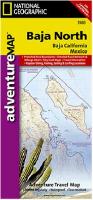
 Sample of the map detail from Baja North sheet
 Thumbnail of Baja North sheet
 Thumbnail of Baja North reverse side
 Sample of the map detail from Baja South sheet
 Thumbnail of Baja South map
 Thumbnail of Baja South reverse side
 Waterproof
 Sample detail from the Baja map
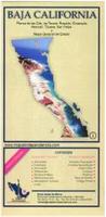
 Thumbnail image of the Southern Baja poster
 Sample of the image detail, from the Southern Baja poster


 Sample detail of the Mexico road map
 Sample detail of the Mexico road map tourist zones insets

 Waterproof!
 Sample detail of the Mexico Travel Map
 Image of the front of the MexicoTravel Map
 Waterproof!

 Sample detail of the Mexico Tourist Map
 Sample detail of the Mexico road map
 Sample detail of the Mexico wall map
 Sample detail of the Mexico wall map central area inset map
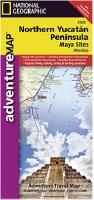
 Sample of the map detail.
 Thumbnail of the front of the map
 Thumbnail of the reverse of the map
 Sample detail from the western Mexico Cruise map.
 Waterproof!
 Sample detail of the Cancun guide map
 Front of the Cancun guide map
 Reverse of the Cancun guide map
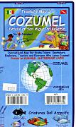 Waterproof map!
 Cozumel map sample
 front of the Cozumel map
 reverse of the Cozumel map
 Waterproof map!
 front of the Cozumel reef fish card
 reverse of the Cozumel reef fish card


 Sample of the road maps
 Sample of the city maps on the reverse of the maps
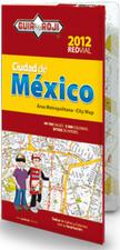
 Sample detail of the Mexico City street map
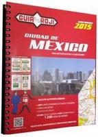
 Sample detail from the Mexico City street atlas.
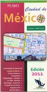
 Sample detail of the Mexico City street map
 Sample detail of the Mexico City city center map