NOTE: There are hundreds of hiking maps for Italy. We have listed a few of the most popular ones directly below; Cinque Terre, Firenze/Chianti, Tuscany, etc. Are you going to a more remote hiking area? Then click on the hiking map series links below, such as the Kompass or Tabacco links.
Adriatic Coast Hiking Maps
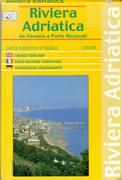
Riviera Adriatica Tourist Map. 1:200,000. Global Map/LAC (Litografica Artistica Cartografica). Detailed tourist/road map of the Venice/Riviera Adriatica area of northeastern Italy. The map covers from Venice in the north to just south of Ancona in the south. The map has numerous spot heights, ocean depth contours, and shaded relief to show elevation. The roads and tiny villages are well marked, with distances along most of the roads. Multilingual legend. ISBN 978-88-7914-185-7.
Sample detail from the Riviera Adriatica map.
$13.99
64-8272-21
1 sheet, folded
Amalfi Coast Hiking Maps
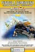
Waterproof! Amalfi Coast, Sorrento Peninsula, and Capri Hiking Map. 1:35,000. Litographia Artistica Cartographica. This detailed touring map for the area covers the Sorrento Peninsula, including the Amalfi Coast and the island of Capri. The map includes 13 inset street maps covering the main tourist towns and resorts in the area, including Sorrento, Amalfi, Positano, Salerno, Castellammare di Stabia, Vico Equense, Ravello, Minori, Maiori, Vietri sul Mare, plus Capri Town and Anacapri. Also included is a plan of the site at Pompeii. The map uses contour lines and shaded relief to show elevation. The map shows the road network, including the local roads and pathways, footpaths and hiking trails, railroads with station locations, ferry links, cable cars, funiculars, and chair lifts. Symbols highlight locations of campsites and motels, archaeological sites, viewpoints, churches, etc. Size is 99 x 69 cm unfolded.
$13.99
64-8272-16
1 sheet, folded.
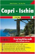
Waterproof! Capri & Ischia pocket map. 1:30,000. Freytag & Berndt. Size is 81 x 44.5 cm. Excellent hiking map, with contour lines to show elevation, hiking trails, tourist sites, etc. With small inset city maps.
$6.95
64-8272-18
1 sheet, folded.
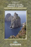
Walking on the Amalfi Coast. Cicerone, May 2010. The steep southern edge of the Sorrento peninsula, on the Gulf of Naples, is famous for its medieval villages perched above plunging cliffs with near-vertical vineyards and lemon orchards. Combined with the rugged landscape of the Monti Lattari further inland, and the idyllic islands of Capri and Ischia, this whole region also makes a perfect holiday destination for walkers.
This new guide introduces readers to a wide range of routes from family strolls to strenuous climbs. The guide to walking the Sorrento Peninsula, Amalfi Coast and Monti Lattari, from Positano, Sorrento and Amalfi, and also the islands of Capri and Ischia in the Gulf of Naples, Italy, Europe. 30 graded day walks for all abilities. A UNESCO World Heritage site crossed by a network of ancient mule tracks and great public transport links.
World Heritage Site criss-crossed by ancient mule tracks and pilgrim routes for easy navigation
Cinque Terre Hiking Map. 1:50,000. Kompass. Sheet #644. The best map available for Cinque Terre! Includes the whole region and has inset maps at 1:5,000 for the five towns. A must for anyone going to the area. With 64-page text. Map and text are in Italian.
Index map showing coverage of this map sheet Sample of the map detail.
$14.99
66-2273-X644
Set, folded
Cinque Terre Hiking Map. 1:40,000. Litographia Artistica Cartographica. Detailed hiking map of the Cinque Terre region. The map shows local roads, backroads and major footpaths, including the paths between the five villages on the peninsula. The map uses shaded relief and spot heights to show elevation, but lacks contour lines. The map uses symbols to show tourist sites and services. Size is 24 x 39 inches when unfolded.
Sample of the map detail.
$13.99
64-8276CT
1 sheet, folded
Cinque Terre & Golfo della Spezia, Montemarcello Hiking Map. 1:25,000. Edizioni Multigraphic. At 1:25,000 this is the most detailed hiking map available for the Cinque Terre region. The map includes hiking trails, backroads and footpaths, and much more. In English.
Sample of the map detail.
$18.99
64-82743-506
1 sheet, folded
Cinque Terre and the Golfo del Tigullio Hiking Map. 1:50,000. Istituto Geografico Centrale, Torino. This is a detailed touring and hiking map of the Cinque Terre region. The map includes hiking trails, backroads and footpaths, and much more. Not as detailed, but more readable than the 1:25,000 map above. In Italian with English in the legend.
Sample of the map detail.
$15.99
64-82741-23
1 sheet, folded
Florence/Firenze/Chianti Hiking Maps
Chianti Hiking Map. 1:50,000. Global Map/LAC (Litografica Artistica Cartografica).
An accurate map that makes easily clear all the anthropogenic (roads, built up areas, paths network) and natural elements that are enhanced by the orographic shading. Size when oopen is 76 x 123 cm.
$11.99
64-8272-28
1 sheet, folded
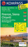
Firenze/Florence/Chianti/Siena Hiking Map. 1:50,000. Kompass. Sheet #2458.
The best map available for the Florence region. Great for driving the backroads and the little hilltop villages. Map and text are in Italian.
Sample detail from the Firenze/Florence hiking map.
$15.99
66-2273-2458
Set, folded
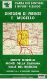
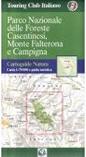
Carta Turistica Stradale Romagna & Repubblica di S. Marino. 1:50,000. Ed. Multigraphic, Firenze. This large double-sided map covers an extended area from Ravenna south to Rimini, San Marino, and Urbino. It includes coverage of the Parco Nazionale Foreste Casentinesi e M. Falterona. In Italian.
$14.99
64-82747-01
1 sheet, folded
San Gimignano Volterra Tourist Map. 1:25,000. Global Map/LAC (Litografica Artistica Cartografica). Detailed tourist/road map of the famous San Gimignano Volterra area of central Italy. This very detailed map is centered on the hill towns of San Gimignano, Colle di Val d'Elsa, and Volterra in Tuscany. The map has contour lines, numerous spot heights and shaded relief to show elevation. The roads and tiny villages are well marked, with distances along most of the roads. Multilingual legend. ISBN 978-88-7914-.
Sample detail from the San Gimignano Volterra tourist map. Sketch map showing coverage of the San Gimignano map
$14.99
64-8272-23
1 sheet, folded
Italian Lake District Hiking Maps
Lake Como (Lago di Como) Hiking Map. 1:35,000. Global Map/LAC (Litografica Artistica Cartografica). An extremely accurate map that has been compiled with every topographic detail so as to make easily clear all the anthropogenic (roads, built up areas, paths network) and natural elements that are enhanced by the orographic shading. Size when oopen is 76 x 123 cm.
Thumbnail image of the Lake Como map.
$14.99
64-8272-26
1 sheet, folded
Le Grigne Hiking Map. 1:35,000. Global Map/LAC (Litografica Artistica Cartografica). This map covers the eastern and northern arms of Lago di Como as well as the Gruppo di Grigne mountains to the east of the Lake. Multilingual legend. Map size is 76 x 109 cm.
Thumbnail image of the Le Girgne map.
$14.95
64-8272-27
1 sheet, folded
Mount Baldo Hiking Map. 1:25,000. Global Map/LAC (Litografica Artistica Cartografica). This detailed, double-sided topographic and hiking map covers the northeastern shoreline of Lago di Garda. The map highlights the numerous hiking trails that are in the area. There is a listing of the most popular trails, with the estimated hiking time, the start locations, etc. Multilingual.
Sample detail from the Mount Baldo tourist map.
$14.99
64-8272-24
1 sheet, folded
Tuscany District Hiking Maps
Maremma Grossetana Tourist Map. 1:130,000. Global Map/LAC (Litografica Artistica Cartografica), 2003. Detailed tourist/road map of the Maremma Grossetana area of west-central Italy. The map covers from Golfo di Follonica in the northwest to Monte Argentario in the south and to Lago di Bolsena in the southeast. The map has numerous spot heights, ocean depth contours, and shaded relief to show elevation. The roads and tiny villages are well marked, with distances along most of the roads. Multilingual legend. ISBN 978-88-7914-349-3.
Sample detail from the Maremma Grossetana tourist map.
$14.99
64-8272-22
1 sheet, folded
Italy Hiking Map Series
Hiking Maps by Kompass.
Recommended Italy Hiking Maps by Kompass. We highly recommend these hiking maps by Kompass. They cover most of the popular hiking areas in northern and central Italy at scales of 1:30,000 to 1:50,000. The maps are current, detailed and accurate - nearly always much more current than the government topographic maps. In particular we recommend the maps covering Cinque Terre, Naples, and the Italian Riviera-Alpi Liguria. Click here to see index maps and a complete listing of available maps.
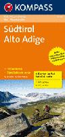
Waterproof! Südtirol Mountain Biking & Hiking Map. 1:70,000. Kompass, #3401. Detailed 4-sheet map set of the Südtirol of northern Italy and southern Austria, from Innsbruck in the north to Salorno in the south. The maps cover Bormio, Ortler, Cortina d'Ampezzo, Bolzano, Merano, Brunico, St. Jakob, Zillertaler Alpen, Stubaier Alpen, and much more. Bilingual German/Italian, with English legend.
Sample of the Südtirol map detail. Sketch map showing the area covered by the Südtirol hiking map
Hiking Maps by Touring Club Italiano Touring Club Italiano. These maps are excellent touring maps of major tourist areas and National Parks in Italy. Recommended. In Italian.
Recommended Atlante Stradale d'Italia (Road Atlas of Italy). 1:200,000. Touring Club Italiano, 2009-2010 edition. The 2012 edition will be available in late November, 2011. This is an excellent, detailed single-volume road atlas of Italy. The maps are the same detailed road maps contained in the three-volume set below, but in a smaller, thicker atlas. The legends and information pages are all multilingual, including English. There are 320 pages of road maps, 144 pages of city-center maps, and 103 pages of place-name index. Softcover, size is 7.25 x 10.5 inches.
Sample map detail of the Italy road atlas.
$37.99
64-82894
Road atlas
Recommended Atlante Stradale d'Italia (Road Atlas of Italy). 1:200,000. Touring Club Italiano. This is an excellent, very detailed road atlas of Italy. It consists of three softcover volumes covering the north, central and southern parts of Italy. Each volume includes maps, extensive tourist information, and a complete index. Each volume is softcover, approximately 150 pages; in Italian.
$36.99
64-8247-1
Atlas, northern volume
$36.99
64-8247-2
Atlas, central volume
$36.99
64-8247-3
Atlas, southern volume
$99.95
64-8247
All 3 volumes
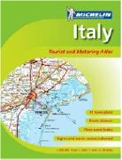
Italy Road Atlas. 1:300,000. Michelin. Spiral-bound. The road map detail includes minor roads, numbered motorway junctions, service areas, highways, intermediate driving distances, steep road gradients, difficult roads, prohibited roads, seasonal restrictions, caravan prohibitions and toll roads. Airports, railways and chair lifts are marked, also car ferries and passenger-only ferries.
The maps use hill shading to show the relief, and symbols depict landmarks. Tourist information includes scenic routes and viewpoints, sport and recreational facilities, sites of interest. The atlas includes 71 city center maps, which are also indexed for main streets.
Also highlighted are locations with entries in Michelin's Red Guide to hotels and restaurants. The legend includes English and the atlas itself is indexed.
Sample from the Italy road atlas
$22.00
64-82893
Atlas.
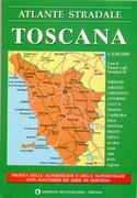
Tuscany Road Atlas (Atlante Stradale Regionale). 1:200,000. Edizioni Multigraphic. This atlas includes 21 pages of road maps at 1:200,000 and 8 pages of index. There are also 10 pages of autostrada strip maps showing gas stations, etc. Softcover, in Italian only.
$17.99
64-82897
Atlas.
Italy Travel Maps
Waterproof!
Italy Travel Map. Scale 1:1,000,000. National Geographic Maps. The front side of the Italy map shows the northern half of the country from its borders with France, Switzerland, Austria, and Slovenia to its capital, Rome, and includes the provinces of Aosta Valley, Piedmont, Lombardy, Trentino-Alto Adige, Friuli-Venezia Giulia, Veneto, Emilia-Romagna, Liguria, Tuscany, Marche, Umbria, Lazio, Abruzzo, and Molise. The southern half of the country including the Mediterranean islands of Sicily and Sardinia, and the provinces of Campania, Apulia, Basilicata, and Calabria are covered on the reverse side of the map. Size is 26 x 38".
Sample detail of the Italy travel map Front of the Italy travel map Rear of the Italy travel map
$11.95
64-82901
1 sheet, folded
Waterproof! Sardinia Adventure Map. 1:220,000. National Geographic Maps, 2011. National Geographic's Sardinia AdventureMap is designed to meet the unique needs of adventure travelers-detailed, durable, and accurate. Sardinia includes the locations of thousands of cities and towns with an index for easily locating them, plus a clearly marked road network complete with distances and designations for highways, major roadways, and more. ISBN 9781566955416.
Sample detail of the Sardinia adventure map Image of the front of the Sardinia adventure map Image of the back of the Sardinia adventure map
$11.95
64-82901-SA
1 sheet, folded
Waterproof!
Sicily Travel Map. Scale 1:225,000. National Geographic Maps. Double-sided map with extensive road details, contour lines and shaded relief to show elevation, fully indexed.
Sample detail of the Sicily travel map
$11.99
64-82901-SI
1 sheet, folded
Waterproof!
Tuscany Travel Map. Scale 1:220,000. National Geographic Maps. Double-sided map with extensive road details, contour lines and shaded relief to show elevation, fully indexed.
Sample detail of the Tuscany travel map
$11.99
64-82901-TU
1 sheet, folded
Italy Travel Maps by Touring Club Italiano
Recommended! Authentic Italy Guides. Touring Club Italiano. Unfortunately this excellent series has been discontinued by the publisher and we have only the Sicily, Tuscany, and Umbria guides left in stock. Travelers looking for the "true essence" of Italy need look no further than the Authentic Italy series from the Touring Club of Italy. These guidebooks offer a uniquely Italian perspective on the regions that only TCI, with more than 100 years of experience providing reliable information to travelers, can provide.
With detailed maps, these guides include everything readers need to discover the delights of the region at their own pace. The subject-keyed design allows readers to quickly scan daily activities and focus in on their particular location. Illustrated throughout with graphics, maps, and photos from the extensive TCI archives, these guides rate restaurants, hotels, B&Bs, villa rentals, spas, and retreats; explores food/regional specialties, with profiles on each category; suggests one-, two-, and three-day itineraries, emphasizing walking tours, special interest tours (wineries, olive oil, ceramics, etc.), and biking routes; outlines an array of shopping options, covering local artisans and handicrafts, markets (antiques, flea markets, craft fairs), outlets, and factory tours; and includes a calendar listing musical, cultural, and food festivals and events.
Sample page from the Authentic Tuscany guide
$24.99
64-82953TU
Authentic Tuscany.
$18.95
64-82953UM
Authentic Umbria.
Recommended Italy Road Map. 1:800,000. Touring Club Italiano.
This double-sided travel map of Italy is our most popular Italy road map. The map has 10 levels of road classification from divided toll roads down to dirt tracks. Distances are marked along major roads. Tourist sites and services are denoted with symbols. National and provincial parks arenoted and color-coded. Multilingual legend includes English. The 40-page booklet is a place names index.
Sample detail from the Italy Travel Map
Italy Provincial 1:200,000 Road Maps by Touring Club Italiano
Recommended! Italy Travel Maps. 1:200,000. Touring Club Italiano has superb road maps of Italy and their provincial/regional series offer excellent detail and shaded relief. Ideal for planning bicycle trips or car trips along the backroads of Italy.
A sample from the Tuscany map
$15.99
64-8271-01
Aosta/Piedmont road map. 1:200,000.
$15.99
64-8271-02
Lombardy road map. 1:200,000.
$15.99
64-8271-03
Trentino/South Tyrol road map. 1:200,000.
$15.99
64-8271-04
Friuli/Venice road map. 1:200,000.
$15.99
64-8271-05
Liguria/Italian Riviera road map. 1:200,000.
$15.99
64-8271-06
Emilia/Romagne road map. 1:200,000.
$15.99
64-8271-07
Tuscany road map. 1:200,000.
$15.99
64-8271-08
Umbria/Adriatic Coast road map. 1:200,000.
$15.99
64-8271-09
Abruzzi/Molise road map. 1:200,000.
$15.99
64-8271-10
Latium/Rome road map. 1:200,000.
$15.99
64-8271-11
Apulia road map. 1:200,000.
$15.99
64-8271-12
Campania/Basilica road map. 1:200,000.
$15.99
64-8271-13
Calabria road map. 1:200,000.
$15.99
64-8271-14
Sicily road map. 1:200,000.
$15.99
64-8271-15
Sardinia road map. 1:200,000.
Italy Travel Maps by Michelin
Italy Travel Map by Michelin. Michelin. Very popular folded road map, different cartographic style from the TCI series.
$12.95
64-82915
Italy. 1:1,000,000. (Michelin M 735).
Italy Regional Travel Maps by Michelin. 1:400,000. Michelin. Very popular folded road map series, different cartographic style from the TCI series. For Sicily, please see Sicily map 64-8270-365 below.
Sketch map showing location of each map sheet
$11.95
64-82915-561
NW Italy - Lonbardia, Piemonte, Valle d'Aosta, Liguria. 1:400,000. (Michelin M 561).
$11.95
64-82915-562
NE Italy - Veneto, Trentino Alto Adige, Fiuli, Venezia Giulia, Emilia Romagna. 1:400,000. (Michelin M 562).
$11.95
64-82915-563
Central Italy - Tuscany, Umbria, Lazio, Marche, Abruzzo, San Marino. 1:400,000. (Michelin M 563).
$11.95
64-82915-564
Southern Italy - Puglia, Molise, Campania, Calabria, Basilicata. 1:400,000. (Michelin M 564).
64-82915-565
Sicily. Michelin 565 Sicily is replaced by Michelin 365 Sicily below.
64-82915-566
Sicily. Michelin 566 Sardinia is replaced by Michelin 366 Sardinia below.
Italy Province Road Maps by Michelin. 1:200,000. Michelin. Superb, and very popular, road maps by Michelin. Michelin has a different style of cartography from Touring Club Italiano. Many people like their less cluttered style better, although others like the TCI maps for their more highlighted road network.
Sample detail from the Tuscany map. Sketch map showing location of each map sheet
Recommended! Southern Tyrol/North-eastern Italy travel map. 1:200,000. Freytag-Berndt. Detailed map of the Tyrolian region of northern Italy. Shaded relief and spot heights show elevation. The roads are portrayed in bold colors, making this an easy map to read the road network. Map size is 54 x 37 inches, unfolded.
Sketch map showing the area covered by the Southern Tyrol Travel Map
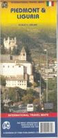
Piedmont and Liguria travel map. 1:250,000. ITMB.
Shaded relief travel map of Piedmont and Liguria provinces.
$10.95
64-82923
1 sheet, folded.
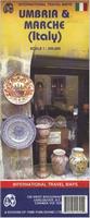
Umbria and Marche travel map. 1:250,000. ITMB.
Shaded relief travel map of Umbria and Marche provinces.
Sample from the Umbria travel map
$10.95
64-82929
1 sheet, folded.
Italy City Maps
Rome City Map. 1:12,500. Touring Club Italiano. Detailed street map of the main tourist areas of Rome. Multilingual legend.
$13.95
64-8294RS
1 sheet, folded.
Rome City Map. 1:17,000. LAC - Litografia Artistica Cartografica. Double-sided map with a map of most of Rome on one side. The reverse side has an enlargement of the main tourist area, plus a metro map and street index.
Image of the front of the Rome map. Image of the reverse of the Rome map.
$13.99
64-8294RV
1 sheet, folded.
Waterproof Rome and Southern Italy Travel Map. 1:10,000 / 1:925,000. ITMB. 2nd edition, May, 2013. This is really a new map: the Rome map is completely new cartography and covers a larger area than the previous edition and the southern Italy map on the reverse is completely new and not issued before. coverage significantly, using the Tevera River as a north-south axis. This places the Vatican and the 'new' city on the left side of the page, with the main shopping area, the Roman remains, the Colosseum, and the railway station on the right hand side. The map goes as far north as the ring road, so most former Olympic buildings are shown, and as far south as the Giancolense hospital complex, which is further than our competitors cover. Naturally, the map notes major touristic attractions, hotels, shopping areas, religious buildings, park and plazas, theatres, post offices metro lines and stations. The second side of the map is equally fascinating. It is essentially a driving map, using symbols to note touristic attractions, whether those be castles, historic churches, interesting towns, beaches,remains of Greek and early Roman settlement.
Sample detail of the Rome city map
$9.95
64-82941RI
1 sheet, folded.
Florence Laminated City Map. 1:7,000. Borch. This soft-laminated folded map of Florence in the 13th edition shows: Florence City Center at 1:7,000, Fiésole 1:12,000, Pisa 1:7,000, Florence & Environs 1:80,000, Florence & Region 1:450,000, Cathedral of Santa Maria del Fiore 1:1,900, Italy administrative, Top 24 Sights of Florence and 12 of Pisa. Borch maps are easy to fold, durable and water-repellent with a wipeable surface. Borch Maps show hotels, museums, monuments, markets, top sights and points of interest, useful statistics, conversion charts for temperatures, weights and measurements, climate charts showing temperatures, sunshine hours, precipitation and humidity, overview maps, time zones, and much more...
Sample detail from the Borch Florence city map Image of the front of the Borch Florence city map Image of the back of the Florence city map
$9.95
64-8294FJ
1 sheet, folded.
Italy City Plan Maps. Touring Club Italiano and LAC, Italy. Most maps are indexed. In Italian.
$14.99
64-8294AG
Agrigento. 1:6,000.
$14.99
64-8294AM
Alessandria.
$14.99
64-8294AN
Ancona. 1:7,000.
$14.99
64-8294AR
Arezzo. 1:7,000.
$14.99
64-8294AS
Asti. 1:10,000.
$14.99
64-8294AV
Avellino. 1:5,000.
$14.99
64-8294AT
Bari. 1:10,000.
$14.99
64-8294BE
Belluno. 1:6,800.
$14.99
64-8294BD
Benevento. 1:6,500. LAC.
$14.99
64-8294AW
Bergamo. 1:9,000.
$14.99
64-8294BI
Biella. 1:10,000.
$13.99
64-8294B
Bologna. 1:13,000.
$13.95
64-8294BN
Bologna. 1:12,500. Touring Club Italiano.
$13.99
64-8294BO
Bolzano (Bozen). 1:20,000.
$14.99
64-8294C
Brescia. 1:12,000.
$14.99
64-8294BR
Brindisi. 1:15,000.
$14.99
64-8294CA
Cagliari. 1:9,000.
$14.99
64-8294CD
Caserta. 1:5,000.
$14.99
64-8294CF
Catania. 1:11,000.
$14.99
64-8294CE
Cefalu. 1:5,000.
$13.99
64-8294CO
Como. 1:10,000.
$14.99
64-8294CP
Cosenza. 1:6,000.
$14.99
64-8294CR
Cremona. 1:6,000.
$14.99
64-8294CU
Cuneo. 1:10,000.
$14.99
64-8294EM
Empoli, Sovigliana, Spicchio. 1:7,500.
$14.99
64-8294EH
Ferrara. 1:8,000.
$8.95
64-8294FM
Firenze (Florence). 1:12,500. Touring Club Italiano.
$13.99
64-8294F
Florence (Firenze). 1:12,000. LAC. The best map of the whole city.

 Sample detail from the Riviera Adriatica map.
 Waterproof!

 Waterproof!

 Sketch map of the area covered by this guide
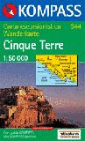
 Index map showing coverage of this map sheet
 Sample of the map detail.
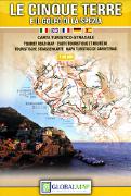
 Sample of the map detail.
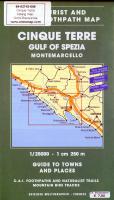
 Sample of the map detail.
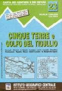
 Sample of the map detail.
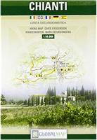
 Sample detail from the Firenze/Florence hiking map.
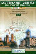
 Sample detail from the San Gimignano Volterra tourist map.
 Sketch map showing coverage of the San Gimignano map
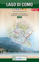
 Thumbnail image of the Lake Como map.
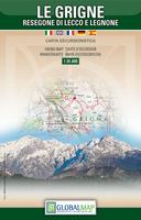
 Thumbnail image of the Le Girgne map.
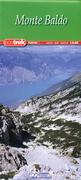
 Sample detail from the Mount Baldo tourist map.
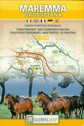
 Sample detail from the Maremma Grossetana tourist map.
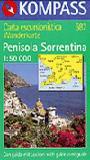
 Waterproof!
 Sample of the Südtirol map detail.
 Sketch map showing the area covered by the Südtirol hiking map


 Recommended
 Sample map detail of the Italy road atlas.
 Recommended

 Sample from the Italy road atlas
 Waterproof!
 Sample detail of the Italy travel map
 Front of the Italy travel map
 Rear of the Italy travel map
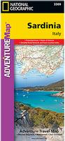 Waterproof!
 Sample detail of the Sardinia adventure map
 Image of the front of the Sardinia adventure map
 Image of the back of the Sardinia adventure map
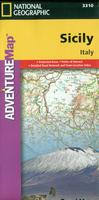 Waterproof!
 Sample detail of the Sicily travel map
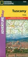 Waterproof!
 Sample detail of the Tuscany travel map
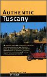 Recommended!
 Sample page from the Authentic Tuscany guide
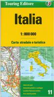
 Sample detail from the Italy Travel Map
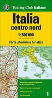
 Thumbnail index for the series
 Sample detail from southern sheet.
 Sample of one of sheets
 Thumbnail index for the series
 Detailed index for the northern sheet (#1)
 Detailed index for the central sheet (#2)
 Detailed index for the southern sheet (#3)
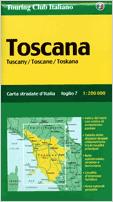

 A sample from the Tuscany map
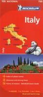

 Sketch map showing location of each map sheet


 Sample detail from the Tuscany map.
 Sketch map showing location of each map sheet
 Recommended!
 Sample from the Freytag Berndt Italy travel map
 Sketch map showing the area covered by the Italy Travel Map
 Recommended!
 Sketch map showing the area covered by the Southern Tyrol Travel Map
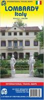
 Sample from the Umbria travel map
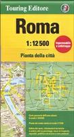
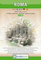
 Image of the front of the Rome map.
 Image of the reverse of the Rome map.
 Waterproof
 Sample detail of the Rome city map
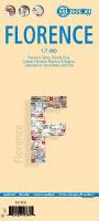
 Sample detail from the Borch Florence city map
 Image of the front of the Borch Florence city map
 Image of the back of the Florence city map