|
|
Belgium River Itineraries Map (Itinéraires fluviaux de Belgique). 1:250,000. Navicarte #23. One sheet showing the navigable river and canal systems in Belgium. Multilingual legend.
Belgium Cycling Maps - click here.Belgium Railway Maps - click here.
Belgium Travel and City Maps
Belgium City Maps
On one side is a current contoured topographic survey map at 1:50,000 showing the area between Waterloo, Wavre, Gembloux, Fleurus and Nivelles. An overprint shows the movements of the French and the allied forces between 16th and 18th June, and also indicates sites of main battles and present day museums and information offices. The map is accompanied by notes describing the main events. On the reverse are six separate panels. A present day map at 1:250,000 indicates troop movements across a slightly larger area, extending south to Charleroi. Five panels present reproductions of mapping by cartographers William Blackwood and Sons showing in detail the dispositions of various army units at the battles of Quatre Bras and Ligny on 16th June, battle of Waterloo in the morning of 18th June and during its height, plus the battle of Wavre on 18th and 19th June.
Belgium Topographic Maps
Belgium 1:25,000/1:20,000 Topographic Quadrangle Maps.Belgium 1:50,000 Topographic Quadrangle Maps - click here.Belgium 1:100,000 Topographic Quadrangle Maps - click here.
Belgium 1:250,000 Topographic Map. 1:250,000. IGN. Includes a full index/gazetteer. Multilingual.
Belgium Administrative/Political and Physical MapsBelgium Administrative Map (Belgique Administrative/Administratief Belgian/Verwaltungseinheiten Belgien). 1:300,000. IGN. 1995. A single-sheet map showing the outline of Belgium and the internal regional (provincial), d'arrondissement, and commune (county equivalent) boundaries and the capital city (county seat) of each commune. There is an extensive index of town/cities in the margins.
Belgium Flags
|
||||||||||||||||||||||||||||||||||||||||||||||||||||||||||||||||||||||||||||||||||||||||||||||||||||||||||||||||||||||||||||||||||||||||||||||||||||||||||||||||||||||||
 Belgium Maps


 Sample detail of the Belgium travel map
 Sample of the map detail
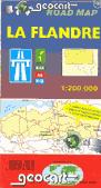

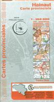
 Sample detail from the Belgium province map series.

 Sample detail from the Brussels map.
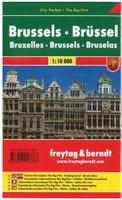

 Sample detail from the Brussels map.
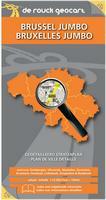
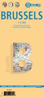
 Front of the Brussels map.
 Reverse of the Brussels map.
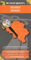

 Sample from the Bruges map.
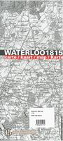
 Sample #1 from the Waterloo map.
 Sample #2 from the Waterloo map.

 Belgium Flags