Click here for our complete cycling maps listings for the USA and Europe.
Ohio Bicycle Trails Reference Map. American Bike Trails. Large 26" X 38", full color, two sided. Loaded with information on over 100 Trails!
62-8781
1 sheet, folded
$6.95
Ohio Bicycle Trails guide. American Bike Trails. Over 85 trails throughout Ohio, both surfaced & mountain biking. Illustrated, in color, easy to reference and use. Softcover, 192 pages.
62-87812
Guide
$16.95
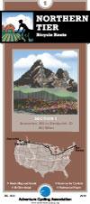
Northern Tier Route
Northern Tier Route Series. Adventure Cycling Association. 4,315 miles -- From the Puget Sound to fishing villages in Maine, the Northern Tier crosses three mountain ranges - the Cascades, Rockies and
Adirondacks. Along the way the route passes through Glacier National Park, the headwaters of the Mississippi and Amish country. Discover the beauty of America by crossing the country on the Northern Tier.
Route map.
62-2230-NT
Anacortes, WA, to Bar Harbor, ME. Set of 11 maps. 10% discount!
$165.82
62-2230-NT01
Anacortes, WA, to Sandpoint, ID
$16.75
62-2230-NT02
Sandpoint, ID, to Cut Bank, MT
$16.75
62-2230-NT03
Cut Bank, MT, to Minot, ND
$16.75
62-2230-NT04
Minot, ND, to Fargo, ND
$16.75
62-2230-NT05
Fargo, ND, to Grand Rapids, MN
$16.75
62-2230-NT06
Grand Rapids, MN, to Stillwater, MN
$16.75
62-2230-NT07
Stillwater, MN, to Muscatine, IA
$16.75
62-2230-NT08
Muscatine, IA, to Monroeville, IN
$16.75
62-2230-NT09
Monroeville, IN, to Lackawanna, NY
$16.75
62-2230-NT10
Lackawanna, NY, to Ticonderoga, NY
$16.75
62-2230-NT11
Ticonderoga, NY, to Bar Harbor, ME
$16.75
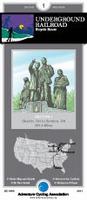
Underground Railroad Bike Route
Historic Underground Railroad Bike Route. Adventure Cycling Association. Mobile, AL to Owen Sound, Ontario. 2058 miles. The Underground Railroad Bicycle Route honors the bravery of those that fled bondage and those that provided shelter. This route passes points of interest and historic sites along a 2,100-mile corridor. Beginning in Mobile, Alabama - a busy port for slavery during the pre-civil war era - the route goes north following rivers through Alabama, Mississippi, Tennessee, and Kentucky. Waterways, as well as the North Star, were often used by freedom seekers as a guide in their journeys to escape slavery.
Upon crossing into Ohio, the route leaves the river to head inland toward Lake Erie and enters Canada at the Peace Bridge near Buffalo, New York. In Ontario, the route circumvents the shores of Lake Ontario and ends at Owen Sound, a town founded by freedom seekers 150 years ago.
Route map.
62-2230-UR
Mobile, AL to Owen Sound, Ontario. Set of 5 maps. 10% discount!
$75.37
62-2230-UR1
Mobile, AL to Fulton, MS. 401.5 miles.
$16.75
62-2230-UR2
Fulton, MS to Owensburg, KY. 466 miles.
$16.75
62-2230-UR3
Owensburg, KY to Milford, OH. 394 miles.
$16.75
62-2230-UR4
Milford, OH to Erie, PA. 461 miles.
$16.75
62-2230-UR5
Erie, PA to Owen Sound, Ontario. 380 miles.
$16.75
Detroit Alternative Route. Adventure Cycling Association.
Sheet 6A. This alternate, beginning in Oberlin, Ohio, takes cyclists around the western side of Lake Erie through historically rich Michigan. There are many sites to visit in the towns that the route goes through. In Michigan the route becomes much more urban. Because there is no bicycle-friendly connection between Detroit and Windsor the route crosses into Canada north of these cities, which were both important sites to freedom seekers.
Sheet 6B. From Sombra, Ontario, the route heads north through rural countryside, visiting several Underground Railroad sites before reaching Owen Sound, the terminus of the main route, located on the southern side of Lake Huron's Georgian Bay. The Windsor Option, also in this section, can become a loop on its own connecting to section 1. From Sandusky,Ohio, you can cross Lake Erie via ferry. The route then goes northwest along the shore to Windsor, where many freedom seekers settled after their escape to Canada. It continues to the northeast where it reconnects to the Alternate at Sombra, Ontario.


 Route map.
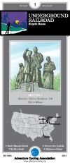
 Route map.