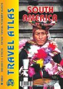
South America Road Atlas. 1:3,000,000. ITMB.
All of the continent of South America is now available in an easy-to-read, easy-to-use, easy-to-store road atlas at a superb scale. In addition to showing each country systematically, logically, and in great detail, physical features, points of interest, beaches, reefs, parks and reserves, major airports, and roads are shown. The atlas is 5 1/2" wide by 8 1/2" high (15cm x 22cm). This atlas is 112 pages in length, is fully indexed, and has a hard card cover, and a spine.
$19.95
66-2489
Atlas
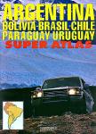
Southern South America Atlas (Atlas de Rutas). Firestone/Zagier & Urruty.
2015 edition of the most complete and updated atlas available for Argentina and surroundings (Chile, Bolivia, Uruguay, Paraguay and south of Brazil). Includes more than 168 city plans and 230 road maps, hotel and campsite lists, etc. Produced locally by Argentina experts and travelers. 220 pages, center-stapled soft-cover.
Sample detail from the city maps in the Atlas de Rutas. Sample detail from the road maps in the Atlas de Rutas.
$44.99
66-2488
Atlas.
South America Travel Maps
Recommended South America Shaded Relief Map. 1:5,000,000. ITMB, Canada.
This double-sided map uses shaded relief to show elevation. Excellent detail is included on towns, military posts, rivers, dry lakes, and much more. Ideal for travelers visiting more than one country in South America.
Thumbnail of the front of the map Thumbnail of the back of the map
$14.95
66-2451
1 sheet, folded
Recommended South America Regional Shaded Relief Maps. 1:4,000,000 & 1:2,800,000. ITMB, Canada.
This three-sheet map uses shaded relief to show elevation. Excellent detail is included on towns, military posts, rivers, dry lakes, and much more. Ideal for travelers visiting more than one country in South America. Sheet size is 110 x 78 cm.
Thumbnail of the NE map Thumbnail of the NW map Thumbnail of the Southern map
$12.95
66-2450N
South America North sheet. 1:3,800,000.
$8.95
66-2450NE
South America Northeast sheet. 1:2,800,000.
$8.95
66-2450NW
South America Northwest sheet. 1:4,000,000.
$12.95
66-2450S
South America South sheet. 1:4,000,000.
Che's Route Map - Ernesto Guevara's trip across South America. 1:12,000,000. de Dios.
The 'must' points of the tour and the details of the 50 main places of the 1952 "road trip". From his departure from the Argentine city of Córdoba, famous for its colonial architecture, to the Patagonia, the Seven Lakes circuit, the Andean crossing, the fascinating city of Temuco, the port of Valparaíso, the Atacama desert, the Incas valley, Cuzco, Machu Picchu, the Inca Road, the city of Lima, the still virgin corners of Tingo María, the Ucayali river, Iquitos, the Amazon River and the chaotic and surprising Leticia... Map size is 45 xc 68 cm.
$8.95
66-2471
1 sheet, folded.
South America Wall Maps
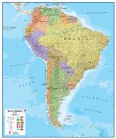
Recommended South America Wall Map. 1:7,000,000. Maps International.
This colorful and detailed laminated map of South America measures 47" x 39" with a scale of 1:7 million. It includes national capitals, cities, country flags, latitude and longitude lines, physical features, and terrain shading. This map is the most current version available and will be a perfect addition to any home, office, or school.
Thumbnail of the map
South America Physical Map. National Geographic Maps.
A large-format print from the award-winning National Geographic World Atlas. This finely-detailed, informative map is perfect for home, office, or school.
This stunning map shows the physical features of South America. See the drama of the Andes as they span the entire continent; and how the Amazon and all its tributaries snake through the northern part of South America.
Available in two sizes: small size 29" x 36" and large size 36" x 48".
An image of the full map A detail of the map
$24.95
66-24492
Small, paper
$39.95
66-24492L
Small, laminated
$54.95
66-24493
Large, paper
$99.95
66-24493L
Large, laminated
South America Wall Map - Executive Style. National Geographic Maps.
This elegant, richly colored antique-style map features the incredible cartographic detail that is the trademark of National Geographic quality. This map of South America shows political boundaries, place names, airports, major roads and highways, and other geographic features for the entire continent. Size is 24 x 30 inches.
An image of the full map
$14.99
66-24494
Small, flat
$19.99
66-24494L
Small, laminated.
South America Topographic Maps
South America Topographic Maps. We stock topographic maps for all countries in South America. Please click on the country links at the top of the page to see the appropriate listings.


 Sample detail from the city maps in the Atlas de Rutas.
 Sample detail from the road maps in the Atlas de Rutas.
 Thumbnail of the front of the map
 Thumbnail of the back of the map
 Recommended
 Thumbnail of the NE map
 Thumbnail of the NW map
 Thumbnail of the Southern map
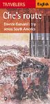

 Thumbnail of the map
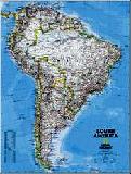
 An image of the full map
 A detail of the map
 A sample of the legend
 An enlarged view of the mounted map
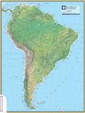
 An image of the full map
 A detail of the map
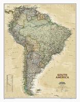
 An image of the full map