Great Britain Maps


  • Administrative, Physical, and other thematic maps
  • 1:50,000 & 1:25,000 topographic maps on CD-ROM!
  • Topographic quadrangle maps and gazetteers
    • 1:25,000 Topographic Maps (Outdoor Leisure & Explorer maps).
    • 1:50,000 Landranger topographic map series
    • 1:250,000 AA regional road map series
    • Soviet Military Topographic Maps of the U.K.
    • Isle of Man Topographic Maps
  • Bicycling Maps and Guides of Great Britain
  • Hiking and tourist maps of Great Britain
    • Harvey's Waterproof hiking/topo maps.
    • 1:25,000 Ordnance Survey Outdoor Leisure maps.
    • 1:25,000 Ordnance Survey Explorer maps.
    • Ordnance Survey Touring maps
    • Waterways Maps & Guides
    • Great Britain Wine Map
  • Hiking guidebooks for the UK
  • Travel and City Maps
    • Great Britain Railroad Map
    • Travel and city maps
    • Road and city atlases
  • Historical Maps & Atlases
  • Great Britain Satellite Image Posters from Spaceshots.
  • Geology and thematic maps
    • 1:50,000 geology quadrangle maps
    • 1:250,000 geology quadrangle maps
    • Offshore and Regional Geology Maps
    • Reproductions of Historical Geology Maps
  • Great Britain Flags

Great Britain Historical Maps


Ancient Britain map. Ordnance Survey, 2005. The map shows the location of sites from the Stone Age to the early Middle Ages on a modern road map base. Each archaeological period is identified using different symbols and colors. Key sites are highlighted with photographs, text and thumbnail maps. Additional text in the margins.
Ordering GB--Ancient Britain map64-6192AB1 sheet, folded.$17.95


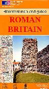
Great Britain Historic Maps. Ordnance Survey. These maps are now out of print and are available only as long as our supply lasts. These maps cover various historical topics and regions; each includes descriptive text and color photos. Recommended for tourists.
Ordering GB--Roman Cantebury map64-6192CARoman & Medieval Canterbury. 1:2,500. 1990. OS.$14.95
Ordering (GB) Georgian Bath map64-6192GBGeorgian Bath. 1:2,500. 1989. OS.$14.95
Ordering (G.B.) Roman Britain map64-6192RBRoman Britain. 1:625,000.$14.95
Ordering GB--Roman & Medieval Bath64-6192RMRoman & Medeival Bath. 1:1,250. 1989. OS.$14.95


click for larger image
The Trafalgar Way map. Ordnance Survey, 2005. Commemorative map of the 1805 journey from Falmouth to London by Lt. John Richards Lapenotiere who carried news of the naval victory and Lord Nelson's death to the Admiralty in London. A period map is used with the route overprinted, along with information on the journey, the battle, and Nelson.
Ordering (GB) Trafalgar Way map.64-6192TR1 sheet, folded.$14.95


image


© Copyright 2025 East View Companies, Inc.
5130 Industrial Street, Suite 100, Maple Plain, MN 55359-8005
All Rights Reserved
For more information please Contact Us