We have an extensive stock of Baltic region maps. The bulk of the maps are listed under the appropriate country listing. The maps below are road maps for the region - for more detailed mapping, please check the appropriate country listing.
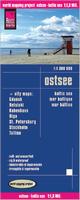
Waterproof Baltic Sea Region Travel Map. 1:1,300,000. Reise Know-How.
Detailed road map of the Baltic Sea region and surrounding coastlines. The reverse side has detailed city-center street maps for Gdansk, Helsinki, Kobenhavn, Riga, St. Petersburg, Stockholm, and Tallinn. With contour lines and spot heights showing elevation, detailed road network, symbols for tourist sites and services. In German with English legend.
Sample detail of the Baltic Sea Region Travel Map
The Baltic States of Estonia, Latvia, and Lithuania are three of the nicest countries to visit in Europe. Access is easy, through Poland heading north or via a ferry from Finland coming south. As part of the EU, the three countries enthusiastically removed border controls for citizens of other EU countries a number of years ago.
Baltic Coast Nautical Charts. 1:50,000. These are Soviet Navy charts of the Baltic coastline from the Russian-Estonian border to Kaliningrad. Additional large-scale charts, up to 1:2,000 in scale, cover major harbors or coastal military ports. This set includes 36 sheets. In Russian.
 Waterproof
 Sample detail of the Baltic Sea Region Travel Map
 Sketch map showing area covered by the Baltics map
 Sample detail of the Baltic region map
 Sample detail of the Baltic region map
 Thumbnail of the front of the Baltic region map
 Thumbnail of the reverse of the Baltic region map