Afghanistan Maps


Afghanistan digital topographic maps - click here!

  • Afghanistan Travel Maps.
  • Afghanistan Wall and Satellite Maps.
  • Afghanistan Atlases.
  • Digital Afghanistan Topographic Maps.
  • Afghanistan Topographic Maps.
    • Afghanistan 1:50,000 topographic maps, soviet series. Includes digital and paper maps and map samples.
    • Afghanistan 1:200,000 topographic maps, soviet series. Includes digital and paper maps, index maps, sample images, and itemized listings.
    • Afghanistan 1:250,000 topographic maps, USA/NIMA series.
    • Afghanistan 1:500,000 topographic (TPC) maps, USA/NIMA series.
  • Afghanistan Province and District Maps
  • Afghanistan Satellite Maps
  • Afghanistan Geologic & Thematic Maps.
  • Afghanistan Flags


Afghanistan Travel Maps


Afghanistan map
Afghanistan, Pakistan, Kabul + 5 Cities Geographical Map. 1:2,000,000. GiziMap, 2010. This is a new map, with new cartography, covering all of Afghanistan and Pakistan at 1:2,000,000. The map of Afghanistan and Pakistan is on one side of the map while the reverse has a large map of Kabul 1:50,000), plus inset maps of Herat, Jalalabad, Kabul city center (1:20,000), Kandahar, Kunduz, and Mazar-e Sharif, and index of places names for both Afghanistan and Pakistan. The map has a superb presentation of the region's topography using color shading, contour lines, and spot heights to show elevation. The map has numerous names of geographic features on the map. The road network includes six types of roads from motorways to dirt tracks. Many of the routes are numbered and distances are shown between road junctions. Symbols denote tourist sites and services on both the main map and the city maps. Legend in English plus five languages.
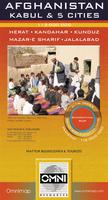
Sketch showing area covered by the map.
Sample detail of the Afghanistan map.
Sample detail of the Kabul city inset map.
Ordering Afghanistan/Kabul map folded (Gizi)64-069101 sheet, folded.$14.99
Ordering Afghanistan/Pakistan map, flat64-06910R1 sheet map, rolled/flat.$19.99


Afghanistan road mapWaterproof!
Afghanistan Travel Map. 1:1,000,000. Reise Know-How.
A double-sided map, splitting the country into east and west regions with a generous overlap of coverage. The road network is easy to see on a clear base which shows the area's topography by contours lines, spot heights, and elevation coloring. Administrative boundaries are shown with names of the provinces. Road network includes unsurfaced roads and tracks. Symbols highlight various places of interest, including archaeological remains, viewpoints, nature reserves, wells, etc. The map has a latitude and longitude grid at intervals of 1° and an index of place names. Map legend includes English.
Ordering Afghanistan road map (Reise)64-069061 sheet, folded$15.99


Afghanistan Travel Map. 1:1,500,000. Nelles Verlag. Excellent general map with cultural and physical information. Multilingual.
Sample detail of the map.
Ordering Afghanistan Travel Map (NV).64-06901 sheet, folded$13.95

Afghanistan travel map
Afghanistan Travel Map. 1:1,000,000. ITMB.
Detailed map of this war-torn, geopolitically important country, which is at the crossroads of Asia and the Middle East.
Sample detail of the Afghanistan map
Ordering Afghanistan travel map (ITMB)64-069051 sheet, folded$12.95


Afghanistan Map. 1:1,500,000. Pakistan Survey, 1993. A good quality road map produced by Afghanistan's neighbor to the south. The map includes cities, provinces, roads, railways, rivers and lakes. Folded, 33 x 44 inches. In English.
Ordering Afghanistan map  (Pak Surv.)64-06491 sheet, folded$19.95


Kabul and Khyber Pass travel map
Kabul & the Khyber Pass Travel Map. 1:16,500 & 1:1,000,000. ITMB.
This map of Kabul & the Khyber Pass is a great map for those wanting to see some details of probably the most famous mountain pass in the world.
Sample detail #1 from the Congo Travel Map
Sample detail #2 from the Congo Travel Map
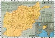
Ordering (Afgh.) Kabul & Khyber Pass map (ITMB)64-0692KAB1 sheet, folded$12.95


Afghanistan Wall & Satellite Maps


Afghanistan wall mapRecommended!
Ayazi Map of Afghanistan. Approx. 1:1,500,000. Ayazi Publishing, 2001.
Afganistan at a glance, timeline of Afghan history, primary roads, secondary roads, international airports, local airports, rivers, and lakes. Size is 28 x 40".
Thumbnail of the entire map
Sample detail of the map.
Ordering Afghanistan Wall Map (Ayazi)64-069021 sheet, flat$19.99
Ordering Afghan Wall Map (Ayazi)  ITEMIZE64-06902110 copies$159.99
Ordering Afghanistan Wall Map (Ayazi)64-06902L1 sheet, laminated$29.99

 Middle East wall map
Middle East map (formerly the Afghanistan, Pakistan, and Middle East map). National Geographic Maps. This finely detailed political map shows up-to-date country boundaries and place names, as well as beautiful shaded relief. The map covers a broad geographic area ranging from northern Africa through the Middle East to the western edge of China and India. Includes complete coverage of Afghanistan, Pakistan, Tajikistan, Iran, Iraq, Kuwait, Syria, Israel, Jordan, Lebanon, Saudi Arabia, Qatar, Bahrain, United Arab Emirates, Yemen, Oman, Cyprus, and Eritrea. Also includes parts of India, China, Kyrgyzstan, Uzbekistan, Turkmenistan, Azerbaijan, Armenia, Turkey, Egypt, Sudan, Ethiopia, and Djibouti. Measures 30" x 23". Scale: 1 inch = 96 miles.
An image of the full map
A detail of the map
A sample of the legend
An enlarged view of the mounted map
Ordering Middle East map (NGS), paper64-0646Flat/rolled$14.99
Ordering Middle East map (NGS)64-0646LLaminated$24.99
Ordering Afgahnistan & Middle East map (NGS)64-0646BLMounted, black$169.95
Ordering Afgahnistan & Middle East map (NGS)64-0646GOMounted, gold$169.95
Ordering Afgahnistan & Middle East map (NGS)64-0646WHMounted, white$169.95
Ordering Afgahnistan & Middle East map (NGS)64-0646WOMounted, wood-grain$169.95


Afghanistan Atlases


Afghanistan A to Z Atlas
The A to Z Guide to Afghanistan Assistance Atlas 2009. Afghanistan Research and Evaluation Unit, 2010, 8th edition. This spiral-bound atlas contains six main units; A to Z (short descriptions of approximately 80 government and non-goverment organizations active in Afghanistan); Government; Documents; Maps; Contacts; and a Reference Index. The Maps section includes a fold-out double-sided physical and administrative map of Afghanistan plus fold-out street maps of Kabul, Hirat, Kandahar, and Mazari Sharif. This is a detailed, useful, guide for anyone interested in Afghanistan. Well-produced, sturdy, in English.
Part of a government organization description.
Ordering Afghan Atlas, spiralbound64-0644Atlas.$39.99


Afghanistan General Atlas. (n.d.). Sahab, Iran. This 200-page atlas is primarily a cultural atlas. The first 60 pages contain black & white maps while the remaining 140 pages contain black & white photographs. While the atlas is of generally low quality, it does have useful information in it. One copy left in stock. Trilingual.
Ordering Afghan--General Atlas (S)64-0695Atlas$149.99


Afghanistan Topographic Maps

Afghanistan 1:50,000 topographic map series - click here.

Afghanistan 1:200,000 topographic map series - click here. Includes itemized listings, sample images, index maps, etc.


Afghanistan District and Province Maps


The provinces and districts of Afghanistan have changed numerous times in the past 15 years. The maps below are based on the 34-province and 329-district model and both the province and district map sets give complete coverage of Afghanistan.

Afghanistan district maps
Afghanistan District Maps. 2004/2005. Afghanistan Information Management Services. This is a set of maps covering 329 districts of Afghanistan. All of the maps are color plots as litho-printed maps were never done for this series. The maps show province and district capitals plus villages; tracks and primary and secondary roads; rivers and lakes. There is no elevation information. All maps are approx. 11.7 x 16.5 inches, thus scale varies with the size of the district. The maps have latitude/longitude ticks every 10' along the margins. The maps are in English. Maps are available only as a set at this time.
Index showing Afghanistan province and district names (1.8mb .pdf file).
Sample of an Afghanistan district map.
Thumbnail image of an Afghanistan district map.
Ordering Afghan. District Map Set64-06495S1 set, 331 sheets.$4935.00


Afghanistan province maps
Afghanistan Province Maps. 2004/2005. Afghanistan Information Management Services. This is a set of maps covering the 34 districts of Afghanistan. All of the maps are color plots as litho-printed maps were never done for this series. The maps show province and district capitals plus villages; tracks and primary and secondary roads; rivers and lakes. There is no elevation information. All maps are approx. 11.7 x 16.5 inches, thus scale varies with the size of the district. The maps have latitude/longitude ticks every 10' along the margins. The maps are in English. Maps are available only as a set at this time.
Index showing Afghanistan province and district names (1.8mb .pdf file).
Sample of an Afghanistan district map.
Ordering Afghanistan Province map set (AIMS)64-06493S1 set, 34 sheets.$1019.66


Afghanistan Digital Maps


Afghanistan image mosaic
Natural-color Image Mosaics of Afghanistan: Digital Database and Maps. USGS & USAID, 2007. The 50 tiled images in this dataset are natural-color renditions of the calibrated six-band Landsat mosaics created from Landsat Enhanced Thematic Mapper Plus (ETM+) data. Natural-color images depict the surface as seen by the human eye. The calibration of the Landsat ETM+ maps produced by Davis (2006) are relative reflectance and need to be 'grounded' with ground-reflectance data, but the difficulties in performing fieldwork in Afghanistan precluded ground-reflectance surveys. For natural color calibration, which involves only the blue, green, and red color bands of Landsat, we initially used a MODIS natural-color image, which was then modified using Munsell color readings of ground surfaces to accurately depict the surface color.

Each map quadrangle is 1° of latitude by 1° of longitude. The numbers assigned to each map quadrangle refer to the latitude and longitude coordinates of the lower left corner of the quadrangle. For example, quadrangle Q2960 has its lower left corner at lat 29° N., long 60° E. Each quadrangle overlaps adjacent quadrangles by 100 pixels (2.85 km). Only the 14.25-m-spacial-resolution UTM and 28.5-m-spacial-resolution (WGS84 geographic) geotiff datasets are available as image tiles in this report to decrease the number of DVDs needed. The image tiles are three-band, eight-bit geotiffs with embedded georeferencing. The country of Afghanistan spans three UTM zones: 41-43. A 300 dpi pdf map and three 600 dpi jpeg2000 maps of the entire country are also provided.
Thumbnail of the entire image.
Ordering Afghanistan Natural-Color Image64-0660DVD set.$59.99


Mosaic of Digital Raster Soviet Topographic Maps of Afghanistan. 1:200,000. USGS & USAID, 2005. Georeferenced raster maps compiled from the Soviet military 1:200,000 topographic maps. In Cyrillic.
Ordering Afghan 1:200k raster set (US-AID)64-06526GDVD set.$139.95


Afghanistan Geologic & Thematic Maps


Afghanistan Geologic Map
Geology & Mineral Map of Afghanistan. Various scales. USGS, 2006. 52 x 69 inches. This map is derived from digitization of the original data from two 1977 geologic maps/reports. The data is overlain on a shaded relief base map, derived from SRTM data. Some modernization of geologic unit descriptions has been done, but no new geologic field mapping is included in this map. Mineral information is derived from several reports from 1977 to 2002, along with some unpublished field work done by the authors. All in all, a good summary map for those interested in the geology and mineral resources of this area.
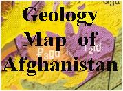
Sample of the map detail.
Ordering Afghanistan Geologic & Mineral Map64-06011 sheet, folded.$19.99


Maps of Mineral Deposits and Occurrences of Afghanistan. 1:2,000,000. AMMI. Each sheet covers a specific commodity group. Black and white. 73 x 57 cm.
Ordering Afgh.--Non-ferrous metals64-0641-02Non-ferrous Metals$49.95
Ordering Afghan.--Precious metals64-0641-03Rare and Precious Minerals$49.95
Ordering Afghan.--Tin/Tung. metals64-0641-04Tin, Tungsten, Molybdenum, Bismuth$49.95
Ordering Afghanistan Non-metallic min. map64-0641-05Non-metallic Mineral Deposits$49.95


(Afghanistan) Topography and Vegetation and Geology of Darrah-e Issik-e Payan (Issik Valley). 1:25,000. Exploration Pamir '75, printed by Freytag/Berndt. This is more a topographic/trekking map than a geologic/vegetation map. The base map is a detailed 1:25,000 topographic map and some geologic/vegetation information is overlain without obscuring the topographic data. The area is along the Issik River and Issik Glacier due south of the Koh-e Pamir mountain in northeastern Afghanistan.
Ordering (Afghan) Darrah-e Issik hiking64-06711 sheet, folded$17.95


Afghanistan Flags
Ordering Afghanistan Flag 2x367-1073AFGAfghanistan. Size 2 x 3 ft.$64.95


image


© Copyright 2025 East View Companies, Inc.
5130 Industrial Street, Suite 100, Maple Plain, MN 55359-8005
All Rights Reserved
For more information please Contact Us