Good quality full-color topographic maps. Extensive descriptive text on the reverse side of the paper originals (not included with the digital maps).
Language
In cyrillic (Russian).
64-0652
Set of 123 original paper sheets
$492.00
64-06526
Set of 123 non-georeferenced raster scans
$1230.00
64-0652G
Set of 123 georeferenced raster scans
$1845.00
Afghanistan 1:250,000 Topographic Map Set. 1:250,000. NIMA. This is the best coverage in English of Afghanistan. We have all but two quadrangles in stock. Itemized listings are coming soon. Please see the JOG 1:250,000 Topo Listings to order.
Afghanistan 1:500,000 Topographic Map Set. 1:500,000. NIMA. Good basic topographic/aeronautical chart coverage in English, produced by the US military. Seven sheets give complete coverage.
Southeast Afghanistan, W Pakistan (Quetta, Multan)
$34
Natural-color Image Mosaics of Afghanistan: Digital Database and Maps. USGS & USAID, 2007. The 50 tiled images in this dataset are natural-color renditions of the calibrated six-band Landsat mosaics created from Landsat Enhanced Thematic Mapper Plus (ETM+) data. Natural-color images depict the surface as seen by the human eye. The calibration of the Landsat ETM+ maps produced by Davis (2006) are relative reflectance and need to be "grounded" with ground-reflectance data, but the difficulties in performing fieldwork in Afghanistan precluded ground-reflectance surveys. For natural color calibration, which involves only the blue, green, and red color bands of Landsat, we initially used a MODIS natural-color image, which was then modified using Munsell color readings of ground surfaces to accurately depict the surface color.
Each map quadrangle is 1° of latitude by 1° of longitude. The numbers assigned to each map quadrangle refer to the latitude and longitude coordinates of the lower left corner of the quadrangle. For example, quadrangle Q2960 has its lower left corner at lat 29° N., long 60° E. Each quadrangle overlaps adjacent quadrangles by 100 pixels (2.85 km). Only the 14.25-m-spacial-resolution UTM and 28.5-m-spacial-resolution (WGS84 geographic) geotiff datasets are available as image tiles in this report to decrease the number of DVDs needed. The image tiles are three-band, eight-bit geotiffs with embedded georeferencing. The country of Afghanistan spans three UTM zones: 41-43. A 300 dpi pdf map and three 600 dpi jpeg2000 maps of the entire country are also provided.
Thumbnail of the entire image.
64-0660
DVD set.
$59.99
Mosaic of Digital Raster Soviet Topographic Maps of Afghanistan. 1:200,000. USGS & USAID, 2005. Georeferenced raster maps compiled from the Soviet military 1:200,000 topographic maps. In Cyrillic.
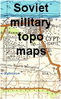 Afghanistan Topographic Map Series (Soviet Military)

 Thumbnail of the entire image.