We highly recommend the Nepal 1:25,000 and 1:50,000 topographic maps. These maps, in English are a must for any trekker. We also highly recommend the new hiking/topographic maps from Nepa Maps also. These highly detailed topographic maps, nearly all new or redone in 1998 or 1999, cover all of the classic and many new hiking/trekking routes in the Himalayas.
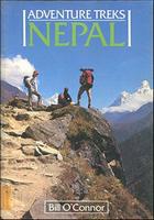
Adventure Treks in Nepal. Cicerone Press. 1990.
Bill O'Connor describes with vivid recollection ten of the best treks he has done in Nepal, while also providing all the factual and practical details necessary, from detailed route guides to advice on how to obtain a permit, to plan and organise a trek yourself. For the armchair traveller the book is an enthralling read full of life and color and for those inspired to go themselves there is all the information available to start turning a dream into reality.' (From the cover). 160 pages. ISBN 1-85223-306-0. Large format.
$20.95
65-04951AT
Guide
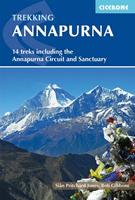
Trekking Annapurna. Cicerone Press.
A comprehensive trekking guidebook to the Annapurna region - the most popular trekking area in Nepal. Fourteen diverse treks are described including the classic Annapurna Circuit and the Annapurna Sanctuary as well as treks in the lesser known Machhapuchhre area, the foothills of Lamjung Himal and restricted areas - Mustang, Damodar and Nar-Phu.
$29.95
65-04951AN
Guide
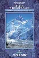
Everest - A Trekker's Guide. Cicerone Press.
Guidebook to treks in the Everest and Khumbu region of the Himalaya in Nepal. All the main Nepal trekking routes, including from Lukla (and Jiri) to Namche Bazaar, and routes to Thame, Gokyo, Thangboche, Lobuche, Kala Pattar and Everest Base Camp. Includes two routes in Tibet from Tingri to the Rongbuk monastery and Kharta to the Kangshung Face.
$24.95
65-04951EV
Guide
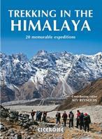
Trekking in the Himalaya Guide. Cicerone Press.
An inspirational guidebook to 20 treks along the 2400km Himalayan chain. Includes classics such as the treks to Everest and K2 base camps and the Annapurna Circuit. Also epic glacier treks, ultra-long expedition treks and sacred treks. This is a book to inspire and excite, guaranteed to entice any with an adventurous spirit and love of wild places.
$29.95
65-04951HI
Guide
Mount Kailash Hiking Guide. Cicerone. This comprehensive guide to the Kailash trekking region - sacred to Bhuddists, Hindus, Bonpos, Jains, and other religions - opens up a region of increasing interest to Western visitors. Kailash (22,028ft high) has for more than a thousand years been a central pilgrimage site for some of the world's major religions. The book provides all the essential planning info for a trip to one of the world's most remote regions, including travel into and within Tibet. It guides the trekker on the journey round the sacred peak, and also describes a trip to the ethereal fortress ruins of Tsaparang, the former capital of Guge. This is Tibet's greatest Buddhist treasure house of art and paintings, a fairytale location not to be missed. The author recommends the maps listed below.
Location map of the trek Sample of one of the maps in the guide
$22.95
65-04951MK
Mt. Kailash Guidebook.
Maps recommended by the author:
$16.99
65-4373
Kailash. 1:50,000. Gecko. Includes Darchen, Darpoche, Chuku Gompa, Dira Phug, Dolma La, Zuthrul Phug Gompa, Mt. Kailash.
$20.99
65-0481-12
Kailash - Manasarovar. 1:200,000. Himalaya Map House. This topographic map has a 1:200,000 map of the region and a sketch map at 1:66,000 of the routes up Mount Kailas. The map covers Simikot, Nara Pass, Sera, Purang, Manasarovar, Rakas Tal, Kailas, Limi, Humla.
$13.95
65-43901
Tibet. 1:2,400,000. Himalaya Map House. Clear, easy to read map covering the whole of Tibet with all but the south-eastern corner of Nepal. Relief shading, with main peaks and passes prominently marked, indicates the topography. The map shows towns and settlements, roads and local airports. An index of localities includes peaks and passes. The map also includes a street plan of Lhasa indicating places of interest and tourist facilities.


 Location map of the trek
 Sample of one of the maps in the guide