|
|
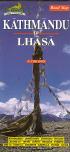
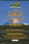
(Nepal) Road Map of Kathmandu to Lhasa. 1:700,000. Nepa, Kathmandu. A shaded relief map highlighting the road system between Kathmandu and Lhasa. Includes an index of towns/villages, symbols for tourist sites such as temples, monasteries, national parks, etc. Multilingual legend.
 Sample detail from the Kanchenjunga Trekking Map Sample detail from the Kanchenjunga Trekking Map
 Sketch map showing areas covered by each sheet. Sketch map showing areas covered by each sheet.
Nepal Satellite Maps
Nepal Topographic MapsNepal 1:25,000 and 1:50,000 Topographic Maps. 1:25,000 and 1:50,000. Nepal Survey. We are very excited about these maps finally being available. They are high quality topographic maps produced under contract by the Finnish Survey. The maps are in English and show tremendous detail. The two series are complementary and do not overlap and use the same grid and numbering system. Northern Nepal is covered at 1:50,000 scale and southern Nepal is covered at 1:25,000 scale. Coverage of the Lumbini Zone uses a different grid and numbering system (no idea why). All quads are available, regardless of gray/white coloring on the index. We have prepackaged some sheets to cover the most popular areas, which are listed below. The coverage of each set is marked on the accompanying index map.
Nepal 1:200,000 Topographic Quadrangle Map Set. 1:200,000. Soviet government. High quality topographic maps with good detail. Each sheet has extensive descriptive text on the reverse. This set gives complete coverage of Nepal in 37 sheets. In Russian.
Nepal Trekking MapsNepal Trekking Maps by Nepa - Hiking/Topographic MapsNepa Hiking Maps - click here for a complete listing. We are pleased to offer the complete line of more than 40 maps produced by Nepa Maps and the Himalaya Map House, the only
registered map publishing company in Nepal. These maps are of very high quality and are essential for anyone trekking in the region.
Swiss Foundation of Alpine Research Trekking Maps
Trekking Maps by Gecko MapsSuperb trekking maps by this Swiss publisher. The map detail lives up to the Swiss reputation for accuracy and detail.
Pokhara Town and Valley Tourist Map. 1:9,000 to 1:50,000. Karto-Atelier, Forch. A detailed map that uses both contour lines and shaded relief to show elevation and topography. One side has a 1:50,000 regional map of Pokhara and the nearby lakes. The reverse has 1:9,000 city and lakeside maps. Multilingual legend. Laminated. ISBN 3-906593-12-6.
Trekking Maps by Leomann & West Col
Nepal Himalaya. West Col Productions.
Trekking Maps by Schneider Maps
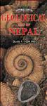
Nepal Geologic and Thematic Maps
Nepal Geology Quadrangle Map Series. 1:125,000. Nepal Survey. Complete coverage is available. Black/white maps, all done in the mid-1980's.
Nepal Land Systems Map Series. Nepal Survey. Extensive coverage is available.
Nepal Land Utilization Map Series. Nepal Survey. Extensive coverage is available.
Nepal Land Capability Map Series. Nepal Survey. Extensive coverage is available.
Nepal--Atlas of Mineral Resources of the ESCAP Region - Volume 9. 1:1,000,000. United Nations. 1993. Includes two maps; Geological Map of Nepal and the Mineral Resources Map of Nepal. Good summary maps. Complete with 107-page descriptive text.
Nepal, Himalayas--Geological Map of the Annapurna-Manaslu-Ganesh Himal. 1:200,000. 1986. CNRS. This is an excellent map of the popular mountain climbing region of the Himalayas. With 136-page bilingual text.
(Nepal) Population Density Atlas. 1988. Majesty's Government of Nepal. This atlas contains 54 maps at various scales.
Nepal Travel GuidesNepal Hiking Guides - click here
|
||||||||||||||||||||||||||||||||||||||||||||||||||||||||||||||||||||||||||||||||||||||||||||||||||||||||||||||||||||||||||||||||||||||||||||||||||||||||||||||||||||||||||||||||||||||||||||||||||||||||||||||||||||||||||||||||||||||||||||||||||||||||||||||||||||||||||||||
 Nepal Maps & Guides
 Sample detail from the Nepal Map
 Waterproof!


 Sample from the main road map.
 Sample from the Pokhara Valley map.
 Waterproof
 Sample detail of the Nepal travel map


 Laminated!
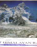 Spectacular photo-poster!
 Sample of the middle portion of the photo-poster
 A more detailed sample of the center of the photo-poster
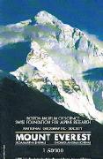
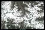 Mt. Everest - A Satellite Image Poster. SatPrint. Mount Everest is the grandest of all mountains. It rises to over 29,000 feet (8,800 meters). It continues its upward motion along with the rest of the Himalayas. This piece will give you some insights into why the Tibetan name for Mt. Everest is Chomolangma (Goddess Mother of the Snows), and the Nepali have given it the name Sagarmatha (Mother of the Universe). Size is 36 x 24".


 Eastern Nepal index.
 Central Nepal index.
 Western Nepal index.
 Lumbini Zone index.


 Sample #1 of the main map
 Sample #2 of the main map
 Sample of an inset city map
 Sample from the panoramic map
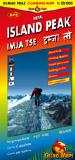
 Sample of the main map
 Sample of the panoramic map
 Sample of the climbing routes map
 Image of the entire map
 Sample #1 of the map detail
 Sample #2 of the map detail
 Sample #3 of the map detail
 Index map showing sheet coverage
 Sample of the map detail


 Index map
 Sample image
 Eastern half
 Western half
 Eastern half
 Western half
 Eastern half
 Western half
 Nepal Flags