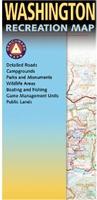
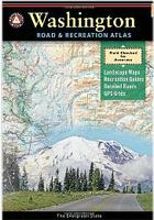
Washington Road and Recreation Atlas. 1:200,000. Benchmark Maps, 2007. The Evergreen State offers an incredibly wide range of outdoor recreation. Turn to the Washington Road & Recreation Atlas for the latest, most accurate maps and reliable information to make the most of these opportunities. The large-scale Landscape Maps make this atlas perfect for either freeway travel or four-wheeling fun. Includes Game Management Units and public land ownership.
Sample detail from the Washington recreation atlas.
$26.95
62-99482
Atlas
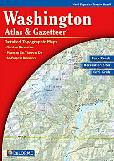
Washington Atlas and Gazetteer. 1:150,000. DeLorme.
Gazetteer information usually includes campgrounds, attractions, historic sites & museums, recreation areas, trails, freshwater fishing sites & boat launches, canoe trips or scenic drives, etc. (Categories vary slightly by state and available recreation opportunities.)
$29.95
62-9948
Atlas
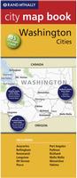
Washington Road Maps - Paper Maps
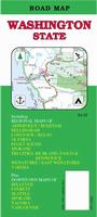
Washington Road Map. Rand McNally.
This detailed road map has clearly labeled Interstate, U.S., state, and county highways; indications of parks, points of interest, airports, county boundaries, and more; mileage and driving times map; and a detailed index.
Detail of the Washington Road Map
$7.99
62-9990
1 sheet, folded
Washington Road and Recreation Map. 1:650,000. Benchmark Maps.
The Washington Recreation Map was created for outdoor lovers who want the high quality recreation information in the Benchmark atlases but with the convenience of a traditional folding map. Complete public lands detail and hunting unit boundaries are shown as well as categorized recreation listings. It's an extremely complete map of Washington.
Sample detail from the Washington recreation map.
$9.95
62-99905
1 sheet, folded
Recommended Washington Large-Print Road Map. GM Johnson.
This detailed road map has larger print than other road maps, making it easier to read. It has inset regional maps and inset city-center maps for driving into/out of major cities in the state.
$5.95
62-99908LP
1 sheet, folded
Washington Road Map. 1:650,000. GM Johnson.
This detailed road map has inset regional maps for seven areas, including Seattle, Aberdeen/Hoquiam, Bellingham, Puget Sound, etc. The map also has inset city-center maps for six cities including Seattle, Olympia, Bellingham and others.
$4.95
62-99908
1 sheet, folded
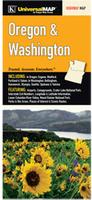
Oregon / Washington road map. Kappa.
The Oregon and Washington fold map is a full-color, regional map, including: Eugene, Medford, Portland, and Salem, in Oregon; and Bellingham, Kennewick, Olympia, Seattle, Spokane, and Yakima, in Washington; and features: Airports, Campgrounds, Crater Lake National Park, Interstate Exit Numbers, Latitude and Longitude information, the Lower Columbia River Valley, Mount Rainier National Park, Parks and Rec Areas, Places of Interest, and Scenic Routes.
$7.99
62-89907
1 sheet, folded.
Washington Regional Road Maps. Various publishers.
The regional maps of Washington, such as maps of Puget Sound or Olympic Peninsula, have a wealth of recreation information, so they are listed in the Washington Recreation Maps below.
Washington Road Maps - Laminated Maps
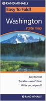
Laminated Washington Easy-to-Fold® Road Map. Rand McNally.
The durable and convenient Washington EasyToFold state map will take all the wear and tear your journey can dish out. The heavy-duty laminated design allows you to mark your route, make notes, then wipe the surface clean for further use. Map size is 17 x 18 inches unfolded, ideal for using in a car.
$9.99
62-99901
1 sheet, folded
Laminated Washington Pearl® Road Map. 1:650,000. GM Johnson.
This laminated road map includes inset maps of Seattle and other areas. Ideal for use in a car.
$6.95
62-99911
1 sheet, folded
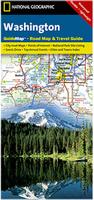
Waterproof Washington State Guide Map. National Geographic Maps.
Our up-to-date, detailed road map and travel guide to Washington State. The main map features Washington's highways, toll roads, rest areas, interstates, major and minor cities, National Parks, state parks, points of interest, ski areas, and more. Detailed inset maps of Seattle-Tacoma, downtown Seattle, Olympia, Spokane, and Yakima highlight local roads, points of interest, and local infrastructure. For handy reference, all cities and counties are cross-referenced to an index and a driving distances chart is provided for Washington's 18 largest cities. Map size is 26 x 38 inches unfolded.
Sample detail of the Washington Guide map Front of the Washington Guide map Reverse of the Washington Guide map
$7.95
62-99914
1 sheet, folded
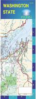
Laminated Washington Road & Recreation Map. Great Pacific Recreation Maps.
This detailed map has scenic routes, city & recreational indexes, 12 inset city-center maps, shaded relief, and laminated for long-lasting use.
$7.95
62-99909
1 sheet, folded
Washington City Maps - Paper Maps
Seattle City Maps - Paper Maps
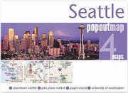
Pocket-sized Seattle PopOut® Map. PopOut.
Small shirt-pocket-sized maps that utilize "pop-out" folding to fit an 11 x 17 map into a 4 x 6 in folded product. Contains a map of the city center, a regional map, and shows the main public transit lines.
$6.95
62-9992SEB
1 sheet, folded
Pocket-sized Seattle PopUp® Map. Van Dam
VanDam's new Seattle Pop-Up maps all of Seattle's attractions, hotels, museums, neighborhoods and more with 3-D buildings in our new easy to unfold format. Includes detailed Downtown Seattle and Metro Area map.
This compact map package refolds easily to 3.75" x 6" (8.5" x 11" open) and fits discreetly in your shirt pocket. Complete street index make navigating the Emerald City fun and easy.
Sample detail #1 of the Seattle PopUp map Sample detail #2 of the Seattle PopUp map
$6.95
62-99921SP
1 sheet, folded
Downtown Seattle Street Map. Great Pacific Recreation Maps.
Detailed "walking-scale" coverage of Downtown PLUS adjacent neighborhoods.
Full coverage of the heart of Seattle: from Green Lake south to SoDo and from Lake Washington west to Puget Sound.
Expanded "Downtown Building Index," complete with addresses and construction and refurbishment dates.
Expanded "Recreational Index," complete with destination addresses & phone numbers
Improved cartography features color coding and/ or symbols for parks, retail centers, breweries, wineries, performing arts venues, viewpoints, marinas, live entertainment venues, & public transit facilities.
Comprehensive Transportation Guide: Freeway interchanges & exit numbers, Metro Transit bus routes, Downtown Seattle Transit Tunnel (DSTT), LINK light rail, So. Lake Union Streetcar, Monorail, ferries, Greyhound, Amtrak & Sounder commuter rail.
$6.95
62-99921SE
1 sheet, folded
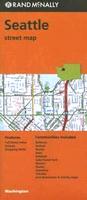
Seattle Street Map. Rand McNally.
This detailed Seattle Metro area street map also covers Burien, Lake Forest Park, Renton, Seatac, Shoreline, and Tukwila. Map size is 28 x 40 inches unfolded.
$6.99
62-9992S
1 sheet, folded
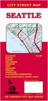
Seattle Street Map. GM Johnson.
This detailed map covers the Seattle metro area plus Bellevue, Kent, Kirkland, Renton, the shoreline area, and more. Also includes an inset map of downtown Seattle and a small regional map.
$5.95
62-9992SEC
1 sheet, folded
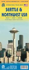
Pocket-sized Seattle & NW USA Street Map. 1:12,500 and 1:1,000,000. ITMB.
This map follows ITMB's recent trend of having a detailed city map on one side and a regional map on the reverse. The Seattle map is at 1:12,500 and the Seattle regional area map on the reverse is at 1:1,000,000.
Sample detail #1 of the Seattle Street map Sample detail #2 of the Seattle Street map
$7.95
62-99921SI
1 sheet, folded
Washington City Maps for cities other than Seattle - Paper Maps
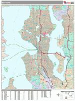
Washington City Maps. We offer city and county maps by Rand McNally, GM Johnson, and Pittmon. Many of the Pittmon county maps are a bit old and in black/white, but they are ideal for taking backroad trips through the Washington countryside. The newer maps tend to be in color. With Rand McNally cutting 80% of its printed map line, small local publishers such as Pittmon (located in Portland, OR) will become important as the only producer of maps of small cities in their area.
Thumbnail of the Rand McNally Bellingham map Sample detail of the Pittmon Vancouver city map detail Sample detail of the Pittmon Lewis county map detail
$3.95
62-9992AD
Adams County map. (Pittmon)
$3.95
62-9992AS
Asotin County map. (Pittmon)
$4.95
62-9992BE
Bellevue City Map. (Rand McNally).
$5.95
62-9992BF
Bellingham City Map. (GM Johnson).
$3.5
62-9992BH
Benton County map. (Pittmon).
$3.5
62-9992CH
Chelan County map. 1:175,000. (Pittmon).
$3.95
62-9992CL
Clark County map. 1:,000. (Pittmon).
$3.95
62-9992CO
Cowlitz County map. 1:,000. (Pittmon).
$3.95
62-9992DO
Douglas County map.
$4.95
62-9992EV
Everett & Edmonds map. (Rand McNally).
$5.95
62-9992EW
Everett & Edmonds map. (GM Johnson).
$3.5
62-9992FF
Ferry County map. 1:175,000. (Pittmon).
$3.95
62-9992FR
Franklin County map. 1:130,000. 1992. (Pittmon).
$3.5
62-9992GB
Garfield County map. 1:125,000. (Pittmon).
$4.95
62-9992GI
Gig Harbor map. (GM Johnson).
$3.95
62-9992GR
Grant County map. 1:175,000. (Pittmon).
$3.95
62-9992IS
Island County map.
$3.95
62-9992JE
Jefferson County map. 1:135,000. (Pittmon).
$5.95
62-9992KE
Kelso & Longview map. (GM Johnson).
$4.95
62-9992KEL
Kelso & Longview map. (Rand McNally).
$3.95
62-9992KK
Kitsap County map. 1:140,000. (Pittmon).
$5.95
62-9992KN
Kitsap County & Bremerton map. (GM Johnson).
$3.5
62-9992KO
Kittitas County map. 1:175,000. (Pittmon).
$3.95
62-9992KP
Klickitat County map. 1:160,000. (Pittmon).
$3.95
62-9992LE
Lewis County map. 1:130,000. (Pittmon).
$3.95
62-9992LI
Lincoln County map. 1:130,000. (Pittmon).
$4.95
62-9992LON
Long Beach map. (GM Johnson).
$3.95
62-9992LO
Longview, Kelso, Cowlitz Counties map. (Pittmon).
$5.95
62-9992MAR
Marysville city map. (GM Johnson).
$3.95
62-9992MB
Mason County map. 1:135,000. (Pittmon).
$5.95
62-9984
Mount Rainier & Surrounding Communities street map.
$3.5
62-9992OK
Okanogan County map. 1:210,000. (Pittmon).
$5.99
62-9992OL
Olympia City Map. (Rand McNally).
$5.95
62-9992OLY
Olympia street map. (GM Johnson).
$3.95
62-9992PB
Pacific County map. 1:135,000. (Pittmon).
$3.95
62-9992PE
Pend Oreille County map. 1:150,000. (Pittmon).
$3.95
62-9992PI
Pierce County map. 1:150,000. (Pittmon).
$5.95
62-9992POR
Port Angeles city map. (GM Johnson).
$4.95
62-9992PUL
Pullman (WA) and Moscow & Lewiston (ID) City Map. (Rand McNally).
$5.95
62-6492LE
Pullman (WA) and Moscow & Lewiston (ID) City Map. (GM Johnson).
$5.95
62-9992RE
Renton & Auburn city map. (GM Johnson).
$3.95
62-9992SB
San Juan County map. 1:125,000. (Pittmon).
$5.95
62-9992SJ
Skagit County & Mount Vernon map. (GM Johnson).
$3.95
62-9992SL
Skamania County map. 1:150,000. 1995. (Pittmon).
$3.95
62-9992SN
Snohomish County map. 1:135,000. (Pittmon).
$5.95
62-9992SO
Spokane city map. (GM Johnson).
$6.99
62-9992SP
Spokane City Map. (Rand McNally).
$3.95
62-9992SPO
Spokane County map. 1:175,000. (Pittmon).
$6.95
62-99921SPO
Spokane laminated street map.
$3.95
62-9992ST
Stevens County map. 1:175,000. (Pittmon).
$5.99
62-9992T
Tacoma City Map. (Rand McNally).
$7.99
62-9992TAC
Tacoma street map. (GM Johnson).
$3.95
62-9992TG
Thurston County map. 1:125,000. (Pittmon).
$6.95
62-9992TR
Tri-Cities city map. (GM Johnson).
$5.95
62-9992VB
Vancouver City Map. (GM Johnson).
$4.95
62-9992VD
Vancouver and Clark County city map. 1:40,000. 2005. (Pittmon).
$3.95
62-9992WA
Wahkiakum County map. 1:75,000. (Pittmon).
$3.95
62-9992WB
Walla Walla & Hermiston city map. (GM Johnson)
$3.95
62-9992WC
Walla Walla County map. (Pittmon)
$5.95
62-9992WE
Wenatchee and Moses Lake street map. (GM Johnson).
$3.95
62-9992WG
Whatcom County map. No scale. (Pittmon).
$5.95
62-9992WHI
Whidbey Island city map. (GM Johnson).
$3.95
62-9992WJ
Whitman County map. 1:175,000. 1991. (Pittmon).
$4.95
62-9992YB
Yakima city map. (GM Johnson)
$3.95
62-9992YD
Yakima County map. 1:150,000. (Pittmon).
Washington City Maps - Laminated Maps
Waterproof Seattle MapEasy Street Map. MapEasy.
Seattle, home to more than just coffee and software, is a dynamic and fun city. Stunningly located on Elliot Bay, come tour Seattle with us! Explore Seattle Center with its many museums and attractions, and ride to the top of the Space Needle! Walk along the waterfront and through the historic Pike Place Market, filled with its fish and produce vendors. Need a coffee? MapEasy locates every shop in town! And with a detail of the Westlake Center Shopping area, you are sure to find whatever store you are looking for. When you are finished with Seattle, lets head out of town to the islands in Puget Sound or to the National Parks. With MapEasy, you will know where everything is! The Seattle Guidemap includes detailed sections for Pioneer Square, Greater Seattle, and Out-of-Town.
Sample detail #1 of the Seattle MapEasy map Sample detail #2 of the Seattle MapEasy map
$7.95
62-9992SF
1 sheet, folded
Laminated Seattle Street Map - Laminated. Borch.
Our soft-laminated map of Seattle in the 9th edition includes: Seattle Downtown 1:10,000,
Washington University 1:10,000, Olympic National Park 1:500,000, North Cascades National Park 1:400,000, Mount Rainier National Park 1:200,000, Seattle & Region 1:250,000, Western Washington 1: 1 200,000, Public Transport Seattle, 30 top sights, USA administrative & time zones, interesting statistics, conversion chart for temperatures, weights and measures, climate chart with temperatures, sunshine hours, precipitation and humidity.
Sample detail of the Seattle Streetsmart map
$9.95
62-9992SE
1 sheet, folded
Waterproof Seattle Pearl® Street Map. GM Johnson.
A laminated street map of Seattle. The map has a simple accordian fold, so it is easy to use while walking.
$6.95
62-99921SEA
1 sheet, folded
Washington City Street Atlases
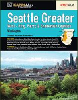
Seattle Greater Street Atlas. Kappa Map Group.
The Seattle Greater (West - King, Pierce & Snohomish Counties) WA Street Atlas is a full-color street detail atlas, including: Auburn, Bellevue, Bothell, Brier, Burien, Covington, Des Moines, Edmonds, Everett, Fife, Gig Harbor, Issaquah, Kenmore, Kent, Kirkland, Lake Forest Park, Lake Stevens, Lakewood, Lynnwood, Maple Valley, Marysville, Mountlake Terrace, Mukilteo, Newcastle, Normandy Park, Pacific, Puyallup, Redmond, Renton, Ruston, Sammamish, Seatac, Steilacoom, Sumner, Tacoma, Tukwila & University Place; and featuring: Airports, Block Numbers, Colleges & Universities, Downtown Seattle, Golf Courses, Hospitals, Marinas, Parks & Rec Areas, Places of Interest, Schools & ZIP Codes.
$24.99
62-99922SEA
Atlas
Washington Cities Street Atlas. Rand McNally.
This pocket atlas contains street maps for twelve Washington cities. The maps cover the main part of the cities, but not the suburbs. These are good for the tourist or business person stopping in several Washington cities, but not for someone wanting a detailed street atlas of the full metropolitan area. Cities included are Anacortes, Bellingham, Kennewick, Longview, Mt. Vernon, Pasco, Port Angeles, Pullman, Richmond, Walla Walla, Wenatchee, and Yakima. Atlas size is 4 x 9 inches, center-stapled.
$7.99
62-9992WAS
Atlas
Washington City, County, and State Business Wall Maps
Washington City Wall Maps.
When it comes to general planning, defining delivery areas, planning direct marketing and delivering products, our city wall maps are perfect to get the detailed information you need.
These maps offer clear mapping by showing all major streets and roads, but leaving out the smaller streets.
If you want a clear map for easy planning, then these are the maps for you; if you want a map showing every little back alley, these are not for you.
We offer wall maps for Auburn, Bellevue, Bellingham, Burien, Everett, Federal Way, Kennewick, Kent, Kirkland, Lakewood, Marysville,
Pasco, Redmond, Renton, Richland, Sammamish, Seattle, Shoreline, Spokane, Spokane Valley, Tacoma, Vancouver, and Yakima.
We offer state and county wall maps for all of the USA. The maps come in sizes from 24 x 36 to 108 x 144 inches. They are available in variety of mounting and framing options. The maps are ideal for business applications, sales territory, delivery planning, direct mail targeting and hundreds of other applications.
Washington Bicycling Maps. Washington is crossed by several very popular long-distance cycling trails. These include the east-west Northern Tier Transcontinental Cycling Trail and the Lewis & Clark Cycling Trail, the north-south Pacific Coast Cycling Trail and the Sierra-Cascade Cycling Trail, and the Washington National Parks Cycling Trail.
We have a lot of regional road maps and hiking/recreation maps of Washington. These maps are organized by region - please click the links below for specific maps.
For the National Geographic/Trails Illustrated hiking maps, this index shows coverage by each map. Click here for the index.
Waterproof North Cascades National Park Hiking Map. 1:100,000. National Geographic Maps #223.
The map includes all of North Cascades National Park, Ross Lake National Recreation Area, and Lake Chelan National Recreation Area, with detailed trails and topographic information. The map includes detailed coverage of Mount Baker Wilderness, Snoqualmie National Forest, Glacier Peak Wilderness, Stephen Mather Wilderness, Ross Lake National Recreatioin Area, Noisy Diobsub Wilderness, Pasayten Wilderness, Wenatchee National Forest, Lake Chelan, Ross Lake, and much more. Includes UTM grids for use with your GPS unit.
Sample detail of the North Cascades map. Front of the North Cascades map.
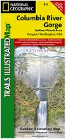
Columbia River Gorge Hiking Map. 1:75,000. National Geographic Maps #821.
Considered one of the best year-round outdoor recreation areas in the country, the Columbia River Gorge contains countless opportunities for hikers, climbers, kayakers, cyclists, windsurfers, and winter sports enthusiasts alike. The 80 mile long gorge contains diverse ecosystems ranging from the lush Oneonta Gorge Rain Forest to the arid Celilo Grasslands.
Our detailed Trails Illustrated recreation map of the Columbia River Gorge contains carefully researched trails, campsites, forest service roads, and points-of-interests and adjoins our Mt. Hood map.
Backcountry users will find the UTM and Latitude/Longitude grids, mileage charts, and other accurate navigation features perfect for exploring the region confidently and safely.
Image of the Columbia River Gorge map. Sample detail of the Columbia River Gorge map.
$14.95
63-2100-821
1 sheet, folded
Mt. Baker Region Maps
Mt. Baker & Bellingham Recreation Road Map. Great Pacific Recreation Maps.
The map covers Bellingham Downtown, Blaine, Port Roberts, Ferndale, Lynden, Sudden Valley, and Western WA University (WWU)Campus. It includes coverage of North Snohomish, Skagit & Island Counties.
The Recreation Finder Index includes Attractions, Parks & Recreation Areas, Campgrounds, RV Parks & Retreat Centers, Farms, Golf Courses, Driving Ranges & Mini Golf.
Sample detail from the Mt. Baker map.
$7.95
62-9992BEL
1 sheet, folded.
Mount Baker, Mt. St. Helens & Snoqualmie National Forest Hiking Maps. National Geographic Maps/Trails Illustrated.
One of five new Trails Illustrated maps for the Washington Cascades region offering the most detailed and up-to-date map for the forest, carefully researched and developed in co-operation with local land managers and agencies. Each map contains easy to read trails, numbered forest service roads, campsites, access points, scenic points-of-interests, and important facilities.
Index map showing coverage of the National Geographic hiking maps Sample detail from the Mount Baker map.
$14.95
63-2100-823
Goat Rocks & North Peak Wilderness Areas hiking map. 1:75,000. Includes William O. Douglas and Tatoosh Wilderness Areas, Pacific Crest Trail, Bumping and Rimrock Lakes, Manastash Ridge & Tatoosh Range, Chinook and White Pass Scenic Byways Wilderness Coverage: Goat Rocks, Norse Peak, Tatoosh, William O. Douglas.
$14.95
63-2100-825
Alpine Lakes Wilderness hiking map. 1:75,000. Includes the Pacific Crest Trail in this area, Cle Elum, Kachess and Keechelus Lakes, Mountains to Sound and Stevens Pass Greenways.
$14.95
63-2100-826
Mount Baker and Boulder River Wilderness Areas hiking map. 1:75,000. Includes the Pacific Northwest Trail, Skagit Wild and Scenic River, Mt. Baker and North Cascades Scenic Byways.
$14.95
63-2100-827
Glacier Peak Wilderness hiking map. 1:75,000. Includes the Pacific Crest Trail in this area, North Cascades Scenic Byway, Stevens Pass Greenway, and Lake Wenatchee State Park.
Mt. Rainier Region Maps
Waterproof Mount Rainier National Park hiking map. Earthwalk Press.
The map contains additional information about hiking and camping in the park, and includes information on bear country and weather conditions. Printed on tear-resistant, waterproof Polyart.
Olympic Peninsula Road Map. The Map Company.
Detailed map of the Olympic Peninsula. Includes Olympic National Park and hiking map. Shows Port Townsend, Port Angeles, Sequim and the entire peninsula. The index includes points of interest, parks, mountains, islands, rivers, and more.
$5.95
62-9981OP
1 sheet, folded
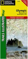
WaterproofOlympic National Park Hiking Map. 1:100,000. National Geographic Maps.
Within the park, there is detailed coverage of Mount Olympus, Tshletshy Ridge, Hurrican Ridge, Huelsdonk Ridge, Bailey Range, camping areas, facilities, ranger stations, nature trails, waterfalls, boat launches, and much more. Also included are the Mount Skokomish Wilderness, Ozette Lake, Lake Pleasant, Lake Crescent, Lake Mills, and Olympic National Forest.
Sample detail from the Olympic N.P. hiking map. Front of the Olympic N.P. hiking map. Reverse of the Olympic N.P. hiking map.
Puget Sound Road Map. 1:235,000. Rand McNally.
Detailed road map by the world-famous Rand McNally. This is a road and street map, not a recreation map thus the roads are easier to read without the background elevation information. Fully indexed.
$6.99
62-9992PU
1 sheet, folded
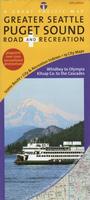
Puget Sound Recreation Map. Great Pacific Recreation Map.
Coverage from Whidbey Island to Olympia and Kitsap County to the Cascades.
Scenic Routes, City & Recreation Indexes, and 19 City Maps
Remarkable Recreational & Business Detail - Beaches & Pools, Boat Launches, Business & Corp. Centers, Conference Centers, Fishing Piers, Hotels, Museums, Parks & Trails, Schools & Colleges, Shopping Centers & Public Markets, Theaters, Wineries & Breweries
Regional Transit information including transit centers, regional transit hubs, LINK light rail, Park & Rides, and the Sounder Commuter Rail system.
$6.95
62-9981PU
1 sheet, folded
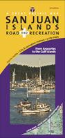
San Juan Islands Recreation Road Map. Great Pacific Recreation Maps.
This map has detailed coverage of Washington's San Juan Archipelago. Includes informatoin on bike routes, hiking trails, scenic drives & whale watching. Also includes detailed inset maps of Friday Harbor, Eastsound, Lopez & Anacortes.
Sample detail from the San Juan Islands road map.
$7.95
62-9981SJ
1 sheet, folded
Washington Central Region Maps
Waterproof! Northwest Coast Trail Map. 1:126,720 & 1:31,680 Adventure Maps.
The NW Coast Trail Map & Guide is a waterproof, topographic (lat/long,UTM grids) trail map that includes route descriptions for the North Oregon Coast and Mountains as well as the South Washington Coast. It includes 15 hike and 5 road bike suggestions. The map depicts put-ins for paddlers, points for birding/wildlife viewing as well as a designated OHV area.
Sample detail from the Northwest Coast Trail Map.
$11.99
62-8971-NWC
1 sheet, folded
Waterproof! Wenatchee & Leavenworth Trail Mountain Biking & Hiking Map. 1:48,000. Adventure Maps.
The Central Washington Mountain Biking and Hiking Adventure Map is a waterproof, topographic map that includes a route guide and trail map covering trails throughout the Wenatchee and Leavenworth areas. This includes detailed map and route descriptions for mountain bike trails, road biking routes, hiking trails, horseback riding trails and nordic/cross-country skiing trails in the Sage Hills, Mission Ridge, Devil's Gulch, Blewett Pass, Alpine Lakes Wilderness, Lake Wenatchee, Mad River and Chickamin Ridge. Size is 27 x 39 inches.
Sample detail from the Salt Lake City Trail Map.
$12.99
62-9971-WE
1 sheet, folded
Washington Coast Region Maps
Washington & Oregon Coast Recreation Map. Great Pacific Recreation Map.
Coverage from Olympic Peninsula to California's Redwoods.
Scenic Routes, City & Recreation Indexes
Large Scale, Shaded relief, Easy Refold
24 Maps in One covering cities and access routes.
Olympic Peninsula/Washington Coast + North Oregon Coast Access Routes
Inland Empire - Eastern Washington & Northern Idaho Road Map. GM Johnson.
Inland Pacific Northwest Travel & Recreation Map. Covers Eastern Washington and Northern Idaho. Including Spokane, Selkirk Mountains, Palouse, Blue Mountains, Lake Pend Oreille, Coeur d'Alene Lake, Lwesiton-Clarkston,Camas Prairie, Hells Canyon, Silver Valley.
$5.95
62-99913
1 sheet, folded
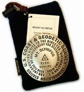
Cast in pewter! Mt. Olympus benchmark paperweight. 3-1/4" cast pewter paperweight modeled after the USGS benchmark at the top of Mt. Olympus.
At 7980 feet (current survey) Mount Olympus is the highest of the peaks located in Olympic National Park. Cloaked with seven glaciers, it is notable for its Blue Glacier receiving up to 500 inches of snow each year--a result of being located on a peninsula which is one of the wettest places in the world. Supplied in a soft fleece drawstring pouch, 3¼" diameter.
Larger image of the Mt. Olympus paperweight.
$59.95
62-9997MOM
Paperweight.
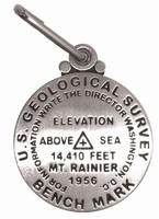
Cast in pewter! Mt. Rainier benchmark paperweight. Formed by ice and fire, the massive Mount Rainier is a volcano at rest. Its majestic glaciated summit dominates the region and attracts seekers of beauty and adventure. It is appreciated for its trails in all seasons, summer wildflowers, and challenging mountaineering experiences. Supplied in a soft fleece drawstring pouch, 3¼" diameter.
Also available as a 1" diameter lapel pin or a 1¼ diameter magnet.
Larger image of the Mt. Rainier paperweight. Larger image of the Mt. Rainier lapel pin and magnet.
$59.95
62-9997RA
Paperweight.
$9.95
62-99971RAL
Lapel pin.
$10.95
62-99972RAM
Magnet.
$9.95
62-9997RAZ
Zipper pull - pendant.
Cast in pewter! Mt. St. Helens benchmark paperweight & Lapel Pin. Thirty years later, following the May 18, 1980 eruption of the beautiful stratovolcano Mount Saint Helens, the Native American moniker "smoking mountain" still applies. The Cascades Volcano Observatory reports on its website "continuous intermittent volcanic activity and ...occasional eruptions of steam and ash, occasional pyroclastic flows" and "...intermittent extrusion of dome-forming." Supplied in a soft fleece drawstring pouch, 3¼" diameter.
Also available as a lapel pin, 1" in diameter, cast in pewter.
Larger image of the Mt. St. Helens paperweight. Larger image of the Mt. St. Helens lapel pin.
$59.95
62-9997MSH
Paperweight.
$9.95
62-99971MSHL
Lapel pin.
Cast in pewter! Additional benchmark paperweights for Washington state.
$59.95
62-9997CP
Cascade Pass, North Cascades National Park, WA paperweight. 5,392 ft.
$59.95
62-9997DP
Desolation Peak, North Cascades National Park, WA paperweight. 6,102 ft.
$59.95
62-9997GP
Glacier Peak, WA paperweight. 10,541 ft.
$59.95
62-9997MA
Mt. Adams, Gifford Pinchot National Forest, WA paperweight. 12,276 ft. Second highest mountain in Washington, after Mt. Rainier.
$59.95
62-9997MB
Mt. Baker, WA paperweight. 10,785 ft.
$59.95
62-9997MTS
Mt. Shuksan, North Cascades National Park, WA paperweight. 9,127 ft. Remote, massive, and majestic, its moderate elevation and challenge can not diminish it as one of the most satisfying mountaineering experiences in the Pacific Northwest.
Cast in pewter! Benchmark lapel pins, magnets, and zipper pulls.
$11.95
62-9997CPL
Cascade Pass lapel pin. 5,392 ft.
$11.95
62-9997MAL
Mt. Adams, WA lapel pin. 12,276 ft. Second highest mountain in Washington, after Mt. Rainier.
$9.95
62-99971RAL
Mt. Rainier lapel pin.
$10.95
62-99972RAM
Mt. Rainier magnet.
$9.95
62-9997RAZ
Mt. Rainier zipper pull - pendant.
$11.95
62-9997MSHZ
Mt. St. Helens zipper pull. 8,364 ft.
Washington Wall Maps
Washington State and County Wall Maps. Intelligent Direct.
We offer state and county wall maps for all of the USA. The maps come in sizes from 24 x 36 to 108 x 144 inches. They are available in variety of mounting and framing options. The maps are ideal for business applications, sales territory, delivery planning, direct mail targeting and hundreds of other applications.
Click here to order county wall maps and to see sample images, descriptions, and prices.
Click here to order state wall maps and to see sample images, descriptions, and prices.
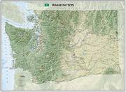
Washington Wall Map. National Geographic Maps.
Washington's diverse terrain and vegetation is rendered accurately through the map's color palate, shaded relief, and ocean bathymetry. Inherent to National Geographic reference cartography, the state wall maps contain thousands of place names and precise locations of: cities, major roadways and railways, airports, federal and state protected lands, mountain ranges and prominent peaks, marine sanctuaries, military installations, major lakes, rivers and reservoirs, and other geographic features. Map size is 41 x 31 inches.
Thumbnail of the Washington wall map. Sample detail of the Washington wall map.
$19.99
62-9949
Each, rolled
$29.99
62-9949L
Laminated
Washington Topographic Wall Map. 1:500,000. 1982. USGS. Map size is 132 x 94 cm.
Washington Bouguer Gravity Map. 1:500,000. 1974. WSDNR (GM-11). Printed in black and white on transparent paper, the map measures 146 x 107 cm.
$6.5
62-9912
1 sheet, folded
Earthquakes in Washington and Oregon: 1872-1993. USGS, 1994. The map (45.5 x 36.5") displays earthquakes that have occurred in or near Washington and Oregon during 1872 to 1993. The epicenter symbol sizes are scaled into three magnitude categories: magnitudes 1.5-3.4, magnitudes 3.5-5.4, an magnitudes of 5.5 and greater. The epicenter symbols are color-coded to indicate the time period when the earthquake occurred (1872-1969 or 1970-1993). The symbols are also color coded to indicate the plage (North American or Juan de Fuca) in which the earthquake occurred. Base map from Raven Maps.
$12
62-9916
Each, rolled
Washington Geothermal Resources Map. 1:500,000. 1981. NOAA/WSDNR (GM-25). Illustrates the known and potential geothermal fields, areas, and hot springs. Map size is 130 x 110 cm.


 Sample detail from the Washington recreation atlas.

 Detail of the Washington Road Map
 Sample detail from the Washington recreation map.
 Recommended
 Oregon / Washington road map. Kappa.
 Laminated
 Laminated
 Waterproof
 Sample detail of the Washington Guide map
 Front of the Washington Guide map
 Reverse of the Washington Guide map
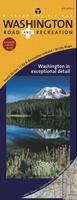 Laminated
 Pocket-sized
 Pocket-sized
 Sample detail #1 of the Seattle PopUp map
 Sample detail #2 of the Seattle PopUp map
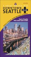
 Pocket-sized
 Sample detail #1 of the Seattle Street map
 Sample detail #2 of the Seattle Street map
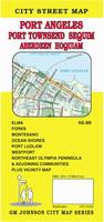
 Thumbnail of the Rand McNally Bellingham map
 Sample detail of the Pittmon Vancouver city map detail
 Sample detail of the Pittmon Lewis county map detail
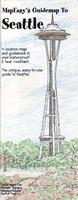 Waterproof
 Sample detail #1 of the Seattle MapEasy map
 Sample detail #2 of the Seattle MapEasy map
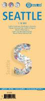 Laminated
 Sample detail of the Seattle Streetsmart map
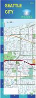 Waterproof
 Sample detail from the Seattle wall map.

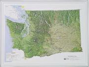 Washington Raised Relief Maps.

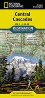
 Thumbnail image of the front of the Central Cascades map.
 Thumbnail image of the reverse of the Central Cascades map.
 Sample detail of the Central Cascades map.
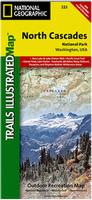 Waterproof
 Sample detail of the North Cascades map.
 Front of the North Cascades map.
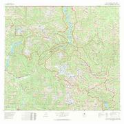
 Sample detail of the North Cascades map.
 Image of the North Cascades map.
 Image of the Columbia River Gorge map.
 Sample detail of the Columbia River Gorge map.
 Sample detail from the Mt. Baker map.
 Index map showing coverage of the National Geographic hiking maps
 Sample detail from the Mount Baker map.
 Waterproof
 Waterproof!
 Sample of the map detail from the Mt. Rainier map.
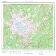
 Sample detail from the Mt. Rainier N.P. wall map.
 Image of the Mt. Rainier N.P. wall map.
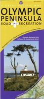
 Sample detail from the Olympic Peninsula recreation map.
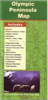 Olympic Peninsula Road Map. The Map Company.
 Waterproof
Olympic National Park Hiking Map. 1:100,000. National Geographic Maps.
Waterproof
Olympic National Park Hiking Map. 1:100,000. National Geographic Maps.
 Sample detail from the Olympic N.P. hiking map.
 Front of the Olympic N.P. hiking map.
 Reverse of the Olympic N.P. hiking map.
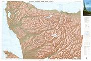 Olympic National Park Wall Map. 1:125,000. USGS.
 Sample detail from the Olympic N.P. hiking map.
 Image of the Olympic N.P. hiking map.
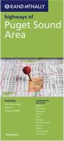
 San Juan Islands Recreation Road Map. Great Pacific Recreation Maps.
 Sample detail from the San Juan Islands road map.
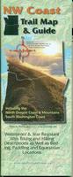 Waterproof!
 Sample detail from the Northwest Coast Trail Map.
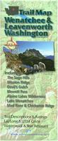 Waterproof!
 Sample detail from the Salt Lake City Trail Map.
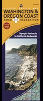
 Sample detail from the Washington and Oregon Coast road map.
 Front of the Washington and Oregon Coast road map.
 Reverse side of the Washington and Oregon Coast road map.
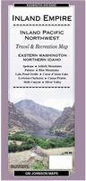
 Cast in pewter!
 Larger image of the Mt. Olympus paperweight.
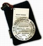 Cast in pewter!
 Larger image of the Mt. Rainier paperweight.
 Larger image of the Mt. Rainier lapel pin and magnet.
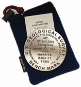 Cast in pewter!
 Larger image of the Mt. St. Helens paperweight.
 Larger image of the Mt. St. Helens lapel pin.
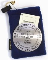 Cast in pewter!


 Cast in pewter!


 Thumbnail of the Washington wall map.
 Sample detail of the Washington wall map.
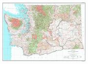
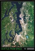
 Thumbnail image of the Seattle From Space poster
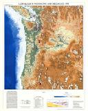

 Washington Flags