Contact information. Includes contact e-mails, telephone and fax numbers, and mailing address.
Kappa Map Group Maps and Atlases.
New editions City Street Atlases. Kappa Map Group.
These atlases feature airports, block numbers, colleges and universities, golf courses, hospitals, marinas, parks and rec areas, places of interest, schools, and ZIP codes.
$14.99
62-7292HO
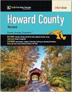
(MD) Howard County Street Atlas. ADC.
$21.99
62-7292PR
(MD) Prince George's County Street Atlas. ADC.
$19.99
62-7292AN
(MD) Anne Arundel County Street Atlas. ADC.
$21.99
62-90921BU
(PA) Bucks County Street Atlas. ADC.
New editions City Street Maps. Kappa Map Group.
These maps feature airports, block numbers, colleges and universities, golf courses, hospitals, marinas, parks and rec areas, places of interest, schools, and ZIP codes.
$7.99
62-9592AUS
(TX) Austin street map. Mapsco.
$7.99
62-9592H
(TX) Houston street map. Mapsco.
New editions State Road Maps. Kappa Map Group.
$7.99
62-94905E
Tennessee East road map.
US Forest Service Maps
New editions National Forest Hiking Maps. U.S. Forest Service, 2016-2018.
USFS maps are famous for showing the numerous Forest Service back-country roads. The maps provide forest-wide information on attractions, facilities, services, and opportunities. While many of the 1:126,720 scale maps have contour lines, others at this scale lack contours.
$19.99
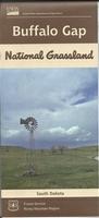
62-93802
(SD) Buffalo Gap National Grasslands Map. 1:126,720. 2018.
$19.99
62-86782
(ND) Dakota Prairie / Sheyenne National Grasslands Map. 1:126,720. 2016.
$19.99
62-56774
(CA) Stanislaus National Forest Map. 1:126,720. 2017.
New editions State Atlas & Gazetteers by DeLorme. The atlases feature detailed topographic maps for the entire state in handy atlas form. Each atlas features the most up-to-date road information for the state, from interstate highways to dirt logging roads. The maps also show an abundance of geographic features and landmarks, information on places to go and things to do, all cross-referenced to the map.
$29.95
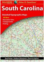
62-9248
South Carolina Atlas and Gazetter.
$29.95
62-9348
South Dakota Atlas and Gazetter.
$29.95
63-0148
Wisconsin Atlas and Gazetter.
$24.95
63-0248
Wyoming Atlas and Gazetter.
Alaska Road Atlas
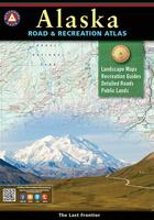
New title! Alaska Road and Recreation Atlas. Benchmark Maps, 2016.
Alaska truly is the Last Frontier. This atlas displays this rugged scenery and recreation potential with superb precision. The Landscape Maps reveal landforms with amazing realism and detail, clearly showing how the states vast network of roads, waterways, and recreation landmarks fit into the landscape. A complete Recreation Guide lists a myriad of outdoor activities. Arranged by category and boasting unequalled insight and detail, it is the ideal planning tool from a simple scouting trip to an extended exploration.
Sample detail from the Alaska road atlas.
Boone and Blowing Rock street map. 1:32,000. Also covers Watauga County.
$6.95
62-8592GXE
Greenville street map. 1:32,000. Also covers Pitt County.
$6.95
62-8592HF
Hendersonville street map. 1:36,000. Also covers Henderson County.
$6.95
62-8592GU
Greensboro North and East suburbs street map. 1:36,000. Covers northern and eastern Guilford County.
$6.95
62-8592CA
Raleigh South and West Suburbs - Cary and Apex street map. 1:36,000.
$6.95
62-8592RALE
Raleigh North and East Suburbs - Wake Forest and north and east Wake County street map. 1:36,000.
$6.95
62-8592SOU
Southern Pines and Pinehurst street map. Also covers Moore County.
Oklahoma Road Map
New title! Oklahoma Recreation Road Map. 1:633,6000. Benchmark Maps, 2017.
One side provides a full state map that features Public & Tribal Lands, land cover (forest, grassland, cropland, & wetland), extensive highway networks, point-to-point mileages, recreation sites, Roadside America attractions, campgrounds, parks & wildlife areas, boating & fishing access points, and public hunting areas. The reverse side features categorized recreation listings with helpful descriptions, current contact information, and map grid references.
Thumbnail image of the front of the Oklahoma road map. Thumbnail image of the reverse of the Oklahoma road map.
$7.95
62-88904
1 sheet, folded.
Pennsylvania City Maps
New title York and Gettysburg Street Map. 1:32,000. GM Johnson, 2018.
Includes coverage of Adams County, York County, Abbottstown, Arendtsville, Bendersville, Biglerville, Carroll Valley, East Berlin, Fairfield, Gettysburg, Littlestown, Mcsherrystown, New Oxford, York, Cross Roads, Dallastown, Dillsburg, Dover, Glen Rock, Goldsboro, Hallam, Hanover, Jacobus, Lewisberry, Loganville, Manchester, Mount Wolf, New Freedom, New Salem, North York, Railroad, Red Lion, Seven Valleys, Shrewsbury, Spring Grove, Stewartstown, West York, Windsor, Wrightsville, Yoe, York Haven, and Yorkana.
Sample detail from the Brunswick street map.
$6.95
62-9092YOR
1 sheet, folded.
South Carolina City Maps
New titles South Carolina Street Maps. 1:36,000. GM Johnson, 2018.
$6.95
62-9292CL
Clemson and Easley street map. 1:36,000. Also covers Pickens County.
$6.95
62-9292HI
Hilton Head and Beaufort street map. 1:36,000. Also covers Beaufort County.
Belgium, Northern France, and Luxembourg Cycling Maps
New titles Belgium, Northern France, and Luxembourg Cycling Maps for "Green Routes - Voies Vertes". 1:75,000. Alta Via, Belgium.
Alta Via's topographical cycling maps emphasize car-free cycling routesso-called Voies Vertes(Green Routes), a cycling network that runs through Belgium, Luxembourg and the North of France.
All LF and Ravel cycle routes are included, supplemented with old railways and towpaths that have been transformed into bike paths.
The map also lists all youth hostels, bivouac areas, trekking huts, etc.
New editions Belgium Street Maps. 1:10,000 - 1:15,000. Michelin, 2018.
Detailed street maps of Bruges and Liege. city maps include an extensive street index, car parks and one-way streets, public transportation, hospitals and service stations, entertainment, shopping and points of interest.
$9.99
64-1992BRUG
Bruges street map. 1:10,000. Michelin #69.
$9.99
64-1992LIE
Liege street map. 1:15,000. Michelin #99
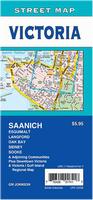
Canada City Maps
New title Victoria Street Map. 1:25,000. GM Johnson.
Detailed street map of Victoria, on Vancouver Island. Includes suburbs such as Saanich plus a small inset map of downtown Victoria and one of the Gulf islands.
Sample detail from the Victoria street map.
$5.95
64-2892VIC
1 sheet, folded.
Kompass Hiking Maps
Hiking maps of Europe by Kompass. Various scales. Kompass Verlag.
Detailed hiking/cycling/topographic maps of popular outdoor recreation areas in the Dolomites and northern Italy. Multilingual legends including English. Some maps have small booklets that are not in English.
Sample detail from the Bolzano cycling and hiking map.
$29.99
66-2273-X672
Dolomites Hiking Map. 1:35,000. Kompass #672. Multi-sheet set that covers a larger area than most Kompass maps.
$29.99
66-2273-2440
Heart of Tuscany Hiking and Cycling Map. 1:50,000. Kompass #2440. Multi-sheet set that covers a larger area than most Kompass maps.
$15.99
66-2273-2450
Cinque Terre Hiking Map. 1:35,000. Kompass #2450. Riviera Levante is one of the most famous hiking areas in Italy. From the coast, the mountains rise to 800m; Old paths lead through chestnut forests and rural agricultural land, mostly with a fantastic view of the sea.
$15.99
66-2273-2458
Firenze, Siena, and Chianti Hiking Map. 1:50,000. Kompass #2458. Between Florence and Siena the typical Tuscany spreads - with the picturesque hills, vineyards, holm oaks and the cypress and olive groves.
$15.99
66-2273-2463
Lake Trasimeno, Area Protetta Val d'Orcia, Montepulciano, and Montalcino Hiking and Cycling Map. 1:50,000. Kompass #2463. The unspoiled nature around Italy's fourth largest lake, Lake Trasimeno, is best explored on foot or by bike. Located in the middle of the idyllic hilly landscape, the lake is also called the "Sea of ??Umbria.
$15.99
66-2273-2464
Perugia - Assisi - Città di Castello - Gubbio Hiking and Cycling Map. 1:50,000. Kompass #2464.
$15.99
66-2273-2470
Maremma - Grosseto - Monte Argentario - Isola del Giglio Hiking and Cycling Map. 1:50,000. Kompass #2470.
$15.99
66-2273-2474
Monti Sibillini nel Parco Nazionale Hiking and Cycling Map. 1:50,000. Kompass #2474.
$15.99
66-2273-2476
Parco Nazionale del Gran Sasso e Monti della Laga Hiking and Cycling Map. 1:50,000. Kompass #2476.
$16.99
66-2273-2558
E5 Long Distance Hiking Trail From Lake Constance to Verona Hiking Map. 1:50,000. Kompass #2558. The entire E5 long-distance hiking trail from the Atlantic coast of Brittany to Verona is 3200 km long. This map covers the 600 km route from Lake Constance via the Alps to Verona, passing through Germany, Austria, Switzerland and Italy.
$14.99
66-2273-3414
Bolzano and Merano Cycling Map. 1:70,000. Kompass #3414.
Norway Road Map
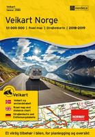
New edition Norway Road Map. 1:1,000,000. Nordeca, 2018.
Detailed road map of Norway. The map shows services including gas stations, ferry crossings, natural and cultural attractions, national tourist routes, an index of names of cities and a table of distances. Legend in English, Norwegian and German.
$27.99
65-11905
1 sheet, folded.
Spain City Maps
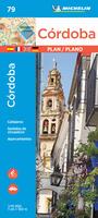
New edition Cordoba Street Map. 1:10,000. Michelin, 2018.
Detailed street map of Cordoba, Michelin #79. The map information includes transport, directions of circulation, location of monuments, etc. With multilingual legend, including English. With street index.
$9.99
65-3295COR
1 sheet, folded.
Visiting North Carolina? Like to visit Omni? Please click here for a Mapquest map to our offices. If you are passing through central North Carolina, we would be pleased to have you visit our store and warehouse. We are located about 30 minutes east of Greensboro, 60 minutes west of Raleigh, and 2 hours northeast of Charlotte. We are open Monday-Friday 8am - 5:30pm and weekends by prior arrangement.
Contact information: For information on a map or other product: [email protected] To place an order or check on an order: [email protected] For questions on an invoice: [email protected] Phone: (1) 336-227-8300
Fax: (1) 336-227-3748
 New editions

 New editions
 New editions
 New editions
 New editions
 New title!
 Sample detail from the Alaska road atlas.
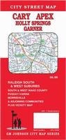 New titles
 Sample detail from the Cary street map.
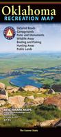 New title!
 Thumbnail image of the front of the Oklahoma road map.
 Thumbnail image of the reverse of the Oklahoma road map.
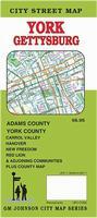 New title
 Sample detail from the Brunswick street map.
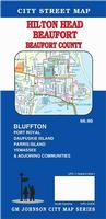 New titles
 New titles!
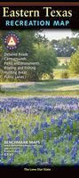
 Sample detail from the Eastern Texas road map.
 Front of the Eastern Texas road map.
 Reverse of the Eastern Texas road map.
 Front of the Western Texas road map.
 Sample detail from the Western Texas road map.
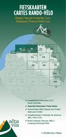 New titles
 Sketch map showing area covered by each sheet
 Sample detail from the Calais cycling map.
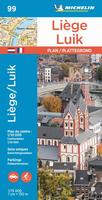 New editions
 New title
 Sample detail from the Victoria street map.
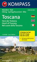
 Sample detail from the Bolzano cycling and hiking map.


 New edition
 New edition