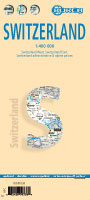
shows the physical reality of this mountainous country to good advantage without obscuring the places of interest to visitors. The road/rail infrastructure within the country is well shown with perhaps more villages being included than would normally be the case. The road network in surrounding countries has been simplified to focus attention on Switzerland itself. Touristic points, such as castles, fortresses, ski areas, and museums have been included, but we removed a lot of data, such as gas stations, schools, post offices, most churches and police stations in an effort to avoiding cluttering the map with an over-load of information.
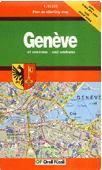
The Geneva side of the map goes from the airport in the north to south of the Old Town and from the Lancy area in the west to the UN complex in the east, showing an improved range of major buildings and businesses as well as hotels, restaurants, pedestrian walkways, churches, tram and train lines and stations, and of course, the famous Jet D'Eaux.
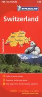
Switzerland Travel Map. 1:400,000. Michelin #729. Touring map of Switzerland with bold relief shading. Road information indicates motorway junction numbers, dual carriageways, difficult or dangerous roads, gradient markings for steep roads, high-altitude passes, seasonal traffic restrictions, etc. Intermediate driving distances are marked, also toll sections, railways & funiculars. Tourist information includes scenic roads, viewpoints, recreational facilities, etc. Latitude and longitude lines are drawn at 20' intervals.
$12.95
65-39908
1 sheet, folded
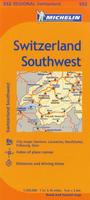
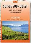
Switzerland Regional Road Maps. 1:200,000. Michelin. These three regional maps give superb detail of Switzerland. Special Michelin reads-like-a-book format for easy use in folding and unfolding. Useful information for planning trips, including gas stations, 24-hour service stations, toll gates, rest areas and service plazas. Clear, precise cartography. Icons pinpoint important travel information.
$11.95
65-39908-551
Northern Switzerland. #551.
$11.95
65-39908-552
Southwest Switzerland. #552.
$11.95
65-39908-553
Southeast Switzerland. #553.
Laminated Switzerland Laminated Travel Map. 1:400,000. Borch. This soft-laminated folded map of Switzerland shows Switzerland West at 1:400,000; Switzerland East 1:400,000; Switzerland administrative regions with its alpine passes; and Europe time zones. Borch Maps are easy to fold, durable and water-repellent with a wipeable surface. Borch Maps show hotels, museums, monuments, markets, public transport, top sights and points of interest, useful statistics, conversion charts for temperatures, weights and measurements, climate charts showing temperatures, sunshine hours, precipitation and humidity, overview maps, time zones, and much more...
$10.95
65-39906
1 sheet, folded.
Switzerland City Maps
Switzerland City Maps. Photoglob/Orell Füssli. Photoglob/Orel Füssli publishes an excellent line of Swiss city maps. Multilingual legend.
Sample from the Basel map
shows the physical reality of this mountainous country to good advantage without obscuring the places of interest to visitors. The road/rail infrastructure within the country is well shown with perhaps more villages being included than would normally be the case. The road network in surrounding countries has been simplified to focus attention on Switzerland itself. Touristic points, such as castles, fortresses, ski areas, and museums have been included, but we removed a lot of data, such as gas stations, schools, post offices, most churches and police stations in an effort to avoiding cluttering the map with an over-load of information.
The Geneva side of the map goes from the airport in the north to south of the Old Town and from the Lancy area in the west to the UN complex in the east, showing an improved range of major buildings and businesses as well as hotels, restaurants, pedestrian walkways, churches, tram and train lines and stations, and of course, the famous Jet D'Eaux.
Cold War Soviet Military Map! Geneva City Topographic Map. 1:10,000. Soviet government, 1974. This map is a regular topographic map that includes contour lines, power lines, rail/trolley lines, etc. An interesting Cold War map to own. In Russian.
$20.00
65-3994GE
1 sheet, flat.
Switzerland Recreation, Topographic, and General Maps
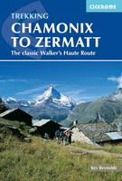
We stock the excellent English-language Cicerone hiking guides to Switzerland. We also stock the hiking and topo maps that each book's author recommends.
Trains are an excellent way to travel in Switzerland - yes they do run on time. We stock an excellent public transport map and a superb rail atlas of Switzerland.
Switzerland Thematic, General, and Cultural Maps
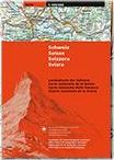
Switzerland National Map (Carte Nationale de la Suisse). 1:200,000. Federal Office of Topography SwissTopo. The most accurate and clearly legible general map of Switzerland for motorcyclists and motorists, rail travelers and adventurers. Complete rail network, all freeways and highways, all major and connecting roads.
Good representations of settled areas and terrain. Names of important objects. Entire Switzerland and adjoining foreign territory on 4 sheets, available as a set of 4 sheets, in French/German/Italian.
Index map showing sheet coverage.
$59.99
65-3946
4 sheets, folded
Switzerland Bureau and Organization Map (Büro- und Organisationskarte Schweiz). 1:301,000. Kümmerly + Frey. No date. A political map of Switzerland showing the cantons and districts and their capitals. The cities are also coded to show population. Roads, highways, distances, railroads and cog railroads are also shown. A separate booklet lists all villages, towns, and cities in Switzerland with their zip code and map-location code. The map legend is in German, French, Italian and English, while the booklet is in German, French and Italian only. Folded in a plastic slipcover.
$19.95
65-39473
1 set, folded.
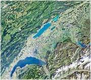
Satellite Map of Switzerland. 1:300,000. Bundesamt für Landestopographie. An attractive map suitable for framing. This image was compiled from Landsat 5 images obtained during the period of 1990-1994.
$35.95
65-3982
1 sheet, rolled
Switzerland Castles Map (Burgenkarten). 1:200,000. Bundesamt für Landestopografie. This is a four-sheet topographic map of Switzerland with many large-scale city maps. The map shows 100+ castles with locations and descriptions. In German/French.
$74.95
65-3962
4 sheets, folded
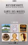
Switzerland Map of Museums. 1:300,000. Bundesamt für Landestopografie. This is a single-sheet map showing the locations of numerous museums. The map comes with a 55-page text giving locations and hours of operations. A separate 478-page guide book gives detailed information about each musuem. In German/French.
$29.95
65-3963
Set, with guidebook
$17.95
65-39631
Set, without guidebook
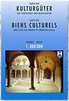
Switzerland Cultural Sites. 1:300,000. Bundesamt für Landestopografie. 1995. Several large-scale maps cover the most popular spots, and each site is described in the 74-page text. In French/German.


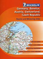
 Sample map detail from the Germany road atlas
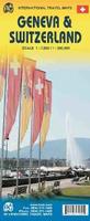
 Sample detail of the Switzerland road map side of the map
 Sample detail of the Geneva city map side of the map
 Thumbnail of the Switzerland road map side of the map
 Thumbnail of the Geneva city map side of the map
 Laminated

 Switzerland City Maps. Photoglob/Orell Füssli. Photoglob/Orel Füssli publishes an excellent line of Swiss city maps. Multilingual legend.
 Sample from the Basel map
 Index map showing sheet coverage.