The Haute Route covering from Chamonix to Zermatt, from Mont Blanc to the Matterhorn, is one of the most popular routes in all of the world. The guide below is considered the best English-language guide to the route. Also listed below are the hiking maps that the author refers to in the guide.
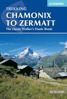
Chamonix to Zermatt: 'The Walkers Haute Route'. Cicerone, by Kev Reynolds.
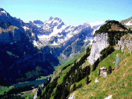
Chamonix to Zermatt, Mont Blanc to the Matterhorn- in two weeks of mountain travel you will see the greatest collection of 4000 metre peaks in the Alps and visit some of the most spectacular valleys. You will discover delightful villages and remote hamlets, wander flower meadows and forests, skirt exquisite tarns that turn mountains on their heads, and clamber beside glaciers. The way intrudes on lonely stone-filled corries, with marmots along the boulders and ibex on the heights, and provides a surprise around every corner. The route is more than 180 kilometres long. It crosses 11 passes, gains more than 12,000 metres in height and is a strong contender for the title of Most Beautiful Walk in Europe.
This edition includes the exciting two-day Europaweg - a true high-level path that carries the Haute Route way above the Mattertal and into Zermatt - a worthy conclusion to a great trek. 188 pages, laminated cover. Several maps are recommended to accompany this guide, these are listed below. The first set are the 5 hiking/topo maps produced by the Swiss map agency. These five maps have the hiking trails marked in red and include the Europaweg. The second set are the two oversized combination sheets #5003 and 5006 that cover the entire route. However, these two maps do not have the trails highlighted in red - they are marked in thin black line, and they do not include the Europaweg trail. The author notes that the 1:25,000 maps are not needed due to the quality of the 1:50,000 maps and the superb way-marking on the trail itself.
Index showing the lower walker's route, but not the new Europaweg high route
$24.95
64-56981CH
Guide
Recommended Maps:
$29.99
65-39530273T
Montana.
$29.99
65-39530274T
Visp.
$29.99
65-39530282T
Martigny.
$29.99
65-39530283T
Arolla.
$29.99
65-39530284T
Mischabel.
or 1:50,000 Special combination sheets:
$39.99
65-395305027T
Grand St-Bernard - Combins - Arolla hiking map. Sheet 5027T.
$39.99
65-395305028T
Monte Rosa - Matterhorn hiking map. Sheet 5028T.
Haute Route Ski Maps. In recent years we have been surprised at the number of requests for the 1:50,000 ski-touring topographic maps covering the Haute Route. Below are the five ski-touring maps that cover the same route.
$29.99
65-39532-273
Montana.
$29.99
65-39532-274
Visp.
$29.99
65-39532-282
Martigny.
$29.99
65-39532-283
Arolla.
$29.99
65-39532-284
Mischabel.
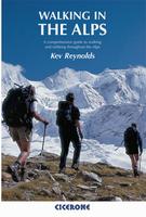
Walking in the Alps. Cicerone, by Kev Reynolds. Walking is unquestionably the best method of exploring, and it is the mountain walker for whom journeys in the Alps reveal some of the finest views, the greatest contrasts. This book is a definitive guide to the many thousands of possible routes, with a geographical span that ranges from the Maritime Alps of southern France to the Julians of Slovenia, from Italy's Gran Paradiso to the little-known Turnitzer Alps of eastern Austria, and from the ice-bound giants of the Bernese Oberland to the green rolling Kitzbuheler Alps and the bizarre towers of the Dolomites of South Tirol, showing the amazing diversity of this wonderful mountain chain.
There are walks to suit every taste: gentle and undemanding, long and tough, and everything in between. A superb guide for helping you choose the hike of your choice and doing the basic planning. One of Cicerone's detailed guides is then recommended for use on the trail.
$39.95
66-22951WA
Guide
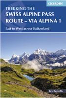
Swiss Alpine Pass Route - Via Alpina 1. Cicerone.
This guidebook presents the stunning Alpine Pass Route, a 360km (225 mile) long-distance trail that traverses Switzerland from east to west, from Sargans to Montreux on Lake Geneva (Lac Léman).
The main route is described in 18 daily stages of 12.5-29km (8¾-18 miles), with suggestions of ways in which public transport could be used to support a tighter itinerary than the 3 weeks recommended. Comprehensive route description is accompanied by 1:100,000 mapping and a wealth of advice for planning a successful trip, covering safety, transport, accommodation and language.
$27.95
65-39971AP
Guide
Recommended 1:50,000 Swiss Hiking/Topo Maps:
$29.99
65-39530237T
Walenstadt hiking map. Sheet 237T.
$29.99
65-39530238T
Montafon hiking map.
$29.99
65-39530245T
Stans hiking map. Sheet 245T.
$29.99
65-39530246T
Klausenpass hiking map. Sheet 246T.
$29.99
65-39530247T
Sardona hiking map. Sheet 247T.
$29.99
65-39530255T
Sustenpass hiking map. Sheet 255T.
$29.99
65-39530262T
Rochers de Naye hiking map. Sheet 262T.
$34.99
65-3952-5004
Berner Oberland hiking map. Sheet 5004.
$34.99
65-3952-5009
Gstaad - Adelboden hiking map. Sheet 5009.
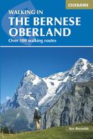
The Bernese Alps, Switzerland. Cicerone, by Kev Reynolds. Over 100 routes in the Bernese Alps are described in this third edition of Kev Reynolds' popular guide. It is an indispensable companion to a region that boasts famous peaks such as the Eiger, Monch and Jungfrau.
But there are lesser-known mountains too that are just as scenically dramatic, and in their shadow peaceful villages and seemingly forgotten hamlets are lodged in spectacular locations. Add to that the romantic valleys, lakes, flower-filled meadows and a network of mountain huts and rustic inns for those who want to experience the Alps of the Victorian pioneers, and you will understand why the Bernese Alps seduce the connoisseur back year after year.
All this, and more, is available to the mountain walker, and this indispensable guide will enable you to explore the very best of the Bernese mountain wonderland. The author recommends several maps to accompany this guide; these are listed below.
$27.95
65-39971BE
Guide
Recommended 1:50,000 Swiss Hiking/Topo Maps:
$29.99
65-39530253T
#253T. Gantrisch. 1:50,000. Bundesamt für Landestopografie.
$29.99
65-39530254T
#254T. Interlaken. 1:50,000. Bundesamt für Landestopografie.
$29.99
65-39530255T
#255T. Sustenpass. 1:50,000. Bundesamt für Landestopografie.
$29.99
65-39530262T
#262T. Rochers de Naye. 1:50,000. Bundesamt für Landestopografie.
$29.99
65-39530263T
#263T. Wildstrubel. 1:50,000. Bundesamt für Landestopografie.
$29.99
65-39530264T
#264T. Jungfrau. 1:50,000. Bundesamt für Landestopografie.
$29.99
65-39530265T
#265T. Nufenenpass. 1:50,000. Bundesamt für Landestopografie.
$29.99
65-3970-18
#18. Jungfrau Region - Oberhasli. 1:60,000. Kümmerly + Frey.
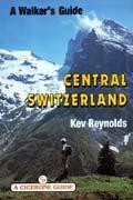
Central Switzerland - A Walking Guide. Cicerone, by Kev Reynolds. Few regions of the Alps contain greater contrasts than Central Switzerland. The shores of the riviera - like Lake of Lucerne and the ice-clad peaks of the Winterberg massif are a world apart, yet they have two things in common; both are spectacular scenery and have magnificent walking country nearby. This guidebook points the way to secluded corners of rarely-trodden glens as well as the better known valleys, along lakeside pathways and across lofty ridges with stunning views to dream on. Here indeed is a mountain region with vast potential for the walker and all who love fine scenery.
Lucerne, Brunnen, Altdorf, Andermatt and Engelberg ensure that there's no shortage of accommodation - of all standards. But there are also numerous other villages and remote alp hamlets, less known but no less lovely, that offer overnight lodgings in the peace of the mountains. Kev Reynolds describes the villages, valleys and mountains of Central Switzerland, and provides 90 of the region's best walking routes that will lead to some of the finest views in all the Alps.
This guidebook has been planned for use by walkers who may never have ambled through an alpine valley before, as well as the more experienced mountain trekker aiming for the high cols and rugged inner recesses of glacier hung peaks. There is something in the Alps for all to enjoy.
$22.99
65-39971CS
Guide
Recommended 1:50,000 Swiss Hiking/Topo Maps:
$29.99
65-39530235T
Rotkreuz.
$29.99
65-39530236T
Lachen.
$29.99
65-39530245T
Stans.
$29.99
65-39530246T
Klausenpass.
$29.99
65-39530255T
Sustenpass.
$29.99
65-39530256T
Disentis.
Chamonix to Zermatt: 'The Walkers Haute Route'. Cicerone, by Kev Reynolds. Chamonix to Zermatt, Mont Blanc to the Matterhorn- in two weeks of mountain travel you will see the greatest collection of 4000 metre peaks in the Alps and visit some of the most spectacular valleys. You will discover delightful villages and remote hamlets, wander flower meadows and forests, skirt exquisite tarns that turn mountains on their heads, and clamber beside glaciers. The way intrudes on lonely stone-filled corries, with marmots along the boulders and ibex on the heights, and provides a surprise around every corner. The route is more than 180 kilometres long. It crosses 11 passes, gains more than 12,000 metres in height and is a strong contender for the title of Most Beautiful Walk in Europe.
This new edition includes the exciting two-day Europaweg - a true high-level path that carries the Haute Route way above the Mattertal and into Zermatt - a worthy conclusion to a great trek. 188 pages, laminated cover. Several maps are recommended to accompany this guide, these are listed below. The first set are the 5 hiking/topo maps produced by the Swiss map agency. These five maps have the hiking trails marked in red and include the Europaweg. The second set are the two oversized combination sheets #5003 and 5006 that cover the entire route. However, these two maps do not have the trails highlighted in red - they are marked in thin black line, and they do not include the Europaweg trail. The author notes that the 1:25,000 maps are not needed due to the quality of the 1:50,000 maps and the superb way-marking on the trail itself.
Index showing the lower walker's route, but not the new Europaweg high route
$24.95
64-56981CH
Guide
Recommended 1:50,000 Swiss Hiking/Topo Maps:
$29.99
65-39530273T
Montana.
$29.99
65-39530274T
Visp.
$29.99
65-39530282T
Martigny.
$29.99
65-39530283T
Arolla.
$29.99
65-39530284T
Mischabel.
or 1:50,000 Special combination sheets:
$34.99
65-3952-5003
Mt. Blanc - Grand Combin. Sheet 5003.
$34.99
65-3952-5006
Matterhorn-Mischabel. Sheet 5006.
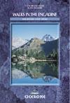
Walks in the Engadine, Switzerland. Cicerone, by Kev Reynolds. Tucked away in the south-east corner of Switzerland, the Engadine is a region of lakes and mountains, home of the country's only national park, guardian of the Romansch language and location for some of the most sublime villages in all the Alps.
In this long-awaited second of edition of his guide Walks in the Engadine, Kev Reynolds has selected more than 100 of his favourite routes that not only reveal breathtaking views, but take the walker into secretive inner glens and onto remote alp pastures bypassed by the 21st century. Graceful Piz Bernina, glacier-hung Piz Pal, the bold granite form of Piz Badile - these form part of the backdrop. But there are other peaks too that the modest walker can climb, and snow-free passes that link one enchanting valley to another.
$22.95
65-39971EN
Guide
Recommended 1:50,000 Swiss Hiking/Topo Maps:
$29.99
65-39530249T
Tarasp.
$29.99
65-39530258T
Bergün.
$29.99
65-39530259T
Ofenpass.
$29.99
65-39530268T
Julierpass.
$19.99
65-3952-269
Berninapass. Sheet 269.
$19.99
65-3952-278
Monte Disgrazia. Sheet 278.
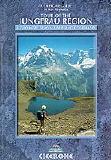
Tour of the Jungfrau Region - a Two-Week Trek in the Bernese Oberland. Cicerone, by Kev Reynolds. Making a horseshoe loop among some of the most spectacular mountain scenery in all the Swiss Alps, this brand new tour is destined to become one of the classic walks of Europe. In a journey of 9-10 days the walker visits pastures, ridges, summits &passes, skirts exquisite mountain lakes, and gazes on waterfalls, gorges and glaciers - all in the shadow of such iconic peaks as Wetterhorn, Eiger, Monch and Jungfrau. Accommodations are both plentiful & atmospheric, and the route has lots of bad-weather alternatives. Despite the nearby presence of popular resorts like Grindelwald, Wengen, Lauterbrunnen and Murren, the Tour of the Jungfrau Region explores some surprisingly remote landscapes, including part of a World Natural Heritage site
$19.95
65-39971JU
Guide
Recommended Swiss Hiking/Topo Maps:
$29.99
65-39530254T
#254T. Interlaken. 1:50,000. Bundesamt für Landestopografie.
$29.99
65-39530264T
#264T. Jungfrau. 1:50,000. Bundesamt für Landestopografie.
$29.99
65-3970-18
Jungfrau Region #18. 1:60,000. Kümmerly+Frey.
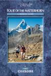
Tour of the Matterhorn guidebook. Cicerone Guides. The Tour of the Matterhorn is a superb alpine trek with a huge variety of scenery and culture. As the Matterhorn straddles the Swiss-Italian frontier, the trek visits both countries, each with its own unique traditions, way of life and scenery. The tour goes over high passes reached by delightful footpaths and through charming alpine villages where life has hardly changed for centuries, providing a precious insight into local life. Not only is the Matterhorn seen from all sides, but there are also superb vantage points for views of many of the other high summits of the region.
The Tour of the Matterhorn is regarded as a relatively 'new' tour as it has been documented only in the last few years. The paths it uses, though, are generally anything but new - these are often ancient ways over passes leading from one valley to another. The tour includes two glacier crossings and usually takes about eight to ten days to complete. This guide includes suggestions for shorter variants as well as information for the ascent of peaks along the way. Paperback with waterproof cover, 17.2 x 11.6 cm. The author recommends two overview maps and/or six detailed maps to accompany the guidebook; these are listed above. In the guidebook each section of the trail is referenced to the maps listed below.
Map showing the entire route Elevation profile for the entire hike
$19.95
65-39971MA
Guide.
Maps #1: 1:50,000 overview maps.
$34.99
65-3952-5006
Matterhorn-Mischabel. Sheet 5006. Switz. Bundes. für Topo.
La Valpelline, Valle di Ollomont. 1:30,000. IGC sheet 115.
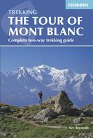
Tour of Mont Blanc. Cicerone, by Kev Reynolds. The Tour of Mont Blanc is one of the best - if not the best - of the world's classic walks. It circumnavigates the Mont Blanc massif in about eleven days. The walk has all the excitement of the high mountains yet none of the worry of altitude sickness. It crosses numerous cols with stunning views of spectacular snow and rock peaks. Accommodation along the route is plentiful.
The 'official' Tour du Mont Blanc follows an established route around the main block of mountains containing not only Mont Blanc but its principal allied summits such as Verte, Chardonnet, Gouter, Géant, Jorasses, d'Argentière, Dolent and numerous others. The author describes the tour both in the traditional 'anti-clockwise' direction and the 'clockwise' direction. There are several alternative routes that subsequently link, and these are also described.
The routes, along with suggestions for alternative exploration, have been created on what the author thinks gives the very best perspective and appreciation of the whole region and provides the best balance of visual return for the physical effort required. At every opportunity recommendations are made that will bring the walker into closer contact with the area and enhance memories of the visit.
This guide is in full colour, and has a good section on points of interest, accommodation details and natural history of the region. The second edition (2007) includes new routes around Courmayeur and Arnuva and to Lac Blanc.
Tour of Mont Blanc overview route map. Elevation profile for the entire route. Sample of one day's hike route map from the guide.
$24.95
64-56981MB
Guide
Maps:
$18.99
64-5662-A1
Mont Blanc 1:50,000 topo. (Rando Taride #A1).
or
$19.99
64-5648-3531ET
Massif du Mont Blanc 1:25,000 topo map. France IGN.
$19.99
64-5648-3630OT
Chamonix 1:25,000 topo map. France IGN.
The Tour of Mont Rosa. By C.J. Wright. The Tour of Monte Rosa is a challenging and very varied adventure, taking a high route around the massif, which has ten summits over 4000m. Italy and Switzerland meet here, and the contrast between these two countries, their different culture, food and languages, give this trek its originality.
Guides:
$26.95
65-39971MR1
Guide.
Maps: Group 1.
$29.99
65-39530273T
Swiss 1:50,000 hiking/topo #273T - Montana.
$29.99
65-39530274T
Swiss 1:50,000 hiking/topo #274T - Visp.
$29.99
65-39530282T
Swiss 1:50,000 hiking/topo #282T - Martigny.
$29.99
65-39530283T
Swiss 1:50,000 hiking/topo #283T - Arolla.
$29.99
65-39530284T
Swiss 1:50,000 hiking/topo #284T - Mischabel.
$19.99
65-3952-293
Valpelline. Sheet 293.
$19.99
65-3952-294
Gressoney. Sheet 294.
$34.99
65-3952-5006
Matterhorn-Mischabel. Sheet 5006.
Maps: Group 2.
$16.99
64-82741-05
Cervino - Matterhorn e Monte Rosa. Ayas, Aosta, Vreuil Cervinia, Brussion, Challand, Champoluc, Chatillon, Gressoney, Valpelline, Valtournenche, Zermatt.
$15.99
64-82741-10
Monte Rosa, Alagna e Macugnaga. Bannio, Domodossola, Fobello, Lago d'Orta, Omegna, Saas Fee, Valle Antrona, Valstrona, Varallo Sesia, Villadossola, Zermatt.
Maps: Group 3.
$13.99
66-2273-XX87
Breuil/Cervinia - Zermatt map. 1:50,000.
$13.99
66-2273-XX88
Monte Rosa map. 1:50,000.
Walking in Ticino, Switzerland. By Kev Reynolds. Cicerone Press. Walks in the lovely Italian part of Switzerland. The Ticino is best-known for Lugano and Locarno, but the region offers wonderful hiking along hidden trails.
The author recommends five maps to accompany the guide; these are listed below.
$22.99
65-39971TI
Guide
Recommended 1:50,000 Swiss Hiking/Topo Maps:
$34.99
65-3952-5007
Locarno - Lugano. 1:50,000 topo map #5007.
$29.99
65-39530265T
Nufenenpass. Sheet 265T.
$29.99
65-39530266T
Valle Leventina. Sheet 266T.
$29.99
65-39530275T
Vallee Antigorio. Sheet 275T.
$29.99
65-39530276T
Val Verzasca. Sheet 276T.
The Valais, Switzerland - A Walking Guide. Cicerone, by Kev Reynolds. 120 routes throughout the Swiss Valais, one of Switzerland's finest mountain regions. Detailed coverage of Bettmeralp, Ltschental, Saastal, Mattertal, Turtmanntal, Val d'Annivers, Val d'Herens, Val de Nendaz, Val de Bagnes, Val d'Entremont, Val ferret, Vallee de Trient.
With full colour maps and 100 high quality photographs to illustrate the book. The Matterhorn, Monte Rosa, Zinarothorn, Ober Gabelhorn, Dent Blanche, Weisshorn, Bietschhorn, Grand Combin: these are some of the most dramatic mountains in Europe. Here they form a backdrop to a series of routes that should answer the dreams of any keen mountain walker.
Best-known, perhaps, for the resorts of Zermatt and Saas Fee, the Valais district of Switzerland is also the location of the Litschental and Turtmanntal, the Val d'Anniviers, Hèrens, Bagnes and Ferret valleys and valleys in which there are numerous alp hamlets nestling among the pastures. There are also dozens of small lakes, the longest glacier in the Alps, pristine snowfields, meadows full of flowers, marmots that will eat out of your hand, and no shortage of accommodation, ranging from low-cost dormitories and campsites to the grandest of hotels.
In this, the third edition of his popular guide, Kev Reynolds has selected and described 120 routes that represent the very best of this magical region. Rewritten and with a new design, fresh maps and colour photos throughout, Walking in the Valais is your passport to some memorable walking holidays in this Alpine wonderland. The author recommends several maps to accompany the guide - these are listed below.
$22.95
65-39971VB
Guide
1:50,000 Swiss Hiking/Topo Maps:
$29.99
65-39530264T
Jungfrau.
$29.99
65-39530272T
St. Maurice.
$29.99
65-39530273T
Montana.
$29.99
65-39530283T
Arolla.
$34.99
65-3952-5003
Mt. Blanc - Grand Combin. Sheet 5003.
$34.99
65-3952-5006
Matterhorn-Mischabel. Sheet 5006.
$34.99
65-3952-5009
Gstaad - Adelboden. Sheet 5009.
Trekking the Vosges & Jura. Cicerone Press.
Guidebook to a 687km (427 mile) trek through eastern France, traversing the Vosges and the Haut-Jura plateau. The route follows the GR53 from Wissembourg to Schirmeck, before picking up the central section of the GR5 from Schirmeck to Nyon on Lake Geneva, taking in wooded and grassy hills, river gorges and fascinating castle ruins.
 Index showing the lower walker's route, but not the new Europaweg high route


 Map showing the entire route
 Elevation profile for the entire hike


 Tour of Mont Blanc overview route map.
 Elevation profile for the entire route.
 Sample of one day's hike route map from the guide.