Waterproof! Poland Travel Map. 1:850,000. Reise Know-How. A double-sided map with northern Poland on one side and southern Poland on the reverse. The map has clear road and good tourist detail with relief indicated by contours, elevation tinting and peak heights, and a latitude/longitude grid at 1° intervals. The road detail includes minor roads and selected tracks and also shows intermediate driving distances on main roads. Main railways, canals and airfields are indicated and a range of symbols depict many features such as places of interest, landmarks, viewpoints, antiquities, campsites, and nature reserves. Restricted areas, national parks and regional boundaries are also marked. Includes extensive index of place names. Longitude and latitude lines are drawn at 1 degree intervals. Printed on waterproof, tear-resistant synthetic paper.
$15.99
65-19910
1 sheet, folded.
Waterproof! Northern Poland Travel Map. 1:350,000. Reise Know-How. This detailed map covers Poland north of latitude 52° 40' North. The sheet is double sided; northeast Poland on one side and northwest Poland on the reverse. Elevation is shown by contours, altitude tinting and peak heights. Road detail includes minor roads and selected tracks and shows intermediate driving distances on main roads. Main railways, canals and airfields are indicated and symbols depict many features such as places of interest, landmarks, viewpoints, antiquities, campsites, and border crossings. Restricted areas, nature reserves and regional boundaries are also marked. The map includes an extensive index of place names. There is a 20' Latitude/longitude grid.
$15.99
65-19915
1 sheet, folded.
Poland Travel Map. 1:500,000. Freytag & Berndt. While the map has no relief information and the carography is simpler than other maps of Poland, the road detail is clear and the large scale allows for more smaller locations to be included.
Driving distances and steep road gradients are indicated, also main railways, funiculars, car ferries & airports. Also included are border crossing points, national parks, scenic routes, campsites and landmarks such as castles and ruins.
The index booklet includes postcodes. Multilingual legend includes English. Size is 84 x 124 cm.
$14.95
65-1990
1 sheet, folded
Poland Travel Map. 1:700,000. Michelin. Ideal for route planning, this map has a clearly defined road network on an uncluttered background, with intermediate driving distances marked. The larger cities are clearly marked and named. Railways, recreation sites and places of interest are marked and the map also shows scenic routes, railways, chairlifts and forests. Hilly areas are depicted by relief shading and national and provincial borders are also shown.
A larger scale inset map shows the approach roads and through-routes for Warsaw. Includes index and driving distance chart. Size is 154 x 100 cm.
$12.95
65-19902
1 sheet, folded
Holiday Map of Mierzeja Wislana (Mierzelja Wislana mapa turystyczna). 1:50,000. Maplan. 1994. An excellent road map of the peninsula between Gdansk, Poland and Kaliningrad, including the mainland region around Elblag. With inset maps of cities in the region and extensive text on the reverse. In Polish. ISBN 83-86223-02-2.
$9.95
65-1981
1 sheet, folded
Holiday Map of Polwysep Helski Peninsula. 1:50,000. Maplan. 1996. An excellent road map of the popular resort peninsula just north of Gdansk. The map contains city maps for the several towns along the peninsula. The reverse side has extensive tourist information, photographs, etc. Multilingual. ISBN 83-86223-08-1.
$9.95
65-19812
1 sheet, folded
Warmia and Mazury Tourist Map with Olsztyn city plan. 1:300,000 & 1:20,000. BAKS. 1992. A tourist map of the lakes region of northern Poland with a city street map of Olsztyn on the reverse. Multilingual.
$9.95
65-1993WB
1 sheet, folded
Chopin at Zelazowej Woli. 1:250,000. BAKS. 1990. This map highlights Chopin's travels around the Warsaw region. Multilingual, with text on the reverse.
$9.95
65-1993ZE
1 sheet, folded
Poland City Maps
Warsaw street map. 1:15,000. Freytag & Berndt.
Clear street mapping with an enlargement of the city center. On the reverse is an index of streets. Bus and tram lines are all marked as well as stations of the underground system. Multilingual legend, including English.
Sample detail from the Warsaw city map
$12.95
65-1992WAR
1 sheet, folded
Warsaw street map. 1:10,000. ITMB.
Map of Warsaw with an enlargement for the historic Old Town and a small inset map of the city with its outer districts. The map has clear, easy to read cartography with names in large print and easy to see symbols highlighting places of interest and facilities. Tram routes are shown with stops and line numbers. Metro stops and railway stations are prominently marked. One way streets are indicated.
Sample detail from the Warsaw city map
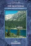
The High Tatras. By Colin Saunders & Renata Narozna. Cicerone Press. A detailed guide to the Tatras, a deservedly popular area between Poland and Slovakia. The guide covers not only the High Tatras, but also the limestone of the White Tatras and the slate of the Western Tatras. 248 pages. 1-85284-150-8.
$28.95
65-19951HT
Guide
Poland Geologic and Thematic Maps
Geological Map of Poland without Cainozoic Deposits (Mapa Geologiczna Poski bez utworów Kenozoiku). 1:1,000,000. Panstwowy Instytut Geologiczny, 2000. One sheet, folded. Bilingual.
$19.95
65-1900
1 sheet, folded.
Gravimetric Atlas of Poland (Atlas Grawimetryczny Polski). 1:750,000/1:500,000. Panstwowy Instytut Geologiczny. 1995. 2 maps w/text
$79.95
65-1912
.
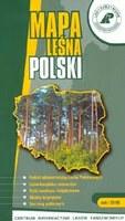
Forest Map of Poland (Mapa Lesna Polski). 1:750,000. Lasy Panstwowe & PPWK, Warszawa 2003. Detailed road map with forests, districts, reserves, with species illustrations. On the reverse are 4 thematic inset maps with extensive notes. Size is 108x88 cm. In Polish.
$9.95
65-19802
1 sheet, folded.
Potential Natural Vegetation of Poland (Potencjalna Roslinnosc Naturalna Polski). 1:300,000. Polska Akademia Nauk/Instytut Geografii i Przestrzennego Zagospodarowania, 1995. This twelve-sheet map offers detailed coverage of the natural vegetation of Poland, breaking the vegetation into 69 different vegetation zones/types. Bilingual.
$159.95
65-1937
12 sheets, rolled.
Biomass and Biofuels, Resources and Uses in Energetics Poland 2004 (Biomasa i Biopaliwa. Zasoby i Wykorzystanie w Energetyce Polska 2004). 1:1,200,000. Wydawnictwo Gea, 2004. This map shows the locations of biomass resources in Poland, showing both resources and use (factories, etc.). The uses are broken into solid biomass, biogas, and biofuels. The resources are broken into wood wastes, animal wastes, forests, arable land, landfills (biogas), sewage treatment plants, oil mills (rapeseed oil), etc. With photos and advertising in the margins. Size is 39 x 27". Trilingual English-Polish-German.
$33.95
65-1935
1 sheet rolled.
Map of Brown Coal Deposits and Prospect Areas. 1:500,000. Geological Institute, Poland. 1991. Four sheets with short text. In Polish with English summary.
$15.95
65-1942
Set, folded
Geological Map for Tourists - Gory Stolowe Mts. 1:50,000. Panstwowy Instytut Geologiczny & Cesky Geologicky Ustav, 1999. Gory Stolowe Mts. are situated on the Polish/Czech border. 1 sheet, folded. Trilingual.
$9.95
65-1971
1 sheet, folded.
Poland 1:50,000 Geologic Quadrangle Maps (Szczegolowa Mapa Geologiczna Polski sraw z objasnieniami). 1:50,000. Geological Institute, Poland. This series contains 121 sheets with 92 explanation booklets. Coverage is not complete, however additional maps are being added annually. A few new sheets are listed below. In Polish.
$18.00
65-1957CZ
Czarny Dunajec.
$18.00
65-1957LE
Lebork.
$18.00
65-1957NO
Nowy Targ.
$18.00
65-1957SS
Sroda Slaska.
$18.00
65-1957SZ
Szydlowiec.
$18.00
65-1957WI
Wierzbica.
Poland 1:200,000 Geologic Quadrangle Maps (Mapa Geologiczna Polski). 1:200,000. Geological Institute, Poland. Some new sheets are listed below. There are approximately 75 sheets available. In Polish.
$34.95
65-1958GN
Gniezno.
$34.95
65-1958GU
Gubin.
Lublin Region Geologic and Mineral Deposits Atlas. 1:500,000. 1983. Geological Institute, Poland. This atlas contains 44 sheets illustrating the geological structure and mineral deposits of eastern Poland. Trilingual.
$99.95
65-1970
44 sheets, folded
Geological Atlas of the Western Outer Carpathians. 1:500,000. 1989. Geological Institute, Poland. The atlas contains an 18-page text and several maps covering geology, tectonics, basement, geophysics, etc. In English.
$64.95
65-1972
Set, folded
Photogeological Map of Sudety Mountains (Mapa Fotogeologiczna Sudetow). 1:200,000. WG. 1986. Two sheets showing dislocations and satellite/radar lineaments. With 19-page text. Trilingual.


 Waterproof!


 Sample detail from the Warsaw city map
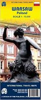
 Sample detail from the Warsaw city map
 Poland City Maps. Demart, PPWK.