Poland Regional Touring Maps. PPWK. 1990-current. These maps cover a variety of tourist areas not covered by the National Park maps above. Most are in Polish only with English legends; a few have multilingual descriptions on the reverse. The 1:50,000 and 1:100,000 maps are topographic maps with tourist information (hiking trails, tourist services and sites, etc.). The 1:200,000 scale maps are shaded relief maps with tourist sites and services and city inset maps.
65-1993BB
Baltic Coast. 1:200,000. 2004.
$9.95
65-1993BH
Bialowieza Forest. 1:75,000. 1991.
$9.95
65-1993KA
Kaczawa Mts. 1:60,000. 1992.
$9.95
65-1993KB
Karkonosze Mts. hiking/topo map. 1:50,000. 2004.
$9.95
65-1993KC
Karpate Mts. (Krakow & south). 1:200,000. 2004.
$9.95
65-1993KE
Kaszubska (Ziemia Kaszubska - west of Gdansk). 1:100,000. 2004.
$9.95
65-1993MB
Makow Mts. 1:50,000. 2004. Polish only.
$9.95
65-1993MC
Maly (Bielsko Biala and east). 1:50,000. 2004.
$9.95
65-1993PO
Podhale Spisz Orawa (Zakopane and north). 1:50,000. 2004.
$9.95
65-1993SB
Sadecki Mts. 1:50,000. 2004. Polish only.
$9.95
65-1993SL
Slaski (Bielsko-Biala and south). 1:50,000. 2004.
$9.95
65-1993SM
Small Beskid Mts. 1:75,000. 1993.
$9.95
65-1993SS
Stolowe Mts. 1:60,000. 1992.
$9.95
65-1993SU
Sudety (Wroclaw & SW; centered on Jelenia Gora & the Karkonosze). 1:200,000. 2004.
Wielkie Jeziora Mazurskie. (The lake region around Gizycko). 1:200,000. 2004.
$9.95
65-1993ZY
Zywiecki (NE of Zylina). 1:50,000. 2004.
$9.95
Poland Topographic Maps
Poland 1:25,000 Topographic Maps. 1:25,000. These are the official topographic maps of Poland, giving complete coverage in 2500 sheets. We can supply all maps currently in print; about 90% coverage is available. The remaining sheets will be supplied as they are printed. In Polish.
We no longer stock this series, but we are happy to special-order any sheets. There is about a 4-week delivery time with this series.
65-1950
1:25,000
$14.95
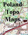
Poland 1:50,000 Topographic Maps. 1:50,000. These are the official topographic maps of Poland. This is a new series which is much improved from the old series. The best thing about this series is that it is on a latitude/longitude grid, rather than the old Polish grid system.
The New Series has a bilingual Polish/English legend, which includes locating such things as breweries, bakeries, hostels and hotels (what else do you need for travelling?),
along with all the standard topographic map information such as gov't offices (from city to national), railroads, etc. The maps are smaller, meaning about twice as many sheets are needed to cover the same area. The New Series
uses a new grid system (the soviet grid system with numbers such as "M-34-137-D") which means there is not a one-to-one correspondence between sheets of the old and new series. There are currently 133 sheets of 650 available, with more in the works. Standing orders are welcome and receive a discount.
We are happy to accept standing orders for the New Series - please contact us for a discounted price.
Click here. Sample from the Gliwice sheet. Sample from the Kampinoski Park sheet. Section of the legend. Sample of old series maps.
Poland 1:10,000 City Topographic Maps by the soviet military
Poland City Topographic Maps. 1:10,000. Soviet government. These maps are regular topographic maps that include contour lines, power lines, rail/trolley lines, etc. In Russian. Some of these maps are available only as digital files. Please check with us for availability of paper maps.


 Click here.
 Sample from the Gliwice sheet.
 Sample from the Kampinoski Park sheet.
 Section of the legend.
 Sample of old series maps.