|
|
Pakistan Road Map. 1:2,000,000. Pakistan Survey, 6th edition, 2006. This is a good quality road map with a distance chart and index to cities and towns. 35 x 43 inches, folded.
Pakistan Topographic MapsPakistan topographic maps at 1:200,000 and 1:100,000 - click here. 1:250,000 topographic JOG charts - click here. There is some coverage of Pakistan and northern India in the 1:250,000 JOG chart series. There is also complete coverage available in the soviet military 1:200,000 and 1:100,000 topographic map series (in cyrillic) - see above. Pakistan 1:500,000 Topographic Maps. Pakistan Survey. These are the official 1:500,000 topographic map series for Pakistan, done by the Pakistan Survey Dept. There are 26 sheets giving complete coverage of Pakistan, including the NWFP, FATA (Federally Administered Tribal Areas; along the border with Afghanistan) and FANA (Federally Administered Northern Area; the northern areas contested by India and China). Available only as a set at this time.
Pakistan Hiking Maps
Karakoram Himalaya. West Col Productions.
Pakistan Physical and Political MapsPakistan Atlas. Pakistan Survey, 2nd edition, 1997. This atlas contains 25 pages of 1:1,000,000 physical maps covering all of Pakistan, 44 thematic maps at 1:5,000,000 and 12 city maps. There are 44 pages of world and continental maps. Hardcover, 143 pages, measuring 18 x 13 inches when closed.
Pakistan Physical Map. 1:1,000,000. 1991. Two sheets, hypsometric shading with some intermediate contour lines. Better detail than the 1:1,500,000 map below, but 12 years older.
Pakistan Map (Physical). 1:1,500,000. Pakistan Survey, 2003. This map uses vibrant color shading to show elevation, spot elevations, railroads, five levels of roads, a 2° latitude/longitude grid, and much more. Folded.
Pakistan Physical Map. 1:2,500,000. Pakistan Survey, 2002. Hypsometric shading.
Pakistan Population and Administration Map. 1:7,000,000. Pakistan Survey, 2003. This map is a small administration map with a table of population by region and district.
Pakistan Political Divisions Map. 1:2,500,000. Pakistan Survey. The matching map to the physical map above.
Pakistan Administrative Map. 1:2,000,000. Pakistan Survey, 1st edition, 2007. Detailed map showing administrative boundaries within Pakistan. An inset chart gives the area and population for all districts in Pakistan. 32 x 39 inches, folded. In English.
Pakistan Showing Political Divisions Map. 1:3,000,000. Pakistan Survey, 3rd edition, 2007. A small, basic political map of Pakistan. Size is 24 x 27 inches, folded. In English.
Pakistan General Information Map. Pakistan Survey, 1981. This map uses symbols to depict economic activity, roads, railways, cities, agricultural production, land cover, wildlife, etc. With inset maps depicting airports, population, wildlife, and Junagadh. 35 x 40 inches, folded.
Pakistan Main Industries, Minerals and Fuels Map. 1:2,000,000. Pakistan Survey, 1983. The map focuses on industrial activity, engery and mineral resources. 33 x 38 inches, folded.
Pakistan Province Maps. Pakistan Survey. Some maps, such as the Gilgit/Kashmir map, are quite detailed, with contour lines, spot elevations, latitude/longitude ticks along the map edges, and much more. Others are less detailed, lacking the contour lines and using hypsometric shading instead.
Pakistan District Maps. 1997-2008. Pakistan Survey. There are maps available for 102 of the approximately 130 districts. This includes maps for the five Karachi districts that were combined into a single district in 2001.
|
||||||||||||||||||||||||||||||||||||||||||||||||||||||||||||||||||||||||||||||||||||||||||||||||||||||||||||||||||||||||||||||||||||||||||||||||||||||||||||||||||||||||||||||||||||||||||||||||||||||||||||||||||||||||||||||||||||||||||||||||||||||||||||||||||||||||||||||||||||||||||||||||||||||||||||||||||||||||||||||||||||||||||||||||||||||||||||||||||||||||||||||||||||||||||||||||||||||||||||||||||||||||||||||||||||||||||||||||||||||||||||||||||||||||||||||||||||||||||||||||||||||||||||||||||||||||||||||||||||||||||||||||||||||||||||||||||||||||||||||||||||||||||||||||||||||||||||||||||||||||||||||||||||||||||||||||||||||||||||||||||||||||||||||||||||||||||||||||||||||||||||||||||||||||||||||||||||||||||||||||||||||||||||||||||||||||||||||||||||||||||||||||||||||||||||||||||||||
 Pakistan Maps and Guides
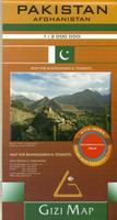
 Sketch showing area covered by the map.
 Sample detail from the Pakistan and Afghanistan map.
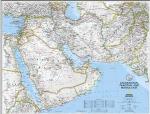
 Image of the entire Pakistan and Afghanistan map.
 An image of the full map
 A detail of the map
 A sample of the legend
 An enlarged view of a mounted map
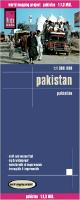 Waterproof!


 Sample #1
 Sample #2
 Shows the coverage of the map
 Sample #2
 Sample of the Pakistan map detail.


 Sample of one of the Pakistan sheets
 Index covering Pakistan
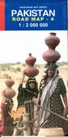
 Sample of the Map #4 detail
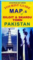
 Sample of the Gilgit map detail
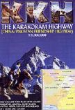
 Sample of the road map
 Sample of one of the city inset maps
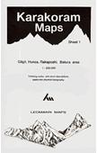


 Pakistan Flags