Because of the nature of political boundaries in the Himalayas, it is often difficult to "pigeon-hole" a particular map into a single section. This section brings together maps that that cover the Himalayas in their entirety, such as the Nelles Verlag Himalayas map, and maps that cover only part of the Himalayas, such as the Karakoram or Mt Everest maps. Many of these maps are also listed under their appropriate country, such as Nepal or India.
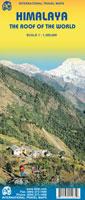
Himalayas Map. 1:1,300,000. ITMB, 1st ed., Aug. 2009. The 'Roof of the World' is an apt name for the Gordian knot of mountains that radiates out from Tibet like a galaxy spiral - north to the Aleutians, south to Indonesia, east to Japan, and west to Europe. The Himalayan region is not only of paramount strategic value (why else would India and Pakistan fight over Kashmir so ferociously or China cling to Tibet so tenaciously?), but it is a lovely and exotic part of the world. Think of Nepal, Bhutan, Sikkim, the Karakoram Highway, the new rail line to Lhasa, the hill towns of India, the sanctuary provided to the Dali Lama, the mountain treks in the Mustang Valley, the majesty of Mount Everest! It is all on this double-sided map - from Kabul in the west to Assam in the east and from the isolated Tibetan plateau in the north to the Indus Valley in the south.
Himalaya Region map sample
$12.95
65-75901
1 sheet, folded
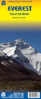
Mt. Everest Maps
Mt. Everest hiking map. 1:100,000. ITMB.
The fascination of climbing to the 'top of the world' intrigues many people. Few of us will ever do it, but many of us can go to the base camp and climb a bit. This is a detailed map of the peak, showing all known climbing routes to the summit, with the focus on the Nepalese side simply because it is more developed touristically. There must be 30 hotels and guest houses between Luckla and Base Camp. This is an incredible map, akin to ITMB's Kilimanjaro map. The legend includes: roads by classification, check points, viewpoints, points of interest, camps, monasteries, lodging, stupas, airports, waterfalls, glaciers, health posts and other information.
Sample of the Mt. Everest map detail
$12.95
65-04811
1 sheet, folded
Mt. Everest Route and Summit Map. 1:50,000. Swiss Foundation for Alpine Research. 1991.
An excellent double-sided map showing the Mt. Everest massif and the summit area. The routes for 24 expeditions are shown, with brief description of each expedition. A nice map.
Sample detail from the Mt. Everest map Sample of the Mt. Everest map detail
$37.99
65-0481
1 sheet, folded
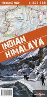
Indian Himalayas Map & Indian Himalayas Guidebook
Indian Himalaya Map. 1:350,000. TerraQuest, Poland. This laminated, folded map offers both a planning map of the region and more detailed strip maps of the main hiking routes. On one side is a 1:750,000 regional topographic map of the Indian Himalaya region while the reverse has numerous strip maps at 1:350,000 showing 22 different trekking routes.
The 1:750,000 overview map covers all of the north-western area between the borders with Pakistan and Nepal, and a smaller map at 1:750,000 covering the north-eastern section in Sikkim.
Elevation is shown by 100m contour lines, spot heights, plus superb shaded relief. Coloring indicates different types of vegetation/ground cover. Numerous peaks, passes, and places are named, plus locations of particular interest.
Road network includes local tracks and railway lines are marked. The 22 recommended treks are marked, with their start-stop points and estimated time required. Also marked are hotels, campsites, tea huts, temples and monasteries, etc. Latitude and longitude grid is at 10' intervals.
On the reverse the 22 recommended hiking trails are shown on more detailed 1:350,000 topographic maps, with more information on the facilities and places of interest along each route.
Sample detail #1 of the Indian Himalaya map. Sample detail #2 of the Indian Himalay map.
$24.99
64-7671
1 sheet, folded
Indian Himalaya Hiking Guide. 1:350,000. TerraQuest, Poland. This guidebook is unique in presenting detailed descriptions of 22 trekking itineraries in the Indian Himalaya. The routes have been especially devised to pass through the most scenic and culturally interesting regions of northern India. The information on the distance and time needed to cover particular route sections makes it easy for experienced trekkers and trekking novices alike to plan their trip in great detail.
Maps and height profiles. Each trek description includes a 1:350 000-scale map (with the route marked on it) and a height profile diagram that reflects landform features. This is what makes the guidebook unique and - even more importantly - invaluably useful when trekking the Himalaya mountains.
Practical information. The guidebook offers all kinds of indispensable tips: from food and drink, through recommended equipment, to transportation. You will find it priceless to learn which time of the year to choose for your expedition, and what to look out for to make it safe.
Himalaya Maps by Swiss Foundation for Alpine Research
Janak Himal Map. 1:100,000. Swiss Foundation for Alpine Research. A color map of the Janak Himal region of eastern Nepal.
$15.95
65-04812
1 sheet, folded
Abi Gamin hiking/topo map. 1:150,000. Swiss Foundation for Alpine Research and the Survey of India. 1981.
A small map, in brown and white only, of the area north of Abi Gamin, extending south so it just includes the summits of Abi Gamin and Kamet. Size is 12 x 8.7 inches, folded.
$7.50
65-7567
1 sheet, folded
Himalayan Maps by Deutscher/Österreichischen Alpenverein (Alpenvereinskarte).
Himalayan Mountain Maps (Alpenvereinskarte). Deutscher/Österreichischen Alpenverein. The Deutscher/Österreichischen Alpenverein publishes a series of well-known topographic maps for many of the most popular mountain peaks in Europe and Asia. These maps are often reproduced from maps produced during some of the early classic expeditions to the Himalayas and elsewhere, such as the 1934 Deutsche Himalaya-Expedition.
All maps are full topographic maps with 25 meter contours unless noted otherwise.
These blue "index" buttons below show the area of coverage of each map.
Mount Everest. 1:25,000. 1957. Includes the Chinese side of Mt. Everest.
$19.95
65-7579-08
Pamir-e Wakhan, Dardistan Geologic Map. 1:250,000. 1975. Geological map of the Selsela Koh-e Wakhan (Pamir-e Wakhan) and parts of the High Hindu Kush, Hindu Raj and Western Karakoram. No elevation information on this map.
$19.95
64-0692PT
Village of Ptukh, Afghanistan. 1:5,000. 1978 (1975 expedition).
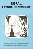
Himalayan Maps by Nelles Verlag - "Schneider Maps"
Recommended! West Col Productions of the U.K. produces a series of maps that cover the Indian Himalaya, the Nepal Himalaya, and the Karakoram. They also produce maps covering the central high Atlas Mountains in Morocco, and several maps covering mountains in East Africa, Mt. Ararat, and the Caucasus Mountains; you will find these maps listed by individual country. These maps typically lack contour lines, but show ridge lines and peaks with yellow lines. Numerous spot elevations locate the peaks, and rivers and other drainage features are shown in blue. Roads are shown in black and categorized by road surface type. Villages, old mines, and other cultural features are marked. On the reverse of the map, or in a separate booklet is text describing the popular trekking routes, tourist information, diagrams, cross sections, and more. These maps are on better quality paper than the Mandala maps above. The maps are somewhat expensive, but are well worth the price, as they cover areas where little or no other mapping is easily available.
Indian Himalaya - Jammu & Kashmir. West Col Productions.
Himalaya & Tibet Map, with Bhutan, Ladakh, and Sikkim. 1:1,600,000. Gecko Maps, 2009. Detailed topographic map showing monasteries, pilgrimage routes, sacred places, holy mountains, and much more. With a 1° latitude/longitude grid for GPS use. Map size is 99 x 148 cm.
Shows area covered by the map Sample #1 Sample #2
$14.99
65-4372
1 sheet, folded.
Chitawan Map. 1:150,000. Gecko Maps (formerly Karto Atelier), 2000. Includes Chitawan National Park, Narayangadh (1:25,000), Hetauda (1:25,000), Sauraha (1:10,000), and a panoramic view map. The map includes a listing of animals most likely to be seen, a table of services offered by resorts outside Sauraha, a summary climate chart. The main map has a 5' latitude/longitude grid for use with a GPS.
Sample #1 of the main map Sample #2 of the main map Sample of an inset city map Sample from the panoramic map
$16.99
65-04854
1 sheet, folded.
Island Peak Hiking Map. 1:20,000. Gecko Maps, A detailed topographic map with coverage extending west from Island Peak to also include Chukung and Chukung Ri peaks. The map has 40-meter contour intervals, spot heights, and shaded relief. There are numerous inset maps; a small panoramic map, an elevation cross section, Chukhung village map, small overview map, and two insets of climbing routes. Also on the map you will find a description of 4 different climbing routes to the summit of the Island Peak (in 6 lenguages; English, German, Italien, French, Nepali and Japanese). With a 1' latitude/longitude grid for use with a GPS.
Sample of the main map Sample of the panoramic map Sample of the climbing routes map
$16.99
65-04856
1 sheet, folded.
Kailash Hiking Map. 1:50,000. A very detailed topographic hiking map with 20-meter contours, spot heights, and relief shading. with an inset map of Darchen (1:4,000) and a small overview map of Tibet at 1:12,000,000. The map indicates different types of terrain and land use: pastures, swamps, glaciers, rocks and gravel. An overprint shows the trekking route around Mount Kailash and highlights various places of interest. Symbols depict such cultural landmarks as monasteries, chortens, prayer flagpoles and ritual sites, also viewpoints, ruins, lodges, shelters and campsites.
The map also includes a small plan of Darchen at 1:4,000. All place names are in both Roman and local script.
Sample #1 of the main map Sample #2 of the main map Sample #3 of the main map Sample of the Darchen city map
Nepal Map. 1:1,000,000. Gecko Maps (formerly Karto Atelier). A decent road map of Nepal, showing elevation, distances between main road junctions, and much more. Elevation is shown with contour lines (500-meter intervals), spot heights, and shaded relief. Inset maps include a 1:250,000 map of Kathmandu Valley, a 1:250,000 map of Pokhara Valley, and a road distance chart. There is a 15' latitude/longitude grid for use with a GPS. Map size is 19.5 x 38".
Sample from the main road map. Sample from the Pokhara Valley map.
$16.99
65-04906
1 sheet, folded.
Lhasa City Map. 1:4,000. Gecko Maps. This is an extremely detailed street map of Lhasa with numerous inset maps. The map highlights traditional Tibetan architecture and townscapes. On side of the map has the main map covering the Old Town, Potala, and other main tourist areas of Lhasa. The reverse side has a large map of Lhasa Old Town, plus eleven inset maps of such places as Potala, Marpori, Greater Lhasa, Temple Jokhang, etc. Descriptive text is included for each map. Map size is 20 x 41".
Sample from the main Lhasa map Sample from the Potala Palace inset map Sample from the Norbulinka Summer Palace inset map
 Himalaya Region map sample
 Sample of the Mt. Everest map detail
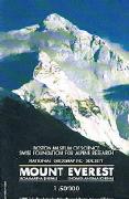
 Sample detail from the Mt. Everest map
 Sample of the Mt. Everest map detail
 Sample detail #1 of the Indian Himalaya map.
 Sample detail #2 of the Indian Himalay map.
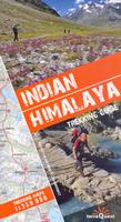
 Sketch map showing the coverage of the the Indian Himalaya Trekking Guide
 Sample detail of a map in the Indian Himalaya trekking guide.
 Sample detail of the route description in the Indian Himalaya trekking guide.
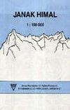
 These blue "index" buttons below show the area of coverage of each map.


 Sketch map showing sheet layout.
 Sample #1 of the Schneider hiking map detail
 Sample #2 of the Schneider hiking map detail


 Index of sheet coverage.
 Sample of the map


 Shows area covered by the map
 Sample #1
 Sample #2
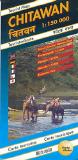
 Sample #1 of the main map
 Sample #2 of the main map
 Sample of an inset city map
 Sample from the panoramic map
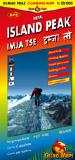
 Sample of the main map
 Sample of the panoramic map
 Sample of the climbing routes map
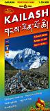
 Sample #1 of the main map
 Sample #2 of the main map
 Sample #3 of the main map
 Sample of the Darchen city map
 Image of the entire map
 Sample #1 of the map detail
 Sample #2 of the map detail
 Sample #3 of the map detail
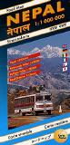
 Sample from the main road map.
 Sample from the Pokhara Valley map.
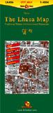
 Sample from the main Lhasa map
 Sample from the Potala Palace inset map
 Sample from the Norbulinka Summer Palace inset map