Norway Supertouring Atlas. 1:400,000. Freytag & Berndt. Spiral-bound road atlas of Norway with 1:3,500,000 summary road maps for Europe. Covers Spain, Portugal, Italy, Greece, coastal France, coastal Slovenia, and coastal Croatia. Includes tourist information, postal codes and full index. Multilingual legend. Size 8¼ x 12".
$34.99
65-1189
Atlas.
Norway Travel and City Maps
Norway Travel Map. 1:650,000. ITMB. A good quality double-sided map with a small inset map of central Oslo. The map shows elevation by color shading and spot heights. Also shows ferry routes, railroads, etc.
$12.95
65-11903
1 sheet, folded.
Norway Travel Map. 1:600,000. Freytag & Berndt. This double-sided map offers good detail of Norway. The less visited northern part is divided into three sections on the back of the map so that it all fits. The more popular southern part is on the front side of the map. The attached booklet includes simple street plans of Trondheim, Hammerfest, Bergen, Oslo, Narvik and Stavanger.
$14.99
65-11901
1 sheet, folded.
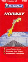
Norway Travel Map. 1:1,250,000. Michelin. Classic road map by this world-famous map company. Ideal of route-planning or driving trips but lacks the detail of the back-roads that are included on the more detailed, but more cluttered maps also listed here. Elevation shown by shaded relief, major areas of vegetation is shown by color shading. The road network is clear and easy to read. Intermediate distances are shown along major roads. . Size is 50 x 121 cm.
$12.95
65-11904
1 sheet, folded.
Norway Travel Map. 1:1,000,000. Ugland. Detailed road map for all of Norway published by a large Norwegian map company. Multilingual legend.
$27.99
65-11905
1 sheet, folded.
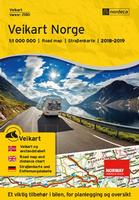
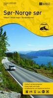
Norway Regional Travel Map Series. 1:500,000. Nordeca, Norway. 2014-2015. This series, revised on a regular basis, has a new scale at 1:500,000. The series is a detailed five-sheet road/travel map set that covers all of Norway. In Norwegian with multilingual legend, including English.
Sample detail from the Norway regional road map. Sketch map showing coverage of each map sheet.
Bergen Street Map. 1:20,000 and 1:8,500. Cappelens.
Includes detailed city-center map at 1:8,500. Includes coverage of Litle Sotra, Loddefjord and Mathopen to the west, Eidsvag and Asane in the north. The map has all road names and a road name index with 2300 names. Symbols in Norwegian, English, German and French.
$29.99
65-1192B
1 sheet, folded.
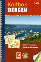
Bergen Street Atlas. 1:10,000 and 1:5,000. Statens Kartverk and Ugland/Nordeca. Detailed spiral-bound street atlas of this popular tourist destination in Norway. The atlas is in Norwegian with the legend being English/Norwegian. Approximately 150 pages of street maps and 10 pages of street name index.
Sample detail of the Bergen street atlas
Oslo Street Map. 1:20,000. Freytag/Berndt.
Folded paper street map of Oslo. One side features a detailed map of the city of Oslo, as well as an inset of the greater area around the city in Norway. The flipside features the index for the map.
Laminated! Oslo Street Map. 1:11,000. Borch.
Folded double-sided laminated street map of Oslo. The map includes a detailed map of Oslo city center at 1:11,000; plus maps of Holmenkollen & Tryvannshogda 1:25,000; Oslo & Region 1:200,000; Western Norway 1:800,000; Public Transportation, Norway administrative/time zones, etc.
$9.99
65-1192OS
1 sheet, folded.
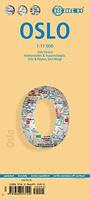
Oslo PopOut Street Map. 1:30,000. PopOut.
Explore Oslo with the help of this genuinely pocket-sized, pop-up map. Small in size yet big on detail, this compact, dependable, city map will ensure you don't miss a thing.
Includes 2 popout maps - a detailed street by street plan of the city centre as well as an overview map of greater Oslo
Handy, self-folding, tourist map is small enough to fit in your pocket yet offers extensive coverage of the city in an easy-to-use format
Thorough street index is also featured and cross-referenced to the map so you can easily find your destination
Key places of interest are listed offering you advice on the best things to see
Size is 4 x 5 inches folded.
$6.95
65-1192OP
1 sheet, folded.
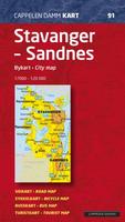
Stavanger and Sandnes Street Map. 1:20,000 and 1:7,000. Cappelens.
Folded paper map with street names, one-way roads, roadside roads, walkways, bike routes, beaches, sights, hotels, guest houses, campsites, car rental, gas stations, pharmacies, banks, malls, sports facilities, schools, kindergartens, bus stops and bus routes. Map legend is in English.
$29.99
65-1192S
1 sheet, folded.
Trondheim Street Map. 1:8,000 and 1:4,500. Cappelens.
With bus stops, one-way drives, cafes and hotels and much more.
$29.99
65-1192T
1 sheet, folded.
Norway Topographic Maps
All of Norway is covered by detailed topographical maps at 1:50.000 scale. There is also a series of hiking maps at scales of 1:50.000 - 1:100.000 covering the most popular places in Norway. These maps shows hiking routes, skiing routes, huts and shelters, and many have practical information on the reverse side. The maps have a UTM grid.
Spitsbergen Explorer Map. Ocean Explorers Maps, UK. The Spitsbergen Explorer is the ideal map to accompany cruising amongst these dramatic islands. The Svalbard Archipelago was a pioneer destination for Arctic tourism, and the Explorer contains essential details on the flora and fauna that have attracted visitors since the mid-19th century. The map features illustrated biographies of no less than 27 explorers associated with the archipelago, including Willem Barents, Umberto Nobile, Horatio Nelson and Roald Amundsen. We have even included a calendar plotting the Polar Night and the Midnight Sun.
Thumbnail of the front of the map Thumbnail of the reverse of the map.
$11.99
65-1174
1 sheet, folded.
Svalbard/Spitsbergen 1:500,000 Topographic Maps. 1:500,000. This 4-sheet set offers complete coverage of the Svalbard archipelago. This is a special-order item with a 2-week delivery time.
$89.95
65-11725
4 sheets, folded.
Lofoten Islands Maps and Guidebook
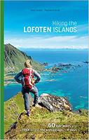
New guide! Lofoten Islands Hiking Guide. Souyris & Brede.
Hiking the Lofoten Islands is both an invitation to discover this bit of Arctic paradise and a practical guidebook that answers two questions, essential for any hiker:
Where should I hike on each of the islands, given the time I have, the weather, and my physical condition?
What itineraries should I follow?
Part 1 is an introduction to the islands.
Part 2 contains descriptions of 60 hikes with maps, photos and more.
Great companion map! Lofoten Islands Topographic/Hiking Map #2549. 1:100,000. Nordeca.
Includes contour lines at 20m intervals, hiking trails, tourist information, and more. Descriptive text is multilingual, including English.
Sample page from the Lofoten hiking map
$29.99
65-1173-2549
1 sheet, folded.
Norway Hiking Maps
Norway Hiking Maps. Statens Kartverk. These are topographic/hiking maps covering some popular regions in Norway. They show hiking trails, stream fords, trams, footbridges, campsites, ferries, and much more. Legends are bilingual English/Norwegian. We often recommend these over the 1:50,000 topos as they are site-centered, often double-sided and hence cover larger areas than the topos.
Index for southern Norway Index for central Norway Index for northern Norway Index for far northern Norway
$29.99
65-1173-2551
Mjosa - Randsfjorden map. 1:100,000. 2001. This is a new hiking map covering the area between the lake Mjosa and the lake Randsfjorden and filling in the gap between the maps "Oslo Nordmark" in the south and "Jotunheimens fogard" in the north.
$29.99
65-1173-2535
Alesund map.
$29.99
65-1173-2531
Ardal map.
$29.99
65-1173-2375
Beitostolen map.
$29.99
65-1173-2429
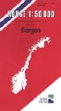
Bergen map. 1:25,000.
$29.99
65-1173-2247
Drammensmaarka Sor map.
$29.99
65-1173-2676
Finnskogen Sor map.
$29.99
65-1173-2541
Frafjord - Bjerkreimsheiane map. 1:50,000. 2001. This map also covers an area in southwestern Norway. From Lysefjorden in the north, slightly overlapping the new "Sirdalsheiane" sheet noted above, to Orsdalsvatnet in the south.
$29.99
65-1173-2515
Geilo map.
$29.99
65-1173-2517
Hallingskarvet map.
$29.99
65-1173-2557
Hardangervidda map. 1:100,000.
$29.99
65-1173-2203
Haukelifjell map.
$29.99
65-1173-2687
Hemsedal Nord map.
$29.99
65-1173-2688
Hemsedal Sor map.
$29.99
65-1173-2684
Hovden Nord map.
$29.99
65-1173-2685
Hovden Sor map.
$29.99
65-1173-2421
Hovringen Kvamsfjellet map.
$29.99
65-1173-2681
Lysefjordan map. 1:50,000.
$29.99
65-1173-2219
Lifjell map.
$29.99
65-1173-2525
Norefjell-Eggedal map.
$29.99
65-1173-2537
Orskogfjellet map.
$29.99
65-1173-2385
Reineskarvet map.
$29.99
65-1173-2509
Ringebu map.
$29.99
65-1173-2521
Rondane Sor map.
$29.99
65-1173-2523
Rondane Nord map.
$29.99
65-1173-2543
Sirdalsheiane map. 1:50,000. 2001. This map covers an area in southwestern part of Norway from Lindeland in the south to Svartevassdammen in the north and from Lysefjorder with Kjærag in the west to Rosskreppfjorden in the east.


 Sample detail from the Norway regional road map.
 Sketch map showing coverage of each map sheet.
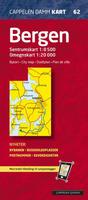
 Sample detail of the Bergen street atlas

 Thumbnail image of the front of the map
 Thumbnail image of the reverse of the map
 Laminated!


 All of Norway is covered by detailed topographical maps at 1:50.000 scale. There is also a series of hiking maps at scales of 1:50.000 - 1:100.000 covering the most popular places in Norway. These maps shows hiking routes, skiing routes, huts and shelters, and many have practical information on the reverse side. The maps have a UTM grid.

 Thumbnail of the front of the map
 Thumbnail of the reverse of the map.
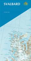
 New guide!
 Sample page from the Lofoten hiking guide
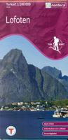 Great companion map!
 Sample page from the Lofoten hiking map

 Index for southern Norway
 Index for central Norway
 Index for northern Norway
 Index for far northern Norway