|
|
Netherlands Regional Travel Maps. 1:200,000. Michelin. Long the standard for European road maps.
Amsterdam City Maps - Paper Maps
Amsterdam PopOut city map. 1:13,500. PopOut.
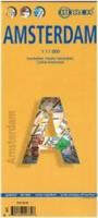
Amsterdam city map. 1:12,500. Freytag & Berndt.
Amsterdam city map. 1:12,500. Michelin.
Amsterdam City Maps - Waterproof Maps
Amsterdam city map. 1:11,000. Borch.
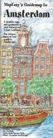
Amsterdam city map. 1:12,500. MapEasy.
Amsterdam city map. 1:12,500. Michelin.
Amsterdam city map. 1:12,500. Redmap.
Netherlands City Topographic Maps. 1:10,000. Soviet government. These maps are regular topographic maps that include contour lines, power lines, rail/trolley lines, etc. In Russian. These maps are hard to acquire and we are often out of stock. Please call/e-mail us for current inventory.
Netherlands Topographic MapsNetherlands 1:50,000 Topographic Quadrangle Maps - click here. 1:50,000. Topographische Dienst. Sets are available as loose sheets or as a 4-volume bound atlas. Each map covers 20 x 25 km of area. Each volume has 50+ pages of index in the back. The atlas contains complete coverage of the Netherlands in a 23 x 28 cm format. Netherlands 1:25,000 Topographic Quadrangle Maps - click here. 1:25,000. Topographische Dienst. Complete coverage in 308 sheets.
Netherlands Atlases
Netherlands Provincial Topographic Atlases. 1:25,000. Topographische Dienst. 2002-. These atlases show extensive detail for the Dutch provinces. In Dutch.
Netherlands Historical Provincial Atlases. These atlases are designed to complement the atlases listed above (65-05537). In Dutch.
Netherlands National Park MapsNationaal Park Dwingelderveld Wandelkaart. 1:20,000. ANWB, 2005. Topographic map showing hiking trails and roads through this national park. In Dutch.
Nationaal Park Veluwezoom en het Deelerwoud Wandelkaart. 1:20,000. ANWB. Topographic map showing hiking trails and roads through this national park. In Dutch.
Nationaal Park Zuid-Kennemerland Wandelkaart. 1:20,000. ANWB. Topographic map showing hiking trails and roads through this national park. In Dutch.
|
||||||||||||||||||||||||||||||||||||||||||||||||||||||||||||||||||||||||||||||||||||||||||||||||||||||||||||||
 Netherlands Maps and Netherlands Guides
 Sample detail from the ITMB Netherlands travel map
 Sample detail from tne Benelux map.
 Sample detail from tne benelux map.
 Sample detail from tne Michelin Netherlands maps.
 Thumbnail of the front of the Freytag Amsterdam map
 Waterproof.
 Waterproof
 Sample from the MapEasy Amsterdam map
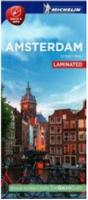 Waterproof.
 Waterproof.
 Sample from the Redmap Amsterdam map
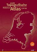
 Netherlands Flags