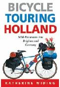
Netherlands Cycling Guide. Katherine Widing, Cycle Publishing. A detailed guide to bicycle touring in one of the best places on the planet. With routes in all 11 provinces and short excursions across the border into neighboring Belgium and Germany.
Holland, it's probably the world's most popular country for bicycle touring. It's the place where you can get literally everywhere by bike - just like the natives do. This book highlights more than 50 delightful bike tours into every corner of the country, and sometimes beyond into some of the most picturesque destinations in neighboring Belgium and Germany. Each route is described in extensive detail and illustrated with 2-color route maps. Several of the routes make extensive use of the remaining pedestrian ferries that have carried people across Holland's river delta country for many centuries.
$18.95
65-0595CY
Guidebook.
Netherlands Cycling Maps (Toeristenkaart). 1:100,000. ANWB. This series offers excellent detail and the cycling routes are all highlighted, with route numbers.
Sheet 5: Noord-Holland, Wassen, Friesland West cycling map.
$15.99
65-05821-06
Sheet 6: Zuid-Holland, Noord-Holland South cycling map.
$15.99
65-05821-07
Sheet 7: Zeeland, Brabant West, and middle and border area cycling map. 1:150,000.
$15.99
65-05821-08
Sheet 8: Limburg and Brabant East and border area cycling map.
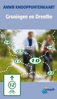
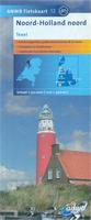
Netherlands 1:50,000 Cycling Maps. 1:50,000. ANWB. This new series of paper cycling maps offers a less-expensive alternative to the waterproof maps listed above. This series offers detailed non-topographic street/road maps, with the numerous cycling routes highlighted. The routes are numbered and categorized, with distances noted. Tehre are numerous symbols locating tourist sites and services. In Dutch only.
Sample of the Netherlands cycling map detail. Index map for the Netherlands cycling maps.
Sheet 20. Limburg Midden en Zuid (middle and south) cycling map.
Waterproof! Netherlands 1:50,000 Topographic "Freetime" Maps. 1:50,000. ANWB. We recommend these instead of the 110-sheet Topo. Dienst 1:50,000 topo set.
Uses the Topo. Dienst. government 1:50,000 topographic maps as base maps.
Printed on waterproof, tear-resistent synthetic paper.
ANWB adds bike paths/trails.
Uses symbols to show sports complexes, tourist information, vegetation type, hydrographic features, etc.
Colors are used to show land type and land use, such as sand, marsh, forest, etc.
Shows ANWB's "paddestoelen" (mushrooms) - numbered roadside markers placed at junctions of small country roads to assist navigating.
Elevation is shown by 5-meter contours, spot heigths, and spot "depths" where the land is below sea-level.

 Sample of the map detail.
 Index map for the Netherlands cycling maps.
 Sample of the Netherlands cycling map detail.
 Index map for the Netherlands cycling maps.
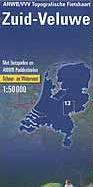
 Sample of the Netherlands cycling map detail.
 Index map for the Netherlands cycling maps.