Downloadable digital maps! Jordan Digital Road Map. 1:400,000. Reise Know-How. This map combines topographic mapping with road and tourist detail. The road information is clear and elevation is shown using contours, spot heights and altitude shading. The map shows six different types of roads, highlighting scenic routes, places of interest, archaeological sites, monasteries, monuments and viewpoints.
Digital versions available for immediate download! Digital versions are available for Compe-GPS, Fugawi, OziExplorer, and Touratech-Quo Vadis, for use with a PocketPC or a PC.
64-86907C
Immediate download digital version for Compe-GPS. (min. v6.8).
$21.99
64-86907F
Immediate download digital version for Fugawi. (.fx4).
$21.99
64-86907O
Immediate download digital version for OziExplorer. (.ozfx3).
$21.99
64-86907T
Immediate download digital version for Touratech QV. (.pny).
$21.99
Paper Jordan Road Maps
Waterproof, tear-resistant! Jordan Road Map. 1:400,000. Reise Know-How. This is the most detailed road map available for Jordan. It is a double-sided map with north of al-Karak on one side and south of al-Karak on the reverse.
It combines clear road and tourist detail with elevation indicated by contours, altitude tinting, mountain passes and peak heights. The road detail shows six categories of roads including selected tracks and paths with intermediate driving distances in km, parking spaces and gas stations on the major roads.
Main railways, ferries, airports, airfields, harbours, national and international boundaries with border crossings and disputed international boundaries, separation walls, areas under full Palestinian control, and the borders of the West Bank, Gaza and the Golan Heights.
Geographical details include national parks and nature reserves, caves, hot springs, periodical inshore waters, canals, waterfalls and dams, salt pans and periodical rivers. Symbols depict many landmarks such as various antiquities, religious buildings, spas and beaches, places of interest, viewpoints, museums, memorials, and accommodations.
It includes an extensive index of place names and a 15' latitude/longitude grid. Trilingual with English, German and Arabic. Printed on waterproof, tear-resistant synthetic paper. Map size is 70 x 100 cm.
64-86907
1 sheet, folded.
$15.99
Jordan Road Map. 1:750,000. Royal Jordanian Geographic Centre, 2009. This is the official tourist map of Jordan. Bilingual. This road map has elevation tinting, main and secondary roads, railways and places of archeological interest, also gas stations, springs, and airports. Intermediate driving distances on main roads are indicated and there is a distance table. On the reverse is a street map of Amman, framed by various colour photographs of tourist attractions and basic information about the country. Map size approx. 76 x 68, in English. Lacks an index of towns/features.
64-86903
1 sheet, folded.
$13.95
Jordan Travel Map. 1:800,000. Freytag/Berndt. Good quality travel map showing roads (with type of surface), railways, rivers and watercourses. Elevation is shown by shaded relief with areas of desert and salt flat clearly marked, and the map also shows archaeological sites and other places of interest. An index is included, and inset maps of Jarash and Petra. On the reverse is a street plan of Amman. Map size is 75 x 68 cm.
64-86902
1 sheet, folded.
$14.99
Jordan Travel Map. 1:730,000. GEOprojects. Side One has a physical map of Jordan at 1:730,000 showing relief, communications, oil pipelines, settlements and places of interest with index of place names. A Business Guide for Jordan gives useful addresses, telephone and fax numbers for ministries, embassies, banks, hotels and other information. Descriptive text about the geography, history and economy of Jordan.
Side two has city maps of Amman at 1:25,000 and Central Amman at 1:10,000 showing detailed street patterns, built-up areas, parks, important buildings and other places of interest with indexes of sectors, street names and places of interest. City Map of Aqaba at 1:20,000 showing streets, built-up and redevelopment areas and parks. Plans of Petra at 1:4,250 and Jerash at 1:10,000 showing archaeological sites. Descriptive texts giving information about the history of Amman, Aqaba, Petra and Jerash, with photographs.
64-8690
1 sheet, folded
$19.99
Jordan & Israel Travel Map. 1:1,400,000. ITMB. Hypsometric/physical/road map. Covers Israel and Jordan. The road map published by the Jordanian Survey is more detailed.
64-86906
1 sheet, folded.
$12.95
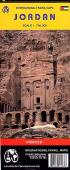
Jordan Map. 1:250,000. Royal Jordanian Geographic Centre, 2005. In Arabic. Two sheets - North Jordan and South Jordan - combined give complete coverage of Jordan. The map shows three levels of administrative boundaries, four levels of roads, airports, towns and villages, hydrology, etc. In Arabic.
64-8644-N
North Jordan. Flat/rolled.
$15.95
64-8644-S
South Jordan. Flat/rolled.
$15.95
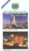
The Tourist Map of Amman. 1:20,000. Royal Jordanian Geographic Centre. 2008. Official street map for Amman. The map has main and secondary roads named, railways are shown, along with district names, area boundaries, built-up areas, parks, gardens, and cemeteries. Symbols depict mosques, churches, embassies, government buildings, hospitals, cinemas, museums, police stations, ruins, bus stations, and post offices. Indexed on the reverse for streets, ministries, embassies, government institutions, districts, hospitals and hotels. Size approx. 96 x 65 cm.
64-8692AM
1 sheet, folded
$13.95
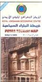
Petra Tourist Map. Royal Jordanian Geographic Centre. An excellent map of this ancient city with its temples made famous by the movie Indiana Jones and the Last Crusade. We recommend the guidebook listed below to accompany this map.
64-8692P
1 sheet, folded.
$12.95
Other Jordan City Maps. Royal Jordanian Geographic Centre. These are standard city street maps showing major buildings, hotels, mosques, etc. Bilingual.
Sample from the Aqaba map
64-8692AG
Aqaba Tourist Map. RJGC.
$13.95
64-8692AJ
Ajlun Tourist Map. RJGC.
$9.95
64-8692AL
AL-Karak Tourist Map. RJGC.
$12.95
64-8692AM
Amman Tourist Map. RJGC.
$13.95
64-8692AN
Amman Mosques. RJGC.
$7.95
64-8692AR
Amman Archaeological Map. RJGC.
$7.95
64-8692J
Jarash Tourist Map. RJGC.
$12.95
64-8692KR
Karak Archaeological Map. RJGC.
$7.95
64-8692MA
Madaba Tourist Map. RJGC.
$12.95
64-8692MR
Mahattat (H4) Archaeological Map. RJGC.
$7.95
64-8692NR
Ma'an Archaeological Map. RJGC.
$7.95
64-8678
Wadi Rum Tourist Map. RJGC.
$12.95
The Madaba Map. Israel Survey. Reproduction of the mosaic Madaba map in the Greek Orthodox parish church of St. George in Madaba, Jordan. The church was built in 1896 A.D. over the remains of a Byzantine church, whose dating is probably to be set at the end of 6th or at the beginning of 7th century A.D. The mosaic panel enclosing the Map was originally some 15.60 by 6 m, or 94 square meters, of which 25 square meters are preserved, corresponding only to about a quarter of the total.
Sample of the map detail.
64-8681
1 sheet, flat
$14.95
Atlas of Jordan and the World. Royal Jordanian Geographic Centre, 2007. This atlas includes a group of natural, economic, and administrative maps of Jordan, as well as basic geographic and astronomic maps, world and continent maps, maps of Arab countries, and more. Softcover, in Arabic.
Sample of a map detail.
64-86481
Atlas
$16.95
Space Atlas of Jordan. Royal Jordanian Geographic Centre, 2000. This bilingual atlas contains 50 pages of satellite image maps covering all of Jordan. Each quadrangle map has a one-page summary of location, topography, geology, agriculture and vegetation, urban features, and image source. Each page has an image key to show rock type in the image.
64-86483
Atlas
$39.95
Jordan Maps and Photos. Royal Jordanian Geographic Centre, 2005. This small atlas includes small sketch maps of Jordan, numerous color photographs, and descriptive text, covering a wide range of natural and cultural topics. 94 pages, softcover, in Arabic.
64-86484
Atlas
$14.95
Jordan & Petra Hiking Guides
Petra: A Travellers' Guide. Garnet Publishing, UK. The best guidebook to this ancient city with its temples made famous by the movie Indiana Jones and the Last Crusade. We recommend the map listed above to accompany this guidebook.
64-8695P
Guidebook.
$16.95
Treks and Climbs in Wadi Rum, Jordan. By Tony Howard. Cicerone Press. 1994, 2nd edition. The first edition of this guide, published in 1987, contained about 140 routes. Since then the number of climbs has doubled. Here are detailed descriptions and 'topos' of all the known routes to date, from short walks, camel treks and 4WD journeys through to sports climbs and major 'big walls' of the highest technical difficulty.
Additionally the author gives information on sites of antiquity, flora and fauna and life with the Bedouin. It is their roguish humour and warm hospitality as much as the magnificence of these deserts and mountains that make a visit to Rum a unique experience. This book tells you everything you need to know.
64-86951TC
Guide
$39.95
Walking in Jordan: Walks, Treks, Caves, Climbs, Canyons. By Di Taylor and Tony Howard. Interlink. It is rare for a book of this nature to describe such a wealth of previously unknown and varied terrain. But here in Walking in Jordan the authors' discoveries reveal an unexpected land of forested hills, beautiful dales carpeted in flowers, huge canyons sometimes with fast-flowing rivers, recently discovered caves, perfect limestone cliffs in wooded valleys, and high mountains with lunar landscapes.
This book not only gives descriptions to well over 100 routes-almost all previously unknown-but also indicates many still unexplored areas for those who wish to make their own discoveries. It gives detailed information on how to get there, when to go, what to take, and everything you need to know about the routes. In so doing, it offers visitors an opportunity to see and experience a country of great antiquity and previously unsuspected remarkable beauty, making a plea to respect the land and its people, both largely unspoiled by tourism. Di Taylor and Tony Howard have been climbing and trekking in the mountains of North Africa and the Middle East for well over 30 years. They were responsible for the discovery in 1984 of the Wadi Rum in south Jordan as a climbing and trekking area. Since then they have returned to Jordan every year, always managing to find some time to explore other parts of the country between world famous sites of Petra, Pella, Ajlun, and Kerak.
They were also invited to document the superlative routes to be found in Jordan's recently formed Nature Reserves, in particular the mountains and canyons of Dana and Mujib and once again in their favorite desert area of Wadi Rum, which was declared a National Park in 1998-a status they had long fought for, in support of the local Bedouin people.
64-86951JO
Guide
$18.95
Jordan Topographic Maps
Jordan 1:100,000 Topographic Quadrangle Map Set. 1:100,000. Soviet government. High quality topographic maps for a country where little else is available. This set gives complete coverage of Jordan in 82 sheets. In Russian.
64-8652
Set of 82 sheets, rolled
$820.00
Jordan 1:200,000 Topographic Quadrangle Map Set. 1:200,000. Soviet government. 1985. High quality topographic maps for a country where little else is available. Each sheet has extensive descriptive text on the reverse. This set gives complete coverage of Jordan in 27 sheets. In Russian.
64-8651
Set of 27 sheets, rolled
$324.00
Jordan 1:500,000 Topographic Maps (TPC charts). 1:500,000. NGIA/NIMA. These are topographic/aeronautical charts produced by the US government and are the best topo maps available in English.
Index map showing TPC chart coverage
67-1055-G04C
TPC Chart G04C - NE Jordan
$24.99
67-1055-G04D
TPC Chart G04D - NW Jordan
$14.99
67-1055-H05B
TPC Chart H05B - Southern Jordan
$19.99
Jordan Muhafadhat Maps. Royal Jordanian Geographic Centre. In Arabic. Jordan has twelve muhafadhat (governates or districts); maps are available for all twelve districts. The maps show the Nahia boundaries, Nahia sub-divisions, four levels of roads, airports, hydrology, villages and towns, and more. In Arabic.
Sample of the map detail from the Al Balqa map.