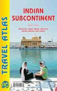
New atlas Indian Subcontinent Road Atlas. Variable scales. ITMB.
The Indian Sub-Continent consists of Pakistan, India, Nepal, Bhutan, Bangladesh, Sri Lanka and Kashmir. Each country (Kashmir being considered shared) is presented as an entity, so Pakistan occupies 30 pages at 1:1,200,000 scale, and Nepal occupies 32 pages at 1:530,000 scale. Eleven city inset maps are included, as well as basic insets for the Andaman and Nicobar island chains. The atlas contains 152 pages of maps and 51 pages of indexes. ISBN 9781553415251.
Shows areas covered by the atlas
$19.95
64-76891
Atlas.
Superb travel or wall map! India Geographical Map. 1:3,000,000. GiziMap, Budapest. This is an excellent shaded relief map of India. The map has hypsometric shading, numerous spot elevations, railways, water wells and springs, and numerous tourist sites such as churches, monasteries, mosques, castles, and much more. Trilingual legend. Size is 86 x 125 cm.
Index of coverage of the map. Sample of a 6 x 6" section of the map Sample #2 Thumbnail image of the map
$14.99
64-76913
1 sheet, folded
$34.95
64-76913R
1 sheet, flat
$36.99
64-76913L
1 sheet, laminated
India Political/Road Map. 1:3,000,000. GiziMap, Budapest. This is an excellent road map of India. The map has railways, water wells and springs, and numerous tourist sites such as churches, monasteries, mosques, castles, and much more. Trilingual legend. Size is 86 x 125 cm.
Index of coverage of the map. Sample of the map detail Thumbnail image of the map
$14.99
64-76912
1 sheet, folded
$19.99
64-76912R
1 sheet, rolled
$36.99
64-76912L
1 sheet, laminated
Waterproof! India Travel Map. 1:2,100,000. ITMB. This new edition adds inset maps of the Andaman and Nicobar Islands, as well as insets for Delhi, Mumbai, and Kolkata. Numerous other updates have been included as India is modernizing rapidly and many changes have occurred since the last edition.
Sample detail of the India Travel Map
$12.95
64-76915
1 sheet, folded.
Waterproof! India South Travel Map. 1:1,300,000. ITMB, 2015.
This map covers India from Hyderabad and Mumbai south to the southern tip of the country. Interesting-sounding names fill the map: Madurai, Kochi, Bangalore, Nagpur, and Pune; the map reeks of adventure and exoticism!
Front of the India South travel map. Reverse of the India South travel map.
$12.95
64-76929
1 sheet, folded.
Waterproof! India Travel Map. 1:3,150,000. National Geographic Maps, 2011. The India AdventureMap differs from a traditional road map for it includes hundreds of points of interest that highlight diverse and unique destinations in the region. The map features UNESCO World Heritage sites, national parks, archaeological sites, nature reserves, Hindu and Buddhist temples, and other points of interest, making it an invaluable resource to travelers hoping to experience all the history and culture India has to offer. Additional travel aids include the location of airports, rail lines, harbors and ferry routes.
Front of the India travel map Reverse of the India travel map Sample detail of the India travel map
$11.95
64-76904
1 sheet, folded.
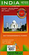
Waterproof! India Regional Travel Maps. 1:1,400,000. National Geographic Maps, 2011. These three maps give complete coverage of India. The maps include hundreds of points of interest that highlight the diverse and unique destinations found in this region. The map features UNESCO World Heritage sites, archaeological sites, wildlife sanctuaries, Hindu and Buddhist temples, forts, ruins, caves and other points of interest, making it an invaluable resource to travelers hoping to experience all the history and culture this part of India has to offer. Additional travel aids include the location of airports, ports and ferry routes.
Front of the Northeast India travel map Reverse of the Northeast India travel map Sample detail of the Northeast India travel map
$11.95
64-76909-NW
Northwest India travel map. Covers Karachi to Lahore to Kashmir, and Delhi to Bhopal.
$11.95
64-76909-NE
Northeast India travel map. Covers Hyderabad north to Nepal and east to the border.
$11.95
64-76909-S
Southern India travel map. Covers from Vadodara south to Trivandrum.
India Travel Maps. 1:1,500,000. Nelles Verlag. These maps use shaded relief to show elevation and include political, travel and geographic information. Sheet size varies.
India Region Index
$13.95
64-7694-1
North India (India #1).
$13.95
64-7694-2
West India (India #2).
$13.95
64-7694-3
East India (India #3).
$13.95
64-7694-4
South India (India #4).
$13.95
64-7694-5
Northeast India (India #5).
$13.95
64-7694-6
Himalayas Region.
(India) Madhya Pradesh tourist road guide and political map. 1:1,640,000. International Publishing, Delhi, 2000. A good political map with roads, distances, railroads, state and district boundaries and district and tehsil headquarters. With inset maps for Bhopal, Khajuraho, and of tourist sites in the region. With data tables showing district
headquarters, population (1991), sex ratio, literacy and places of interest. Includes fifteen pages of descriptive text.
$7.95
64-7696MC
1 sheet, folded.
$17.95
64-7696MCW
1 sheet, rolled, with rods top/bottom.
(India) Maharashtra tourist road guide and political map. 1:1,100,000. International Publishing, Delhi, 2000. A political map roads, railroads, distances between road junctions, state and district boundaries. There is an inset map of Mumbai. Data charts cover population, literacy %, and places of interest. An index of place names and physical features is included. Includes fourteen pages of descriptive text.
$9.95
64-7696MG
1 sheet, folded.
$17.95
64-7696MGW
1 sheet, rolled, with rods top/bottom.
(India) Rajasthan tourist road guide and political map. 1:1,365,000. International Publishing, Delhi, 2000. A political map roads, railroads, distances between road junctions, state and district boundaries. There are several inset maps; physical, tourist, Jaipur City, and Udaipur City. Data charts cover population, sex ratio, literacy %, road length, crops, and mineral resources. An index of place names and physical features is included. Fourteen pages of text describe tourist attractions and services and basic information about the region.
$17.95
64-7696RBW
1 sheet, rolled, with rods top/bottom.
(India) Sikkim Travel Map. 1:140,000. ITMB. A hypsometric physical/road map of Sikkim area of India. Not indexed.
Bangalore Street Atlas. Approx. 1:12,500. Paperback, 140 pages.
$19.95
64-7695CHE
Chennai Street Atlas. Approx. 1:12,500. Paperback, 183 pages.
$19.99
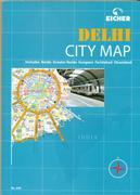
64-7695DEL
Delhi Street Atlas. Approx. 1:12,500. Paperback, 232 pages.
$19.95
64-7695MW
Mumbai Street Atlas. Approx. 1:12,500. Paperback, 162 pages.
$19.95
64-7695PW
Pune Street Atlas. Approx. 1:12,500. Paperback, 124 pages.
(India) National Capital Region. 1:363,000,000 (approx.). International Publishing, Delhi, 1998. With a map of Delhi at 1:60,000 (approx.). The main map shows roads, railroads, district and tehsil boundaries, etc. With fourteen pages of descriptive text.
$7.95
64-7695NC
1 sheet, folded.
$17.95
64-7695NCW
1 sheet, rolled, with rods top/bottom.
Dharamsala City Map, with McLeodganj. 1:1,700; 1:5,000; 1:20,000. Gecko Maps, 2009. Detailed street map of these cities that hosts the Tibetan government in exile.
Sample #1 Sample #2
Agra Street Map. Approx. 1:17,500. 32-page booklet.
$9.95
64-7695AH
Ahmadabad Street Map. Approx. 1:20,000. 2007. 16-page booklet.
$8.95
64-7695AL
Allahabad street map. 1:21,000
$9.95
64-7695AT
Bengalooru (Bangalore) Street Map. Approx. 1:42,000. 64-page booklet.
$8.95
64-7695BH
Bhubaneshwar Street Map. 1:17,000
$9.95
64-7695CD
Kolkata (Calcutta) Street Map. Approx. 1:25,000. 64-page booklet.
$8.95
64-7695CH
Chandigarh Street Map. 1:21,000
$9.95
64-7695M
Chennai (Madras) Street Map. Approx. 1:25,000. 70-page booklet.
$9.95
64-7695CP
Coimbatore Street Map. Approx. 1:20,000. 16-page booklet.
$8.95
64-7695DB
Darjeeling Street Map. 1:9,000. 28 x 40". With 32-page tourist information booklet.
$9.95
64-7695D
Delhi Street Map. Approx. 1:51,000. 103-page booklet.
$9.95
64-7695H
Hyderabad Street Map. Approx. 1:27,500. 56-page booklet.
$8.95
64-7695J
Jaipur Street Map. 1:23,000
$8.95
64-7695KB
Kanpur Street Map. 1:25,000
$8.95
64-7695LU
Lucknow Street Map. 1:25,000
$8.95
64-7695MD
Madurai Street Map. 1:20,000
$9.95
64-7695B
Mumbai (Bombay) Street Map. Approx. 1:46,000. 112-page booklet.
$9.95
64-7695NB
Mumbai and Navi Mumbai Street Map. Eicher Goodearth Pvt. Ltd. Approx. 1:45,000. 16-page booklet.
$9.95
64-7695MY
Ooty and Mysore Street Map. Approx. 1:15,000. 48-page booklet.
$8.95
64-7695P
Pondicherry Street Map. 1:8,600
$9.95
64-7695S
Shimla Street Map. 1:10,500
$8.95
64-7695SR
Srinagar Street Map. 1:22,000
$8.95
64-7695T
Thiruvananthapuram (Trivanduram) Street Map. 1:21,000.
$8.95
64-7695TI
Tirupati & Tirumala Street Map. 1:13,000 & 1:8,500
$9.95
64-7695VB
Varanasi Street Map. Approx. 1:18,000. 40-page booklet.
India City Maps by the Survey of India. Survey of India. These are basic tourist city street maps, showing the locations of banks, hotels, movie theaters, hospitals, historical places, museums and much more.
$8.95
64-7695AI
(India) Ahmadabad city map. 1:30,000. 1990.
$8.95
64-7695BC
(India) Bangladore city map. 1:30,000. 1992.
$8.95
64-7695CE
(India) Calcutta and Haora city map. 1:40,000. 1990.
$8.95
64-7695CI
(India) Chandigarh city map. 1:30,000. 1993.
$8.95
64-7695CO
(India) Coimbatore city map. 1:20,000. 1992.
$8.95
64-7695KH
(India) Khajuraho city map (in Madhya Pradesh). 1:10,000. 1993. Covers the superb Hindu temples of medieval India (950 - 1050 AD).
$8.95
64-7695KU
(India) Kullu city map. 1:10,000. 1993.
$8.95
64-7695MX
(India) Mysore city map. 1:20,000. 1991.
$8.95
64-7695PB
(India) Patna city map. 1:25,000. 1991.
$8.95
64-7695SG
(India) Shillong city map (in Assam). 1:15,000. 1986. With numerous color photos on both sides of the map sheet.
Kerala Road Map. 1:570,000. 28 x 40". With 64-page tourist information booklet.
$8.95
64-7696MB
Madhya Pradesh with Bhopal & Khajuraho Road Map. 1:1,500,000.
$8.95
64-7696MH
Maharashtra Road Map. 1:1,250,000.
$8.95
64-7696O
Orissa Road Map. 1:1,150,000.
$8.95
64-7696P
Punjab Road Map. 1:660,000.
$8.95
64-7696R
Rajasthan Road Map. 1:1,120,000.
$8.95
64-7696S
Sikkim Road Map. 1:200,000.
$8.95
64-7696T
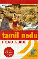
Tamil Nadu Road Map. 1:700,000. 28 x 40". With 88-page tourist information booklet.
$8.95
64-7696U
Uttar Pradesh Road Map. 1:1,100,000.
$8.95
64-7696W
West Bengal Road Map. 1:1,100,000.
India Road Atlases. TT. 32 pages each. In English.
$9.95
64-7697A
India Road Map.
$9.95
64-7697F
Northeast India Road Map. 1:1,300,000.
$9.95
64-7697B
East India Road Map.
$9.95
64-7697C
North India Road Map. 1:2,000,000.
$9.95
64-7697D
South India Road Map.
$9.95
64-7697E
West India Road Map.
India Topographic Maps
Now out of print, limited stock left. India Topographic Quadrangle Maps (TPC charts). 1:500,000. DGIA (NIMA/DMA). Standard topographic coverage of India is restricted by the Indian government. World Aeronautical Charts, including TPC and ONC charts, cover land areas at a standard size and scale for navigation by aircraft operating at high altitudes. However, their level of detail makes them useful as topographic maps for those areas where little else is available. The topographical information includes city tints, principal roads, railroads, distinctive landmarks, drainage patterns, topography and relief. contour lines are at 500 feet intervals, with intermediate contours where appropriate, along with numerous spot heights. Color tints on a hypsometric scale are also shown. The aeronautical information includes visual and radio aids to navigation, airports, airways, restricted areas, obstructions and other pertinent data. There is less detail in some areas due to insufficient information - these areas are labelled on the charts. These are large maps, with a typical size of 42 x 56 inches. Due to the size and color variation of the different print runs and the Conformal Conic Projection, these maps do not splice together well. World Aeronautical Charts are not recommended for use by pilots of low speed, low altitude aircraft.
India 1:200,000 Topographic Quadrangle Map Set. 1:200,000. Soviet government. 1958-1991. Sheets covering central and southern India are dated 1958-1966; sheets covering northern India are dated 1983-1991. Newer sheets are high quality topographic maps for a country where little else is available. The older sheets are better than nothing. This set gives complete coverage of India in 499 sheets, although lately we have been able to get only 400 +/- sheets per set. In Russian.
Northern India index map. Central India index map. Southern India index map. Northeastern India index map.
$34.99
64-76525D
Non-georeferenced individual sheet. Specify sheet number in the "Comments" section of the order form.
$75.00
64-76525G
Georeferenced individual sheet. Specify sheet number in the "Comments" section of the order form.
India 1:100,000 Topographic Quadrangle Map Set. 1:100,000. Soviet government. Coverage is available for northern India only - please see the index map for available coverage. In Russian. Available only as raster files or geo-referenced raster files.
Northern India index map.
$24.95
64-76527D
Non-georeferenced individual sheet. Specify sheet number in the "Comments" section of the order form.
$34.95
64-76527G
Georeferenced individual sheet. Specify sheet number in the "Comments" section of the order form.
India Wall Maps & Physical and Political maps
India Wall Map. 1:5,545,000. National Geographic Maps, 2006. See India as only National Geographic can depict it. This new reference map is one of the most detailed and comprehensive ever published for India and southern Asia. It includes India, Sri Lanka, Nepal, Bangladesh, Bhutan, Tajikistan, and portions of China, Pakistan, Afghanistan, and Myanmar. The India map is punctuated with thousands of place names, and embellished with shaded relief which highlights the region's dramatic topography in such places as the Tibetan Plateau and the Himalaya. Approx. size 23" x 30".
Sample of the map detail. Thumbnail of the entire map Click here for sample images of the various wood-mount options.
$12.99
64-7648
1 sheet, flat.
$19.99
64-7648L
1 sheet, flat.
$199.95
64-7648BL
India map - mounted, black.
$199.95
64-7648GO
India map - mounted, gold.
$199.95
64-7648WH
India map - mounted, white.
$199.95
64-7648WO
India map - mounted, wood-grain.
Population Atlas of India. M. Vijayanunni, Delhi, 1999. Uses 1991 Census data. 210 pages, with 83 maps, primarily district maps. The maps are very detailed covering a wide variety of demographic topics, with notes and tables on opposite pages. Includes a "States and Districts Map 1991" at 1:11,000,000. Size is 2 x 28.5 cm, hardbound.
$37.95
64-7664
Atlas.
India Hill Ranges and Rivers Map. 1:5,000,000. Survey of India. 1990. A simple map showing the main rivers and hill ranges in India. Descriptive text is in the margins. Flat sheet, laminated.
$7.95
64-76660
1 sheet, laminated.
India National Parks Map. 1:5,000,000. Survey of India. 1990. A color map showing the locations of the national parks and forest and wildlife preserves in India. Descriptive text and a few photographs are in the margins. Flat sheet, laminated.
$7.95
64-76661
1 sheet, laminated.
India Political Map. 1:4,300,000. International Publications, Delhi, 2000. Colored political map showing roads, highway numbers, railroads, state boundaries, district headquarters, and distances between cities. With an inset data table showing states, capitals, area, and population (2001). With 22 pages of descriptive text.
$9.95
64-76471
1 sheet, folded.
$17.95
64-76471W
1 sheet, rolled, with rods top/bottom.
India Political Map. 1:4,000,000. TTK Pharma. Colored political map showing roads, highway numbers, railroads, state boundaries, district headquarters, and distances between cities. Printed on waterproof, tear-resistent synthetic paper.
$7.95
64-76473
1 sheet, folded.
Recommended! India tourist road guide and political map. 1:4,300,000. International Publications, Delhi, 2001. This map has significantly more detail than the map above, although both are political maps at the same scale. The map shows roads, railroads, rivers, major ice fields, distances, and much more. With 46 pages of descriptive text.
$9.95
64-76472
1 sheet, folded.
India Trekking Maps
Ladakh & Zanskar Map. 1:300,000. Editions Olizane, 2010. This map is for travelers, bikers, etc. It shows clearly all sites of cultural interest (monastries, tempels,
gompas, forts, etc) as well as roads and trails that can be used by bike. This map is designed to give an overview of the region and to be used as a planning map. For hiking we recommend the more detailed 1:150,000 sectional hiking maps listed below. Map size is 96 x 66 cm, tear-proof, waterproof, synthetic paper.
Sketch map showing the coverage of the three Ladakh maps Image of the front of the Ladakh map Image of the reverse of the Ladakh map
$34.99
64-7672
1 sheet, folded
(India) Ladakh-Zanskar trekking map. 1:150,000. Editions Olizane. This is a superb 3-sheet set that covers all of the Ladakh-Zanskar region at a scale detailed enough for use when hiking. The map is a fully topographic map showing contour lines, trails, monasteries, passes, caves, villages, etc. With latitude-longitude grid for use with a GPS. In English.
Sketch map showing area covered by each sheet Sample image of the map detail.
$34.99
64-7672N
North Ladakh sheet - Nubra & Lower Ladakh. Folded.
$34.99
64-7672C
Central Ladakh sheet - Leh, Padum, Pangong. Folded.
(India) Garhwal Himalaya Map. 1:150,000. Swiss Foundation for Alpine Research and the Survey of India. A two-sheet black/white map of this popular trekking area in the Indian Himalaya.
$79.99
64-76740
2 sheets, folded
(India) Sikkim Himalaya. 1:150,000. Swiss Foundation for Alpine Research and the Survey of India. 1981. A black/white map.
$39.99
64-76741
1 sheet, folded
(India) Karakoram Topographic Map. 1:250,000. Swiss Foundation for Alpine Research. 1990. Two sheets showing the topography of the western end of the Himalayan mountain chain. An decent overview map and ideal for planning trips to the region, but the maps lack contour lines and are not usable for trekking.
$44.99
64-7678
2 sheets, folded
West Col Productions of the U.K. produces a series of maps that cover the Indian Himalaya, the Nepal Himalaya, and the Karakoram. They also produce maps covering the central high Atlas Mountains in Morocco, and several maps covering mountains in East Africa, Mt. Ararat, and the Caucasus Mountains; you will find these maps listed in their appropriate places. These maps typically lack contour lines, but show ridge lines and peaks with yellow lines. Numerous spot elevations locate the peaks, and rivers and other drainage features are shown in blue. Roads are shown in black and categorized by road surface type. Villages, old mines, and other cultural features are marked. On the reverse of the map, or in a separate booklet is text describing the popular trekking routes, tourist information, diagrams, cross sections, and more. The maps are somewhat expensive, but are well worth the price, as they cover areas where little or no other mapping is easily available.
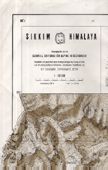
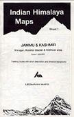
Indian Himalaya - Jammu & Kashmir. West Col Productions.
$19.99
64-7675-1
Srinagar, Kolohol, Kishtwar. 1:200,000.
$19.99
64-7675-2
Kargil, Zanskar, Nun-Kun. 1:200,000.
$19.99
64-7675-3
Nubra Valley, Leh, Zanskar. 1:200,000. 2004.
$19.99
64-7675-4
Chamba, Dhauladhar, West Lahul. 1:200,000.
$19.99
64-7675-5
Kulu, Parbati, Central Lahul. 1:200,000.
$19.99
64-7675-6
Kalpa-Kinnaur, Spiti, Simia. 1:200,000.
$19.99
64-7675-7
Garhwal, Gangotri, Mussourie. 1:200,000. 1987.
$19.99
64-7675-8
Kumaon, Badrinath, Nanda Devi. 1:200,000.
$21.95
64-7675-9
Rupshu, Tso Moriri, Pangong Tso. 1:200,000. 2004.
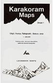
Karakoram Himalaya. West Col Productions.
65-1372-1
Karakoram Himalayas #1 - Gilgit, Hunza, Rakaposhi, Batura. 1:200,000. Out of print and not available.
India Trekking Map Series. 1:250,000. Survey of India. These shaded relief maps show roads, towns and villages, trails, spot elevations, and more. The lack of contour lines makes these less useful than the West Col maps, but they offer the official public maps for the various regions.
$6.95
64-7667-01
(India) Trekking Map - Badari-Kedar. 1:250,000. 1991. Covers between Dehra Dun and Badarinath. Overlaps slightly to the SW of the Badarinath sheet listed above. Fully indexed with some descriptive text.
$6.95
64-7667-02
(India) Trekking Map - Badarinath. 1:250,000. 1986. Located to the SE of the Shimla Hills sheet above.
$6.95
64-7667-04
(India) Trekking Map - Kullu Valley. 1:250,000. 1990. Covers from Darmshala to Kullu. Fully indexed with descriptive text in the margins. ;
$6.95
64-7667-05
(India) Trekking Map - Kumaun Hills. 1:250,000. 1991. Fully indexed with descriptive text in the margins. Overlaps to SE with the Badari-Kedar map. ;
$6.95
64-7667-06
(India) Trekking Map - Shimla Hills. 1:250,000. 1996. This sheet has extensive descriptive text in the margins. ;

 New atlas
 Shows areas covered by the atlas
 Superb travel or wall map!
 Index of coverage of the map.
 Sample of a 6 x 6" section of the map
 Sample #2
 Thumbnail image of the map
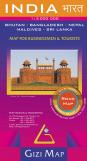
 Sample of the map detail
 Thumbnail image of the map
 Waterproof!
 Sample detail of the India Travel Map
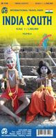 Waterproof!
 Front of the India South travel map.
 Reverse of the India South travel map.
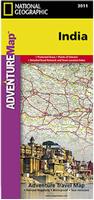 Waterproof!
 Front of the India travel map
 Reverse of the India travel map
 Sample detail of the India travel map
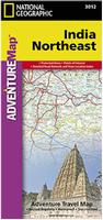 Waterproof!
 Front of the Northeast India travel map
 Reverse of the Northeast India travel map
 Sample detail of the Northeast India travel map
 India Region Index


 Sample from the Mumbai street atlas
 Sample detail of the Delhi street atlas
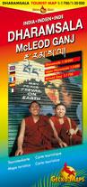
 Sample #1
 Sample #2

 Sample detail of the Darjiling city map
 Sample #1 from the Kolkata street map
 Sample #2 from the Kolkata street map
 Index of state road map guidebooks
 Front of the Tamil Nadu state road map
 Now out of print, limited stock left.
 Index map
 Sample of a map from the series
 Northern India index map.
 Central India index map.
 Southern India index map.
 Northeastern India index map.
 Northern India index map.
 Sample of the map detail.
 Thumbnail of the entire map


 Sketch map showing the coverage of the three Ladakh maps
 Image of the front of the Ladakh map
 Image of the reverse of the Ladakh map
 Sketch map showing area covered by each sheet
 Sample image of the map detail.