|
|
Kos Pocket Map. 1:65,000. Freytag Berndt.
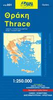
Greece Prefecture Series. Orama. These are excellent road maps of the individual prefectures in Greece. Bilingual.
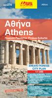
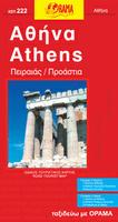
Athens Street Maps
(Greece) Athens City Topographic Map. 1:25,000. Hellenic Military Geographic Service. A good topographic map of Athens. The street detail is not as good as a city street map, but the topographic detail around the city is excellent. In Greek.
Athens City Maps. Road Editions. Two more detailed maps of northern and southern Athens. Includes all of the historic sites and the Olympic village.
Street Maps of Greek Cities
Thessaloniki City Map. 1:10,500. Leadercom. Detailed street map of Thessaloniki with a 30-page street index booklet. In Greek only.
Greece City Topographic Maps. 1:10,000. Soviet government. These maps are regular topographic maps that include contour lines, power lines, rail/trolley lines, etc. They offer coverage of cities for which we have not been able to obtain standard city street maps. In Russian. NOTE: many of these are available only as digital raster files at $50/sheet.
Greece Hiking GuidebooksGreece Hiking/Trekking Guides Connects you to the Greece Hiking/Trekking Guides by Cicerone Press listings Greece Topographic Quadrangle MapsTopographic maps issued by the Greek government are normally restricted by the Greek military and rarely available. We are pleased to announce that we have received the 1:250,000 topographic maps. In the meantime, the soviet military-issue series offer a good alternative. Greece TPC Chart Topographic Maps. 1:500,000. NGA/NIMA. This series of maps, published by the US military, offers the best buy on topographic coverage. These sheets are aeronautical maps on a topographic base map, with contour lines, lat-long grid, UTM coordinates, and more. In English.
Greece Topographic Maps. 1:1,000,000. HMGS. This 5-sheet set is the only topographic coverage of Greece currently available for export. The maps have 200 meter contour intervals.
Physical Map of Greece. 1:1,000,000. Hellenic Military Geographic Service. 1985. One sheet, in color. An attractive map using hypsometric tints to show elevation. The map shows 1st class political boundaries and some tourist information such as campsites, hot springs, etc. Bilingual English/Greek.
Road Maps of the Greek Islands
Hiking Maps of the Greek Mountains
Greece Regional Physical Maps. Freytag Berndt. Shaded relief maps with tourist information on the flip side. Map size varies. Multilingual.
Recommended
Greece Geologic and Thematic Maps and AtlasesGreece Geologic Quadrangle Maps. 1:50,000. Greece Institute of Geology and Mineral Exploration. These maps, covering the Greek islands along the Greece-Turkey border, have just been declassified. Most are Greek only; a few are bilingual.
Geologic Map of Crete. 1:200,000. 1977. Greece Institute of Geology and Mineral Exploration. In two sheets with bilingual legend, measuring 168 x 70 cm.
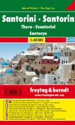
Geologic Map of Thira (Santorini). 1:50,000. 1980. Greece Institute of Geology and Mineral Exploration. Bilingual.
|
|||||||||||||||||||||||||||||||||||||||||||||||||||||||||||||||||||||||||||||||||||||||||||||||||||||||||||||||||||||||||||||||||||||||||||||||||||||||||||||||||||||||||||||||||||||||||||||||||||||||||||||||||||||||||||||||||||||||||||||||||||||||||||||||||||||||||||||||||||||||||||||||||||||||||||||||||||||||||||||||||||||||||||||||||||||||||||||||||||||||||||||||||||||||||||||||||||||||||||||||||||||||||||||||||||||||||||||||||||||||||||||||||||||||||||||||||||||||||||||||||||||||||||||||||||||||||||||||||||||||||||||||||||||||||||||||||||||||||||||||||||||||||||||||||||||||||||||||||||||||||||||||||||||||||||||||||||||||||||||||||||||||||||||||||||||||||||||||||||||||||||||||||||||||||||||||||||||||||||||||||||||||||||||||||||||||||||||||||||||||||||||||||||||||||||||||||||||||||||||||||||||||||||||||||||||||||||||||||||||||||||||||||||||||||||||||||||||||||||||||||||||||||||||||||||||||||||||||||||||||||||||||||||||||||||||||||||||||||||||||||||||||||||||||||||||||||||||||||||||||
 Greece Maps
 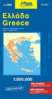 Recommended!
 Sample detail of the Greece road map
 Waterproof!


 Sample detail of the Greece regional maps
 Sketch map showing the coverage of each map in this series.
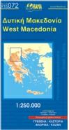
 Sample detail of the Greece regional maps
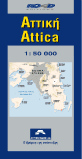


 Sample of a TPC chart


 Waterproof!
 Sample detail of the Santorini hiking map
 Recommended!


 Sample of the panoramic map
 Sample #1 of the main topographic map
 Sample #2 of the main topographic map
 Sample of the inset city map
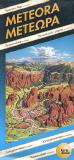 Limited stock!
 Sample of the panoramic map
 Sample of the inset maps
 Greece Flags