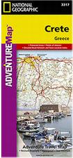
Waterproof! Crete Travel Maps. 1:710,000. National Geographic Maps. The front side of the Greece map shows the northern region of the country with Macedonia and Bulgaria to the north, Albania to the west and Turkey to the east. There are insets detailing the islands of Kerkyra and Zakynthos. The reverse side of the map details the southern portion of Greece showing the islands down to Crete. Map size is 26 x 38" when unfolded.
64-66919N
1 sheet, folded.
$11.95
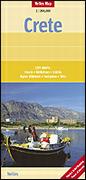
Crete Tourist Map. 1:200,000. Nelles Verlag. Detailed road map of this popular tourist destination. The map uses shaded relief to indicate elevation, symbols to locate tourist sites and services, and much more. Multilingual. Map size is 71 x 50 cm.
64-66917
1 sheet, folded.
$13.95
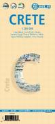
Laminated Crete Tourist Map. 1:200,000. Borch. Laminated, folded travel map. Our soft-laminated folded map of Crete in the 9th edition shows: Crete (West) 1:200 000, Crete (East) 1:200 000, Iraklio 1:7 000, Agios Nikolaos 1:6 000, Chania 1:10 000, Ierapetra 1:10 000, Rethimno 1:9 000, Samaria Gorge 1:90 000, Sitia 1:7 000 and Gavdos 1:200 000. Borch maps are easy to fold, durable and water-repellent with a wipeable surface. Borch Maps show hotels, museums, monuments, markets, top sights and points of interest, useful statistics, conversion charts for temperatures, weights and measurements, climate charts showing temperatures, sunshine hours, precipitation and humidity, overview maps, time zones, and much more...
Sample detail from the Borch Crete travel map Image of the front of the Borch Crete travel map Image of the reverse of the Borch Crete travel map
64-66918
1 laminated sheet, folded.
$10.95
The High Mountains of Crete Hiking Guide. Cicerone Press. Guidebook to walking the high mountains of Crete with its dramatic gorges and numerous peaks rising to over 2100m, high mountain plains, forested crags, massive cliffs and remote beaches. In addition to many walks and trekking routes in the White Mountains, this new edition covers Mount Ida and the Lassithi Mountains.
Sample of one of the overview trail maps. Sketch map showing areas covered by this guide
64-66951WM
guidebook.
$24.95
Western Crete Hiking Guide. Cicerone Press. Kissamos, situated in western Crete, offers a rich variety of landscape for the walker to explore. A wide selection of mountain treks, ridge and hill walks, gorge explorations, cliff and coastal walks, and rambles from village to village and through the many archaeological wonders Crete has to offer. Walks are around the Kissamos and Selinos areas. 259 pages.
Shows locations of described hikes in western Crete. Sample of a walking map.
 Waterproof!

 Laminated
 Sample detail from the Borch Crete travel map
 Image of the front of the Borch Crete travel map
 Image of the reverse of the Borch Crete travel map
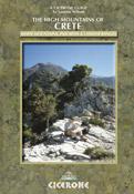
 Sample of one of the overview trail maps.
 Sketch map showing areas covered by this guide
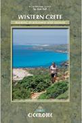
 Shows locations of described hikes in western Crete.
 Sample of a walking map.