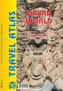
New title! Mayan World road atlas. Variable scales. ITMB.
The Mayas occupied the Yucatan Peninsula and spread inland through modern-day Belize, Guatemala, and Honduras all the way to El Salvador. This atlas covers all these areas: Mexico from Tabasco and Chiapas, through the Yucatan provinces of Campeche, Quintana Roo and Yucatan (1:500,000), all of Belize at 1:250,000, all of Guatemala at 1:470,000, all of Honduras at 1:750,000, and all of El Salvador at 1:250,000. The advantage of this travel atlas is that all of these countries are available in one convenient-to-carry book. Each known Mayan site is marked and named (there are more than 400) in magenta. City maps of Antigua Guatemala, Guatemala City, San Salvador, Tegucigalpa, and Belize City are included in this comprehensive atlas. ISBN 9781553411093.
Sample detail of the Mayan World road atlas
$16.95
65-0195MR
Atlas.
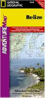
Waterproof! Belize Adventure Map. National Geographic Maps.
National Geographic's Belize AdventureMap details the country's numerous protected areas including its National Parks, preserves, wildlife sanctuaries, archeological reserves, marine reserves, spawning grounds and private reserves. UNESCO World Heritage sites and the locations of archeological ruins are highlighted, along with locations of popular places for diving, surfing, fishing, and more.
A detailed road network, plus inset maps of Belize City and San Pedro, including the location of key infrastructure and pointsof-interest, make the Belize AdventureMap ideal for touring both urban and remote destinations.
The reverse of the Belize AdventureMap, contains detailed interpretive information to Belize's Blue Hole, the ruins of Tikal in Guatemala, The Barrier Reef System, plus information on the many cultures, history, and districts of Belize. Printed on waterproof, tear-resistant synthetic paper.
Sample of the Belize map detail. Image of the entire Belize map
$11.95
64-19988
1 sheet, folded.
Belize Travel Map. Borch Verlag.
Borch's soft-laminated folded map of Belize shows Belize 1:500,000, Belize City 1:13,000; Yucatan Peninsula 1:2,750,000; Ambergris Caye & Caye Caulker 1:250,000; Altun Ha 1:3,000; Cahal Pech 1:2,500; Caracol 1:7,000; El Pilar 1:8,000; Lamanai 1:9,000; Lubaantun 1:5,000; Nim Li Punit 1:7,000; Xunantunich 1:7,000 and Belize administrative map. Borch Maps are easy to fold, durable and water-repellent with a wipeable surface. Borch Maps show hotels, museums, monuments, markets, public transport, top sights and points of interest, useful statistics, conversion charts for temperatures, weights and measurements, climate charts showing temperatures, sunshine hours, precipitation and humidity, overview maps, and much more... ISBN 9783866090484.
Sample detail of the Belize Travel Map Front of the Belize Travel Map Reverse of the Belize Travel Map
$11.95
64-19990
1 sheet, folded.
Belize Travel Map. 1:350,000. ITMB.
Good travel/physical map; the most detailed single-sheet map of the country.
$12.95
64-19989
1 sheet, folded
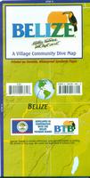
Waterproof Belize Dive Map. Franko's Maps.
This map highlights the dive sites of the Belize coast and the islands of the Reef. The map also shows the road network of Belize with the villages and points of interest. The reverse side includes detailed maps of Ambergris Caye, the Atolls, and Placencia Reef.
Sample detail from Belize Dive Map. Image of the front of the Belize Dive Map.
$8.99
64-19985
1 sheet, folded.
Recommended! Ambergris Cay Topographic/Physical Map. 1:50,000. OS. 1990.
Illustrates this well-known scuba diving region. Available as a folded tourist edition with tourist information overprinted.
$9.95
64-19994
1 sheet, folded
Belize Topographic Maps
BelizeTopographic Quadrangle Map. 1:50,000. 1989-95. Ordnance Survey (International) (4499), Britain. This series offers complete coverage of Belize. These are standard topographic maps, in English. Available only as color plots.

 New title!
 Sample detail of the Mayan World road atlas
 Waterproof!
 Sample of the Belize map detail.
 Image of the entire Belize map
 Sample detail of the Belize Travel Map
 Front of the Belize Travel Map
 Reverse of the Belize Travel Map
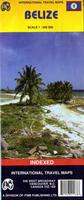

 Waterproof
 Sample detail from Belize Dive Map.
 Image of the front of the Belize Dive Map.
 Sample detail of a Belize 1:50,000 topo map