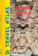
Mayan World road atlas. Variable scales. ITMB. The Mayas occupied the Yucatan Peninsula and spread inland through modern-day Belize, Guatemala, and Honduras all the way to El Salvador. This atlas covers all these areas: Mexico from Tabasco and Chiapas, through the Yucatan provinces of Campeche, Quintana Roo and Yucatan (1:500,000), all of Belize at 1:250,000, all of Guatemala at 1:470,000, all of Honduras at 1:750,000, and all of El Salvador at 1:250,000. The advantage of this travel atlas is that all of these countries are available in one convenient-to-carry book. Each known Mayan site is marked and named (there are more than 400) in magenta. City maps of Antigua Guatemala, Guatemala City, San Salvador, Tegucigalpa, and Belize City are included in this comprehensive atlas. ISBN 9781553411093.
Sample detail of the Mayan World road atlas
65-0195MR
Atlas.
$16.95
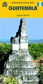
Waterproof! Guatemala Travel Map. 1:470,000. ITMB, Vancouver.
Detailed road map of Guatemala. The map uses colored hypsometric tinting to show elevation. Symbols locate tourist sites and services and distances are shown along the major roads. There are small inset maps showing the main streets in Guatemala City and Antigua.
Thumbnail map of the front of the map Thumbnail map of the reverse of the map
64-6889
1 sheet, folded
$12.95
Waterproof! Guatemala & Belize Road Map. 1:500,000. National Geographic Maps.
This map combines topographic mapping with road and tourist detail. The road information is clear and elevation is shown using contours, spot heights and altitude shading. The map shows six different types of roads, highlighting scenic routes, places of interest, archaeological sites, monasteries, monuments and viewpoints. In English.
Sample of the detail of the Guatemala map.
64-68905
1 sheet, folded.
$11.95
Guatemala City Topographic Maps. NGA (NIMA) and Guatemala IGN. These are large-scale topographic maps covering major cities in Guatemala. While the topography is quite detailed, most but not all of the streets are shown or named. In Spanish or Spanish/English.
64-6892C
Chiquimula. 1:7,500.
$7.95
64-6892G
Guatemala City city map. 1:15,000. 1996. 4 sheets.
Guatemala 1:250,000 Topographic Maps - click here for itemized listings. 1:250,000. IGM. The 12 sheets give complete coverage of Guatemala. In Spanish. These sheets are difficult to get and we are often out of this series. Please note that some sheets
contain only small amounts of land mass and are included on one sheet. As is normal, no information is given on the maps or land outside the country borders. Many of these are co-produced with the NGA.
Summary Index.
Guatemala Thematic Maps
Guatemala Climate Map (Mapa Climatológico Preliminar de la República de Guatemala). 1:1,000,000. IGM. 1975. One sheet showing climate zones based on the Thornthwaite system. In Spanish.
64-6835
Each, rolled
$12.95
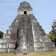
Guatemala Archeology Map (Mapa Arqueológico de la República de Guatemala). 1:500,000. IGM. 1991. Four sheets showing locations of known archeological sites in Guatemala. In Spanish.
64-6839
4 sheets, rolled
$32.95
Guatemala School Map (Mapa Escolar de la República Guatemala). 1:500,000. IGN, 2003. Available in both physical and political versions. AFour sheets, in Spanish.
64-6849
Physical Map. 1990. A shaded relief map that shows roads, archeological sites, etc.
 Sample detail of the Mayan World road atlas
 Waterproof!
 Thumbnail map of the front of the map
 Thumbnail map of the reverse of the map
 Waterproof!
 Sample of the detail of the Guatemala map.
 6 x 6" sample image
 Summary Index.
 Northern Guatemala index map. Large file.
 Southern Guatemala index map. Large file.
 Summary Index.