Colorado - U.S. Forest Service Maps
Return to main Colorado Map listings.
Sample from the Tahoe map from the same series
$7.95
62-57811
Colorado Wilderness Guide Map.
1:1,000,000.
$14.95
62-57800
Arapaho & Roosevelt N.F.
1:126,720.
$16.99
62-57801
Comanche National Grassland.
1:126,720.
$15.99
62-57816
Grand Mesa National Forest Winter Recreation map.
1:126,720. Waterproof. Out of print and only limitred stock left.
$15.99
62-57802
Grand Mesa National Forest - Grand Valley Ranger District Map.
1:101,376. 2015. Waterproof.
$14.95
62-57803
Gunnison Basin Area.
1:126,720.
$16.99
62-80779
(CO/NV) Humboldt-Toiyabe National Foreste - Spring Mountains NRA & Las Vegas RD map.
1:1:126,720.
$14.95
62-57804
Pawnee National Grassland.
1:126,720.
$14.95
62-57805
Pike National Forest.
1:126,720.
$14.95
62-57813
Rocky Mountain Region N.F. & Grasslands.
1:2,000,000.
$14.99
62-57818
Rio Grande National Forest - Conejos Ranger District Map.
1:84,480.
$14.99
62-57819
Rio Grande National Forest - Divide Ranger District map.
1:84,480.
$15.99
62-57817
Rio Grande National Forest - Saguache Ranger District map.
1:126,720. 2012. Waterproof.
$14.95
62-57806
Routt National Forest.
1:126,720.
$15.99
62-57807
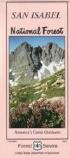
San Isabel National Forest.
1:126,720.
$16.99
62-57808
San Juan National Forest.
1:126,720.
$19.99
62-57815
Uncompahgre National Forest - Mountain Division.
1:63,360. 2017. Waterproof.
$16.95
62-57814
Uncompahgre National Forest - Plateau Division.
1:63,360. Waterproof.
$14.95
62-57809
White River National Forest, part of Arapaho N.F.
1:126,720.
© Copyright 2026 East View Companies, Inc.
5130 Industrial Street, Suite 100, Maple Plain, MN 55359-8005
All Rights Reserved
For more information please
Contact Us
 Sample from the Tahoe map from the same series