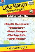
South Carolina Fishing Maps by Fishing Hot Spots are superb maps showing the lake bottoms for hundreds of lakes and rivers across the USA. These maps are printed on either kimdura or Hop-syn (both tear-resistent waterproof synthetic materials), making them nearly indestructible. The maps show lake bottom contours, shoreline features, roads leading to the lakes, boating facilities along the lake shore, and much more.
Fishing Map sample Enlargement
62-6293-L650
Clarks Hill Lake (J. Strom Thurmond)(GA/SC)
$14.95
62-9293-L659
Lake Greenwood. Temporarily out of stock. A new edition is due 4/1/2012.
$14.95
62-6293-L394
Hartwell East.
$14.95
62-6293-L395
Hartwell West.
$14.95
62-9293-L654
Lake Marion (Santee Cooper)
$14.95
62-9293-L656
Lake Moultrie (Santee Cooper)
$14.95
62-9293-L655
Lake Murray
$14.95
62-6293-L649
Russell Lake (GA/SC)
$14.95
62-8593-AL850
Lake Wylie (SC/NC)
$14.95
Fishing Maps for Georgia and South Carolina by AID Fishing Maps
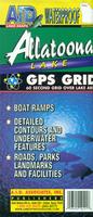
Georgia and South Carolina Fishing Maps. A.I.D. Associates Publishers, 2011. A.I.D. Lake Maps have up-to-date navigation markers, road systems, access points and public areas. They locate the area's goods and services featuring full-color photographs and information on popular Resorts, Marinas, Motels, Bait and Tackle stores, Restaurants and other businesses, as shown on the facilities link. Waterproof and tear resistant. The maps have a 60 second grid over the lake area.
Sample map detail from the Allatoona Lake fishing map
62-62931-HW
(GA/SC) Hartwell West fishing map.
$12.99
62-62931-WW
(GA/SC) Weiss Lake and West Point fishing map.
$12.99
Navionics Fishing Maps. Using advanced computerized hydrographic survey technology, Navionics collected thousands of man-hours of data including water depth, lake bottom characteristics, sonar imagery and global positioning points for selected lakes across the country. The data, ranging from several hundred thousand to several million data points per map, is edited to create highly detailed lake bottom fishing maps.
Features of the lake maps.
Color shaded depth contours.
Major routes and highways.
Double-sided with detailed area insets.
Area points-of-interest.
Top-down satellite photo overlay.
Tear resistant.
3D lake overview.
Water resistant or water proof.
Measures approximately 24" x 36" - folds to small booklet size.
Most popular lakes have multiple sheets for the most detailed coverage.
Buy
Sample
Catalog #
Title
Price
62-92933-HA
(SC) Hartwell Lake fishing map set. 3 sheets.
$49.99
62-92933-RU
(SC) Richard B. Russell Lake fishing map set. 3 sheets.
$36.99
62-92933-TH
(SC) J. Strom Thurmond Lake fishing map set. 3 sheets.
$36.99
62-92933-WY
(SC) Lake Wylie fishing map.
$19.99
South Carolina Fishing Maps by Kingfisher Maps. These maps show the topography of the lakebottoms and locations of shore facilities and lake buoys. Folded maps printed on Polyart synthetic "paper," making them nearly indestructible. With GPS coordinate information.
62-9293-SB
(SC) Saluda fishing map. Single-sided, 11" x 17".
$11.99
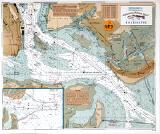
Mid-Atlantic Coastal Fishing Maps. Sealake Products. Sealake, best known for its shipwreck charts (see Mid-Atlantic Shipwreck Charts), is producing a series of laminated coastal fishing charts with data overlain on nautical chart base maps.
These fishing charts are reproductions of NOAA charts or aerial photographs (Murrells Inlet and White Oak River) and are frequently updated with the latest buoy and channel information.
Many show "BiteZones" for trout, flounder, redfish, spots, bluefish, and others.
The charts are magnified and show insets for better readability.
They are also a handy size, perfect for day to day use on all boats.
Many charts show the GPS numbers of points, "BiteZones," creek entrances and creek junctions.
Valuable fishing and area information is compiled with the help of local fishermen and guides.
Many chart borders also have a latitude and longitude scale.
62-92932-BU
Bulls Bay. McClellanville area.
$15.99
62-85932-CM
Cape Fear to Murrell's Inlet.
$15.99
62-92932-CH
Charleston.
$16.99
62-92932-CI
Charleston Harbor to Price Inlet.
$14.95
62-92932-ED
Edisto River (North and South).
$16.99
62-92932-LI
Lighthouse Inlet to Stono Inlet. Charleston area, Kiawah River, Elliot Cut.
 South Carolina Fishing Maps by Fishing Hot Spots are superb maps showing the lake bottoms for hundreds of lakes and rivers across the USA. These maps are printed on either kimdura or Hop-syn (both tear-resistent waterproof synthetic materials), making them nearly indestructible. The maps show lake bottom contours, shoreline features, roads leading to the lakes, boating facilities along the lake shore, and much more.
 Fishing Map sample
 Enlargement
 Sample map detail from the Allatoona Lake fishing map
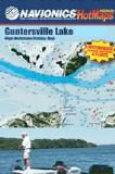


 South Carolina Fishing Maps by Kingfisher Maps. These maps show the topography of the lakebottoms and locations of shore facilities and lake buoys. Folded maps printed on Polyart synthetic "paper," making them nearly indestructible. With GPS coordinate information.


 Mid-Atlantic Coastal Fishing Maps. Sealake Products. Sealake, best known for its shipwreck charts (see


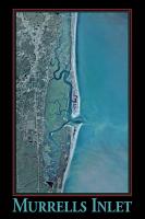
 image of the entire Murrels Inlet poster
 Sample of the poster detail