Click here for our complete cycling maps listings for the USA and Europe.
Bicycling Guide of Iowa. American Bike Trails. Covers over 100 trails. Softcover.
Most guides & journals in the series include:
Directions to Trail sites & accesses
Location & Distance to nearby Communities
Trail Distances, general setting
Conditions & Facilities
Points of interest
State, Sectional & Selective County Overviews
Riding Tips, Contacts, Alternate Trail Uses & Bike Routes
City & County-to-Trail Cross-References
Logs for recording your notes on the rides and trails
62-67801
Guide.
$14.95
Iowa Bicycling Map. American Bike Trails. Includes detailed maps of Des Moines, Waterloo/Cedar Falls, and Quad Cities.
Most maps in the series include:
Trail to Map index
City to Trail index
County to Trail index
Trail Facts: Length, surface, biking type (road or mountain bike)
Trail settings - wooded, prairie, open, wetlands, etc.
Alternate trail uses - hiking, in-line skating, equestrian, etc.
Trail facilities - water, toilets, food, camping, etc.
Trail coordinates - latitudes/longitudes
Trail notes - general descriptions
62-6780
1 sheet, folded
$6.95
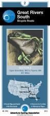
Great Rivers South Route
Great Rivers South Route. Adventure Cycling Association. 1,340 miles - Explore the Mississippi on a route that
would make Tom Sawyer and Huck Finn proud. Along the way visit the jumping-off spot of the
Mormons' long trek west, and enjoy some great cycling in the Ozarks, and along the Natchez Trace.
Route map.
62-2230-GRS
Muscatine, IA, to St. Francisville, LA. Set of 3 maps. 10% discount!
$45.22
62-2230-GRS1
Muscatine, IA, to Cape Girardeau, MO.
$16.75
62-2230-GRS2
Cape Girardeau, MO, to Tupelo, MS.
$16.75
62-2230-GRS3
Tupelo, MS, to St. Francisville, LA.
$16.75
Lewis & Clark Trail Route
Lewis & Clark Bicycle Trail. Adventure Cycling Association. 4,618 miles. Since 1998, Adventure Cycling Association has been compiling a new and ambitious set of bicycling maps following the route of Lewis and Clark. The Lewis & Clark Bicycle Trail was born of a desire to offer bicyclists a way to celebrate the bicentennial anniversary of the Corps of Discovery's journey, which began in 1804.
The Lewis & Clark Bicycle Trail's 4,618 miles cross nine mountain passes, pass through four national parks and monuments, overlook dozens of rivers in addition to the Missouri and the Columbia, and promise you views of bison, elk, deer, antelope and other wildlife. The Trail will be the best possible way to experience the magnificent landscapes witnessed by Lewis and Clark: all of the sense of wonder, all of the adventure, but a lot less inconvenience and hardship.
Our main 1804 westward route of Lewis and Clark is 3,254 miles in length, but overall the maps will cover 4,618 miles. The maps have been divided into eight sections covering both the westbound and eastbound routes taken by the Corps. There will be some mountain biking options available. Services are sometimes few and far between, making this one of our most challenging routes.
Route map.
62-2230-LCS
Hanford, IL to Astoria, OR & back. Set of 8 maps. 10% discount!
$120.60
62-2230-LC1
Hartford, IL to Council Bluffs, IA (555 miles).
$16.75
62-2230-LC2
Council Bluffs, IA to Pierre, SD (485.5 miles).
$16.75
62-2230-LC3
Pierre, SD to Williston, ND (510.5 miles).
$16.75
62-2230-LC4
Williston, ND to Great Falls, MT (538.5 miles).
$16.75
62-2230-LC5
Great Falls, MT to Missoula, MT (479.5 miles).
$16.75
62-2230-LC6
Missoula, MT to Clarkston, WA (242.5 miles), Lolo Trail (145.3 miles), Blackfoot Option (187.5 miles).
$16.75
62-2230-LC7
Clarkston, WA to Astoria, OR (442.5 miles).
$16.75
62-2230-LC8
Three Forks, MT to Williston, ND (506 miles).
$16.75
Northern Tier Route
Northern Tier Route Series. Adventure Cycling Association. 4,315 miles -- From the Puget Sound to fishing villages in Maine, the Northern Tier crosses three mountain ranges - the Cascades, Rockies and
Adirondacks. Along the way the route passes through Glacier National Park, the headwaters of the Mississippi and Amish country. Discover the beauty of America by crossing the country on the Northern Tier.
Route map.
62-2230-NT
Anacortes, WA, to Bar Harbor, ME. Set of 11 maps. 10% discount!
$165.82
62-2230-NT01
Anacortes, WA, to Sandpoint, ID
$16.75
62-2230-NT02
Sandpoint, ID, to Cut Bank, MT
$16.75
62-2230-NT03
Cut Bank, MT, to Minot, ND
$16.75
62-2230-NT04
Minot, ND, to Fargo, ND
$16.75
62-2230-NT05
Fargo, ND, to Grand Rapids, MN
$16.75
62-2230-NT06
Grand Rapids, MN, to Stillwater, MN
$16.75
62-2230-NT07
Stillwater, MN, to Muscatine, IA
$16.75
62-2230-NT08
Muscatine, IA, to Monroeville, IN
$16.75
62-2230-NT09
Monroeville, IN, to Lackawanna, NY
$16.75
62-2230-NT10
Lackawanna, NY, to Ticonderoga, NY
$16.75
62-2230-NT11
Ticonderoga, NY, to Bar Harbor, ME
$16.75
Underground Railroad Bike Route
Historic Underground Railroad Bike Route. Adventure Cycling Association. Mobile, AL to Owen Sound, Ontario. 2058 miles. The Underground Railroad Bicycle Route honors the bravery of those that fled bondage and those that provided shelter. This route passes points of interest and historic sites along a 2,100-mile corridor. Beginning in Mobile, Alabama - a busy port for slavery during the pre-civil war era - the route goes north following rivers through Alabama, Mississippi, Tennessee, and Kentucky. Waterways, as well as the North Star, were often used by freedom seekers as a guide in their journeys to escape slavery.
Upon crossing into Ohio, the route leaves the river to head inland toward Lake Erie and enters Canada at the Peace Bridge near Buffalo, New York. In Ontario, the route circumvents the shores of Lake Ontario and ends at Owen Sound, a town founded by freedom seekers 150 years ago.
Route map.
62-2230-UR
Mobile, AL to Owen Sound, Ontario. Set of 5 maps. 10% discount!


 Route map.
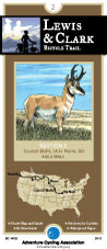
 Route map.
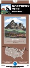
 Route map.
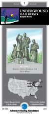
 Route map.


