Click here for our complete cycling maps listings for the USA and Europe.
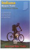
Indiana Bicycling Map. American Bike Trails. Includes info on 90 rides in Indiana. This series of maps offers full state coverage of several mid-western & eastern states.
Trail to Map index
City & County to Trail index
Trail Facts & Settings: Length, surface, biking type (road or mountain bike), wooded, prairie, open, etc.
Trail facilities - water, toilets, food, camping, etc.
Indiana Bicycling Trails guidebook. American Bike Trails. Includes info on over 70 trails throughout Indiana & Kentucky, including both surfaced and mountain biking trails.
Illustrated, in color, easy to reference and use
Directions to trails sites and accesses
Locations and distances to nearby communities
Trail distances, general setting, conditions
Points of interest
State, sectional and selective county overviews
Riding tips
Contacts for additional information
Alternate trails and uses
62-6686
Guide.
$16.95
North Lakes Bicycle Route
North Lakes Bicycle Route. Adventure Cycling Association. 1,095 miles - This loop around northern Lake Michigan features a ferry ride across the lake, miles of beautiful shore line, and the great forests of
Michigan's Upper Peninsula. The route offers an interesting alternative for Northern Tier riders who want to experience the beauty of the Great Lakes.
Route map. Lake Erie Connector Route sketch map.
62-2230-NL
Osceola, WI, to Monroeville, IN. Set of 4 maps. 10% discount!
$60.30
62-2230-NL1
Osceola, WI, to Escanaba, MI
$16.75
62-2230-NL2
Escanaba, MI, to Mackinaw City, MI (and Manitowoc alternate route).
$16.75
62-2230-NL3
Mackinaw City, MI, to Monroeville, IN
$16.75
62-2230-NL4
Lake Erie Connector. Luther, MI to Fort Erie, ON.
$16.75
Northern Tier Route
Northern Tier Route Series. Adventure Cycling Association. 4,315 miles -- From the Puget Sound to fishing villages in Maine, the Northern Tier crosses three mountain ranges - the Cascades, Rockies and
Adirondacks. Along the way the route passes through Glacier National Park, the headwaters of the Mississippi and Amish country. Discover the beauty of America by crossing the country on the Northern Tier.
Route map.
62-2230-NT
Anacortes, WA, to Bar Harbor, ME. Set of 11 maps. 10% discount!
$165.82
62-2230-NT01
Anacortes, WA, to Sandpoint, ID
$16.75
62-2230-NT02
Sandpoint, ID, to Cut Bank, MT
$16.75
62-2230-NT03
Cut Bank, MT, to Minot, ND
$16.75
62-2230-NT04
Minot, ND, to Fargo, ND
$16.75
62-2230-NT05
Fargo, ND, to Grand Rapids, MN
$16.75
62-2230-NT06
Grand Rapids, MN, to Stillwater, MN
$16.75
62-2230-NT07
Stillwater, MN, to Muscatine, IA
$16.75
62-2230-NT08
Muscatine, IA, to Monroeville, IN
$16.75
62-2230-NT09
Monroeville, IN, to Lackawanna, NY
$16.75
62-2230-NT10
Lackawanna, NY, to Ticonderoga, NY
$16.75
62-2230-NT11
Ticonderoga, NY, to Bar Harbor, ME
$16.75
Underground Railroad Bike Route
Historic Underground Railroad Bike Route. Adventure Cycling Association. Mobile, AL to Owen Sound, Ontario. 2058 miles. The Underground Railroad Bicycle Route honors the bravery of those that fled bondage and those that provided shelter. This route passes points of interest and historic sites along a 2,100-mile corridor. Beginning in Mobile, Alabama - a busy port for slavery during the pre-civil war era - the route goes north following rivers through Alabama, Mississippi, Tennessee, and Kentucky. Waterways, as well as the North Star, were often used by freedom seekers as a guide in their journeys to escape slavery.
Upon crossing into Ohio, the route leaves the river to head inland toward Lake Erie and enters Canada at the Peace Bridge near Buffalo, New York. In Ontario, the route circumvents the shores of Lake Ontario and ends at Owen Sound, a town founded by freedom seekers 150 years ago.
Route map.
62-2230-UR
Mobile, AL to Owen Sound, Ontario. Set of 5 maps. 10% discount!
 Sample of the map detail from the Iowa map in the same series.


 Route map.
 Lake Erie Connector Route sketch map.
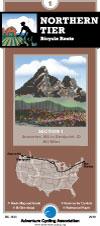
 Route map.
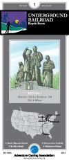
 Route map.


