Tajikistan - 3 map set. 1:500,000. Gecko Maps, 2004-2008. This is an excellent 1:500,000 3-sheet topographic map set of Tajikistan. The maps contain:
Hill-shading with hypsometrical tints
200m contour lines
Include large areas of Uzbekistan, Kyrgyzstan, Afghanistan, and China.
Updated road network with 5 levels of road classification.
City maps of Khujand, Dushanbe, Khorog, Murghab
Overview map of Central Asia
Reverse side of all three maps contain extensive information about Tajikistan and the Pamirs, such as an introduction to the history of the region, cultural aspects, local flora and fauna and suggested itineraries.
The Pamirs - Eastern Tajikistan map. Same map described below. 2004.
$16.99
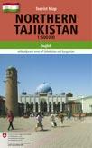
The Pamirs - A Tourist Map of Gorno Badakhshan-Tajikistan (Eastern Tajikistan). 1:500,000. Gecko Maps, 2004. This is the third map in the 3-map set covering all of Tajikistan. This is an excellent 1:500,000 topographic map of the Western and Eastern Pamirs with lots of background information on the reverse of the sheet. Information includes an introduction to the history of the region, cultural aspects, local flora and fauna and suggested itineraries. Also included are street plans of Khorog and Murghab. The map shows altitude through 200m contour lines, five different types of roads including trekking routes, and towns and villages are marked according to size of population. Natural and cultural sites are shown as well as general facilities.
NOTE: This is the same map as the Eastern Tajikistan map just above and completes the 3-sheet set.
(Tajikistan) Fann Mountains. 1:100,000. West Col Productions, 1994.
65-9971
Each, folded
$23.95
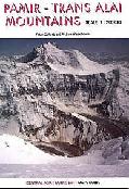
(Tajikistan) Pamir-Trans Alai Mts. 1:200,000. West Col Productions.
65-9970
Each, folded
$23.95
Tajikistan Travel & City Maps
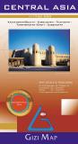
Central Asia Geographical Map - Southern Kazakhstan, Kyrgyzstan, Tajikistan, Turkmenistan (East), Uzbekistan. 1:1,750,000. GiziMap, Budapest. This is a detailed road map of Central Asia, covering southern Kazakhstan, most of Turkmenistan, and all of Uzbekistan, Tajikistan and Kyrgyzstan. Sabzevar, Iran is in the south-west corner and Uryzhar, Kazakhstan is in the north-east corner.
Altitude tinting is used to show relief and other terrain information includes swamps, salt flats and lakes, deserts and glaciers. The map shows various categories of roads with driving distances indicated. Oil and gas pipelines and aqueducts are also marked.
Numerous places of interest, religious buildings, castles, museums and monuments etc., are indicated by symbols. On the reverse, there is an index of localities which includes border areas of the neighbouring countries. This map uses elevation tinting (hypsometric shading) to show elevation, otherwise the map information is the same as the map below. This map shows the physical terrain better than the map below, but the road network is harder to see.
Area covered by this map.
66-2049
Geographic map, folded
$14.99
66-20491
Geographic wall map, flat.
$19.99
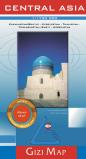
Central Asia Road Map - Southern Kazakhstan, Kyrgyzstan, Tajikistan, Turkmenistan (East), Uzbekistan. 1:1,750,000. GiziMap, Budapest. This is a detailed road map of Central Asia, covering southern Kazakhstan, most of Turkmenistan, and all of Uzbekistan, Tajikistan and Kyrgyzstan. Sabzevar, Iran is in the south-west corner and Uryzhar, Kazakhstan is in the north-east corner.
Terrain information includes swamps, salt flats and lakes, deserts and glaciers. The map shows various categories of roads with driving distances indicated. Oil and gas pipelines and aqueducts are also marked.
Numerous places of interest, religious buildings, castles, museums and monuments etc., are indicated by symbols. On the reverse, there is an index of localities which includes border areas of the neighbouring countries. This map uses shaded relief to show elevation, otherwise the map information is the same as the map above. This map is better as a road map as the lack of elevation tinting makes the map easier to read, but the physical features are not as distinct.
Area covered by this map. Sample of the map detail
66-20492
Road map, folded
$14.99
66-20493
Road wall map, flat.
$19.99
Silk Road Countries Geographic (Physical) Map. GiziMap, Budapest. Superb map of the region, with wonderful color-shading to show elevation, camel symbols to show the various branches of the Silk Route, and much more. Available flat or folded. Covers from the Black Sea in the NW to Saudi Arabia (SW) to Western China (NE) to Western India (SE). The map has hypsometric elevation shading, shaded relief, numerous spot elevations, railways, water wells and springs, and numerous tourist sites such as churches, monasteries, mosques, castles, and much more. Trilingual legend.
Area covered by the map. Sample #1 of the map detail Sample #2 of the map detail Thumbnail of the entire map
66-20496
1 sheet, folded.
$14.99
66-20496R
1 sheet, flat.
$19.99
Silk Road Map. Odyssey Publications, 2007. This map contains four large maps, two per side; The Silk Road: Land and Sea Routes; The Silk Road Across China; The Silk Road Across the Middle East; and The Silk Road Across Central Asia. There is extensive text and photographs to accompany the maps. Double-sided map, size is 39 x 27".
Sample of the Silk Road Map detail.
66-20494
1 sheet, folded.
$19.99
Tajikistan City Topographic/Street Digital Maps. Typically 1:10,000. Soviet military. These are very detailed topographic maps of major cities in Central Asia. The maps show roads, building footprints, power and water lines, railroads, contour lines, and much more. In cyrillic. Unfortunately these are available only as digital raster files. We can also supply all of these with all of the cyrillic transliterated into the latin (English) alphabet.
On the raster image the text appears just underneath and parallel to the original cyrillic text. Please call for price. Please specify "transliterated sheets" in the "Comments" section of the order form.
65-99931DU
Dushanbe. 1:10,000. 1985. 1 sheet.
$75.00
65-99931KU
Kulyab. 1:10,000. 1985. 1 sheet.
$75.00
65-99931KW
Kurgan Tyube. 1:10,000. 1985. 1 sheet.
$75.00
Tajikistan Topographic Maps
Tajikistan 1:100,000 Topographic Map Set. 1:100,000. Soviet military. This set offers complete coverage of Tajikistan in official soviet military-issue topographic maps. In russian.
65-9951
Set of 150 sheets
$1800.00
Tajikistan 1:200,000 Topographic Map Set. 1:200,000. Soviet military. This set offers complete coverage of Tajikistan in official soviet military-issue topographic maps. In russian.
65-9950
Set of 42 sheets
$504.00
Recommended! Central Asia Topographic Map Series. 1:500,000. West Col/EWP. This 11-sheet map series was developed from the Soviet military 1:500,000 topos and transliterated into English, these very detailed maps include contour lines, railroads, airports, power lines, gas lines, and much more. A must for anyone travelling in the area. All sheets are now available.
Sample image Thumbnail of an entire map Index for the series
66-2065-01
Aksu.
$19.99
66-2065-02
Almaty.
$19.99
66-2065-03
Bishkek.
$19.99
66-2065-04
Chimkent.
$19.99
66-2065-05
Dushanbe.
$19.99
66-2065-06
Karakol.
$19.99
66-2065-07
Naryn.
$19.99
66-2065-08
Osh.
$19.99
66-2065-09
Pamir East.
$19.99
66-2065-10
Pamir West.
$19.99
66-2065-11
Tashkent.
$19.99
1:500,000 ONC Aeronautical/Topographic Maps. NGA/NIMA. Offers partial coverage of Tajikistan. Aeronautical/topographic mapping from the US Military. Relief is portrayed by a combination of contours (basic interval 1000ft, intermediate contours shown where appropriate), elevation tinting and relief shading. Spot heights are also given. Towns, villages, major roads, railways and airports are shown but please note that many of the smaller settlements are not named, and the road information is not necessarily up to date, as compilation and revision dates vary. Some air navigation information also appears on the map, such as radio beacons and restricted flying zones. Note that these are large folded sheets, sometimes being 4 x 4 feet when unfolded.
TPC/ONC Index for western Russia, the Middle East, India, etc. Quads in pink are available, those in white are not available.
Sample of a TPC chart
67-1055-F06D
TPC Chart F-6D - E Kyrgizstan, N Tajikistan, S Kazakhstan, very small part of E Uzbekistan.
$34
67-1055-G06B
TPC Chart G-6B - N Afghanistan, S Tajikistan, SW Kyrgizstan, SE Uzbekistan, N Pakistan, western extremity of Xinjiang.
$34
67-1055-G07A
TPC Chart G-7A - W Xinjiang, Eastern extremities of Tajikistan and Afghanistan, N Pakistan.
$34
1:1,000,000 ONC Aeronautical/Topographic Maps. NGA/NIMA. Offers partial coverage of Tajikistan. Aeronautical/topographic mapping from the US Military. Relief is portrayed by a combination of contours (basic interval 1000ft, intermediate contours shown where appropriate), elevation tinting and relief shading. Spot heights are also given. Towns, villages, major roads, railways and airports are shown but please note that many of the smaller settlements are not named, and the road information is not necessarily up to date, as compilation and revision dates vary. Some air navigation information also appears on the map, such as radio beacons and restricted flying zones. Note that these are large folded sheets, sometimes being 4 x 4 feet when unfolded.
TPC/ONC Index for western Russia, the Middle East, India, etc. Quads in pink are available, those in white are not available.
Sample of an ONC chart
67-1056-F06
ONC chart #F-6 - SE Kazakhstan, N. and Central Kyrgyzstan, E. Uzbekistan, N. Tajikistan, W. Xinjiang.
$34
67-1056-G06
ONC chart #G-6 - N. and Central Afghanistan, E. Turkemenistan, NE Iran, N. Pakistan, W. and Central Tajikistan, S. Uzbekistan, S. Kyrgyzstan.
$34
67-1056-G07
ONC chart #G-7 - NW Tibet, SW Xinjiang, Eastern extremities of Afghanistan and Tajikistan, Kashmir region.

 Index map showing the coverage of the 3 sheets.
 Sample #1 from the Northern Tajikistan map
 Sample #2 from the Northern Tajikistan map
 Sample #3 from the Northern Tajikistan map
 Sample #4 from the Northern Tajikistan map
 Sample of the Khujand city map from the Northern Tajikistan map
 Sample #1 from the Southern Tajikistan map
 Sample #2 from the Southern Tajikistan map
 Sample #3 from the Southern Tajikistan map
 Sample of the Dushanbe city map from the Southern Tajikistan map
 Sample #1
 Sample #2
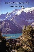


 Central Asia Geographical Map - Southern Kazakhstan, Kyrgyzstan, Tajikistan, Turkmenistan (East), Uzbekistan. 1:1,750,000. GiziMap, Budapest. This is a detailed road map of Central Asia, covering southern Kazakhstan, most of Turkmenistan, and all of Uzbekistan, Tajikistan and Kyrgyzstan. Sabzevar, Iran is in the south-west corner and Uryzhar, Kazakhstan is in the north-east corner.
Altitude tinting is used to show relief and other terrain information includes swamps, salt flats and lakes, deserts and glaciers. The map shows various categories of roads with driving distances indicated. Oil and gas pipelines and aqueducts are also marked.
Numerous places of interest, religious buildings, castles, museums and monuments etc., are indicated by symbols. On the reverse, there is an index of localities which includes border areas of the neighbouring countries. This map uses elevation tinting (hypsometric shading) to show elevation, otherwise the map information is the same as the map below. This map shows the physical terrain better than the map below, but the road network is harder to see.
Central Asia Geographical Map - Southern Kazakhstan, Kyrgyzstan, Tajikistan, Turkmenistan (East), Uzbekistan. 1:1,750,000. GiziMap, Budapest. This is a detailed road map of Central Asia, covering southern Kazakhstan, most of Turkmenistan, and all of Uzbekistan, Tajikistan and Kyrgyzstan. Sabzevar, Iran is in the south-west corner and Uryzhar, Kazakhstan is in the north-east corner.
Altitude tinting is used to show relief and other terrain information includes swamps, salt flats and lakes, deserts and glaciers. The map shows various categories of roads with driving distances indicated. Oil and gas pipelines and aqueducts are also marked.
Numerous places of interest, religious buildings, castles, museums and monuments etc., are indicated by symbols. On the reverse, there is an index of localities which includes border areas of the neighbouring countries. This map uses elevation tinting (hypsometric shading) to show elevation, otherwise the map information is the same as the map below. This map shows the physical terrain better than the map below, but the road network is harder to see.
 Area covered by this map.
 Central Asia Road Map - Southern Kazakhstan, Kyrgyzstan, Tajikistan, Turkmenistan (East), Uzbekistan. 1:1,750,000. GiziMap, Budapest. This is a detailed road map of Central Asia, covering southern Kazakhstan, most of Turkmenistan, and all of Uzbekistan, Tajikistan and Kyrgyzstan. Sabzevar, Iran is in the south-west corner and Uryzhar, Kazakhstan is in the north-east corner.
Terrain information includes swamps, salt flats and lakes, deserts and glaciers. The map shows various categories of roads with driving distances indicated. Oil and gas pipelines and aqueducts are also marked.
Numerous places of interest, religious buildings, castles, museums and monuments etc., are indicated by symbols. On the reverse, there is an index of localities which includes border areas of the neighbouring countries. This map uses shaded relief to show elevation, otherwise the map information is the same as the map above. This map is better as a road map as the lack of elevation tinting makes the map easier to read, but the physical features are not as distinct.
Central Asia Road Map - Southern Kazakhstan, Kyrgyzstan, Tajikistan, Turkmenistan (East), Uzbekistan. 1:1,750,000. GiziMap, Budapest. This is a detailed road map of Central Asia, covering southern Kazakhstan, most of Turkmenistan, and all of Uzbekistan, Tajikistan and Kyrgyzstan. Sabzevar, Iran is in the south-west corner and Uryzhar, Kazakhstan is in the north-east corner.
Terrain information includes swamps, salt flats and lakes, deserts and glaciers. The map shows various categories of roads with driving distances indicated. Oil and gas pipelines and aqueducts are also marked.
Numerous places of interest, religious buildings, castles, museums and monuments etc., are indicated by symbols. On the reverse, there is an index of localities which includes border areas of the neighbouring countries. This map uses shaded relief to show elevation, otherwise the map information is the same as the map above. This map is better as a road map as the lack of elevation tinting makes the map easier to read, but the physical features are not as distinct.
 Sample of the map detail
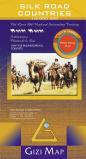
 Area covered by the map.
 Sample #1 of the map detail
 Sample #2 of the map detail
 Thumbnail of the entire map
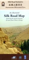
 Sample of the Silk Road Map detail.
 Recommended!
 Sample image
 Thumbnail of an entire map
 Index for the series
 TPC/ONC Index for western Russia, the Middle East, India, etc.
 Sample of a TPC chart
 Sample of an ONC chart