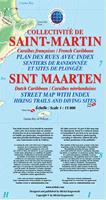
Recommended! St. Martin Travel Map. 1:15,000. Michal Kasprowski, 2013. This is an attractive, detailed road and topographic map of St. Maartin/St. Martin.
Best street map of St. Martin (St. Maarten) on the market.
Covers all roads and streets in detail and is updated on a regular basis.
Indicates tourist destinations, churches, reefs, marinas, airports, gas stations, lighthouses, and other places of interest.
Includes spot heights and elevation contours.
Shows streets of capital cities Marigot and Philipsburg close up in large inset maps.
Includes complete index of road and street names. 103 x 89 cm (40 1/2 x 35 in.)
 Recommended!
