Recommended! St. Barth's Travel Map. 1:10,000. Michal Kasprowski. A detailed, superb, road map of the island.
Best street map of St. Barthelemy on the market.
Covers all roads and streets in detail and is updated on a regular basis.
Indicates tourist destinations, churches, reefs, marinas, airports, gas stations, lighthouses, and other places of interest.
Shows streets of Gustavia (capital of St. Barthelemy) close up in a large inset map.
Includes complete index of road and street names. 98 x 67 cm (38 1/2 x 26 3/8 in.).
66-33883
1 sheet, folded
$16.99
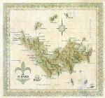
St. Barts Antique-style Wall Map. 18 x 19-1/4".
St. Barts was first claimed by France in 1648. It was sold to Sweden in 1785, which sold it back to France in 1878. Considered by many to be the Caribbean's most beautiful island with dozens of white sand beaches, crystal clear waters, and a green, hilly landscape punctuated by numerous lagoons, St. Barts is a French commune part of Guadeloupe, and therefore part of the European Union.
 Recommended!