Laos, Vietnam, Thailand, and Cambodia Travel Atlas. 1:1,000,000. ITMB, 2012. The Indochina Region consists of five countries, including that portion of Burma that sweeps down the western part of the Malay Peninsula. The four other countries form a cohesive entity for travel, especially now that border and visa requirements for travel have been reduced. Thailand itself is definitely the Number One reason for visiting the region. The first portion of the atlas is devoted to Thailand, including detailed page-size maps of Bangkok, Chiang Mai, and Pattaya. Vietnam is the next most-popular destination and is shown in great detail, with inset maps of Hanoi, Hoi An, Hue, Da Nang, Da Lat, Can Tho, and the central Saigon portion of Ho Chi Minh City. Laos and Cambodia are shown with the same degree of attention to detail, including insets of Vientiane, Phnom Penh, and two maps concentrating on Angkor Wat. This is a compact and convenient way for visitors to the region to have everything they need in one format - easy to carry, easy to use.
Sample detail of the Indochina Travel Atlas
66-20910
Atlas.
$19.95
Waterproof! Laos travel map. 1:600,000. Reise Know-How. Excellent physical/road map printed on Polyart (c) waterproof tear-resistant synthetic paper. With hypsometric contour lines showing elevation. In German with multilingual legend.
65-80903
1 sheet, folded
$15.99
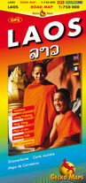
Laos travel map. 1:750,000 + inset maps. Gecko Maps. Excellent road map of Laos, with 13 smaller inset maps. The inset maps are what make this map - detailed insets of all of the tourist areas. While the road map section is not as detailed as the Reise map above, the level of detail is quite sufficient for normal tourist travel.
Laos/Cambodia travel map. 1:750,000 (Cambodia) & 1:1,200,000 (Laos). ITMB. Typical ITM travel map with shaded relief. Two separate maps at different scales, one on each side of the map.
65-80901
1 sheet, folded
$12.95
Laminated! Laos Travel Map. Scale 1:1,650,000. Golden Triangle Rider 4th ed., 2009. This double-sided, laminated map covers all of Laos, from Boten and the Chinese border in the north, to Veun Kham and the Cambodian border in the south. A highly accurate map, ridden and surveyed on the ground with a gps, resulting in accurate road classifications and mileages, plus village names checked and read from the village sign posts. With thirteen citymaps and eight road elevation profiles of the country's most spectacular roads, it makes planning your trip a lot easier. Indexed, in English. Laminated, size is 20 x 26."
Golden Triangle Rider Ltd. is a small company specializing in customized motorcycle trips throughout Thailand and Laos. The owner of the company has made four maps covering northern Thailand and Laos as he was dissatisfied with the available maps. The maps have symbols/names locating hotels/guesthouses/resorts, restaurants, hospitals, massage centers, gas stations, post offices, etc. The maps also show distances, all ridden/checked by the author.
Sample detail of the Golden Triangle travel map
65-80904
$12.99
Laos City Maps. Institut Geographique National (IGN), Laos, 2007. With UTM grids. These are new detailed city maps with bilingual English/Laotian legend. Size is typically 22 x 30 inches.
65-8092PB
Pakxe District Centre Map. 1:10,000. 2007.
$14.95
65-8092SB
Kaison Phomvihan (Savannakhet) City Map. 1:15,000. 2007.
$14.95
65-8092LW
Louangphabang City Map. 1:10,000. 2007.
$14.95
65-8092TH
Thakhek City Map. 1:10,000. 2007.
$14.95
65-8092VJ
Vientiane Capital District Map. 1:25,000. 2007.
$12.95
These street maps generally include topographic contour lines and spot heights to show elevation. Major buildings, including government, police, university, and military, are numbered and identified in the margins. Most maps have a street index in the margins. Nearly all maps have a UTM grid and latitude/longitude tickmarks along the margins. Some maps, noted below, use an air photo mosaic as a base map. These photomaps typically lack elevation information. Typically in either English only or bilingual including English.
Vientiane 1:10,000 Topographic Map Set. 1:10,000. Institut Geographique National (IGN), Laos, 1991. Three sheets covering the part of the city. These are part of a larger 1:10,000 set covering the entire city; only these three sheets were available. With latitude/longitude and UTM tickmarks/grid on the maps. In Laotian only.
65-8092VH
3 sheets, rolled.
$11.95
Laos Atlases & Administrative Maps
The Peoples of Laos Atlas - Rural and Ethnic Diversitites. Bangkok, 1999. Includes 187 pages containing 132 maps, such as "Map of Ethnic Groups of Laos - 1:1,750,000."
65-8049
1 sheet, folded.
$67.95
Atlas of Laos - Territorial Structure of Economic and Social Development (Atlas de la République Démocratique Populaire Lao - Les structures territoriales du développement économique et social). CNRS. 2000. Extensive social and economic information in both text and maps; typically 1/2 page of text and six 1/4-page maps per topic. 160 pages, 290 maps. Size 8.5" x 10". In French.
65-8047
Atlas.
$34.95
Lao Geographic Atlas. 1:5,000,000. Institut Geographique National (IGN), Laos, 2000. Simple thematic school atlas of Laos. Maps typically at 1:5,000,000. In English. Soft cover, 24 pages, size is 9 x 12".
65-80482
Atlas.
$24.95
Economical and Geographical Map of Lao People's Democratic Republic. 1:1,450,000. Institut Geographique National (IGN), Laos, 2008. A hypsometric relief map showing mineral resources. Bilingual, size is 24 x 30".
65-80475
1 sheet, rolled.
$8.95
Administrative Map of Lao People's Democratic Republic. 1:1,500,000. Institut Geographique National (IGN), Laos, 2008. Bilingual, size is 24 x 33".
65-80481
1 sheet, rolled.
$8.95
Administrative Map of Laos, Vietnam, and Cambodia. 1:1,800,000. Institut Geographique National (IGN), Laos, 2005. Size is 43 x 30". In Laotian.
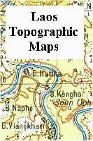
Laos 1:100,000 Topographic Map Set. 1:100,000. Institut Geographique National (IGN), Laos. Dates are mid-1980's. We have only one set in stock. There are 174 sheets for total coverage. We have 171 sheets; the three missing sheets are all in southern Laos and are marked on the index in blue (see index link below). Sold by the set only as original paper sheets, individual sheets available as raster scans. Sheets are 30' (E/W) x 20' (N/S).
Index showing coverage.
65-80505
171 sheets, rolled.
$599.95
Laos 1:200,000 Topographic Map Set. 1:200,000. Institut Geographique National (IGN), Laos, 1987. Fifty-one sheets give complete coverage of Laos. These maps are in French, but have the same format/projection/style as the Soviet military maps. Gauss Kruger projection and Krasovsky ellipsoid. Sold by the set only in paper, individual sheets available as raster scans. Sheets are 1° (E/W) x 40' (N/S).
65-8052
51 sheets, rolled.
$279.99
Laos 1:250,000 Topographic Quadrangle Maps. 1:250,000. Vietnam. This series gives complete coverage of Laos in 28 sheets. Bilingual legend, Vietnamese map text.
65-8053
Set of 28 sheets, rolled
$695.00
Laos 1:500,000 Topographic maps (TPC charts). 1:500,000. NGA (NIMA). Military topographic survey mapping covering about 80% of the world's land masses and significant islands. TPC stands for Tactical Pilotage Chart. These maps are designed primarily as flying charts for military aircraft, but they are useful as general topographical maps where nothing else is available.
Relief is portrayed by a combination of contours (basic interval 500ft, intermediate contours shown where appropriate), elevation tinting and relief shading. Spot heights are also marked. Towns, villages, major roads, railways and airports are shown but note that many of the smaller settlements are not named, and the road information is not necessarily up to date, as compilation and revision dates vary. Some air navigation information also appears on the map, such as radio beacons and restricted flying zones. Please note that in some areas of Africa and South America localised deficiencies or inconsistencies in the survey data at the time of compilation of these maps has resulted in little or no elevation shown or even blank spaces with no detail at all.
To a varying extent, adjacent sheets overlap, but due to the map projection, and the fact that the colours used for relief portrayal are not absolutely constant throughout the series, assembling these sheets to make a larger map may result in mismatched edges. However, for those countries where little else is available, these English-language charts are quite useful.
Index showing map coverage Sample of a TPC chart Sample of an ONC chart
67-1055-J10B
TPC Chart J10B
$34
67-1055-J10C
TPC Chart J10C
$34
67-1055-J11A
TPC Chart J11A
$34
67-1055-J11D
TPC Chart J11D
$34
67-1055-K10A
TPC Chart K10A
$34
Laos 1:1,000,000 Topographic maps (ONC charts). 1:1,000,000. NGA (NIMA). Military topographic survey mapping covering the world's land masses and significant islands with about 270 sheets. ONC stands for Operational Navigation Chart. These maps are designed primarily as flying charts for military aircraft, but they are useful as general topographical maps where nothing else is available.
Relief is portrayed by a combination of contours (basic interval 1000ft, intermediate contours shown where appropriate), elevation tinting and relief shading. Spot heights are also given. Towns, villages, major roads, railways and airports are shown but please note that many of the smaller settlements are not named, and the road information is not necessarily up to date, as compilation and revision dates vary. Some air navigation information also appears on the map, such as radio beacons and restricted flying zones. It should also be noted that in some areas of central parts of Africa and South America localised deficiencies or inconsistencies in the survey data at the time of compilation of these maps has resulted in little or no elevation shown or even blank spaces with no detail at all.
To a varying extent, adjacent sheets overlap, but due to the nature of the map projection and the fact that the colours used for relief portrayal are not absolutely constant throughout the series, assembling these sheets to make a larger map is not recommended.
Index showing map coverage Sample of a TPC chart Sample of an ONC chart


 Sample detail of the Indochina Travel Atlas


 Sample from the 1:750,000 road map.
 Sample from the Vang Vieng area 1:150,000 inset road map.
 Sample from the Vientiane 1:12,000 city center inset map.
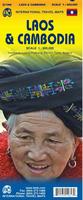

 Laminated!
 Sample detail of the Golden Triangle travel map
 Sample of the map detail from a map in this worldwide series (Barranquilla).
 Sample of the map detail from a map in this worldwide series (Batdambang photomap).
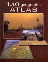


 Index showing coverage.


 Index showing map coverage
 Sample of a TPC chart
 Sample of an ONC chart
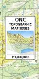
 Laos Flags