Kuwait Maps


  • Kuwait Flags


    Kuwait road map
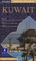
    Kuwait Travel Map with Kuwait City Map. 1:500,000 & 1:70,000 & 1:10,000. Geoprojects, 2007. Excellent road map of Kuwait at 1:500,000 showing relief, communications, oil information and settlements with index of place names. Business Guide for Kuwait giving useful addresses, telephone and fax numbers for ministries, embassies, banks, hotels, restaurants, airlines and car rentals. Descriptive text giving information about the geography, climate, history, social customs, economy, transport and visitor information with accompanying photographs.
    City maps of Kuwait Urban Area at 1:70,000 and Central Kuwait at 1:10,000 showing detailed street patterns, built-up areas, parks, important buildings and places of interest with indexes of districts, street names and places of interest.
    Ordering Kuwait Travel Map (GEO).64-91901 sheet, folded$16.99


    Kuwait road map
    Kuwait Travel Map with Kuwait City Map. 1:390,000 and 1:15,000. ITMB. An excellent road map of Kuwait at 1:390,000 and a Kuwait City map at 1:15,000. The maps show roads, parking, accommodations, tourist info, parks & reserves, attractions, museums, cinemas and much more.
    Sample of the Kuwait City map detail
    Sample of the Kuwait road map detail
    Ordering Kuwait road  map.  (ITMB)64-919011 sheet, folded$12.95


    Kuwait MiniMap
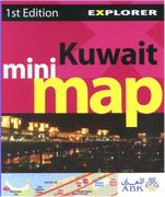
    Kuwait MiniMap. 1:20,000. Explorer Publishing, UAE, 2007. This fold-out Mini Map of the city of Doha features an overview map plus detailed close-ups of the main areas. Map size is 48 x 33 cm.

  • Main Streets & Areas
  • Key Landmarks
  • Hotels & Hospitals
  • Museums & Heritage Sites
  • Places Of Interest
  • Useful Numbers
    Sample detail of the Kuwait MiniMap
    Sample detail of the Kuwait MiniMap
    Ordering Kuwait minimap (Explorer)64-919021 sheet, folded.$7.99


    Atlas of the State of Kuwait from Satellite Images. Kuwait Foundation for the Advancement of Sciences, 2000. Hardcover, 145 pages, bilingual English/Arabic. This atlas contains numerous satellite images illustrating various environmental and geographic features of Kuwait. Typically there is a page of bilingual text to accompany each page of images or maps. Includes a 25-page section on the environmental effects of the Gulf War. A quality publication.
    Ordering Kuwait Satellite Atlas64-9148Atlas$150.00

    Kuwait 1:100,000 Topographic Quadrangle Map Set. 1:100,000. Soviet government. High quality topographic maps for a country where little else is available. This set gives complete coverage of Kuwait in 23 sheets. In Russian.
    Ordering Kuwait--1:100,000 toposet64-9152Set of 23 sheets, rolled$276.00

    Kuwait 1:200,000 Topographic Quadrangle Map Set. 1:200,000. Soviet government. High quality topographic maps for a country where little else is available. This set gives complete coverage of Kuwait in 6 sheets. In Russian.
    Ordering Kuwait--1:200,000 topos   Set64-9151Set of 6 sheets, rolled$72.00

    Kuwait Geologic Map. 1:250,000. 1968. Austria Geol. Bundes. Detailed map showing oil fields, pipelines, roads, and more. An 87-page text is out of print and no longer available. 121 x 88 cm. In German.
    Ordering Kuwait Geologic Map 1:250,00064-91001 sheet, folded$34.95


    Kuwait Flags
    Ordering Flag-Kuwait67-1070KUWKuwait flag, small. Size 4 x 6 in.$3.99
    Ordering Kuwait flag.  2 x 367-1073KUWKuwait flag, large. Size 2 x 3 ft.$49.95


    image


  • © Copyright 2025 East View Companies, Inc.
    5130 Industrial Street, Suite 100, Maple Plain, MN 55359-8005
    All Rights Reserved
    For more information please Contact Us