Kazakhstan Maps


  • Paper Kazakhstan Travel, Road, and City Maps
  • Kazakhstan Atlases
  • Kazakhstan Topographic Maps
  • Kazakhstan Physical, Political, and Thematic Maps
  • Kazakhstan Flags


    Kazakhstan Road Maps


    Kazakstan Road Map. 1:3,000,000. Gizimap.
    Excellent map of Kazakhstan. Also covers Kyrgyzstan, Tajikistan, Turkmenistan and Uzbekistan. Available in two styles; political and geographic. This is a clear and detailed political road map extending from the Baki on the Caspian Sea to the eastern tip of Mongolia, and from Novosibirsk in the Russian Federation to Rawalpindi in Pakistan. Relief is shown through spot heights for peaks and passes, and terrain features such as swamps, salt flats and lakes, deserts and glaciers are indicated. The map shows various categories of roads with distances marked between points, railways, airports, ports, administrative boundaries and national parks. Lines of latitude and longitude are drawn at 2° intervals. An index booklet of place names is included. The physical version referred to below does not have the political colours, but uses elevation tinting to portray relief. In other respects the detail is the same.
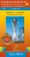
    Sample detail of the Kazakhstan political map
    Thumbnail image of the Kazakhstan political map
    Sketch map showing area covered by the Kazakhstan map
    Ordering Kazakstan Political Map fold (Gizi)65-774711 sheet, folded. $14.99
    Ordering Kazakstan Political Map flat (Gizi)65-77471RWall map, flat/rolled. $19.99
    Ordering Kazkahstan road map laminated (Gizi)65-77471LWall map, laminated. $36.99


    Kazakhstan Geographic Map. 1:3,000,000. Gizimap.
    The best physical map of Kazakhstan. The flat version makes a superb wall map. This is a clear and detailed road map extending from the Baki on the Caspian Sea to the eastern tip of Mongolia, and from Novosibirsk in the Russian Federation to Rawalpindi in Pakistan. Relief is shown through elevation tinting and spot heights, and terrain features such as swamps, salt flats and lakes, deserts and glaciers are indicated. The map shows various categories of roads with distances marked between points, railways, airports, ports, administrative boundaries and national parks. Lines of latitude and longitude are drawn at 2° intervals. An index booklet of place names is included. The political version listed above shows the same detail, without the elevation tinting.

    Sketch map showing area covered by the Kazakhstan map
    Ordering Kazakstan geographic, folded (Gizi)65-77472Physical Map, folded. $14.99
    Ordering Kazakhstan geographic map, rolled65-77473Wall map, flat/rolled. $19.99
    Ordering Kazkahstan geographic map laminated (Gizi)65-77473LWall map, laminated. $36.99


    Waterproof, tear-proof!
    Kazakhstan Road Map. Reise Know-How.
    Printed on Polyart synthetic waterproof and tear-resistent paper. This is a map of the whole country that combines topographic mapping with road and tourist detail. Road information is clear and the relief is presented via contours, spot heights and altitude tinting. It includes an index of placenames. Coordinates grid is overlaid at 1 degree interval. Key to symbols is in English and German.
    Ordering Kazakhstan road map (Reise)65-77911 sheet, folded. $15.99


    Waterproof, tear-proof!
    Kazakhstan & Uzbekistan Road Map. ITMB. 1:3,000,000 (Kazakhstan) and 1:1,580,000 (Uzbekistan).
    The map shows Roads by classification, Main Road, Shipping Route, National Park, Lake, Glacier, Salt Flat, Water Well, Point of Interest and much more...
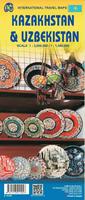
    Thumbnail of the Kazakhstan side of the map
    Thumbnail of the Uzbekistan side of the map
    Ordering Kazakhstan travel map (ITMB)65-779011 sheet, folded. $12.95


    Almaty city map
    Almaty City Map. 1:35,000. National Cartographical and Geodesic Foundation, 2004.
    A detailed street map of Almaty, in English. The reverse side of the map has inset maps and lots of addresses of embassies, hotels, post offices, theaters, and much more.
    Ordering (Kazakh) Almaty City Map (English)65-7792AA1 sheet, folded.$17.99


    Kazakhstan City Maps. In Russian.
    Ordering (Kazakstan) Akmola city map65-7792AKAkmola (Tselinograd) city map. 1:20,000. GUGK, Almaty, 1996. Shows block numbers for the streets. $10.95
    Ordering (Kazakstan) Astana city map (Engl.)65-7792ASAstana. 1:20,000. 2000. In English with an oblast map on the reverse. Ordering (Kazakstan) Astana city map (Engl.) $17.99


    Kazakhstan City Topographic/Street Digital Maps. Typically 1:10,000. Soviet military. These are very detailed topographic maps of major cities in Central Asia. The maps show roads, building footprints, power and water lines, railroads, contour lines, and much more. In cyrillic.
    Ordering (Kaz.) Ekibastus digital city65-77931EKEkibastus. 1:10,000. 1987. 4 sheets.$300.00
    Ordering (Kaz.) Kapchagay digital city65-77931KBKapchagay. 1:10,000. 1984. 2 sheets.$150.00
    Ordering (Kaz.) Rudnyy digital city65-77931RURudnyy. 1:10,000. 1987. 2 sheets.$150.00
    Ordering (Kaz.) Petropavlovsk digital65-77931PEPetropavlovsk. 1:10,000. 1978. 4 sheets.$300.00
    Ordering (Kaz.) Taldy-Kurgan digital65-77931TBTaldy-Kurgan. 1:10,000. 1977. 1 sheet.$75.00


    Kazakhstan railroad map
    Kazakhstan Railroad Map. RGKP, 2006. In Russian. Single-sheet political map of Kazakhstan with the railroad network overprinted.
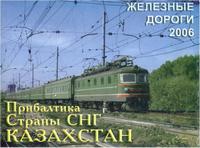
    Sample detail from the Kazakhstan rail map.
    Ordering Kazakhstan Railway Map.65-77711 sheet, folded.$15.99


    Kazakhstan Railroad Map (Zeleznije dorogi). RGKP. Two-sheet political map of Kazakhstan with the railroad network overprinted. In Russian only.
    Ordering Kazakhstan Railway Map.65-77702 sheets, flat.$32.99


    Large Atlas of Kazakhstan
    Large Atlas of Kazakhstan (Bol'shoi Atlas Kazakhstana). 2011. The Large Atlas of Kazakhstan [Bol'shoi Atlas Kazakhstana] is the most up-to-date and comprehensive atlas of Kazakhstan that is currently available. The atlas is a beautiful, high quality, hard-bound atlas with a slip cover. The atlas summarizes current knowledge in the fields of geography, history, culture, and ethnography. One section of the Atlas features an analysis of the Great Silk Road, describes the process of how steppe cultures arose and developed, traces the origins of the Turkic peoples (especially the Kazakhs), and analyzes the role of nomadic cultures in the integration of Eurasian cultures, with emphasis on the geopolitical significance of Kazakhstan as a crossroads of Eurasia. The Large Atlas of Kazakhstan comprises approximately 100 pages of text, 500 unique maps, charts, and plans, and over 2,500 illustrations depicting the history, geography, ethnography, and contemporary life in Kazakhstan. Each atlas weighs slightly over 12 pounds.

  • Covers geography, history, culture, ethnography, and socioeconomic data
  • Hardcover, with slip-case
  • 833 pages
  • Over 500 maps plus over 2,500 illustrations
  • In cyrillic
    Sample #1 of the Kazakhstan atlas
    Sample #2 of the Kazakhstan atlas
    Sample #3 of the Kazakhstan atlas
    Ordering Large Atlas of Kazakhstan in slipcase.65-77497Atlas.$699.99


    National Atlas of Kazakhstan
    National Atlas of Kazakhstan. 2010. Institut Geografii Respubliki Kazakhstan. This is the official national atlas developed by the Kazakhstan Ministry of Environment under the program "Environment Protection in the Republic of Kazakhstan for years 2005-2007."  There are three volumes, each covering a specific theme.

  • Volume 1 - Natural conditions and resources of the environmental situation. Includes 102 maps on geographic position, relief, geological structure, mineral resources, climate, hydrogeological, soils, flora and fauna, and physical-geographical regionalization. This volume reflects the present situation of the environment and resources of Kazakhstan in maps and shows potential opportunities for development, especially as pertains to natural resources.
  • Volume II - Socio-economic conditions of the environmental situation. Includes 117 socio-economic and demographic maps. This volume includes information on demographics, social spheres, industrial development, agriculture, transport development, history, archaeology, and the place of Kazakhstan in the world community.
  • Volume III - Ecological state of natural and economic systems. Includes 127 thematic maps that aid in practical environmental planning, environmental education and training, including maps on the factors of human impact on the environment, the ecological state of the natural systems, hazardous natural processes and emergencies, ecology and man, the environmental situation in particular regions, and nature protection.
  • Hardcover, 3 volumes.
  • In English
    Ordering National Atlas of Kazakhstan65-77498Atlas, 3 volumes.$1475.00


    Topographic Maps. We can supply official soviet military topographic mapping of Kazakstan and soviet central Asia at a variety of scales. These maps are available only as digital maps, either raster and vector versions.


    Kazakhstan 1:100,000 Topographic Maps. 1:100,000. Soviet military. This series gives complete coverage of Kazakhstan. Available only as raster digital files (georeferenced or non-georeferenced or DEMs).
    Index map for Eastern Kazakhstan
    Index map for Western Kazakhstan
    Kazakhstan raster 1:100,000 topos - click here. Itemized listings.
    Kazakhstan georeferenced 1:100,000 topos - click here. Itemized listings.


    Kazakhstan 1:200,000 Topographic Maps. 1:200,000. Soviet military.
    Ordering Kazakhstan--1:200,000    topo65-7750Set of 573 sheets, raster$6876.00


    Kazakhstan Physical Map. This is a decent quality physical (shaded relief or hypsometric relief) map. In cyrillic.
    Ordering Kazakhstan physical map (Russian)65-77475Kazakhstan. 1:3,000,000.$14.95


    Kazakstan Political Map. 1:3,500,000. "Kartografia", Almaty, Kazakstan. 1995-1996. One sheet, showing the internal political boundaries in Kazakstan. Also shows railways, villages, roads, etc. In Russian (cyrillic).
    Ordering Kazakstan Political map65-7749RRussian edition, rolled. 1995.$15.95


    Kazakstan Political Map. 1:2,000,000. "Kartografia", Almaty, Kazakstan. 2000. Two sheets, showing the internal political boundaries in Kazakstan. Also shows railways, villages, roads, etc. In Russian.
    Ordering Kazakstan--Political Map65-77495Two sheets.$24.95


    Kazakstan Nonmetallic Resources/Physical Map. 1:2,500,000. "Kartografia", Almaty, 2000. Two sheets, in Russian. The map shows locations of non-metallic mineral resources using symbols, overlain on a hypsometric physical map. Includes seven inset maps covering climate, tectonics, temperature, administration, etc.
    Ordering Kazakhstan--Physical Map65-7748Two sheets.$24.95


    Kazakhstan Flags
    Ordering Kazakhstan flag.  2 x 367-1073KAZKazakhstan flag, large. Size 2 x 3 ft.$69.95


    image


  • © Copyright 2025 East View Companies, Inc.
    5130 Industrial Street, Suite 100, Maple Plain, MN 55359-8005
    All Rights Reserved
    For more information please Contact Us