Although not a country, "Karelia" is the portion of the Russian Kola Peninsula that is of Finnish heritage/culture.
Severo-Zapodnij Map (Karelia). 1:1,200,000. Roskartografiya, 2007. This is a physical map of of northwestern Russia, using hypsometric contours to show elevation. 4 sheets, in Russian.
65-7846
Set, rolled.
$44.95
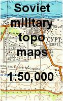
Karelia 1:50,000 Topographic Quadrangle Map Set. 1:50,000. Soviet government, 1950's-1990's. High quality topographic maps for a region where little else is available. This set gives complete coverage of Karelia (Soviet part of the Finnish Peninsula) in 733 sheets. In Russian.
Note: We have a partial set in stock.
Index map Map sample

 Index map
 Map sample