|
|
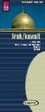
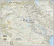
Iraq Road Map. 1:1,750,000. GiziMap. Multilingual. This map has the best depiction of physical features, as well as a superb road information. Also shows locations of archeological sites. The laminated version makes an excellent wall map. In English, Arabic, Russian.
Iraq Planning Map. 1:2,000,000. NIMA, March 5, 2001.
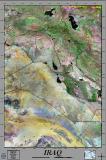
Iraq Physical Map. 1:1,250,000. NIMA, February 2003. A single-sided map that has lat-long coordinates. The map shows roads, airports, dams, district boundaries, border control points, etc. Shaded relief with elevation coloring. Size is 86 x 94 cm. Not as detailed as the Reise-Know-How map listed below, but does include all the airbases.
Iraq Wall Maps
Click here to see our listings of map pins, map tacks, and transparent map dots, all for use with wall maps.
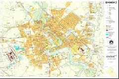
Baghdad City Maps
Baghdad City Map. 1:40,000. NIMA, 2003. A single-sided map that has an excellent street map of Baghdad, with excellent street detail. Includes lat-long coordinates. The map shows gov't and public buildings, hospitals, hotels, religeous buildings, monuments, police, etc. Size is 125 x 78 cm.
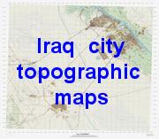
Iraq City Maps. NIMA, 2003. City maps of four major Iraq cities. These maps are city topographic maps rather than city tourist maps. They show contour lines, etc. but do not identify hotels, etc. In English.
|
||||||||||||||||||||||||||||||||||||||||||||||||||||||||||||||||||||||||||||||||||||||||||||||||||||||||||||||||||||||||||||||||||||||||||||||||||||||||||||||||||||||||||


 Best road map of Iraq
 Sample of the detail of the map
 Sample #2 of the detail of the map
 Best wall map!

 Sample detail of the Baghdad map.
 Sample detail of the Iraq map.
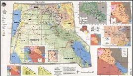
 Thumbnail of the entire map.
 Sample of the detail of the map
 Thumbnail of the whole map

 Thumbnail view of the entire map.
 Detailed view of part of the map.
 An enlarged view of the mounted map
 Now out of print and limited stock available.
 Thumbnail view of the entire map.
 Detailed view of part of the map.
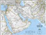
 An image of the full map
 A detail of the map

 Sample of the detail of the map
 Thumbnail of the whole map


 Thumbnail image of the Basra city map
 Sample detail of the Diwaniyah city map