Indonesia Topographic Map Series


  • Indonesia 1:1,000,000 Topographic Maps. Indonesian-issue maps. Index maps and itemized listings.
  • Indonesia 1:250,000 Topographic Maps. Indonesian-issue maps. Index maps, sample images, and more.
  • Indonesia 1:200,000 Topographic Maps. Soviet military-issue maps. Includes digital and paper original maps.
  • Indonesia 1:50,000 Topographic Maps - Sumatera (Sumatra). Indonesian-issue maps. Index maps, sample images, and more.
  • Indonesia 1:50,000 Topographic Maps - Sulawesi. Indonesian-issue maps. Index maps, sample images, and more.
  • Indonesia 1:50,000 Topographic Maps - East & West Kalimantan. Indonesian-issue maps. Index maps, sample images, and more.
  • Indonesia 1:25,000 Topographic Maps - Java. Indonesian-issue maps. Index maps, sample images, and more.
  • Indonesia 1:25,000 Topographic Maps - Bali. Indonesian-issue maps. Index maps, sample images, and more.
  • Indonesia 1:25,000 Topographic Maps - Nusa Tenggara Islands (Flores, Solor, Timor, Lombok, etc.). Indonesian-issue maps. Index maps, sample images, and more.
  • Indonesia 1:25,000 Topographic Maps - East Timor. Indonesian-issue maps. Index maps, sample images, and more.


Indonesia Index Map Set. BAKOSURTANAL. This 33-sheet set includes all of the official index maps for Indonesia, one province per sheet. These are litho-printed on glossy paper and show which maps are available, as of early 2006. Sheet size is 16-1/2 x 12".
NOTE: The availability as shown on the maps is not completely accurate, as there are a few new sheets, and some sheets that are no longer available, but it is a good guide.
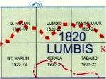
Sample of one of the index maps
Ordering Indonesia Index Map set.64-7750Set, flat/rolled.$34.95


WAC Aeronautical Charts for Indonesia. 1:1,000,000. BAKOSURTANAL. 2005. These charts are similar to the US military's ONC charts, although they use an Indonesian sheet grid, not the ONC sheet grid.
Ordering (Indo.) WAC chart #286067-1056-2860WAC sheet #2860.$24.99
Ordering (Indo.) WAC chart #292067-1056-2920WAC sheet #2920.$24.99
Ordering (Indo.) WAC chart #292167-1056-2921WAC sheet #2921.$24.99
Ordering (Indo.) WAC chart #298067-1056-2980WAC sheet #2980.$24.99
Ordering (Indo.) WAC chart #298167-1056-2981WAC sheet #2981.$24.99
Ordering (Indo.) WAC chart #298267-1056-2982WAC sheet #2982.$24.99
Ordering (Indo.) WAC chart #310167-1056-3101WAC sheet #3101.$24.99
Ordering (Indo.) WAC chart #310267-1056-3102WAC sheet #3102.$24.99


Please note that we have not yet itemized the Indonesian-issue topographic maps. If you want to order individual sheets, then please note the sheet numbers from the index maps and either order by phone (336-227-8300), fax (336-227-3748) or e-mail ([email protected]). Individual sheets are $25 per sheet, regardless of scale, except for East Timor, which are $40 per sheet. The soviet military-issue maps are itemized; please see below.

Indonesia Topographic Map Series - 1:250,000

Published byBakosurtanal.
Publication dates1986-1993.
Scale1:250,000.
Map size.
ProjectionTransverse Mercator.
Contour interval100 meter.
Number of sheets237 sheets; 176 available.
Index mapIndonesia 1:250,000 Index Map.
Indonesia 1:250,000 Land Status Index Map.
Indonesia 1:250,000 Land Use Index Map.
Some index maps have quads colored blue or yellow - these indicate sheets that are available while the white quads are those not yet printed. On those index maps where there are no colored quads, then all of the quads are in print.
Listing of QuadranglesClick here to order individual sheets.
Map sampleClick here
Map qualityGood quality full-color topographic maps.
LanguageIndonesian.
        64-77505-XXXXClick on "Listing of Quadrangles" above to order individual sheets.$25.00
  Ordering Indonesia--1:250,000 topo set.      64-77505 Partial set of 176 sheets$2112.00


Indonesia Topographic Map Series - 1:200,000

Published bySoviet military.
Publication dates1964-1983.
Scale1:200,000
Map sizeVariable.
ProjectionGauss conformal transverse cylindrical projection
Krassovsky ellipsoid
Kronstadt datum.
Contour interval.
Number of sheets120 sheets.
Index mapIndonesia 1:200,000 Index Map - click here to order paper or digital quadrangles using our Click-to-order Index Maps.
Listing of QuadranglesClick here to see a listing of individual sheets with publication dates. Click on the link above to order paper or digital quadrangles.
Map sampleClick here.
CommentsGood quality full-color topographic maps. Extensive descriptive text on the reverse side of the paper originals (not included with the digital maps).
LanguageIn cyrillic (Russian).
  Ordering Indo. 1:200,000 map (Soviet)      64-77509Each sheet, specify sheet # in comments section at checkout$24.99
  Ordering Indonesia--1:200,000 topo 120      64-7751Set of 120 paper sheets$1800.00


Indonesia Topographic Map Series -
1:50,000 Sumatera

Published byBakosurtanal.
Scale1:50,000
Publication dates1979.
Map size15' x 15'.
ProjectionTransverse Mercator.
Contour interval25 meters.
Number of sheets432 sheets.
Index mapSumatera index - click here.
Quads in blue are available; those in white are not. New quads are due any day.
Sumatera (Sumatra)- Aceh province detailed index map.
Sumatera (Sumatra)- Bangkabelitung province detailed index map.
Sumatera (Sumatra)- Barat province detailed index map.
Sumatera (Sumatra)- Bengkulu province detailed index map.
Sumatera (Sumatra)- Jambi province detailed index map.
Sumatera (Sumatra)- Lampung province detailed index map.
Sumatera (Sumatra)- Riau province detailed index map.
Sumatera (Sumatra)- Selatan province detailed index map.
Sumatera (Sumatra)- Utara province detailed index map.
Map sampleSumatera map sample image - click here.
Listing of QuadranglesComing soon.
Map qualityGood quality full-color topographic maps.
LanguageIndonesian
  Ordering (Indo) Sumatera topo set      64-77515SU Set of 431 sheets$3879.00


Indonesia Topographic Map Series -
1:50,000 Sulawesi

Published byBakosurtanal.
Scale1:50,000
Publication dates1992.
Map size15' x 15'.
ProjectionTransverse Mercator.
Contour interval25 meter.
Number of sheets384 sheets. 7 sheets were out of stock on our last order.
Index map Overall Sulawesi 1:50,000 Index Map.
Quads colored blue are available while the white quads are those not yet available.
Sulawesi - Gorontalo province detailed index map.
Sulawesi - Selatan province detailed index map.
Sulawesi - Tengah province detailed index map.
Sulawesi - Tenggara province detailed index map.
Sulawesi - Utara province detailed index map.
Listing of QuadranglesComing soon.
Map sampleSulawesi map sample - click here.
Map qualityGood quality full-color topographic maps.
LanguageIndonesian
  Ordering (Indo.) Sulawesi topo set      64-77515SW Set of 377 sheets$2853.00


Indonesia Topographic Map Series -
1:50,000 East & West Kalimantan

Published byBakosurtanal.
Publication dates1992.
Scale1:50,000
Map size15' x 15'.
ProjectionTransverse Mercator.
Contour interval25 meters.
Number of sheets293 sheets. West - 102 sheets. East - 190 sheets.
Index mapKalimantan index - click here.
Quads in blue are available; those in white are not.
Kalimantan Barat Province detailed index map.
Kalimantan Selatan Province detailed index map.
Kalimantan Tengah Province detailed index map.
Kalimantan Timur Province detailed index map.
Listing of QuadranglesComing soon.
Map sampleEast Kalimantan sample image
West Kalimantan sample image.
Map qualityGood quality full-color topographic maps.
LanguageIndonesian
  Ordering (Indo.) Kalimantan topo set.      64-77515KA Set of 292 sheets$2628.00


tr>

Indonesia Topographic Map Series -
1:25,000 Jawa (Java)

Published byBakosurtanal.
Publication dates1992 - continuing.
Scale1:25,000
Map size7'30" x 7'30".
ProjectionTransverse Mercator.
Contour interval12.5 meters.
Area coveredNearly complete coverage is now available.
Index mapThere are six provinces covering Java - each has its own index map, linked below.
Java - Banten province index map.
Java - Barat Province index map.
Java - DKI Jakarta Province index map.
Java - Java Tengah Province index map.
Java - Timur Province index map.
Java - Yogyakarta Province index map.
Listing of QuadranglesComing soon.
Map sampleJava/Bali map sample image - click here.
LanguageIndonesian
CommentsGood quality, full-color maps. With UTM grid and 12-1/2 meter contours.
  Ordering Java 1:25,000 topo map      64-77515JA-XXXXIndividual sheets, specify sheet number in "Comments" section of order form.$24.99
  Ordering (Indonesia) Java 1:25,000 topo      64-77515JC Partial set of 375 sheets (all sheets that are currently available)$3480.96

.

Indonesia Topographic Map Series -
1:25,000 Bali

Published byBakosurtanal.
Publication dates1992.
Scale1:25,000
Map size7'30" x 7'30".
ProjectionTransverse Mercator.
Contour interval12.5 meters.
Number of sheetsComplete coverage in 51 sheets.
Area coveredComplete coverage.
Index mapBali index - click here.
Listing of QuadranglesComing soon.
Map sampleBali/Java map sample image - click here.
LanguageIndonesian
CommentsGood quality, full-color maps with UTM grid.
  Ordering (Indonesia) Bali 1:25,000 topo      64-77515BA-XXXXIndividual sheets, specify sheet # in "Comments" section of order form.$25.00
  Ordering (Indo) Bali 1:25,000 set - ITEMIZE      64-77515BAComplete set of 51 sheets$459.00

.

Indonesia Topographic Map Series -
1:25,000 Nusa Tenggara Islands (Flores, Solor, Timor, Lombok, Maluku, Irian Jaya, etc.)

Published byBakosurtanal.
Publication dates1992 - continuing.
Scale1:25,000
Map size7'30" x 7'30".
ProjectionTransverse Mercator.
Contour interval12.5 meters.
Number of sheets490 sheets now available, but many more needed for complete coverage - please see indexes below.
Area coveredScattered coverage - see index.
Index mapNusa Tenggara index - click here. Overview index, part 1, showing 1/2 of the sheets available.
Nusa Tenggara index showing the 200 new sheets not shown on the index noted above. Overview index, part 2, showing second half of what is in print.
Quads in blue are available; those in white are not. Note that the sheets shown on both indexes combine to show all available coverage; about 490 sheets.
For selecting your map sheet, use the indexes below, not the two summary indexes above.
Irian Jaya Province index map.
Maluku Province index map.
Maluku Utara Province index map.
Nusa Tenggara Barat Province index map.
Nusa Tenggara Timur Province index map.
Listing of QuadranglesComing soon.
Map sampleNusa Tenggara map sample image - click here.
LanguageIndonesian
CommentsGood quality, full-color maps with UTM grid.
  Ordering (Indonesia) Nusa Tenggara 1:25      64-77515NU-XXXXIndividual sheets, specify sheet # in "Comments" section of order form.$25.00
  Ordering (Indonesia) Nusa Tenggara 1:25      64-77515NTSet of all 490 available sheets (not complete coverage)$4517.80

.

Indonesia Topographic Map Series -
1:25,000 East Timor

Published byBakosurtanal.
Publication dates.
Scale1:25,000
Map size7'30" x 7'30".
ProjectionTransverse Mercator.
Contour interval12.5 meters.
Number of sheets118 sheets.
Area coveredComplete coverage including the enclave.
Index mapEast Timor index - click here.
Listing of QuadranglesComing soon.
Map sampleNusa Tenggara map sample image - click here.
LanguageIndonesian
CommentsGood quality, full-color maps with UTM grid.
  Ordering East Timor 1:25,000 topo - specify      64-77515ET-XXXXIndividual sheets, specify sheet # in "Comments" section of order form.$30.00
  Ordering (Indonesia) East Timor 1:25,00      64-77515TComplete set of 118 sheets$2360.00


image

© Copyright 2023 East View Companies, Inc.
2838 Vicksburg Ln N, Plymouth, MN 55447
All Rights Reserved
For more information please Contact Us