Europe Road Atlas. Michelin. An excellent road atlas covering all of Europe. Spiral-bound, A3-sized version of Michelin's touring road atlas for Europe, covering 40 countries and including 78 city/urban area maps. Roads are numbered, toll roads are marked, and seasonally snowbound routes are indicated. Driving distances between points are also indicated on the map. Railways are omitted. Scales vary from approx. 1:700,000 to 1:3 million. Coverage includes Iceland and extends to Moscow and Istanbul. Most of Turkey falls outside the coverage but Cyprus is included.
There is a useful section on driving in Europe which details the most important 'rules of the road' in each country (i.e. speed limits, essential precautions etc). Climate tables are included, also a driving distance table and details of national motoring organisations.
Indexed for road mapping and some, but not all, of the city maps.
Detail from the atlas
66-2296
Atlas
$24.00
Europe Road Atlas. Hallwag/Kümmerly + Frey. Covers all of Europe as far east as Western Turkey, Odessa, Minsk, St Petersburg & Murmansk. Cartography is clear with little distracting relief information. Road detail includes scenic routes, intermediate driving distances, road closures and gradient values. The map detail also includes railways, ferries, cablecars, airports & airfields. Symbols depict petrol stations, sites of various antiquities and landmarks, natural curiousities & campsites. There is a section of 45 maps of cities showing main approaches and through-routes. Indexed for over 50,000 locations.
Introductiory pages provide a distance table, national speed limits and basic rules of the road, emergency service telephone numbers and international dialling codes.
Sample #1 of the detail of the atlas Sample #2 of the detail from the atlas
66-22961
Atlas
$44.99
Central Europe Road Atlas. 1:500,000 - 1:3,500,000. Freytag & Berndt. This road atlas covers central Europe country by country at 1:500,000, with a legend and map-page overview as an introduction in each country. A place name index follows each country. Cartography is detailed but clear, although two noticeably different styles are used. Driving distances are indicated on the map between specific points and railways and ferry routes are included, also details such as steep gradients, seaonal road closures, filling stations, scenic routes etc. Relief is indicated by some hill shading and spot heights.
NOTE: The only countries covered at the 1:500,000 scale are: Austria, Germany, Switzerland, Italy, Slovenia, Croatia, Bosnia & Herzegovina, Hungary, Czech & Slovak Republics, the Benelux countries, Denmark and Poland. All other European countries are covered at 1:3,500,000 and extends to Moscow, western Turkey, Scandinavia and Iceland.
At the end is a section of indexed street plans of 34 European city centers. These highlight through-roads, pedestrian zones, railway & metro lines and visitor information points.
66-22962
Atlas
$17.95
Austria Road Atlases
Austria Roads & Cities Atlas (Strassen & Städt Österreich). 1:10,000 - 1:500,000. Freytag/Berndt. Subtle relief shading presents the country's mountainous terrain. The mapping includes railways, driving distances, road traffic restrictions, seasonal closures on mountain roads and road gradient indications. Tourist information includes, scenic routes, places of interest, campsites and youth hostels, etc. An overprint highlights the national network of the long-distance footpaths indicating, where appropriate, their European numbers. The index gives the postcode for each locality and includes locations outside the Austrian border. Map legend includes English.
The street plans section covers Vienna, Graz, Klagenfurt, Linz, St Polten, Salzburg, Bregenz, Eisenstadt & Innsbruck. Scales vary, but in each case the whole town is covered and there is a street index. For Vienna there is an overview plan showing principal routes. Detail includes public transport, tourist information offices, post offices, notable buildings, campsites, etc.
Next is an indexed road atlas for Europe at 1:3,500,000 showing driving distances between selected towns.
The final section is a set of city centre street maps for Europe's capital cities, at 1:15,000. Each is indexed.
64-1488
Austria Road Atlas.
$27.99
Austria SuperTouring Road Atlas (Autoatlas Österreich Supertouring). 1:150,000. Freytag/Berndt. Includes the same road maps described above. Also contains a reduced section of street plans shows principal routes through 63 Austrian town and cities. These map are not indexed but indicate a variety of features including railway & metro lines, car parks, tourist information offices, post offices, public buildings etc. Does not contain the Europe road and city maps.
64-14881
Austria Road Atlas.
$24.99
Belgium & Benelux Road Atlases
Belgium Road Atlas. 1:100,000. Geocart. Detailed road atlas of Belgium & Luxembourg. Clear cartography includes access roads at motorway junctions and plenty of minor road detail. Other detail includes railways, ferries, driving distances, petrol stations, airfields, car parks, nature reserves, province & district boundaries, long distance footpaths, hamlets, cemetaries, forest areas & various landmarks. Tourist information symbols include places of interest, recreational facilities, campsites and youth hostels, campsites etc.
The atlas also contains street plans of 38 towns and cities in the two countries, showing points of interest, metro lines, pedestrian zones, information offices, car parks, etc. Both sections are indexed. Map legend includes English.
64-19899
Atlas
$27.99
Benelux Road Atlas. 1:250,000. Geocart. Covers Belgium, Netherlands, and Luxembourg. Coverage extends to the Calais area in order to include the Channel Tunnel access routes. Road detail includes access roads at motorway junctions but the minor road detail is somewhat indistinct due to the particular colours used. Other detail includes railways, ferries, driving distances, petrol stations, airfields, car parks, nature reserves, province boundaries & various landmarks. Tourist information symbols include places of interest, recreational facilities, campsites and youth hostels, etc.
The atlas also contains street plans of 58 towns and cities in the three countries, showing information offices, car parks, metro lines etc. Both the main atlas and the street maps are indexed. Enlargements at 1:100,000 show environs of 20 main cities. Map legends includes English.
64-19898
Atlas
$23.95
Bulgaria Road Atlas
Bulgaria Road Atlas. 1:400,000 - 1:125,000. Cartographia. Detailed spiral-bound atlas of Bulgaria, covering the whole country at 1:400,000 and the Black Sea Coast at a more detailed scale of 1:125,000. Also included are basic street plans of the major towns.
Road detail includes seven kinds of roads, with intermediate driving distances in km and names on main roads. Railways, ferry boat lines and ports, airports are also marked, alongside natural parks and international boundaries with border crossings.
A series of symbols indicates viewpoints and various places of interests, churches, mosques and monasteries, caves, springs, dolmens and ruins, resorts, beaches and spas, lighthouses, mountain inns and campsites.
In the Black Sea Coast sections, gas stations, car parks, information points, hotels and other leisure and public buildings are also indicated.
The atlas includes some tourist information about the country in Hungarian. Legend includes English and German.
64-24788
Atlas.
$25.95
Croatia Road Atlas
Croatia & Slovenia Road Atlas. 1:150,000 (Croatia & Slovenia) & 1:3,500,000 (Europe). Freytag & Berndt. A very detailed road atlas with spot elevations marked, distances between villages shown, individual buildings shown in some cases, thousands of tourist sites and services noted, etc. Spiral-bound.
65-6989
Atlas.
$29.99
Czech Republic Road Atlases
Czech Republic Autoatlas (Autoatlas Ceská republika). 1:100,000. SHOCart. The only road atlas with tourist and cycling marking covering all of the Czech Republic. Spiral-bound atlas, in color, 21 x 15 cm. An excellent road atlas that shows distances and uses green coloration to show vegetated areas. Includes a full index. Multilingual including English and Czech.
64-46906
atlas
$29.95
Czech Republic Autoatlas (Autoatlas Ceská republika). 1:200,000. SHOCart. Spiral-bound atlas, in color, 21 x 15 cm. 75 pages of maps and 48 pages of index. An excellent, compact road atlas that shows distances and uses green coloration to show vegetated areas. Includes a full index. Multilingual including English and Czech.
Estonia Road Atlas. Regio. Spiral-bound road atlas with fine cartography and plenty of detail. Communications detail includes minor and unpaved roads, railways and ferries. Intermediate driving distances are marked on the map. County and commune boundaries are drawn and different types of land use/terrain & prominent topographic features are distinguished eg. forest, open land, marsh, built-up areas, embankments & quarries. Symbols depict a wide range of features eg. customs posts, petrol stations, railway stations, post offices, architectural sites, campsites, recreation facilities, ruins & various landmarks eg. power lines, masts, churches, towers.
Latitude & longitude lines are drawn at 6' and 10' intervals respectively, with intermediate margin ticks every 1'.
Over 40 city maps, road distance table, general road and physical maps of the Baltic States region. Gazetteer of sights of interest and directory of useful information for travellers, including how to use the T-Number tourist information system. Comprehensive index for locations and geographic features.
65-7188
atlas
$62.95
Finland Road Atlas
Road Atlas of Finland (Suomi Vägatlas). 1:200,000 & 1:400,000. WSOY (Genimap). Indexed road atlas covering the southern part of the country at 1:200,000 and the rest, north of around Oulu, at 1:250,000. The cartography is similar to that used in the GT 1:200,000 series of folded road maps, but with height contours only used in the smaller scale section for the northern region. Road classification is detailed and canals, railways and ferries also feature. Regional and local boundaries are shown, with particular emphasis on national parks and military firing ranges. Symbols show places of interest, filling ststions, service stations, hospitals, leisure facilities, accommodations, etc. There are more detailed 1:100,000 maps for large urban areas: Oulu, Helsinki/Espoo/Vantaa, Tampere/Nokia/Ylojarvi, Turku, and the atlas also includes 21 pages of "drive-through" plans of towns at 1:40,000. Map legend includes English. Additional information includes road sign information and a table of road distances. Almost 60,000 names are in the index.
Sample #1
64-55891
Atlas
$67.99
France Road Atlas
France Road Atlas. 1:200,000. Michelin, 2006. The classic spiral-bound Michelin road atlas of France. Typically updated every year.
64-56898
France Road Atlas. 1:200,000. Michelin.
$25.00
Germany Road Atlases
Germany Travel Atlas (MaxiAtlas). 1:150,000. ADAC. Updated every other year. ADAC is Germany's equivalent of the Automobile Association. The large spiral bound atlas has maps at 1:150,00. The maps contain a large amount of tourist information: places of interest with star rating, scenic roads and special tourist routes, national park, etc. Road information shows gradient marking, roads closed to motor traffic, toll roads, etc. Map legend includes English. An extensive index contains over 90,000 names, with their full postcodes.
65-5489A
Germany Road Atlas.
$39.99
Great Britain & Scotland Road Atlases
The most detailed road atlas of Great Britain
Navigator Britain road atlas. 1:100,000 & 1:200,000. Philip's, 2005. Philip's highly acclaimed Navigator sets the standard for British road atlases. With an ultra-large scale of 1:100,000 and over 300 pages of extra clear and up-to-date maps, it is up to four times as detailed as most other atlases.
What makes the Navigator so different is that it shows even the smallest roads and lanes - including those that are often left off less detailed mapping. For main roads and motorways every roundabout, junction and slip-road is shown in detail. In rural areas thousands of individual houses and farms are marked and named, along with footpaths and tracks. These are all features you won't find in other road atlases of Britain.
It includes an exceptional amount of tourist information - showing marinas, ferries, county showgrounds and many more tourist and leisure attractions. It also includes 50 detailed town and city plans, route-planning maps, a distances table and a 41,000 name index, making it second to none for motoring and general reference.
The Navigator is widely used by professional drivers, by the emergency services and in national police training, and recommended in the motoring press and national newspapers.
Exceptional detail at 1:100,000 - from motorways to country lanes. Scottish Highlands at 1:200,000.
Every junction, roundabout and slip-road in detail.
Thousands of individually named farms, houses and hamlets.
Airports, airfields, stations, ferries, canals, and marinas.
64-61970
Atlas.
$44.95
(GB) Philip's Motoring Atlas Britain. 1:300,000. Philip's, 2006. Excellent spiral-bound road atlas of Britain. This is the best atlas on the market for leisure driving short of the more detailed and more expensive Navigator Atlas listed above, with a huge amount of detail on places to visit. National and Forest Parks and Areas of Outstanding Natural Beauty are clearly depicted, and the layer-coloured contours show upland and highland areas. Long distance footpaths, viewpoints, beaches, golf courses, campsites and caravan sites are all marked on the maps. A map of northern France marking the major hypermarkets is provided for drivers using the ferry ports and Shuttle. The unique feature of the atlas is its illustrated listings section, with 850 concise descriptions of properties owned by the National Trust, National Trust for Scotland, English Heritage, Historic Scotland and of gardens owned by the Royal Horticultural Society. The 96 pages of main road mapping are at the large scale of 3 miles to 1 inch (Northern Highlands and Western Isles at 4 miles to 1 inch). The mapping clearly marks roundabouts and multi-level junctions, and in rural areas distinguishes between roads above and below 4 metres wide - a boon for caravanners and drivers of wide vehicles.
64-61975
Atlas.
$23.95
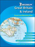
Great Britain Road Atlas. 1:300,000. Michelin. Ideal for touring by car. Presents Michelin's 1:400,000 mapping of the British Isles in an A4 sized atlas at 1:300,000 for greater clarity. Road detail includes driving distances, roundabouts, steep gradients, toll barriers, difficult roads, scenic routes, restricted roads, height limits and load limits. Main railways, funiculars, airports, selected airfields and ferries are included. County boundaries and national parks are marked. Other symbols denote various landmarks, recreation facilities and sites of interest eg. masts, refineries, cliffs, viewpoints, historic buildings, campsites, golf courses, bird sanctuaries.
There is a driving distance table (in miles and km) and a diagram of car ferry services. There are over 70 useful town centre plans and urban area maps, including plans of the Calais and Folkestone Channel Tunnel termini.
64-61979
Road Atlas - Spiralbound
$22.00
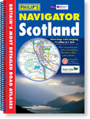
(GB) Navigator Scotland road atlas. 1:100,000 & 1:200,000. Philip's, 2004. Excellent spiral-bound road atlas of Scotland. 1:100,000 maps for the Lowlands and 1:200,000 for the Highlands and outlying islands. Fully indexed. Spiral bound, 11-3/4 x 8-3/4".
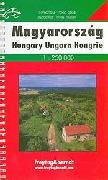
Hungary Supertouring Atlas. 1:250,000. Freytag & Berndt, 2005. Detailed spiral-bound road atlas. Complete with city maps, postal codees, and full index. Multilingual legend.
64-74885
Atlas.
$33.99
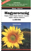
Hungary & Budapest Road Atlas 1:250,000 & 1:20,000. Dimap/Szarvas, 2003. The road atlas section of this volume extends to 81 pages. Apart from scattered spot heights, there is no relief information in the cartography, however the road detail is clear and extensive and includes some minor unpaved roads - except in built-up areas where the scale limits the detail to main roads.
Rest areas, motels and petrol stations on motorways are indicated but junction details are not shown. Intermediate driving distances on most routes are shown and railways - standard and narrow gauge - are included. Airfields, and car and passenger ferries are also indicated. County boundaries, national parks and nature reserves are drawn and symbols depict border crossings, and a range of antiquities, landmarks, monuments, places of worship, ruins, sites of interest and curiosities.
Latitude and longitude lines are drawn at 10' intervals. Multilingual legend includes English translation. Indexed.
Sample #1 Sample #2
64-74880
Spiral-bound atlas.
$19.95
Hungary Road Atlases
Iceland Road Atlas. 1:200,000. Landmaelingar Islands (National Land Survey of Iceland), 2006. The Road Atlas is on a 1:200 000 scale based on a 1:250 000 scale database. The appearance comes from Færdselskort Danmark from the Danish map institute KMS. In addition to normal maps which are on 50 pages the Atlas contains a variety of theme maps, e.g. accommodation, camping sites, museums, swimming pools, golf courses, etc. The Road Atlas also includes a thorough place name index with more than 15,500 entries.
The Road Atlas is very handy. When the book is folded it is only 16 x 31 cm and therefore convenient for the car. When the Road Atlas has been opened you are looking at a 60 cm wide centerfold which gives good overview over large area. One can also look at one page at a time or fold the book into the original form and look at 16 cm map at a time. This makes the usage of the book easy and fun. This format has been very popular in Denmark during many years. 82 pages, multilingual including English.
64-7589
Atlas.
$44.99
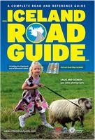
Iceland Road Atlas. Icelandic Geodetic Survey and Vegahandbokin ehf, 2007. This atlas covers Iceland's entire road system plus its geography, culture, and history. This is more of a guidebook with extensive detailed road maps rather than a traditional road atlas. The atlas covers all of the highland and mountain roads, showing detailed maps, extensive descriptive text, color photos, and numerous city maps. In English.
Sample of a text page. Sample of a text page. Sample of a map page. Image of the back cover.
64-7587
Atlas.
$59.99
Iceland Road Atlas. 1:300,000. Mal og menning. Bilingual.
64-75951
Book
$53.99
Ireland Road Atlas
Ireland Road Atlas. 1:250,000. Ireland Ordnance Survey. 2004. This excellent atlas contains maps at the scale of 1:250,000 for all of Ireland. Also includes detailed city street maps, special interest area maps, descriptive text and a gazetteer.
A detail from the atlas.
64-8091
Each
$29.99
Italy Road Atlases
Recommended Atlante Stradale d'Italia (Road Atlas of Italy). 1:200,000. Touring Club Italiano, 2004. This is an excellent, very detailed road atlas of Italy. It consists of three softcover volumes covering the north, central and southern parts of Italy. Each volume includes maps, extensive tourist information, and a complete index. Each volume is softcover, approximately 150 pages; in Italian.
64-8247-1
Atlas, northern volume
$36.99
64-8247-2
Atlas, central volume
$36.99
64-8247-3
Atlas, southern volume
$36.99
64-8247
Atlas, 3 volumes
$99.95
Italy Road Atlases. 1:300,000. Michelin. A popular atlas by the world-famous Michelin Maps group. Includes all of Italy at 1:300,000 and city maps of the main cities. The road detail includes minor roads, numbered motorway junctions, service areas, dual carriageways, intermediate driving distances, steep road gradients, difficult roads, prohibited roads, seasonal restrictions, caravan prohibitions and toll roads. Airports, railways and chair lifts are marked, also car ferries and passenger-only ferries. Spiral-bound. Updated every other year.
Sample fromthe road maps section. Sample from one of the city maps section.
64-82893
Atlas.
$22.00
Latvia Road Atlas
Latvia Road Atlas (Latvijas Autocelu Atlants). 1:200,000 & 1:20,000. Jana Seta. 279 pages, multi-lingual. Approximately 1/3 of the atlas is road maps at 1:200,000 and 1:100,000 for popular areas, 1/3 city maps at 1:20,000, and 1/3 index.
Sample #1 of the road maps Sample #1 of the city maps Sample #2 of the road maps
65-8188
Atlas.
$42.99
Lithuania Road Atlas
Lithuania Road Atlas. 1:200,000. Jana Seta. The 1:200,000 scale mapping allows a lot of detail and clarity at the same time. The map distinguishes between six different types of roads, it shows railways, museums and other place of interest, petrol stations, hotels and campsites and national parks. Towns are marked according to the size of the population. A latitude and longitude grid is given at an interval of 10'.
Sample #1 Sample #2
65-8388
Atlas
$49.99
Netherlands Road Atlases
Netherlands Road Atlas. 1:200,000. ANWB. A glovebox road atlas published by the Dutch auto club in cooperation with the Dutch Tourist Board. The clear cartography provides detailed road information, including names of motorway junctions, exits, bridges and tunnels used in the road and traffic information announcements on the radio, etc. Scenic routes, one-way traffic flow, toll-booths, bridges, intermediate driving distances on main roads, motorway services, railways, ferries, airports, province boundaries and a variety of landmarks eg. windmills, telecommunication masts & castles are included in the detail. The maps give no geographical co-ordinates. Four small maps of Amsterdam, Rotterdam, Den Haag and Utrecht show the main routes through the cities.
Map legend is in Dutch and English. Indexed. 75 pages. Size is 16 x 21cm.
65-0588
Atlas.
$29.99
Norway Road Atlases
Norway Road Atlas. 1:300,000. Statens Kartverk, 2004. An excellent, detailed road atlas of Norway from Norway's national survey organisation. Relief shading with spot heights indicates the terrain, with forested areas and natural features such as glaciers clearly marked.
The road network is clear and easy to read and the maps show main footpaths and a large amount of tourist information: recreational facilities, places of interest, various types of accommodation, etc. The atlas also includes street plans of 80 towns. Paperback.
65-1188
Atlas
$59.99
Norway Supertouring Atlas. 1:400,000. Freytag & Berndt, 2006. Spiral-bound road atlas of Norway with 1:3,500,000 summary road maps for Europe. Covers Spain, Portugal, Italy, Greece, coastal France, coastal Slovenia, and coastal Croatia. Includes tourist information, postal codes and full index. Multilingual legend. Size 8¼ x 12".
65-1189
Atlas.
$34.99
Poland Road Atlases
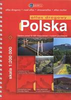
Poland Road Atlas. 1:200,000. Copernicus/PPWK, 2004. Impressive, detailed touring atlas distinguishing many grades of road according to width and surface. Road distances are indicated between markers, along with rest areas, filling stations on motorways and truck stops. Not only are steep gradients indicated but also particularly hazardous stretches of road. Airfields, railways, funiculars and car ferries are also shown.
Subtle relief shading and spot heights depict topography, along with water feature symbols and colours distinguishing built-up areas, sand dunes and forests. The range of border markings include administrative boundaries, restricted areas and national parks. Other symbols depict campsites, hostels, mountain huts, hospitals, churches and lighthouses. Latitude & longitude lines are drawn at 10' intervals.
There is a section of more detailed mapping at 1:100,00 of the environs of Gdansk, Gdynia, Warsaw, Katowice & Krakow. This is followed by a section of 61 city plans at 1:25,000.
The legend for the mapping includes English translations, but the additional pages of information for drivers are in Polish only. This information includes border crossing information, radio station frequencies, traffic signs and regulations and the penalties for breaking these rules!
Finally, inside the back cover is a removable folded map at 1:1,000,000 for route planning.
65-19891
Atlas
$49.99
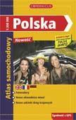
Poland Road Atlas. 1:300,000. Copernicus/PPWK. Compact, detailed touring atlas distinguishing many grades of road according to width and surface. Road distances are indicated between markers, along with rest areas, filling stations on motorways and truck stops. Not only are steep gradients indicated but also particularly hazardous stretches of road. Airfields, railways, funiculars and car ferries are also shown.
Relief is indicated by spot heights, and symbols and colours distinguish built-up areas, marshes and forests. The range of border markings include administrative boundaries, but not restricted areas and national parks. Other symbols depict campsites, hostels, mountain huts and hospitals. Latitude & longitude lines are drawn at 10' intervals.
There is a section of 18 city plans at 1:30,000. The legend for the mapping includes English translations, but the additional pages of information for drivers are in Polish only. This information includes a road distance table, border crossing information, traffic regulations and the penalties for breaking these rules!
Note: most of the maps reproduced at a smaller scale from the atlas listed above. Because of the reduction, the variety of topography symbols and administrative border lines are also reduced and slightly hard to read.
65-1989
Atlas
$25.99
Romania Road Atlases
Romania Road Atlas. 1:500,000. Szarvas, Budapest. This atlas uses shaded relief and vegetation coloring to show the lay of the land. Includes road, mileages, villages, etc. There is a 1:3,500,000 map of central Europe and several city plans at 1:10,000 to 1:18,000. Numerous symbols in the city plans help tourists locate services, hotels, gas stations, and much more. A detailed index to place names completes this spiral-bound atlas. Multilingual.
65-2388
Spiral-bound atlas.
$19.95
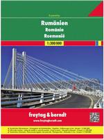
Romania Road Atlas. 1:300,000. Freytag & Berndt. This atlas uses shaded relief and vegetation coloring to show the lay of the land. Includes road, mileages, villages, etc. There are several city maps included. Numerous symbols in the city plans help tourists locate services, hotels, gas stations, and much more. A detailed index to place names completes this spiral-bound atlas. Multilingual.
65-23883
Spiral-bound atlas.
$34.95
Scandinavia Road Atlas
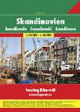
Scandinavia Superatlas. Freytag & Berndt. An excellent spiral-bound road atlas covering all of Scandinavia. Multilingual legend.
66-22933
Atlas
$44.99
Slovakia Road Atlases
Recommended Autoatlas of the Slovenska Republika (Podrobny Auto Atlas Slovenská Republika). 1:100,000. Vokensky Kartograficky Ustav. An excellent spiral-bound road atlas produced from the military mapping of the country. The maps are shaded relief maps with road and tourist information, distances between intersections, and more. A multilingual legend and detailed index is included. In Slovak. Size is 12-3/;4 x 9-1/2". Note: new stock due in 3 weeks.
Slovenia Autoatlas. 1:300,000. Geodetski zavod Slovenije, 2001. Spiral-bound road atlas showing tourist information, with city street maps, indexed, etc. Spiral-bound, 6¼ x 10".
Sample of road map section Sample of city map section
65-9789
Atlas.
$33.99
Slovenia Supertouring Atlas. 1:250,000. Freytag & Berndt, 2000. Spiral-bound road atlas showing tourist information, index with postal codes, etc. Spiral-bound, 6¼ x 10". Limited stock.
65-97891
Atlas.
$19.95
Spain Road Atlases
Spain Road Atlas. 1:400,000. Michelin, 2006. Spiral-bound, also covers Portugal. Michelin's mapping of Spain & Portugal at 1:400,000 is combined here into a spiral-bound atlas (A4-sized pages). Includes Canaries, Azores and Balearics.
Road detail shows minor roads, toll barriers & high passes and includes intermediate driving distances, with steep road gradients and seasonal restrictions also marked. The maps use bold relief shading to show the terrain, and symbols depict plenty of landmarks. Railways, cablecars, funiculars and ferries are marked. Tourist information includes scenic routes and viewpoints, golf courses, caravan & camping sites, pleasure boat harbours. The maps also indicate towns and villages with entries in Michelin's Red Guide to hotels and restaurants. Map legend includes English.
Additional features of the atlas include: a distance table; and indexed street plans of major towns.
65-3287
Atlas, 2006 edition.
$22.00
65-3287A
Atlas, 2003 edition.
$12.00
Spain & Portugal Superatlas. 1:400,000. Freytag & Berndt. Excellent spiral-bound road atlas. Includes tourist information, city maps, and an index with postal codes. 8½ x 11" in size.
65-32871
Atlas.
$29.95
Sweden Road Atlases
Sweden Road Atlas (Lantmateriets Stora Sverigeatlas). Scales vary. Kartforlaget, 2003. This 10 x 14" atlas gives complete coverage of Sweden and includes numerous large-scale city maps. Fully indexed. In Swedish.
65-38895
Atlas
$29.95
Sweden Motorman's Atlas. Scales vary. Kartforlaget, 2005. The south of Sweden is mapped at 1:250,000, and the less populated north at 1:400,000. There are enlargements of the areas around Gothernburg, Stockholm and Malmo at 1:100,000; street plans are provided for these and also for 47 other towns and cities. Seven types of road are detailed, from motorways to small private roads. Car ferry routes, railways, canals and electricity lines are all marked. Symbols are used to show the locations of places of tourist interest, such as hiking trails, campsites, ski lifts, castles, etc.
Boundary information includes municipal, county and provincial borders as well as national park and international borders. At the front of the atlas there are maps that show the distances between main towns and route route-planing maps of the whole of Sweden, Norway and Finland at 1:2,000,000. Inside the back cover there is a map of the country showing what wavelength the local radio stations broadcast on.
Sample #1 Sample #2
65-38894
Atlas
$64.99
Sweden Supertouring Atlas. 1:400,000. Freytag & Berndt. Excellent spiral-bound road atlas. Includes tourist information, city maps, and an index with postal codes. Spiral-bound, 6¼ x 10".
65-38893
Atlas.
$24.99
Switzerland Road Atlas
Switzerland Road Atlas. Kümmerly + Frey. Different colouring clearly distinguishes between toll motorways and those with free access. Detailed road classification includes information on toll roads, traffic restrictions, seasonal closures and roads with traffic controlled by timetable. The maps also clearly show the rail network and indicate viewpoints, spas, motels and both seasonal and permanent campsites. Map legend is in French and German only. The index lists towns and villages with their postcodes but does not include natural features, such as mountains, lakes, etc. This section also contains a distance table and lists of road tunnels, alpine passes, etc.
The second part of the atlas has indexed street plans of 35 main towns in Switzerland, presented at different scales. Basle, Bern, Geneva and Zurich are covered on two or more pages to include the suburbs. The plans indicate public transport, car parks, etc. The legend in this part is in German, French and Italian only.
65-3988
Set, folded
$29.99
Turkey Road Atlas
Recommended Turkey Road Atlas (Köy Köy Türkiye Yol Atlasi). 1:400,000. Map Medya Basin Yayin, 2004. ISBN 975-340-431-X. Very detailed physical/road atlas for all of Turkey. 211 map pages with hypsometric shading and 128 pages of location index. The maps show roads (coded by type), distances, railroads and rail stations, museums, cemeteries, hotels, etc. Paperback, In Turkish with bilingual legend. This is an excellent, detailed, current atlas and highly recommended. In transit - due in 2 weeks. Sample image
65-45882
Road atlas
$79.99
Ukraine Road Atlas
Automobile Road Atlas of Ukraine. 1:1,250,000 - 1:2,000,000. Kartografia. The clear cartography shows six different types of roads, footpaths, railways, shipping and ferry lines, road distances are in kilometres. Town names are marked according to size of population and level of tourist interest. Some physical detail is provided through colour shading. A latitude and longitude grid is given at an interval of 30'. It includes a full index of place names and street plans of 55 towns and cities. The maps are in Ukrainian, but the legend is multilingual including English. In transit, due in 2 weeks. Sample of the map
66-0391
Booklet
$14.99
Visiting North Carolina? Like to visit Omni? Please click here for a Mapquest map to our offices. If you are passing through central North Carolina, we would be pleased to have you visit our store and warehouse. We are located about 30 minutes east of Greensboro, 60 minutes west of Raleigh, and 2 hours northeast of Charlotte. We are open Monday-Friday 8am - 5:30pm and weekends by prior arrangement.
Contact information: For information on a map or other product: [email protected] To place an order or check on an order: [email protected] For questions on an invoice: [email protected] Phone: (1) 800-742-2677 (USA) or (1) 336-227-8300 (International)
Fax: (1) 336-227-3748
 Detail from the atlas
 Sample #1 of the detail of the atlas
 Sample #2 of the detail from the atlas


 Czech Republic Autoatlas (Autoatlas Ceská republika). 1:100,000. SHOCart. The only road atlas with tourist and cycling marking covering all of the Czech Republic. Spiral-bound atlas, in color, 21 x 15 cm. An excellent road atlas that shows distances and uses green coloration to show vegetated areas. Includes a full index. Multilingual including English and Czech.

 Czech Republic Autoatlas (Autoatlas Ceská republika). 1:200,000. SHOCart. Spiral-bound atlas, in color, 21 x 15 cm. 75 pages of maps and 48 pages of index. An excellent, compact road atlas that shows distances and uses green coloration to show vegetated areas. Includes a full index. Multilingual including English and Czech.

 Sample #1
 Sample #2

 Sample #1


 Sample #1
 Sample #2
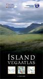

 Sample of a text page.
 Sample of a text page.
 Sample of a map page.
 Image of the back cover.
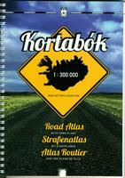 Iceland Road Atlas. 1:300,000. Mal og menning. Bilingual.

 Italy Road Atlases. 1:300,000. Michelin. A popular atlas by the world-famous Michelin Maps group. Includes all of Italy at 1:300,000 and city maps of the main cities. The road detail includes minor roads, numbered motorway junctions, service areas, dual carriageways, intermediate driving distances, steep road gradients, difficult roads, prohibited roads, seasonal restrictions, caravan prohibitions and toll roads. Airports, railways and chair lifts are marked, also car ferries and passenger-only ferries. Spiral-bound. Updated every other year.
 Sample fromthe road maps section.
 Sample from one of the city maps section.
 Sample #1 of the road maps
 Sample #1 of the city maps
 Sample #2 of the road maps
 Sample #1
 Sample #2


 Sample of road map section
 Sample of city map section


 Sample #1
 Sample #2


 Sample image
 Sample of the map